
the story of
erin + seth
and going big for our marriage’s golden birthday
~*~
Today, on 10.10.2020, we’re shooting a wedding. And a decade ago, we were having a wedding of our own!
It’s officially been 10 years since we were married on 10.10.10 — and with 10 being such a significant number for us, of course we had to acknowledge the occasion in a pretty monumental way. This is where the pandemic actually proved surprisingly helpful, postponing some September weddings until next year and leaving a few weeks wide open just ahead of our anniversary.
Thus we set out to celebrate it with an adventure spanning 17 days and more than 4,000 miles. The real significance in all those miles was in them taking us to 10 states, 10 National Parks and 10 other sights (national memorials, national monuments and natural wonders) — one set of 10 for each 10 in our wedding date.
And although it wasn’t planned, I eventually realized there’s even a 10 in the difference between each day of the trip and its date of the month (Day 1 was on the 11th, for example). With all these planned and unplanned instances of “our” number, this was the most epic and appropriate way we could imagine to mark 10 years since 10.10.10, and definitely an experience we’ll remember for our next decade and beyond!
our trip 10s
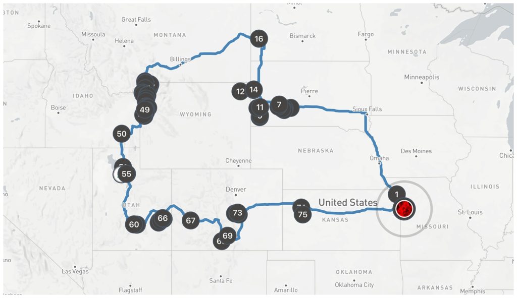
10 states
Missouri • Iowa • South Dakota • North Dakota • Montana •
Wyoming • Idaho • Utah • Colorado • Kansas
10 national parks
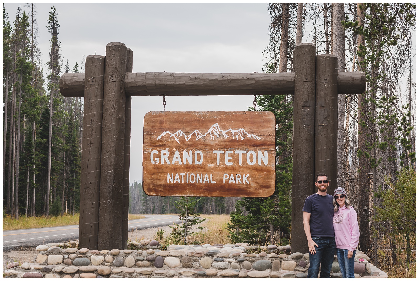
Badlands • Wind Cave • Theodore Roosevelt • Yellowstone • Grand Teton • Capitol Reef • Canyonlands • Arches • Black Canyon of the Gunnison • Great Sand Dunes
10 other sights
Crazy Horse Mountain Memorial • Mount Rushmore National Memorial • Devils Tower National Monument • Center of the Nation Monument • Great Salt Lake (Antelope Island State Park) • Dead Horse Point State Park • Pikes Peak • Garden of the Gods • Monument Rocks Natural Area • Little Jerusalem Badlands State Park
– feature film –
See the occasion come alive in these video highlights!
day 1 • 09.11.20
Independence, MO >>> St. Joseph, MO >>> Kadoka, SD
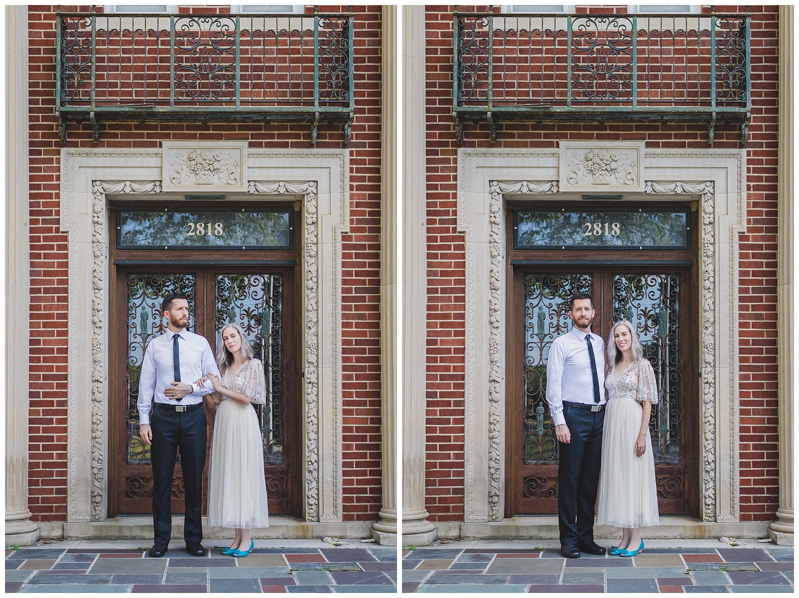
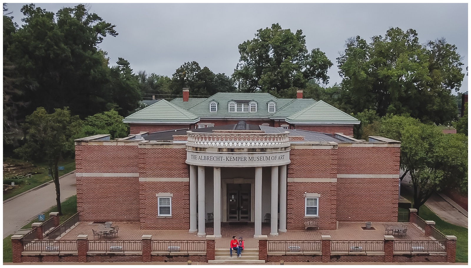
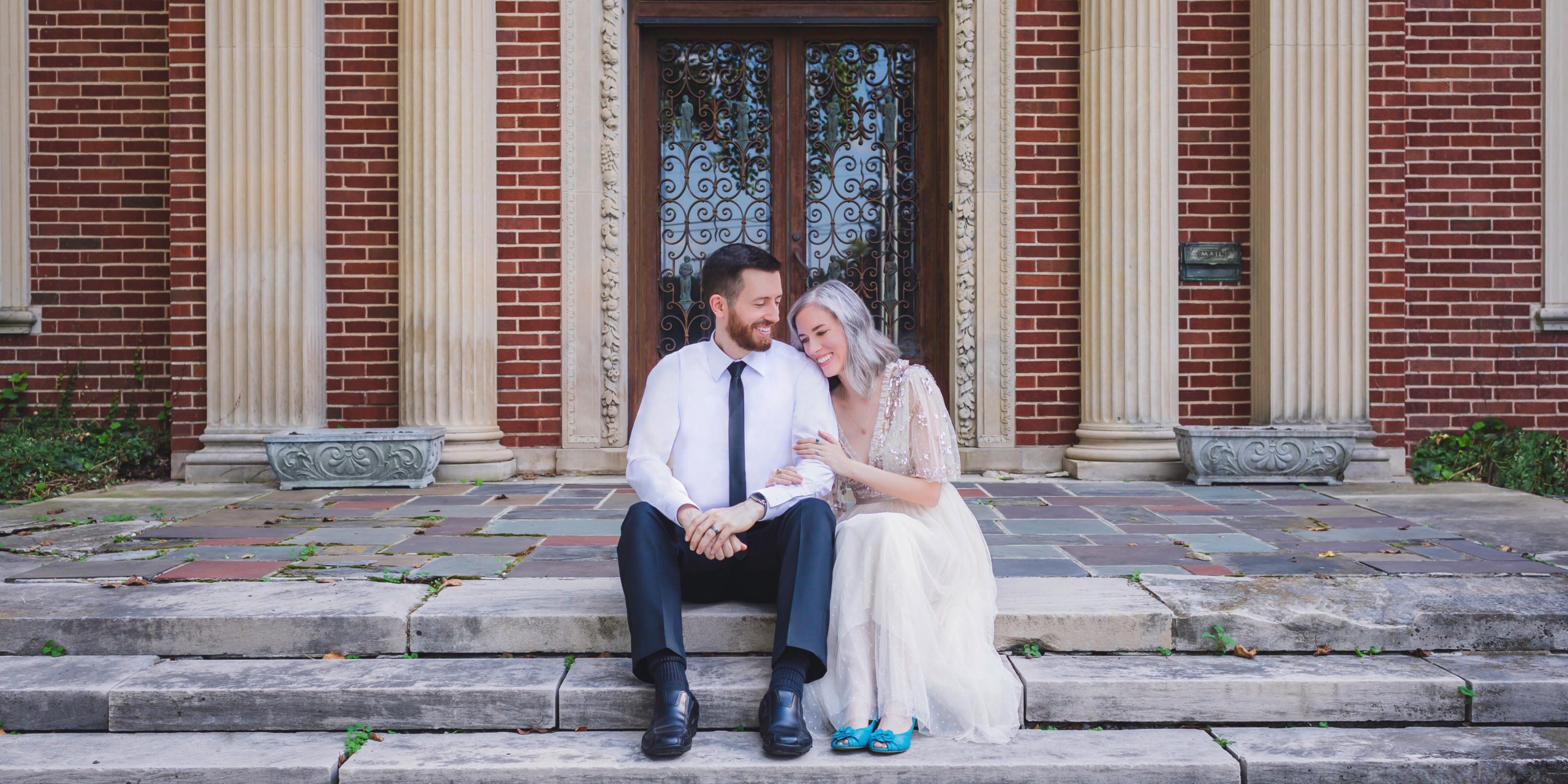
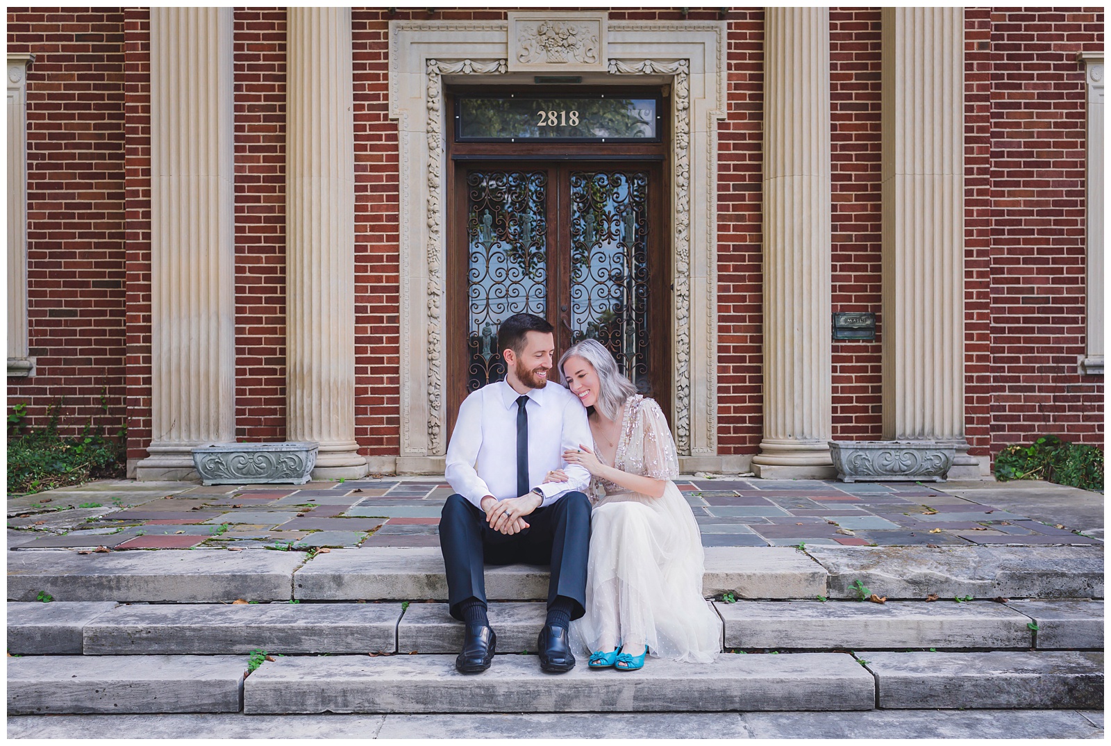 The first stop on our trip was where it all started: The Albrecht-Kemper Museum of Art in St. Joseph. We had our wedding reception and took our wedding portraits there, so it seemed very fitting to begin our 10th-anniversary trip with portraits on the same steps where we were photographed on our wedding day (and even holding one of our wedding photos!).
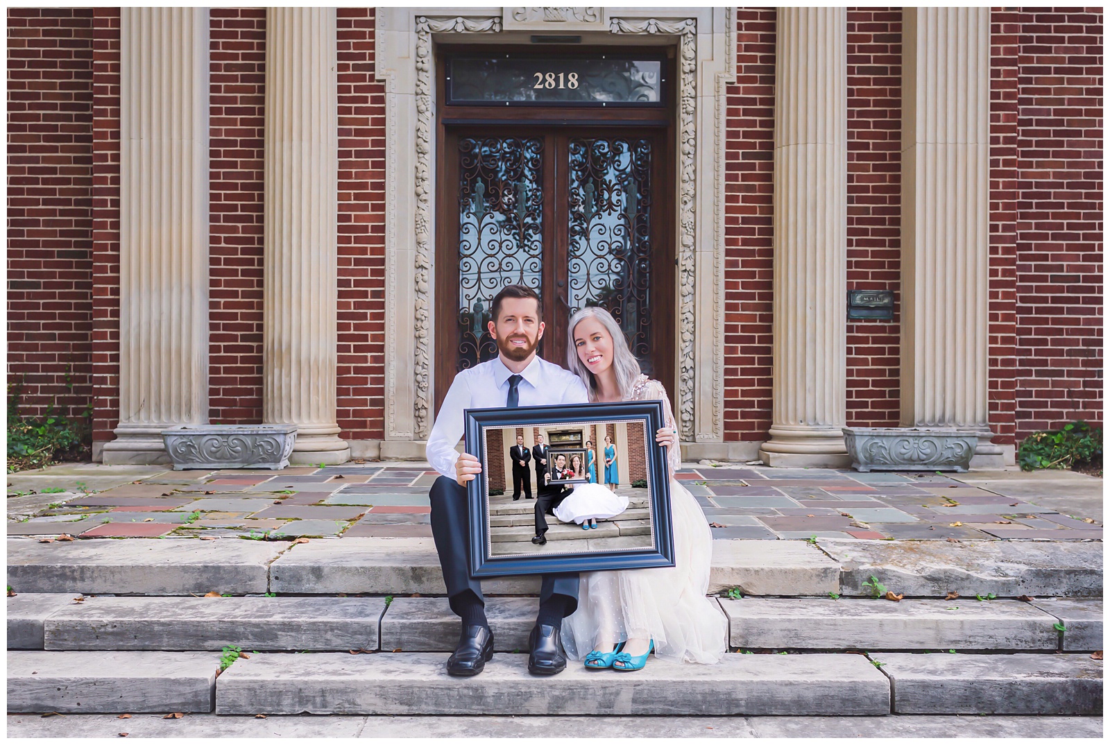
My plan is to put the above photo in that photographed frame — which I guess necessitates sticking to the tradition of taking a new photo with this frame, on these steps, every 10 years!

 Also at the Albrect, I gave Seth an early anniversary gift: a book containing trip itinerary details and location facts (some of which I’ve peppered throughout this post — gotta put that knowledge to good use!), as well as memories from our marriage and other thoughts. Toting around a heavy album may not be ideal for most road trips, but I think this one added something special and helped us focus not just on each day’s activities but also on the deeper meaning behind them.

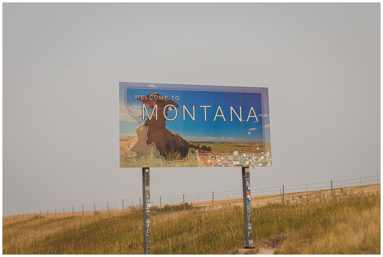
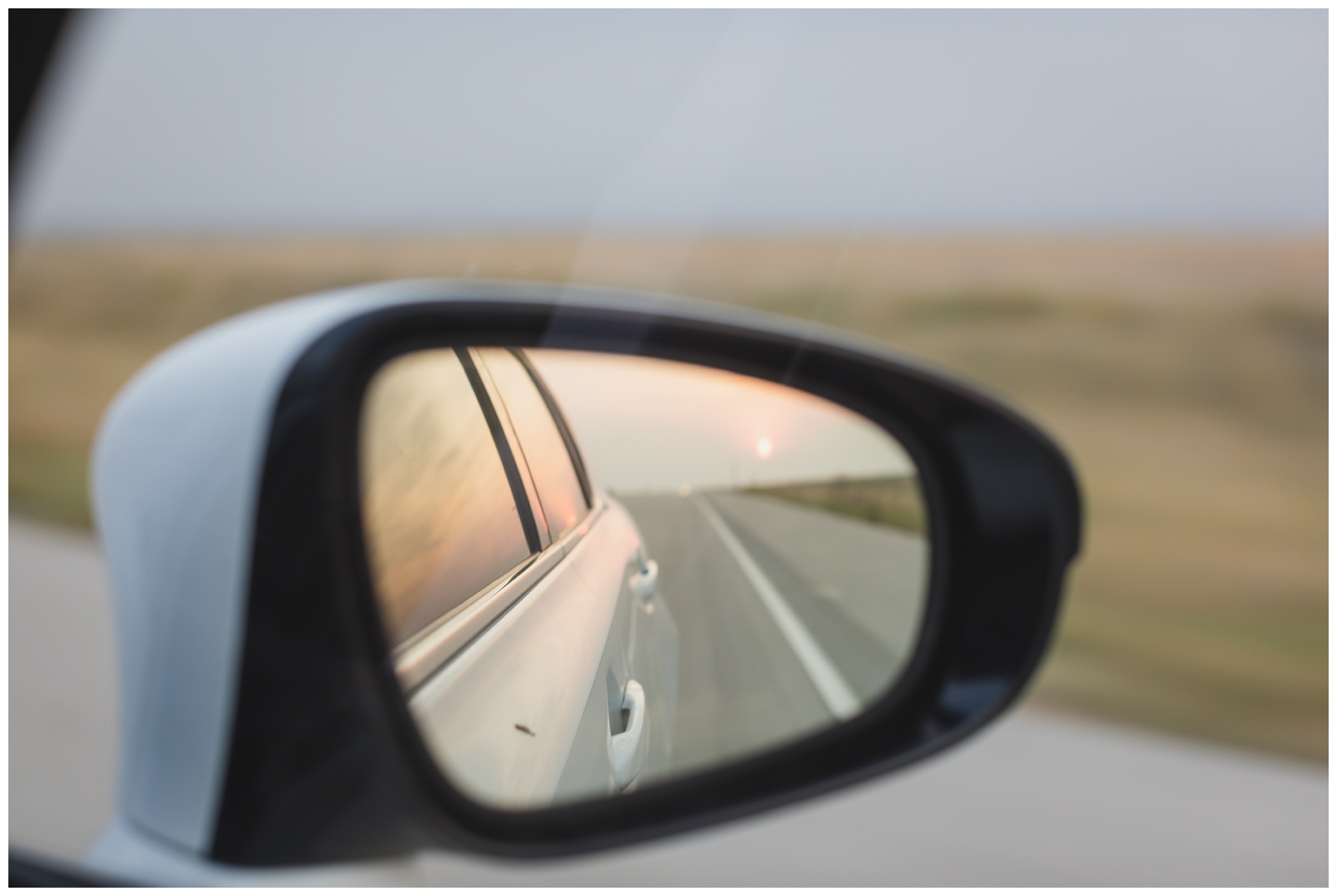
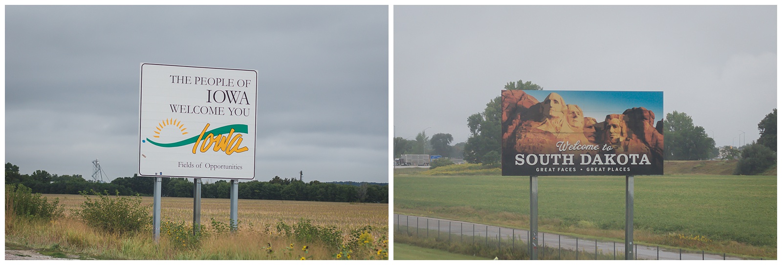 Two state signs down, eight to go! We made a point to photograph them all and paid close attention to the state lines on our GPS map to ensure we didn’t speed by any without snapping the shot.
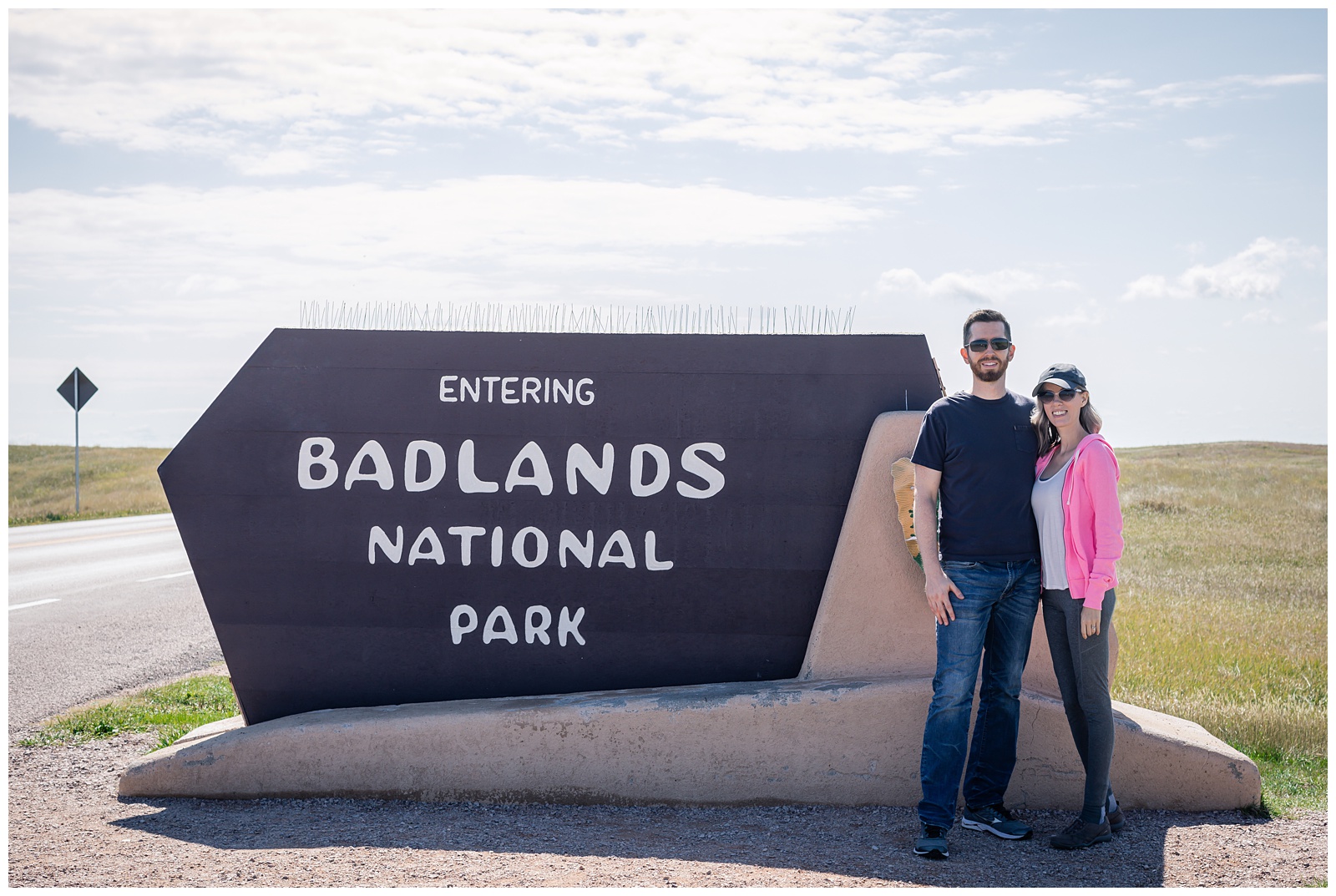
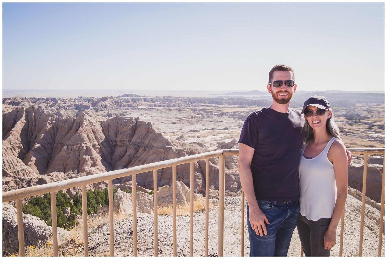
day 2 • 09.12.20
Kadoka, SD >>> Badlands National Park >>> Wall, SD >>> Hot Springs, SD
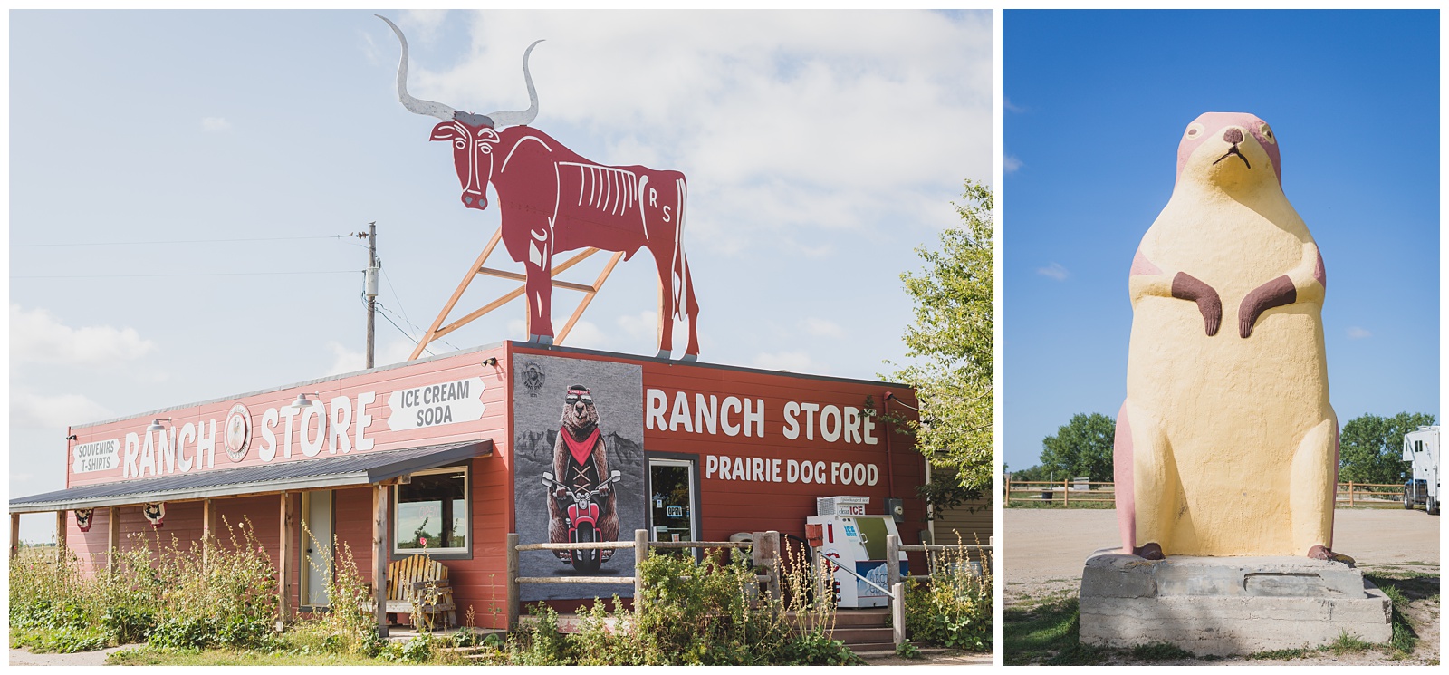
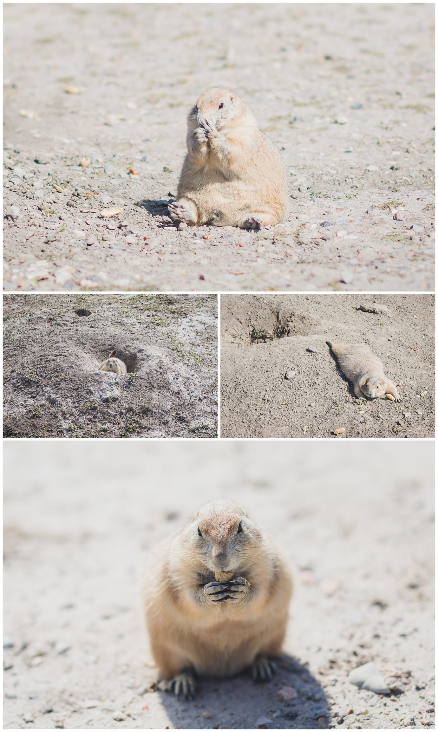
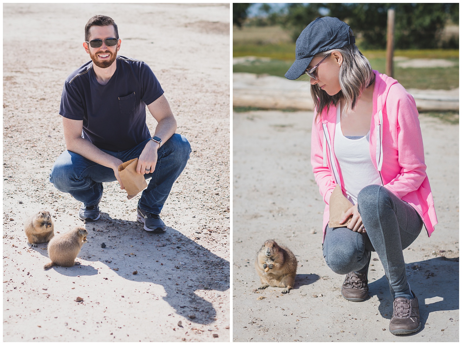
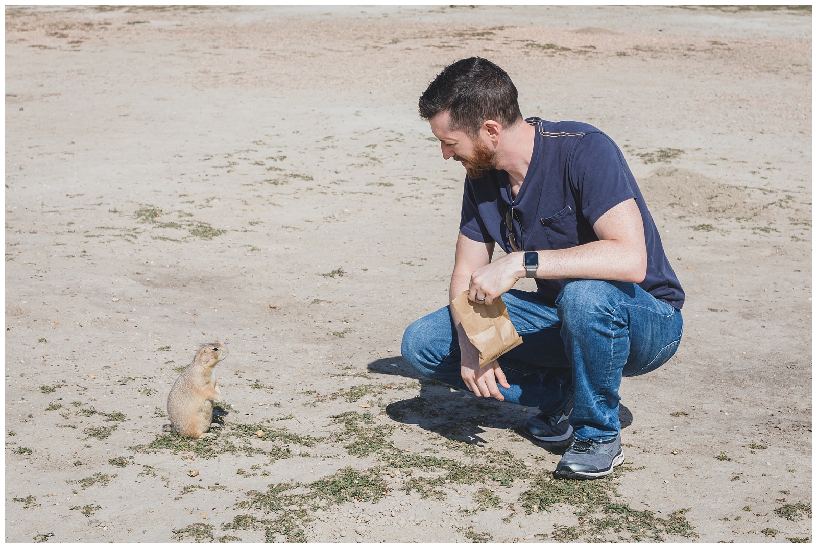
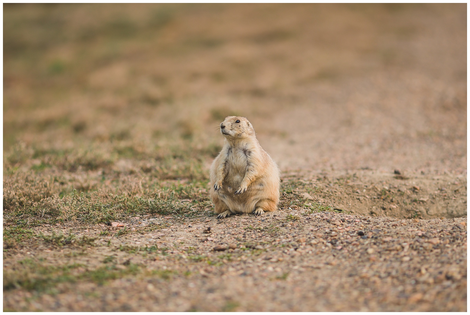
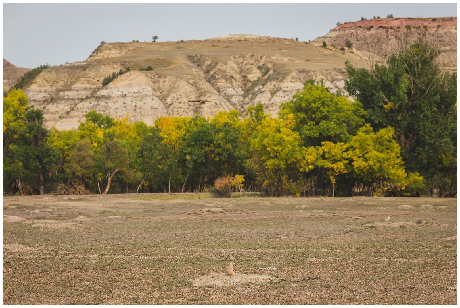
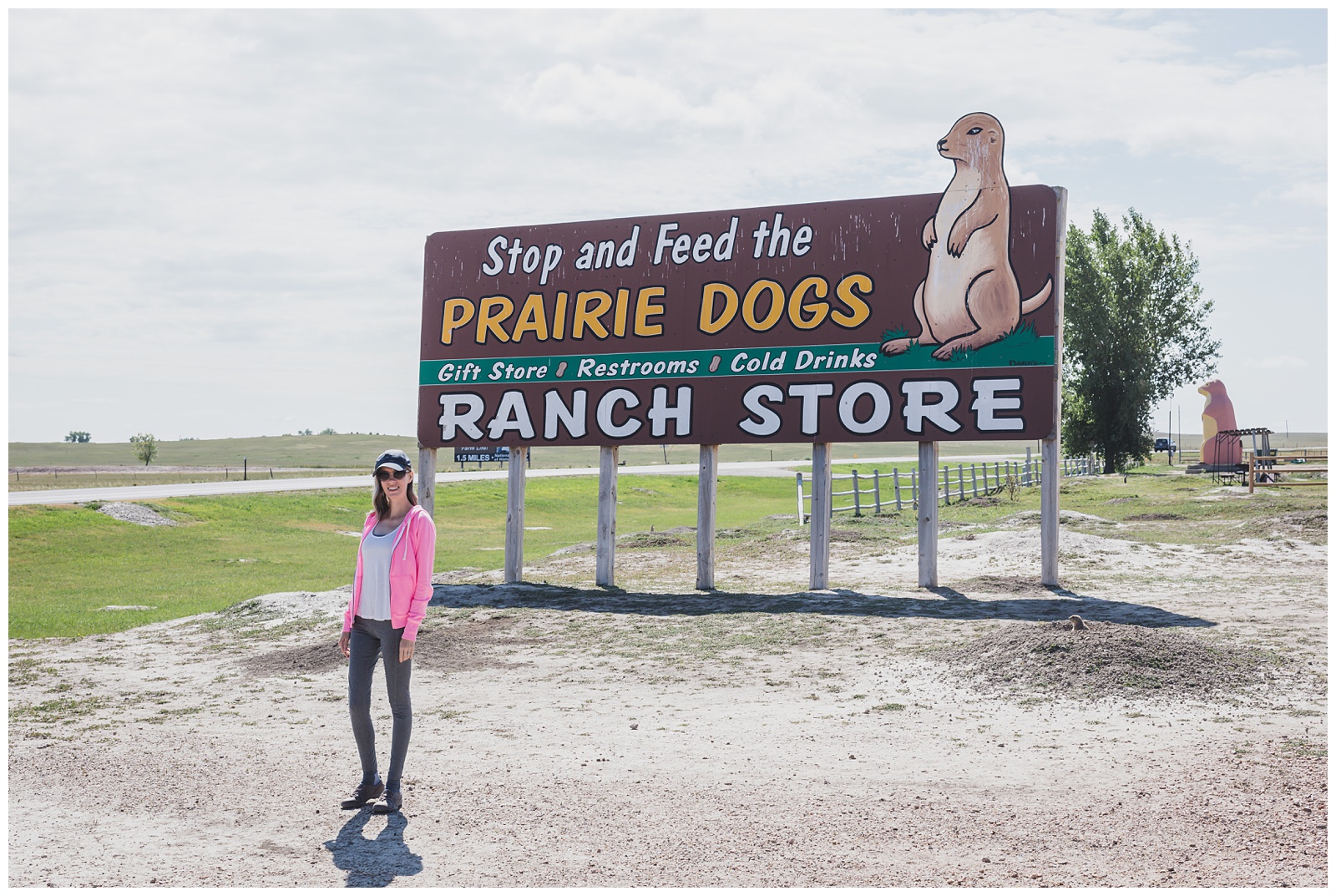 On our way to Badlands, we couldn’t resist stopping to feed the prairie dogs at this little place. Feeding animals in the parks is obviously off-limits, so this first “wildlife” encounter of the trip was also the last one where we fed any!
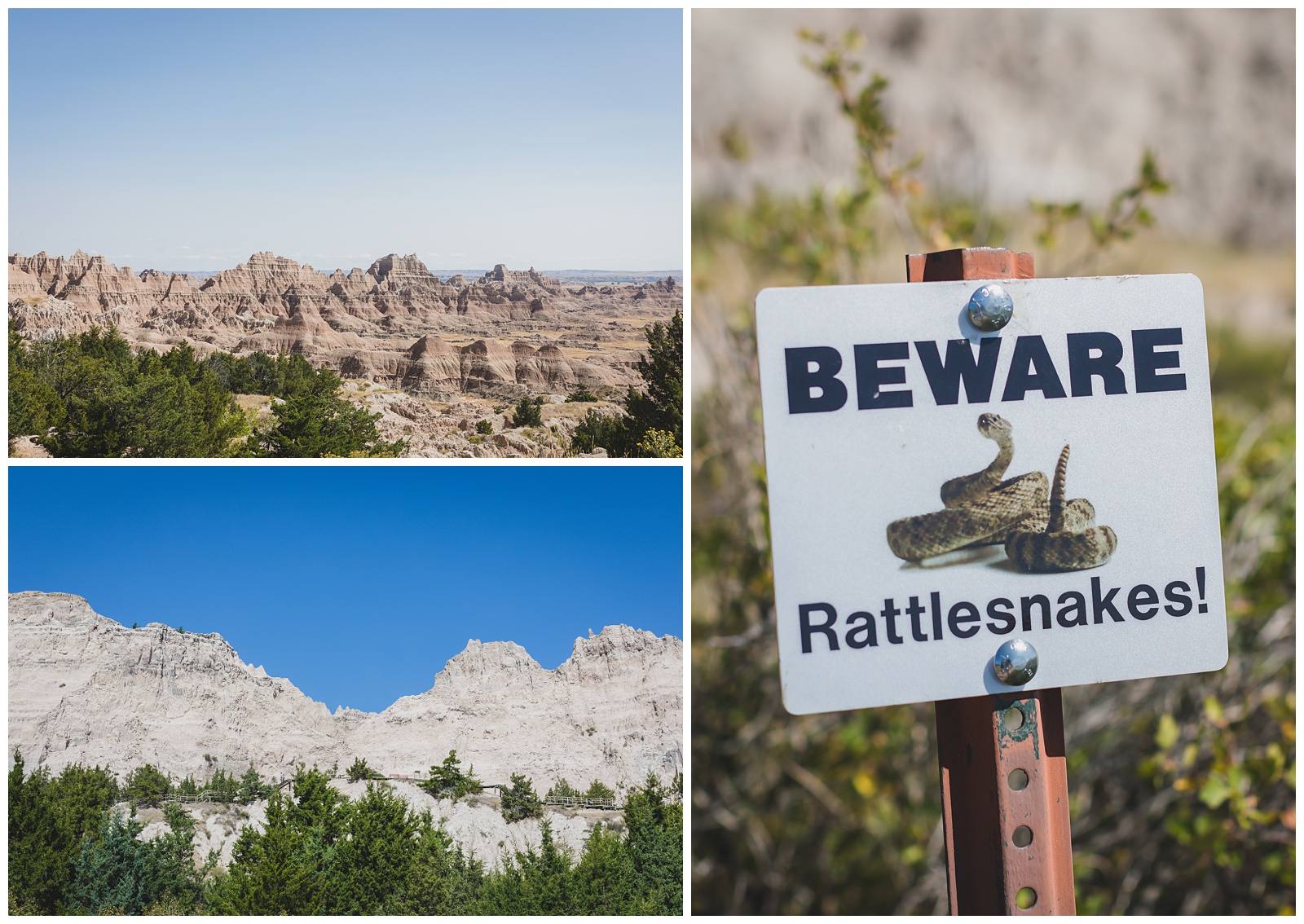
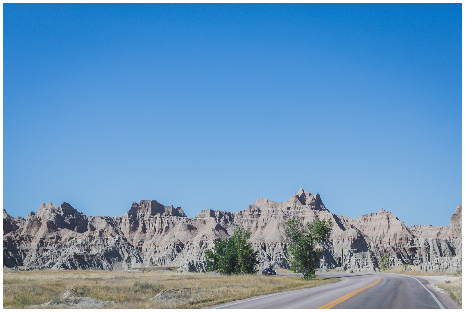
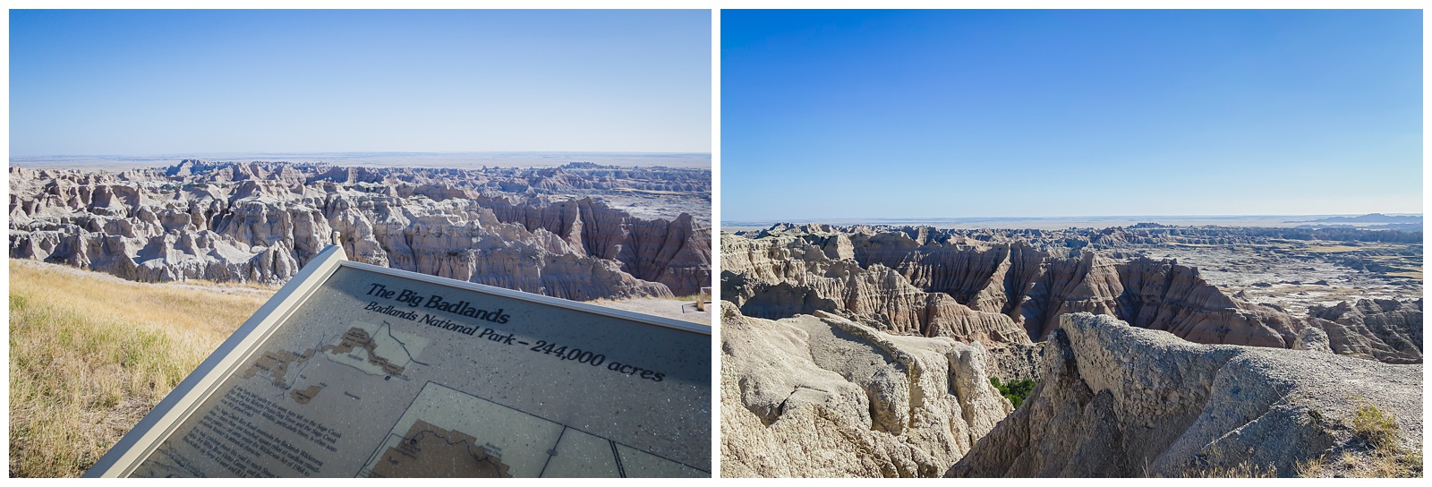
 The name “Badlands” comes from the Lakota, who first called it “mako sica,” or “land that is bad,” due to the lack of water, bizarre topography and extreme temperatures. {Source: National Parked}
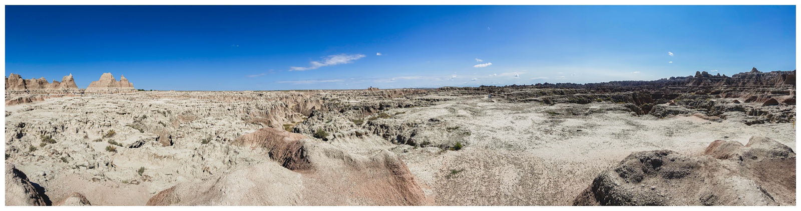
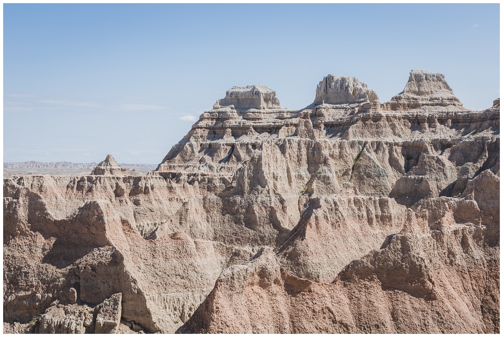
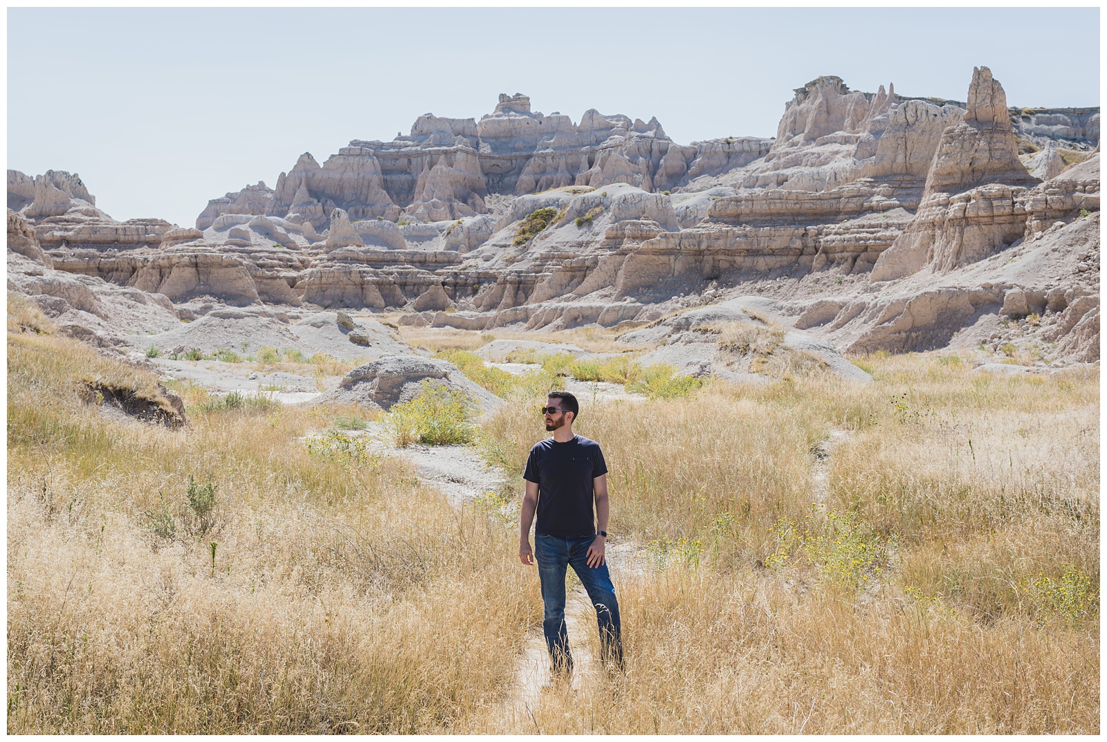
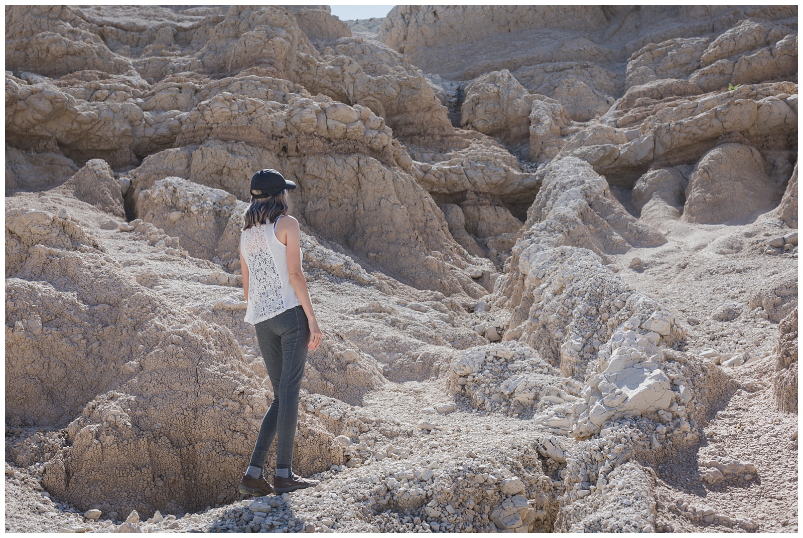
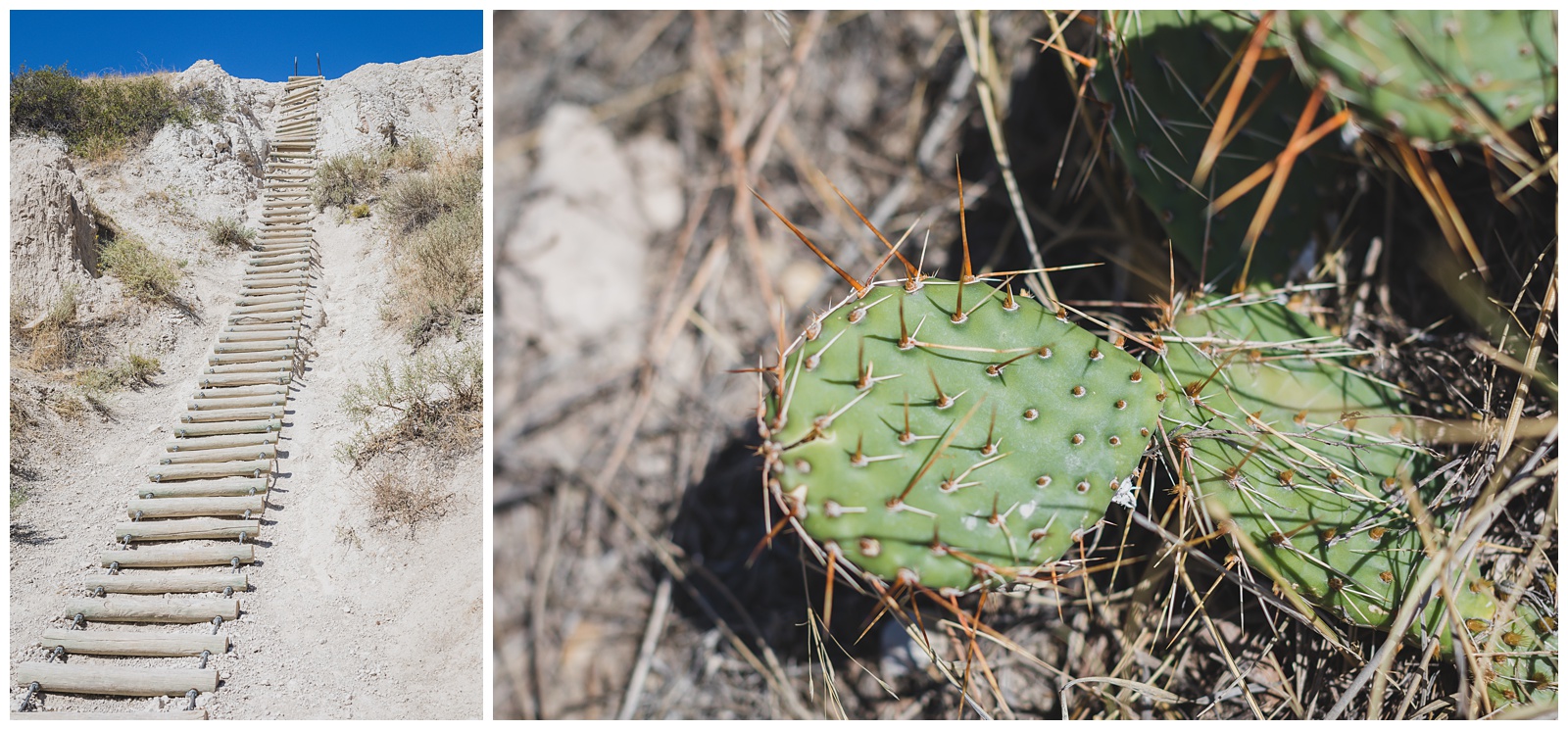
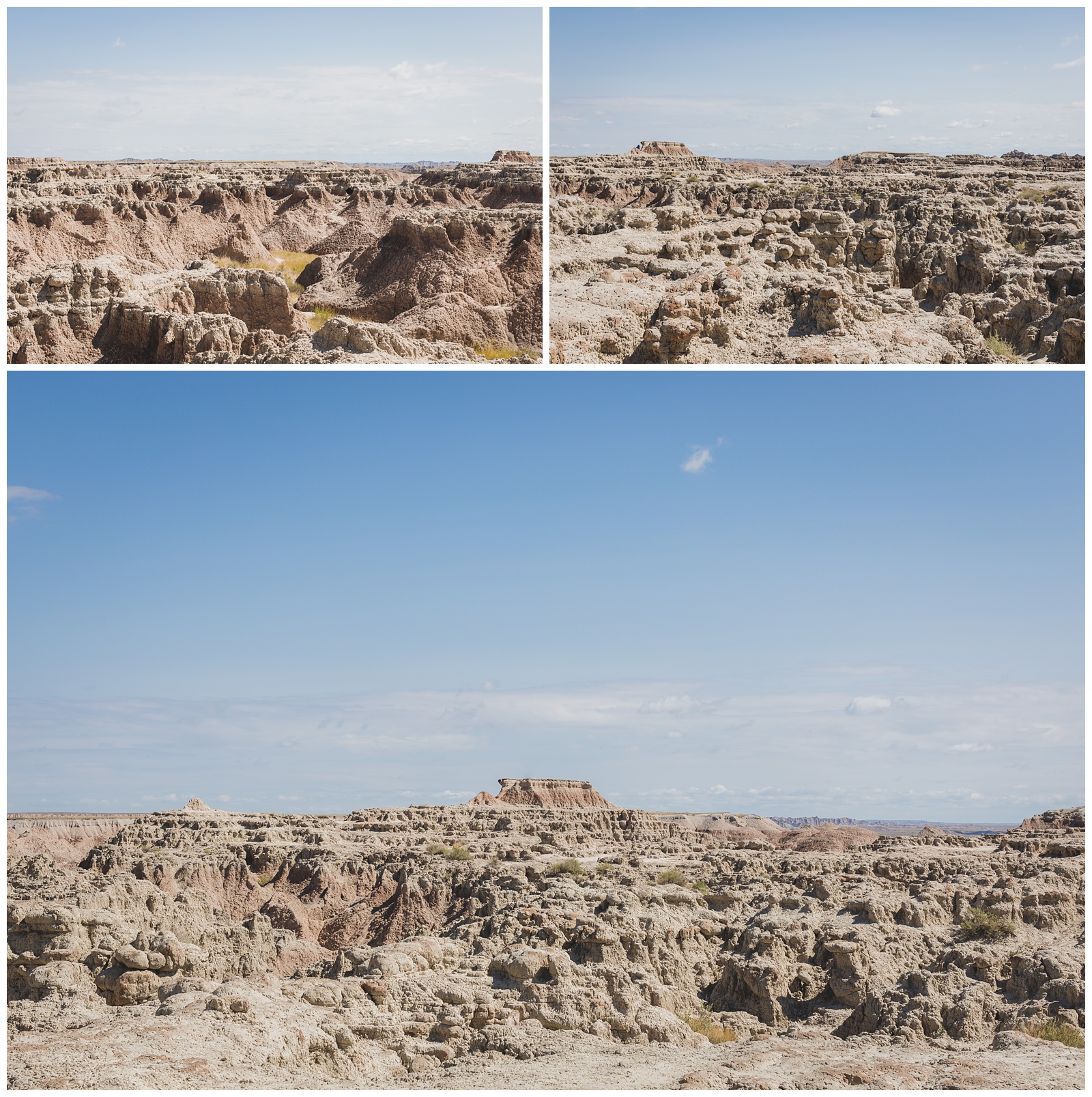 We began our time at Badlands hiking Door Trail, Window Trail and Notch Trail (all starting from the same area near the park’s northeast entrance).
 Yeah, I married a model … No big deal. 😀
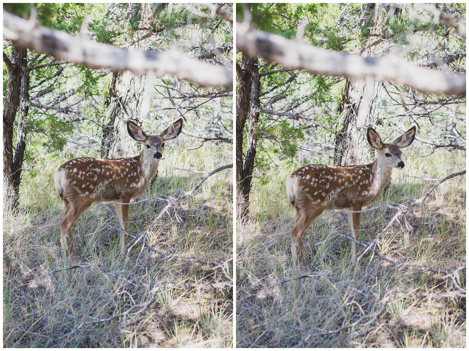
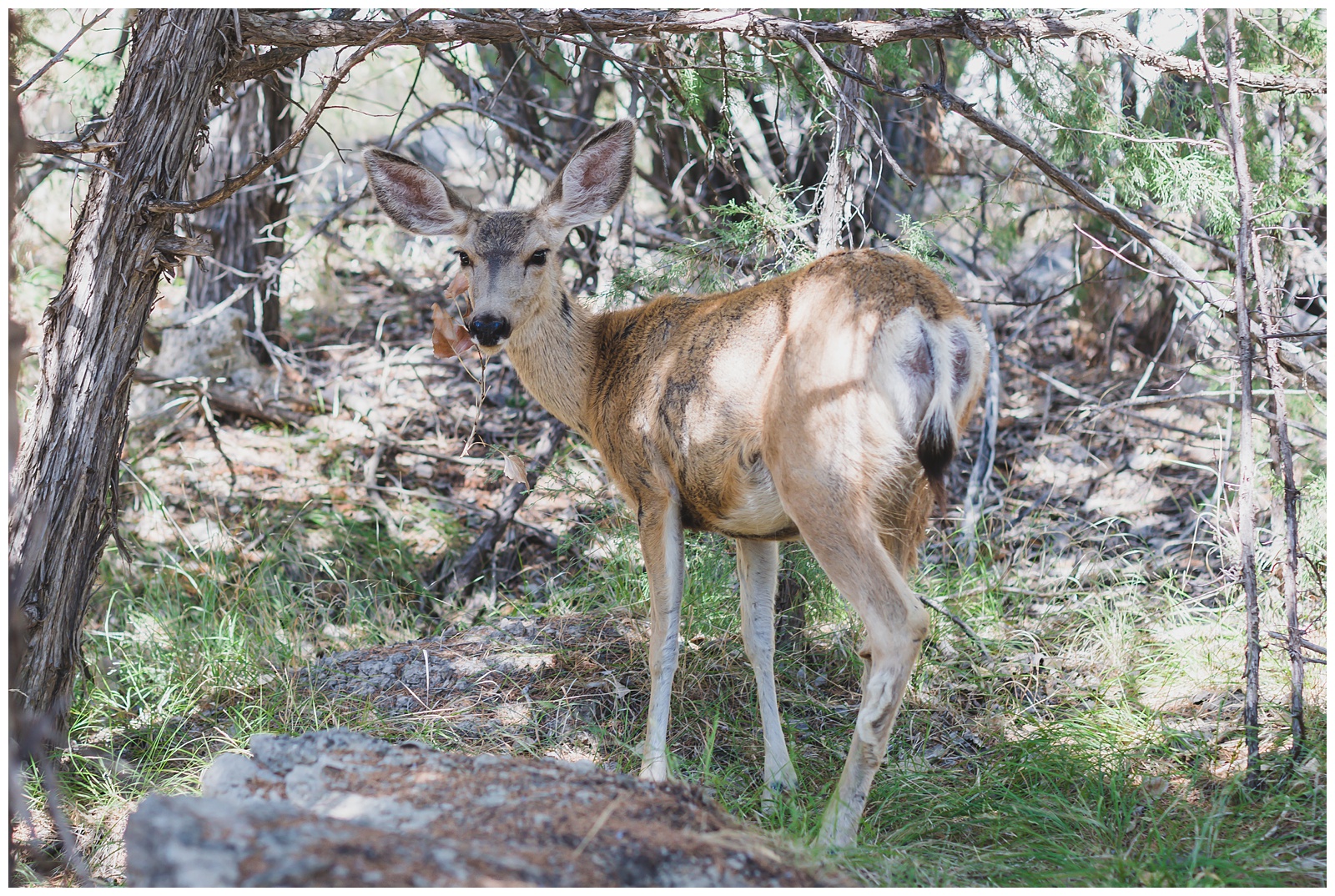
 Going farther into the park, we hiked Cliff Shelf Nature Trail and had our first larger wildlife sightings in the form of a fawn and a doe. Deer may not be the most exotic wildlife, but it was still cool to see them that close.
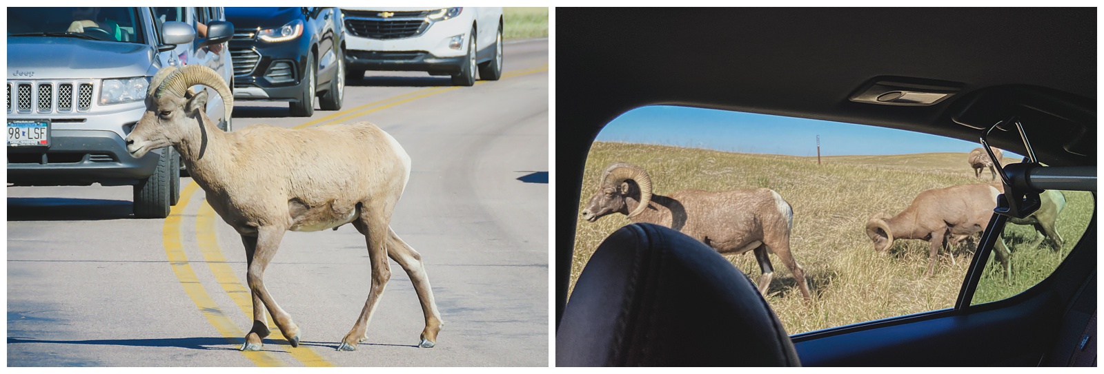
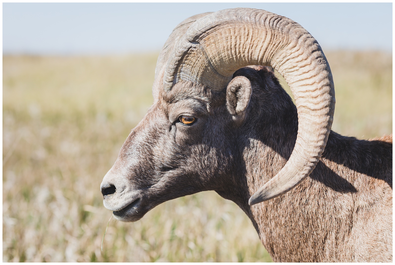
 Driving Badlands Loop Road, we came across a group of bighorn sheep!
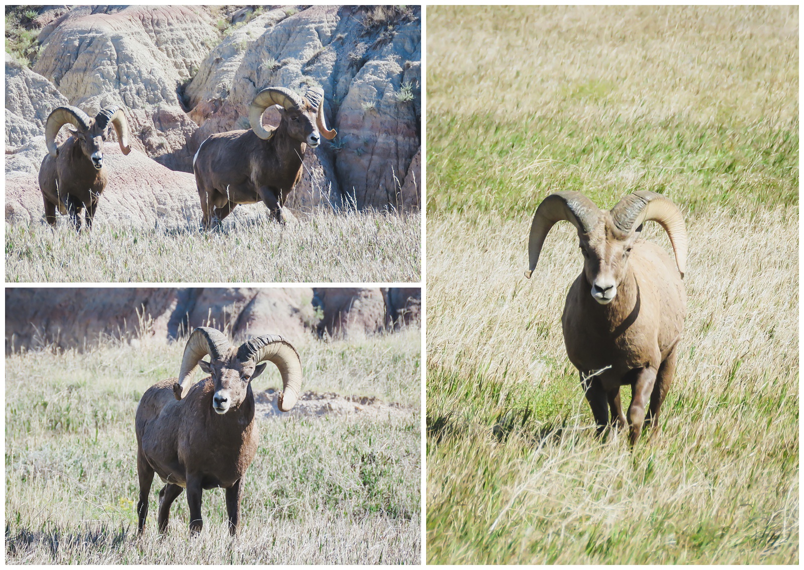
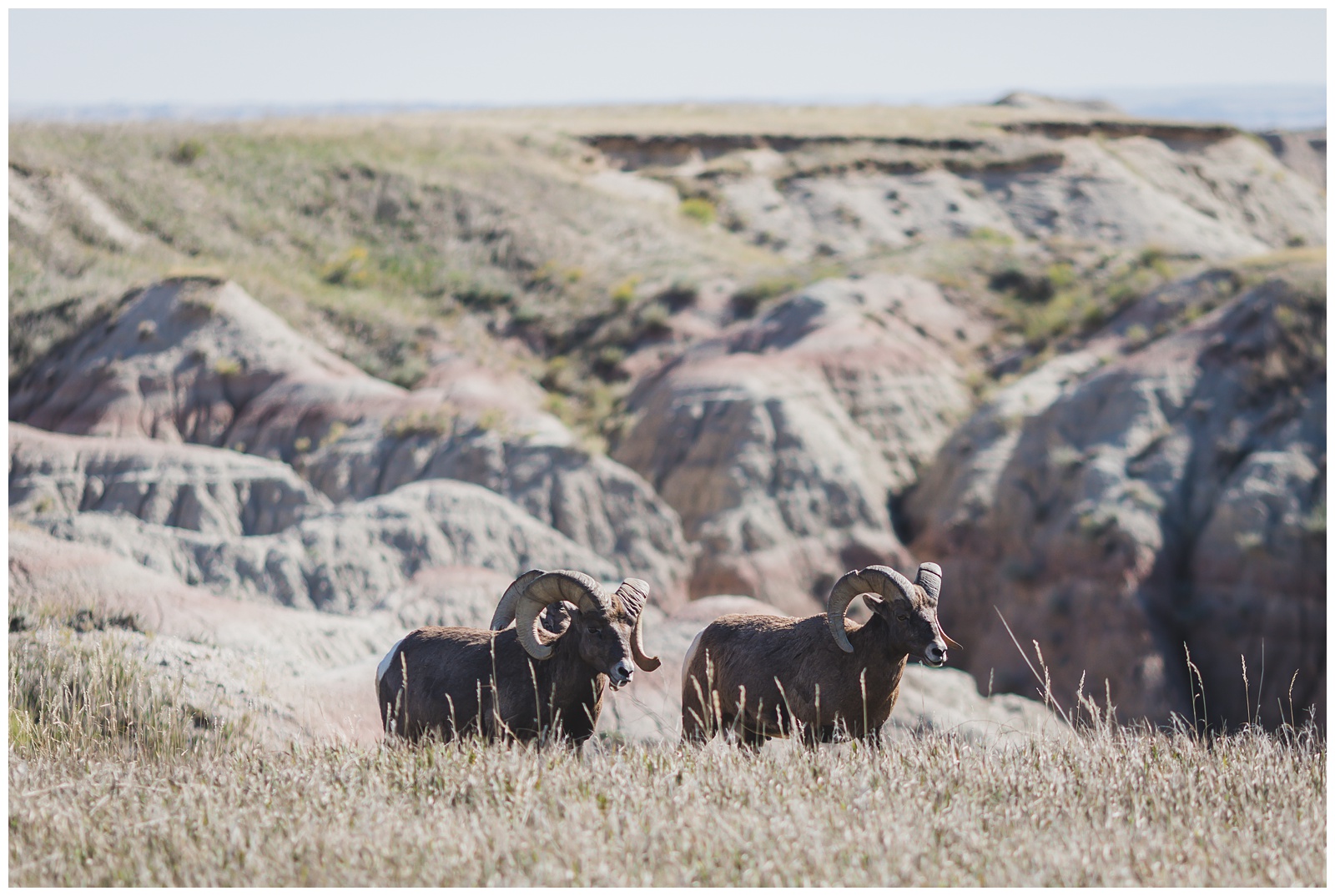
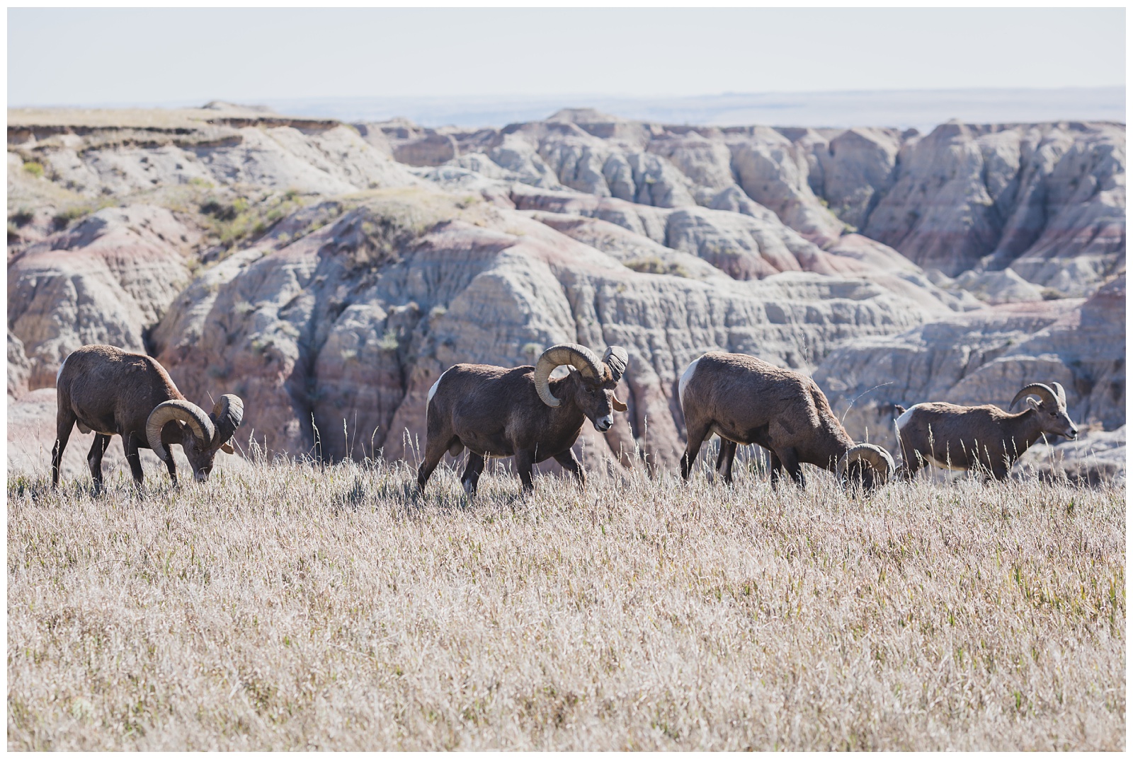 We photographed them with telephoto lenses but soon didn’t need that kind of reach, as the sheep made their way onto the road and walked right by our car.
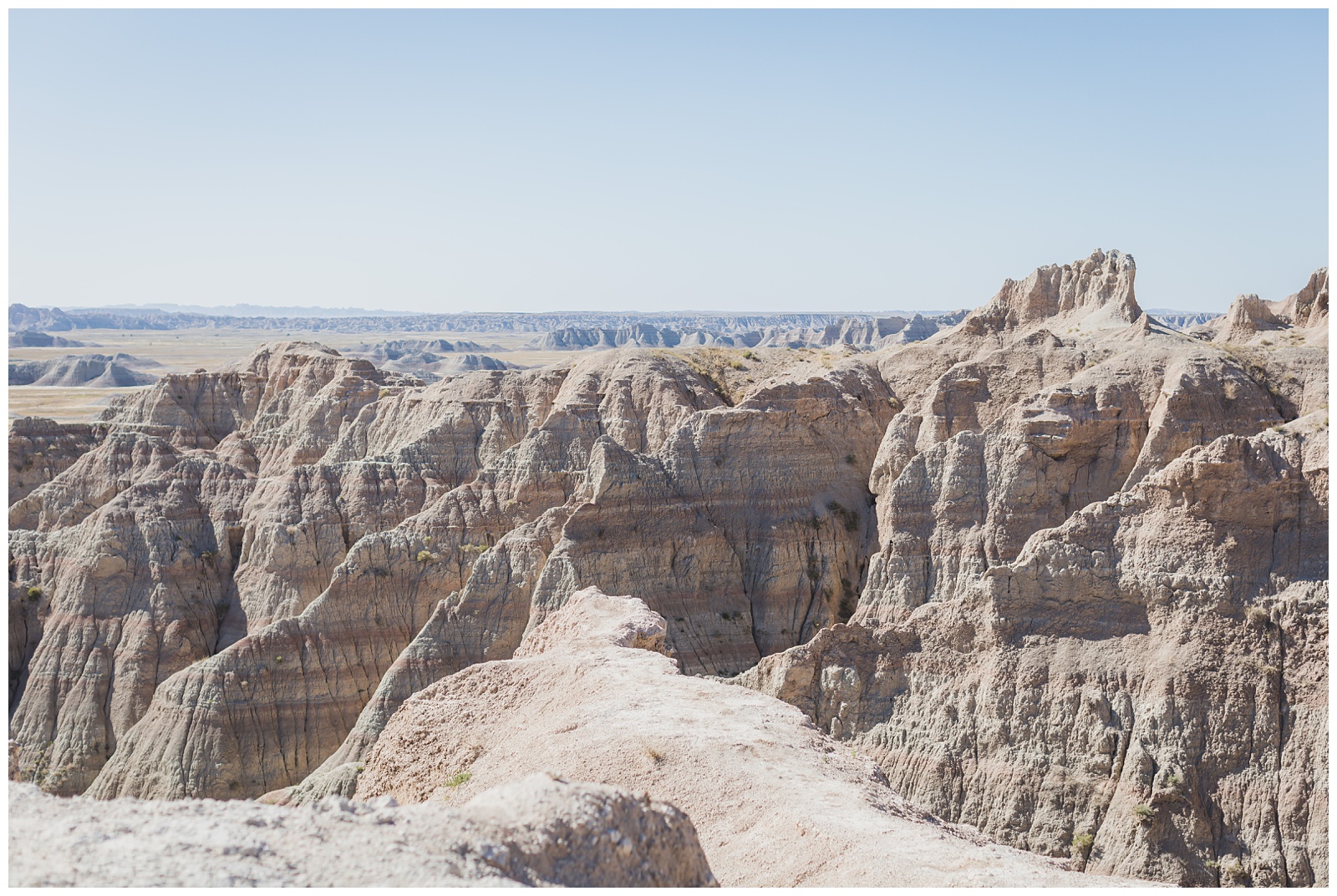
Our last stop in the park was Pinnacles Overlook, which is supposed to be a prime sunset spot. But we had a schedule to keep and couldn’t stick around!
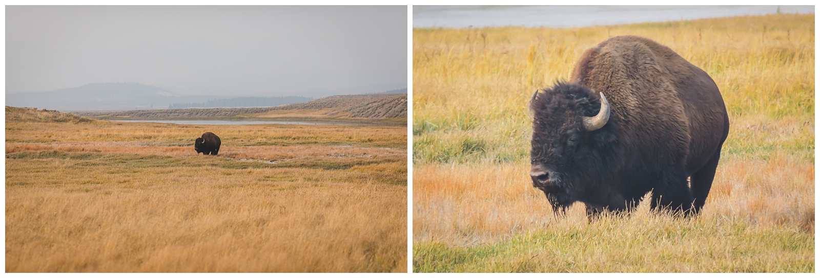
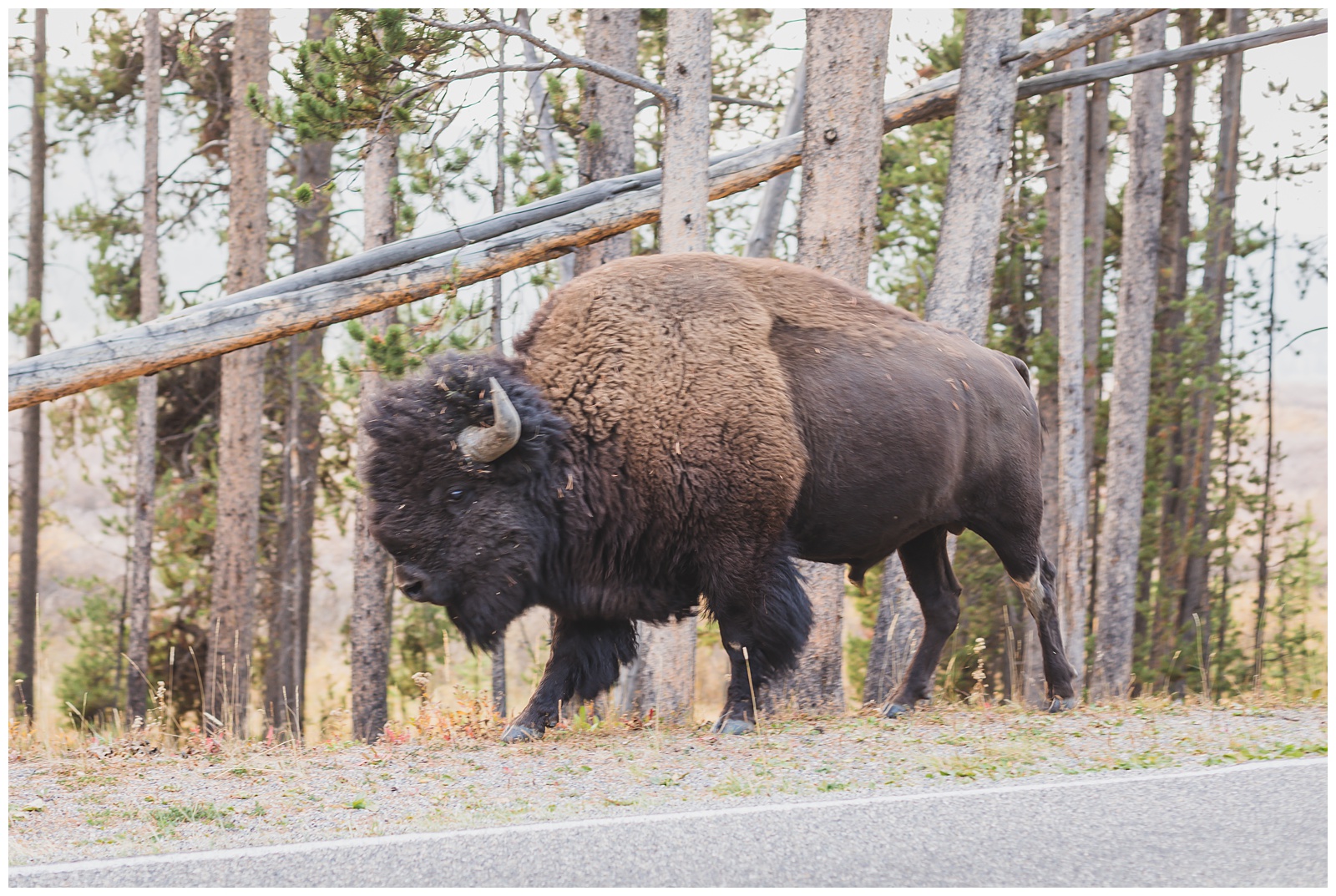
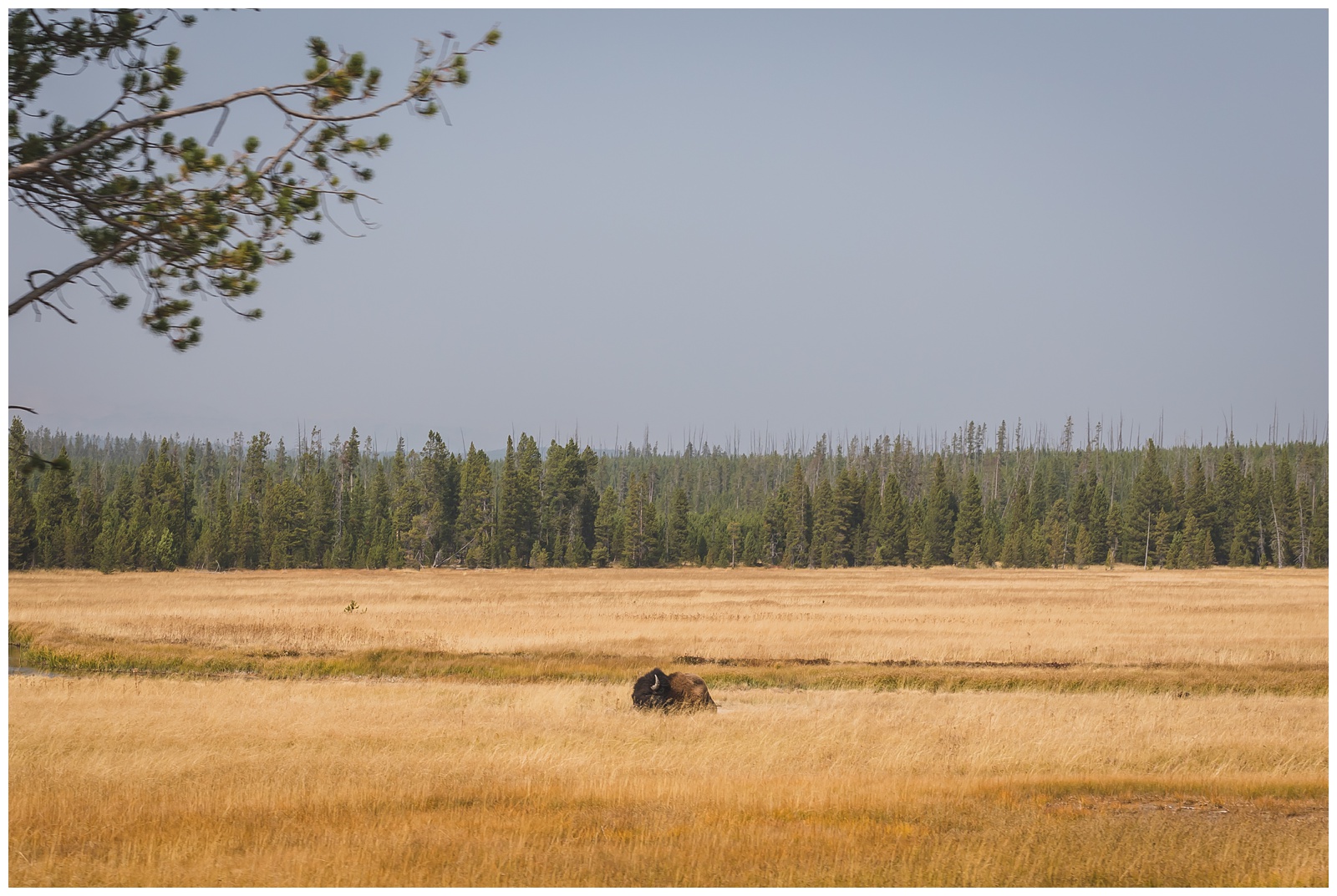
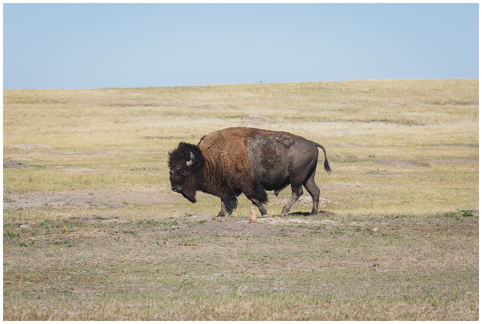 Leaving Badlands, we saw our first bison of the trip. I love the contrast here between it and the prairie dogs at its feet.
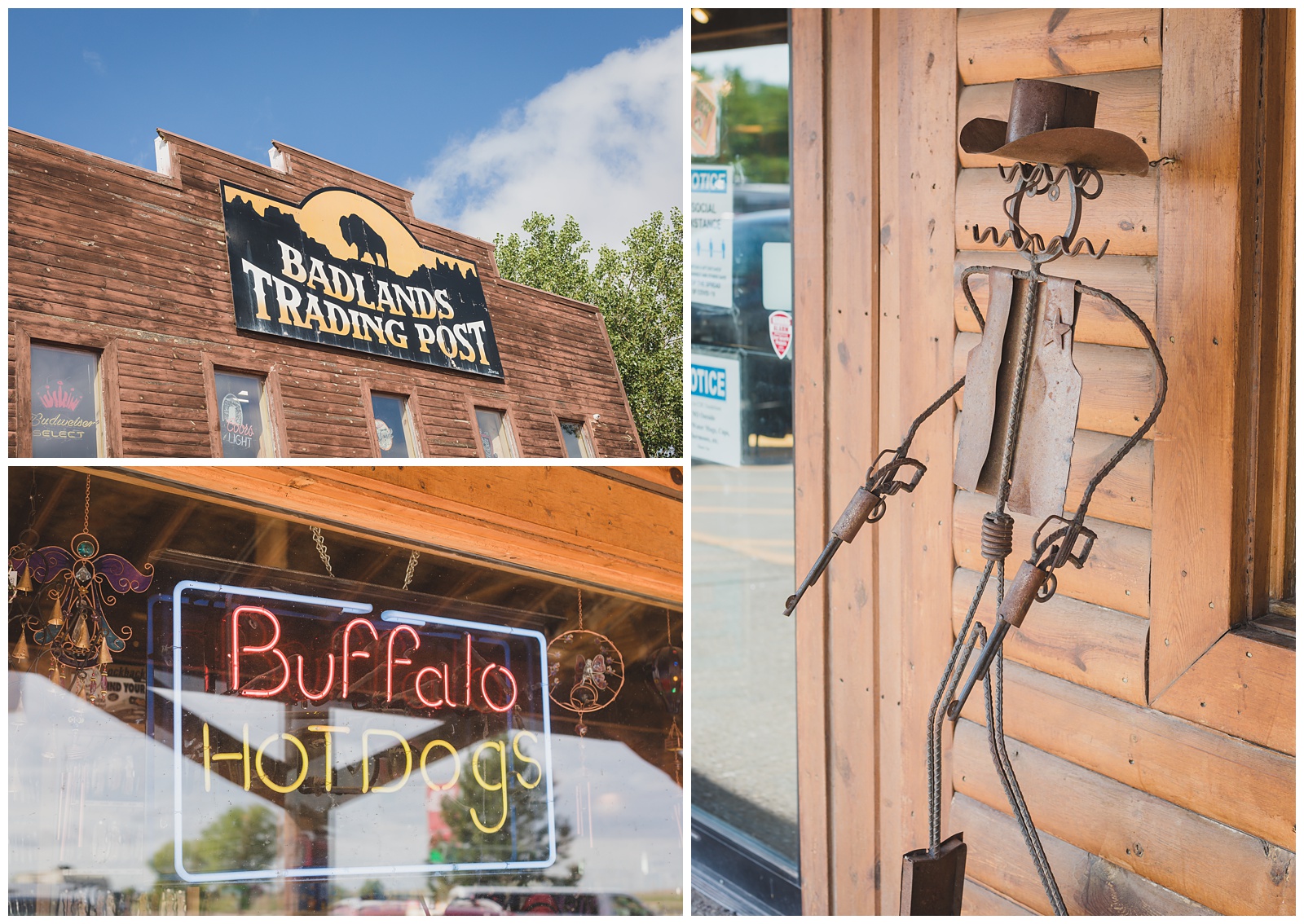
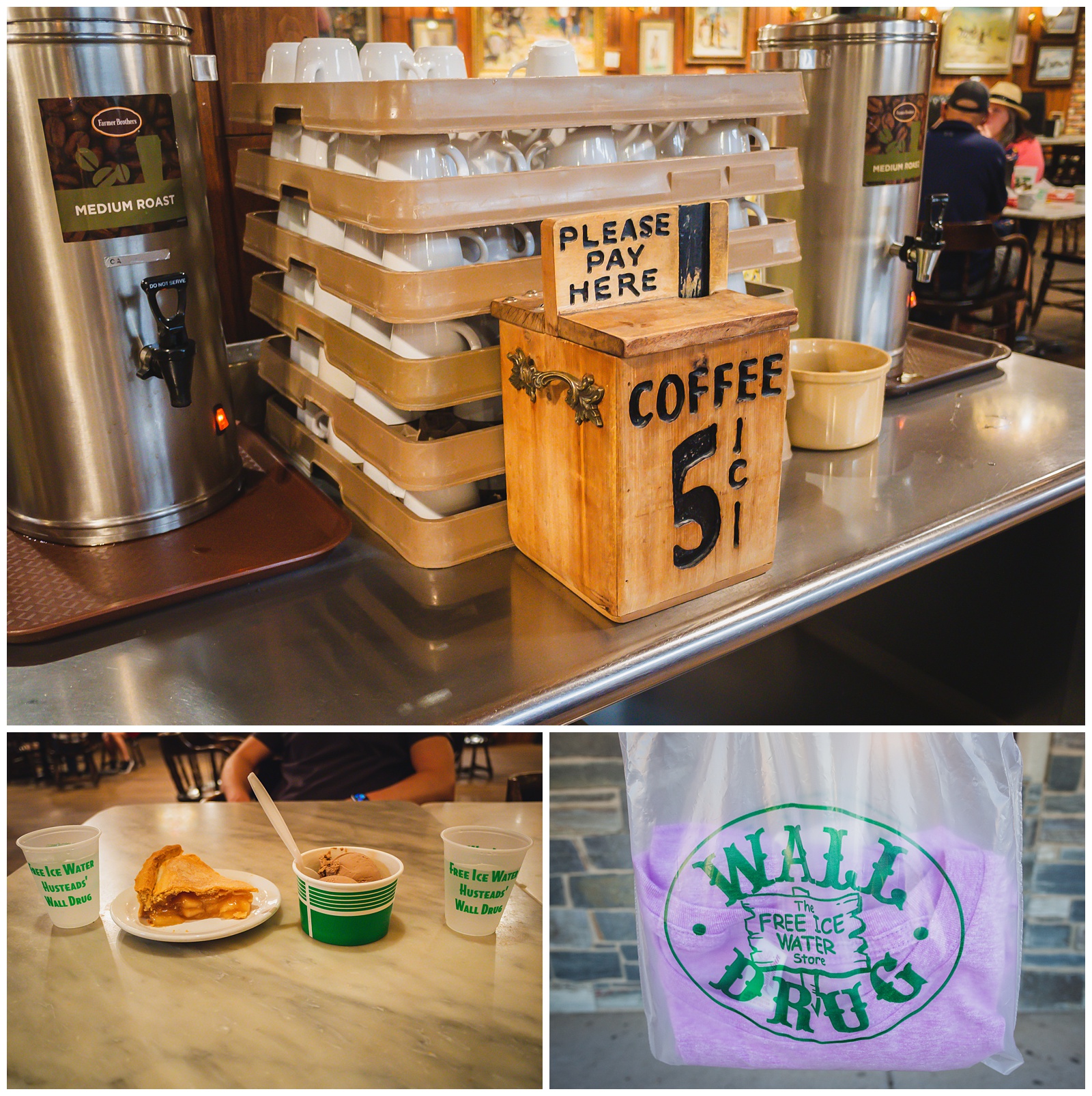
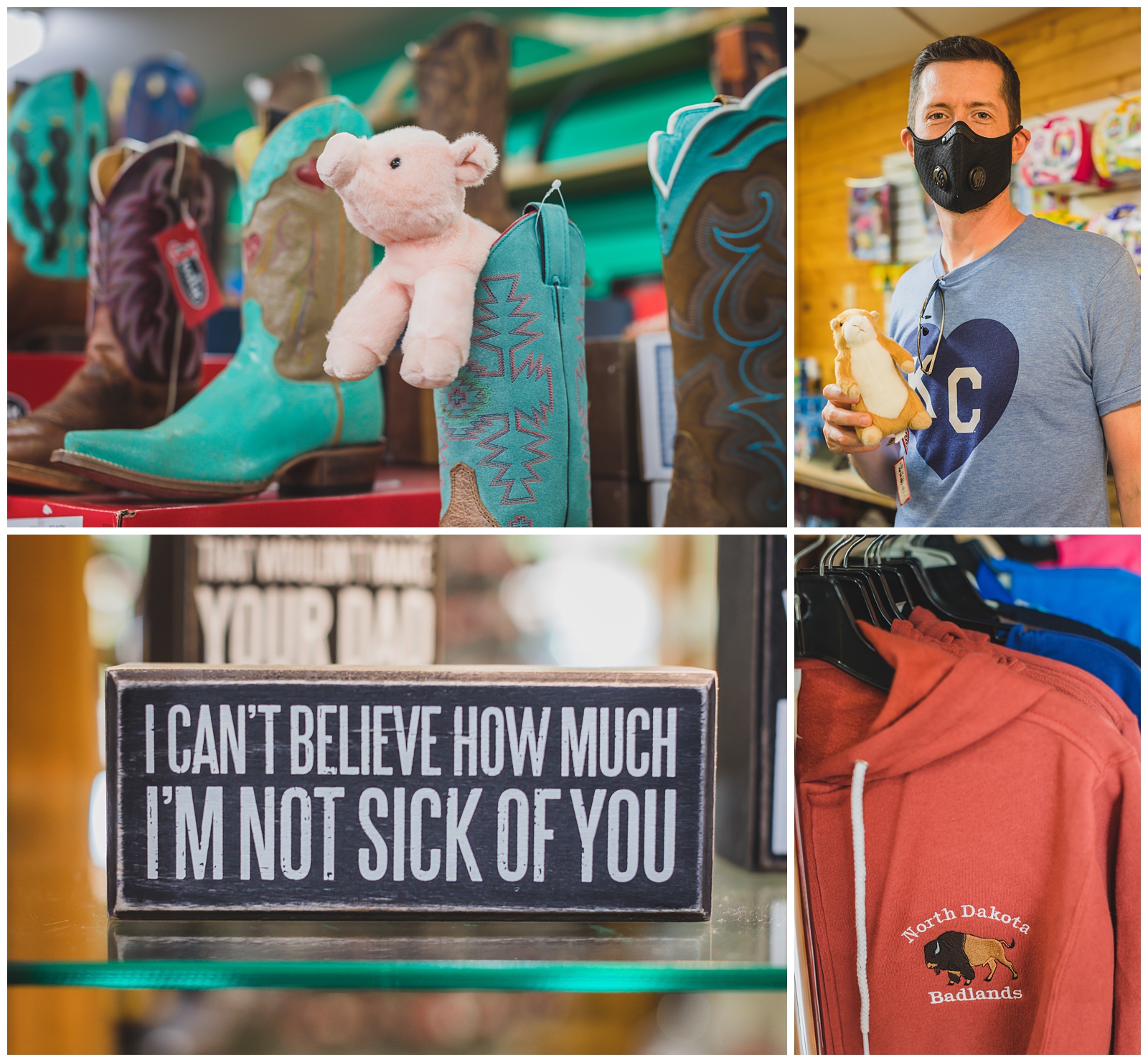
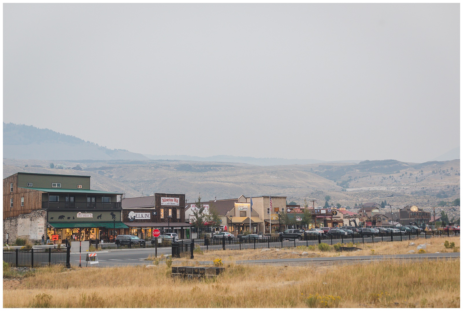
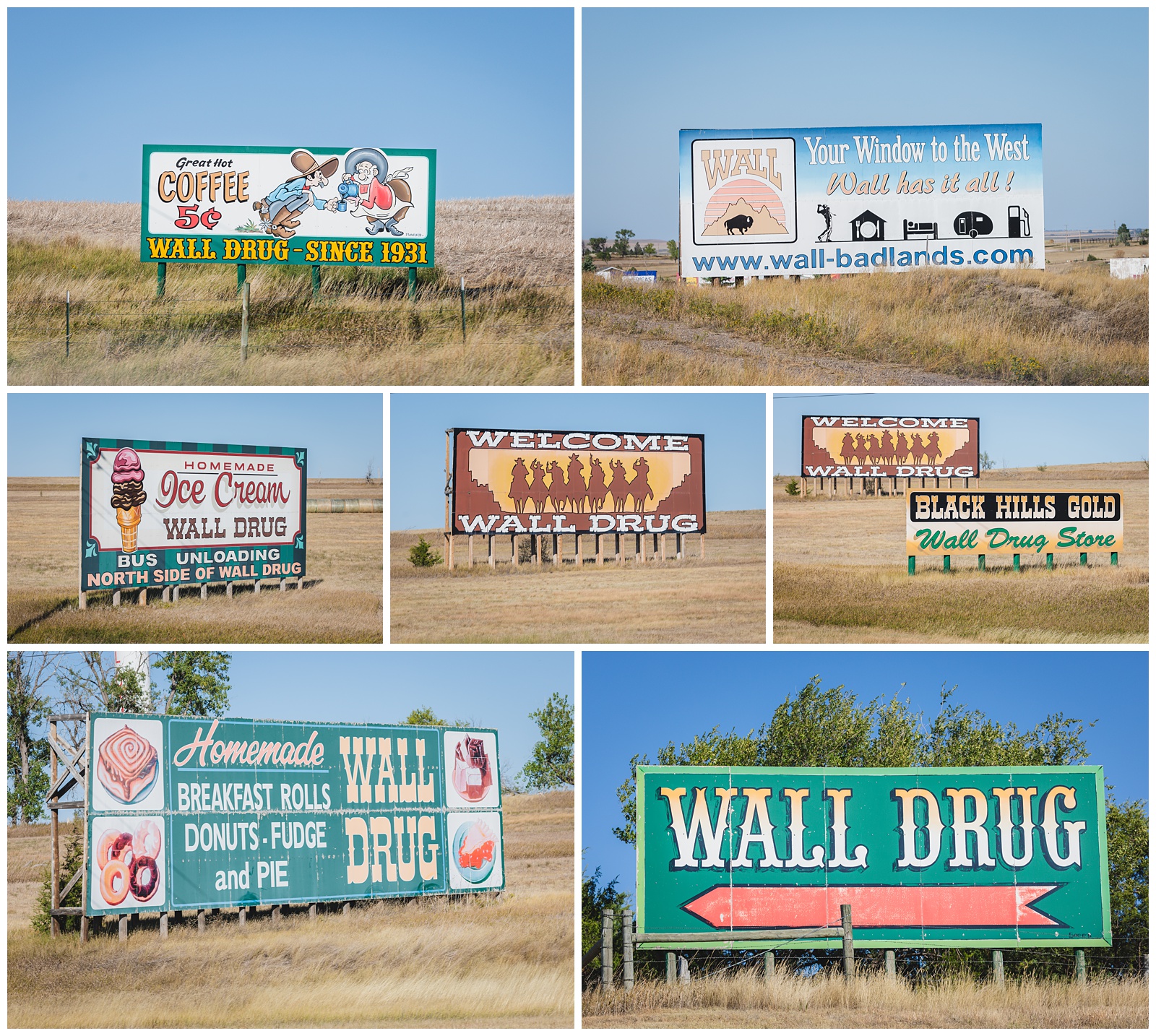 The billboards for Wall Drug start hours away — almost as soon as you enter South Dakota. It was already on our itinerary, but I told Seth that even if it hadn’t been, all that advertising might have enticed us to check it out.
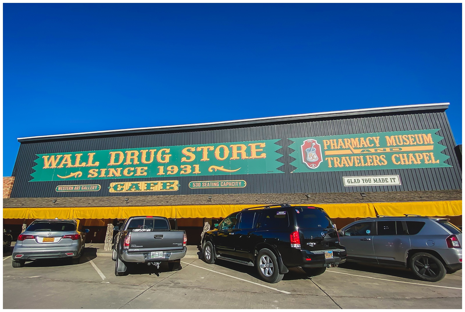
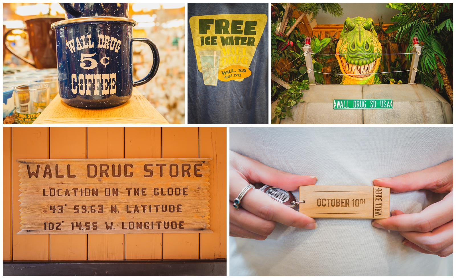 Wall Drug became famous for its free ice water (which was a big deal for weary Depression-era travelers). And it still offers 5-cent cups of coffee, just like in its early days. These are simple things that obviously have made a big difference, because the tiny town of 800 people draws more than 2 million visitors each year! {Source: Wall Drug}
day 3 • 09.13.20
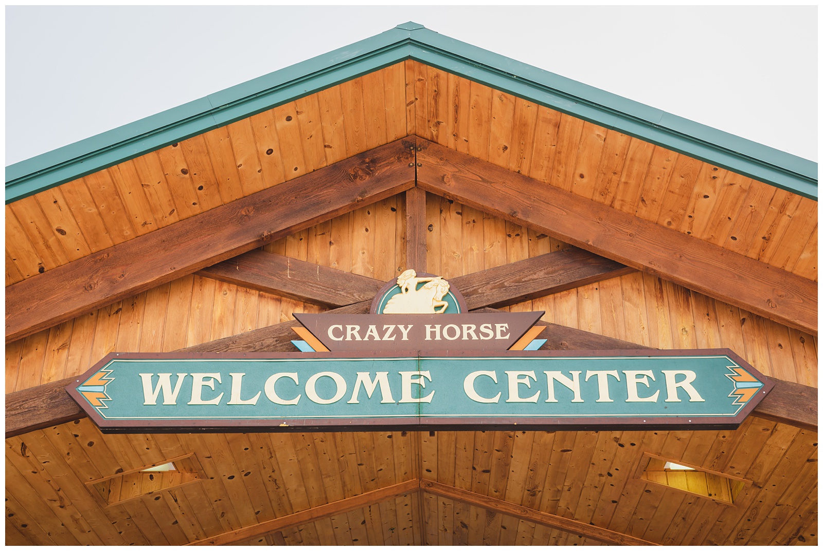
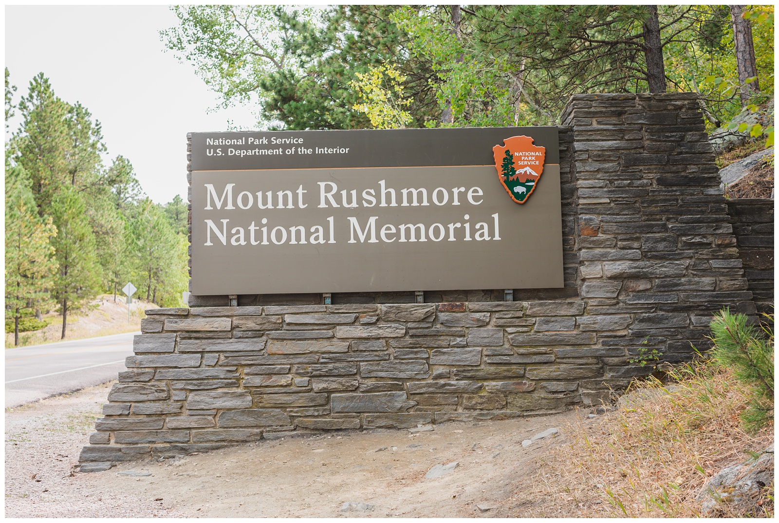
Hot Springs, SD >>> Wind Cave National Park >>> Crazy Horse Mountain Memorial >>> Mount Rushmore National Memorial >>> Devils Tower National Monument >>> Belle Fourche, SD
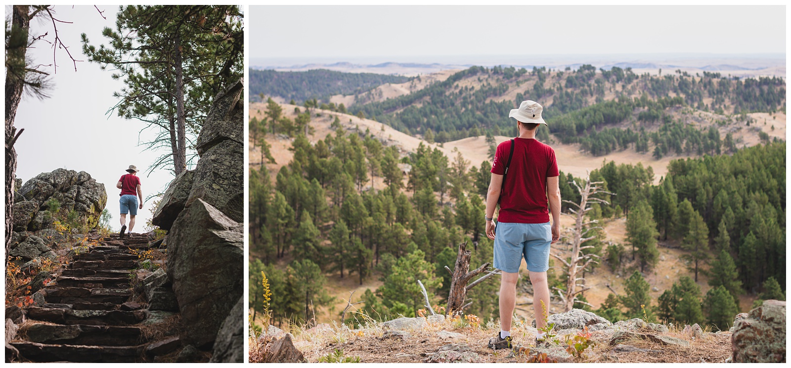
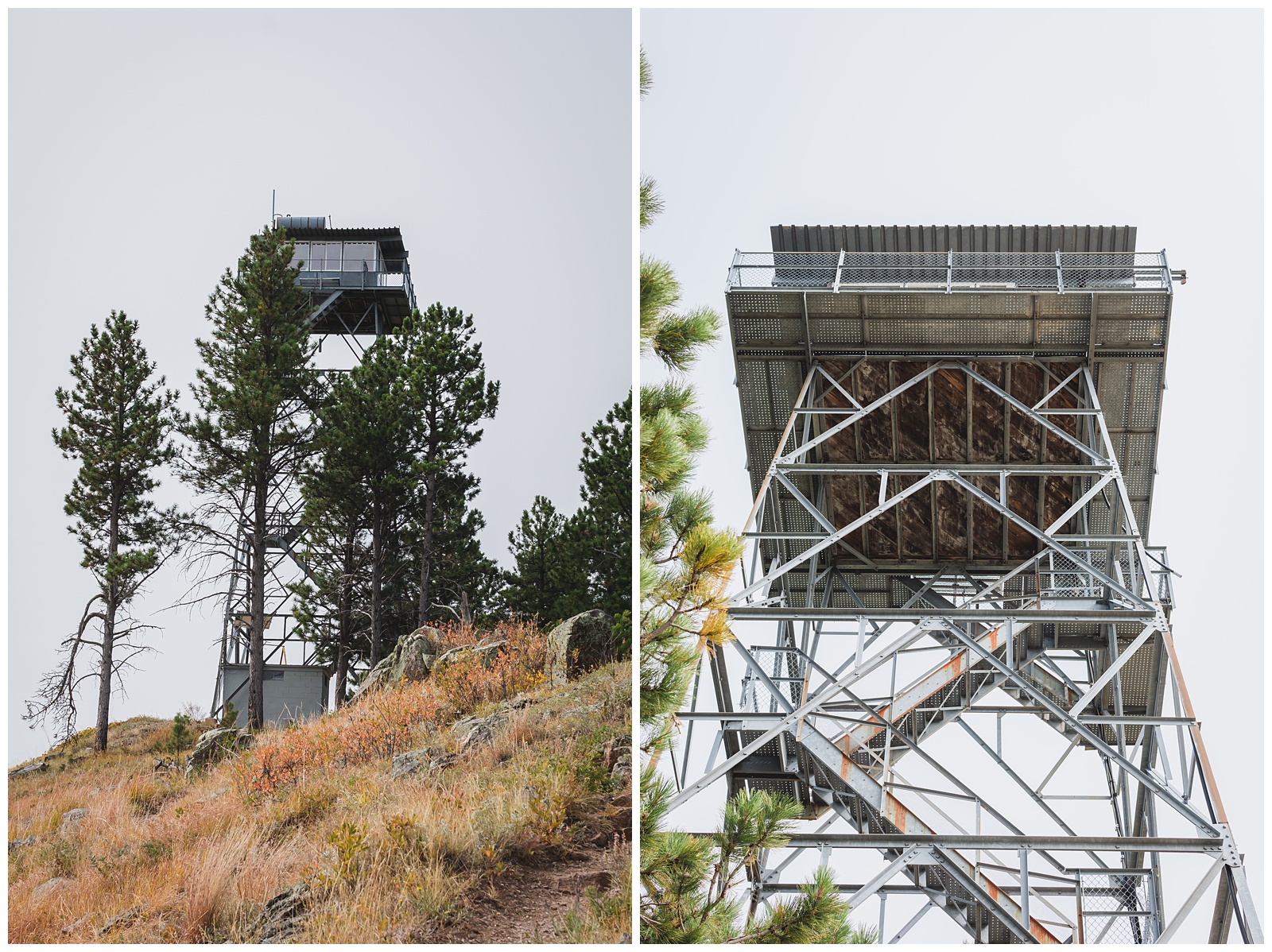
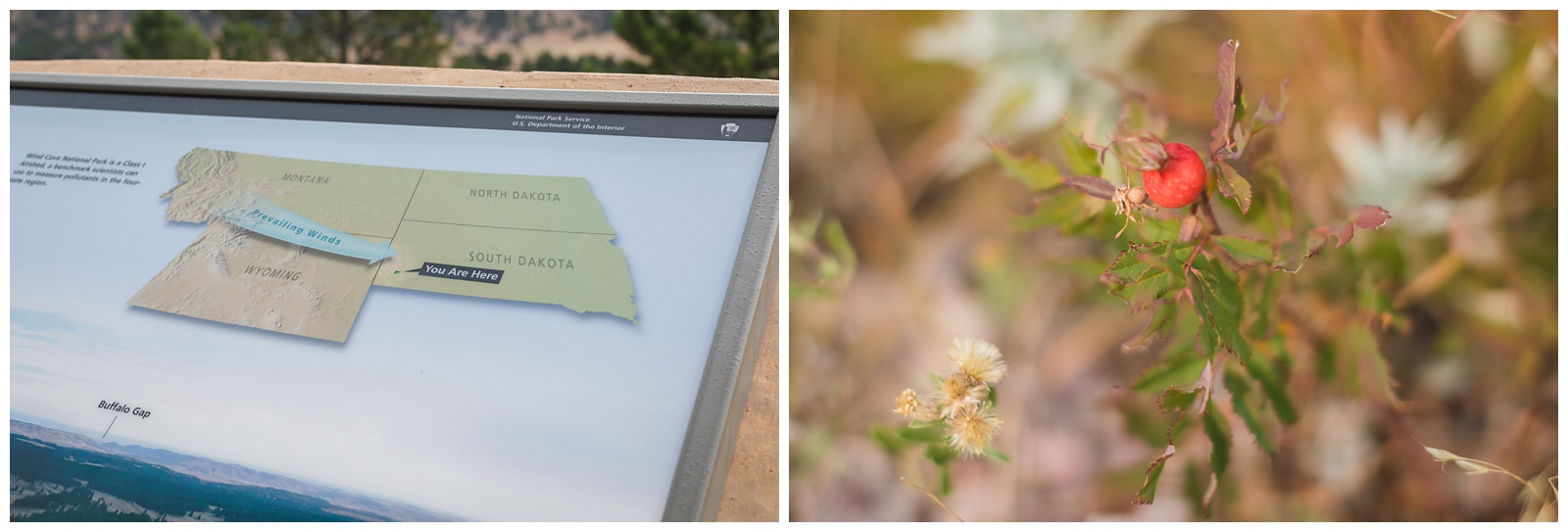
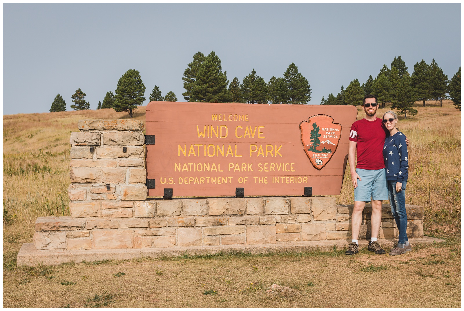 Wind Cave was the first cave to be designated a National Park anywhere in the world. Although the cave is currently closed, we still enjoyed driving through the park and hiking to its highest point via the Rankin Ridge Trail.
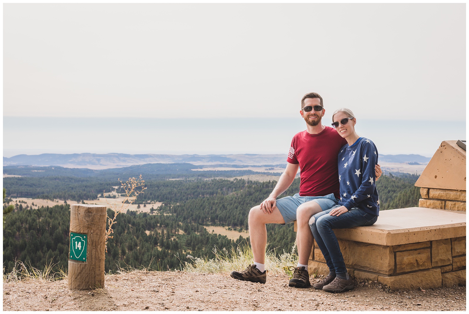
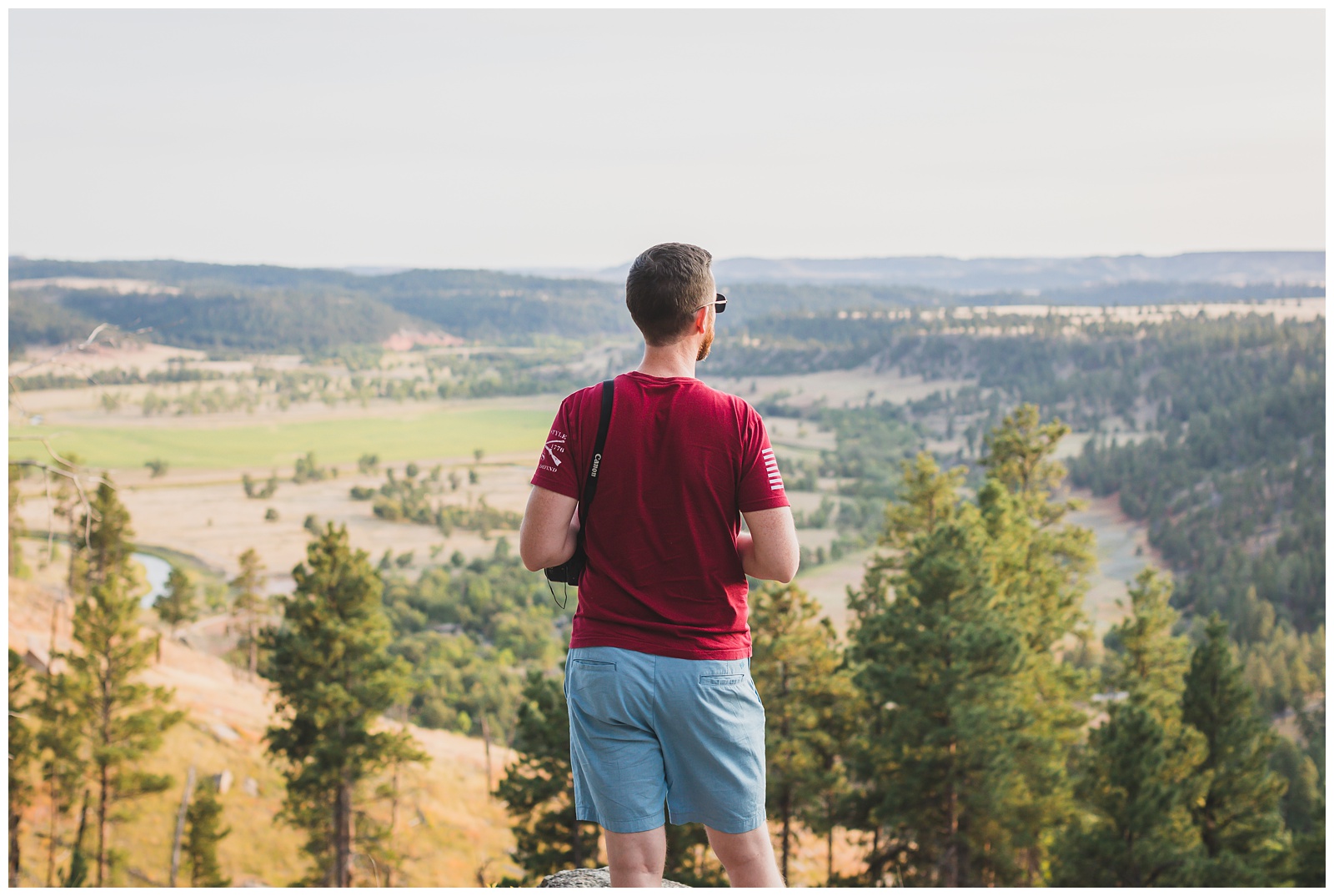
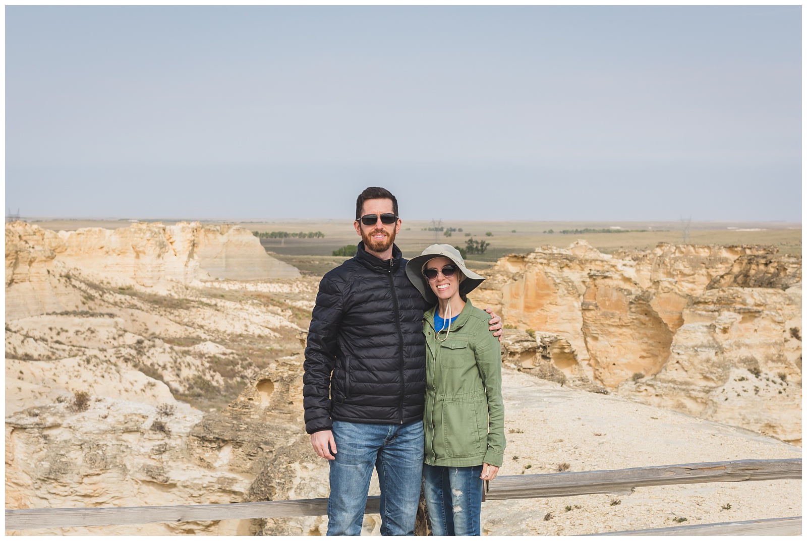
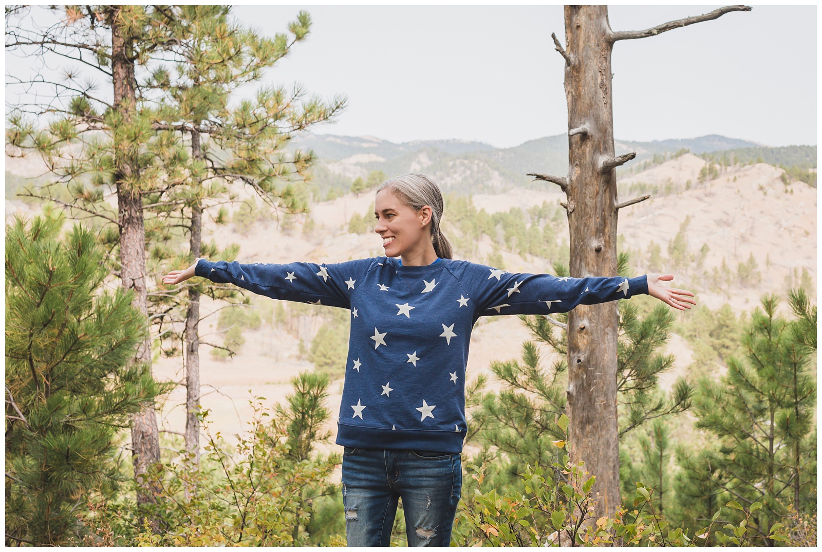 I hadn’t known what to expect from the Black Hills and was surprised how similar they seemed to some spots in Colorado. This is my “I’m in the mountains!” pose. 🤗
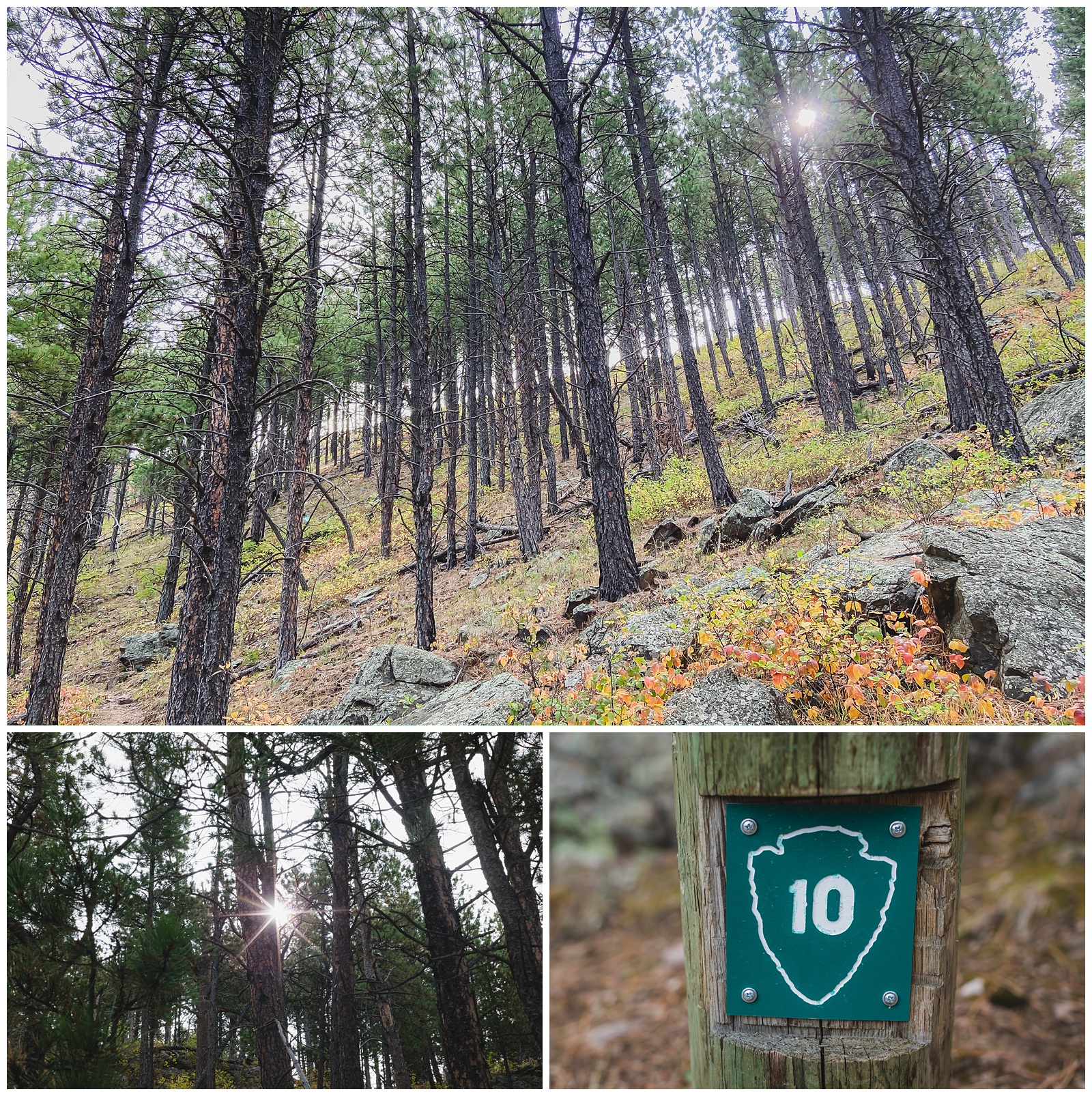 Of course we had to photograph any “10” markers we came across!
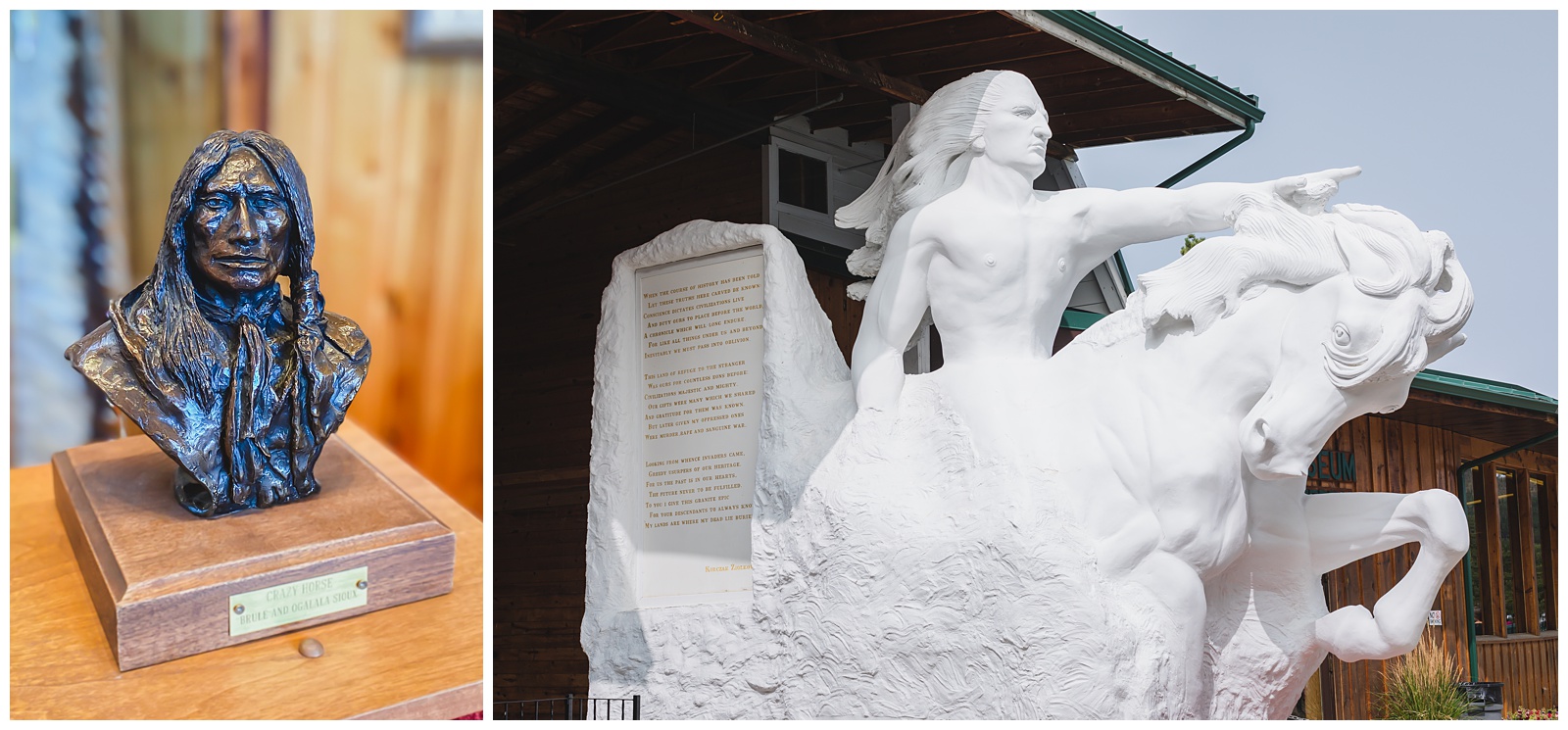 The white sculpture shows how Crazy Horse Mountain Memorial is intended to look one day …
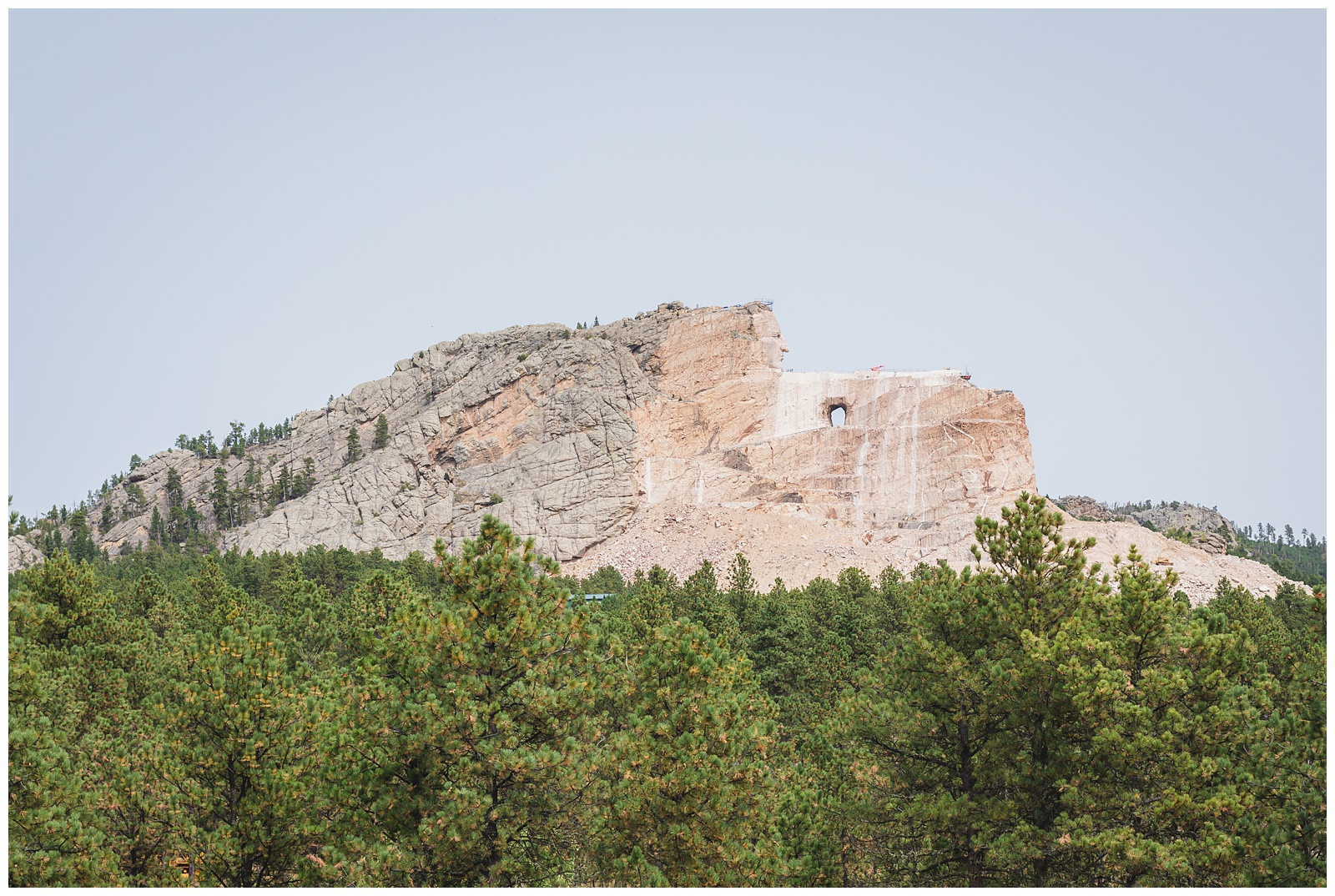
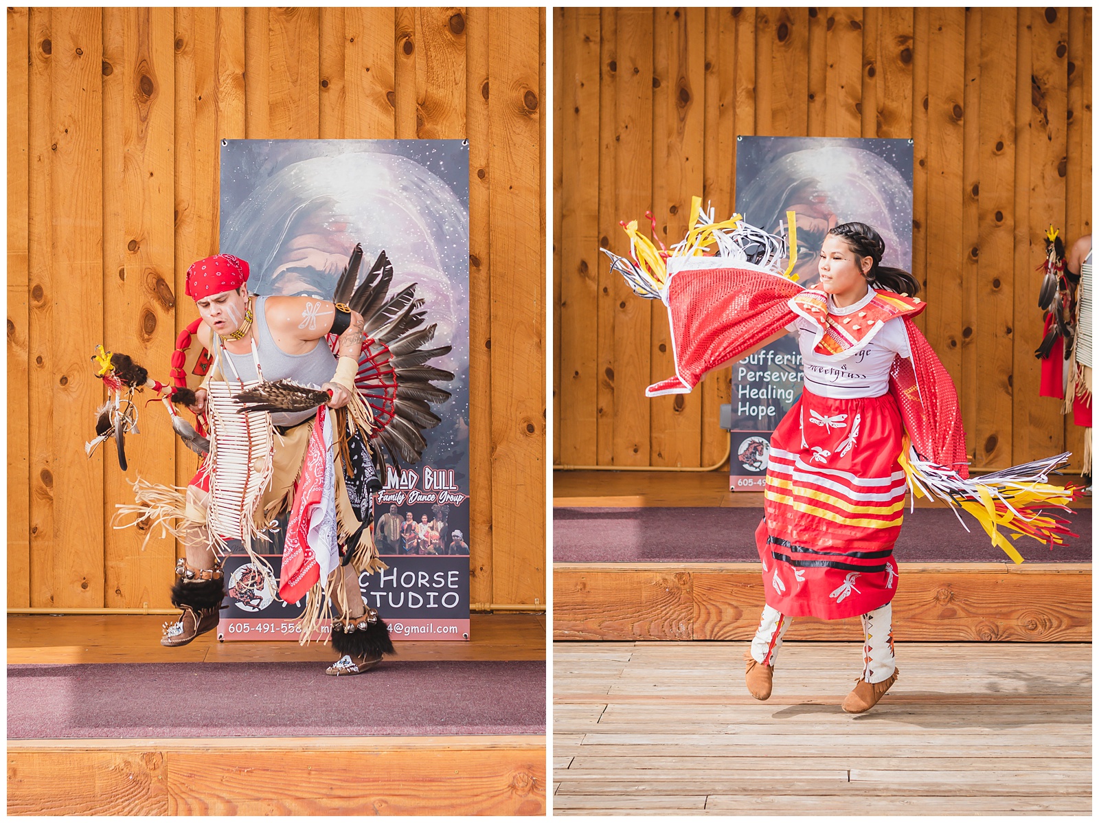
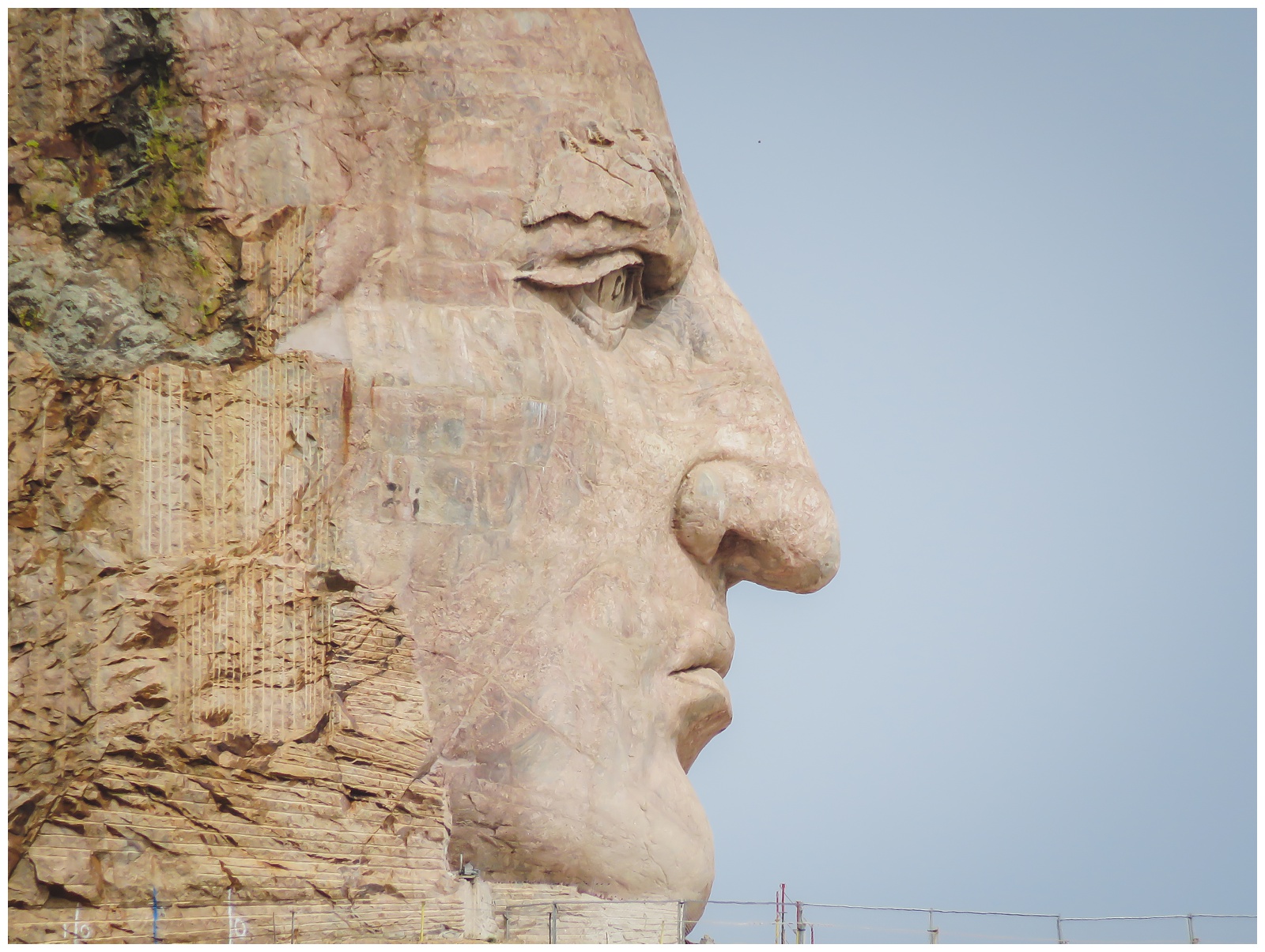 And this is it currently; the face is almost 90 feet tall! The memorial and on-site museum honor not only Lakota leader Crazy Horse but also the history and culture of all North American Indians.
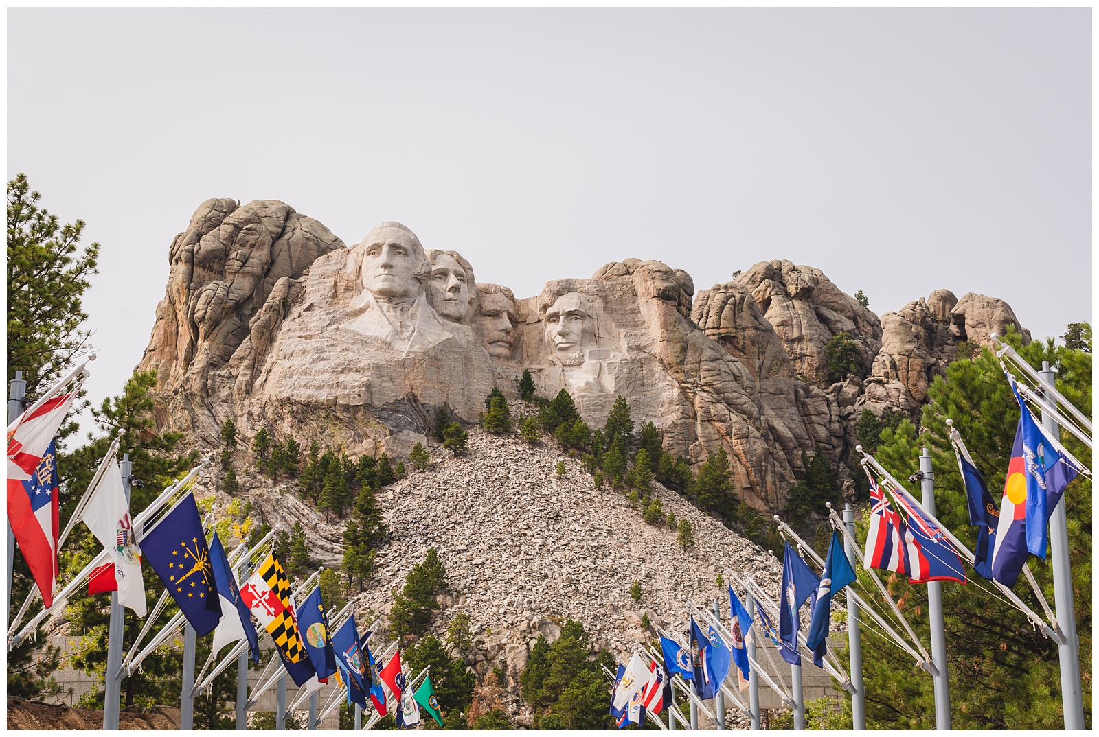
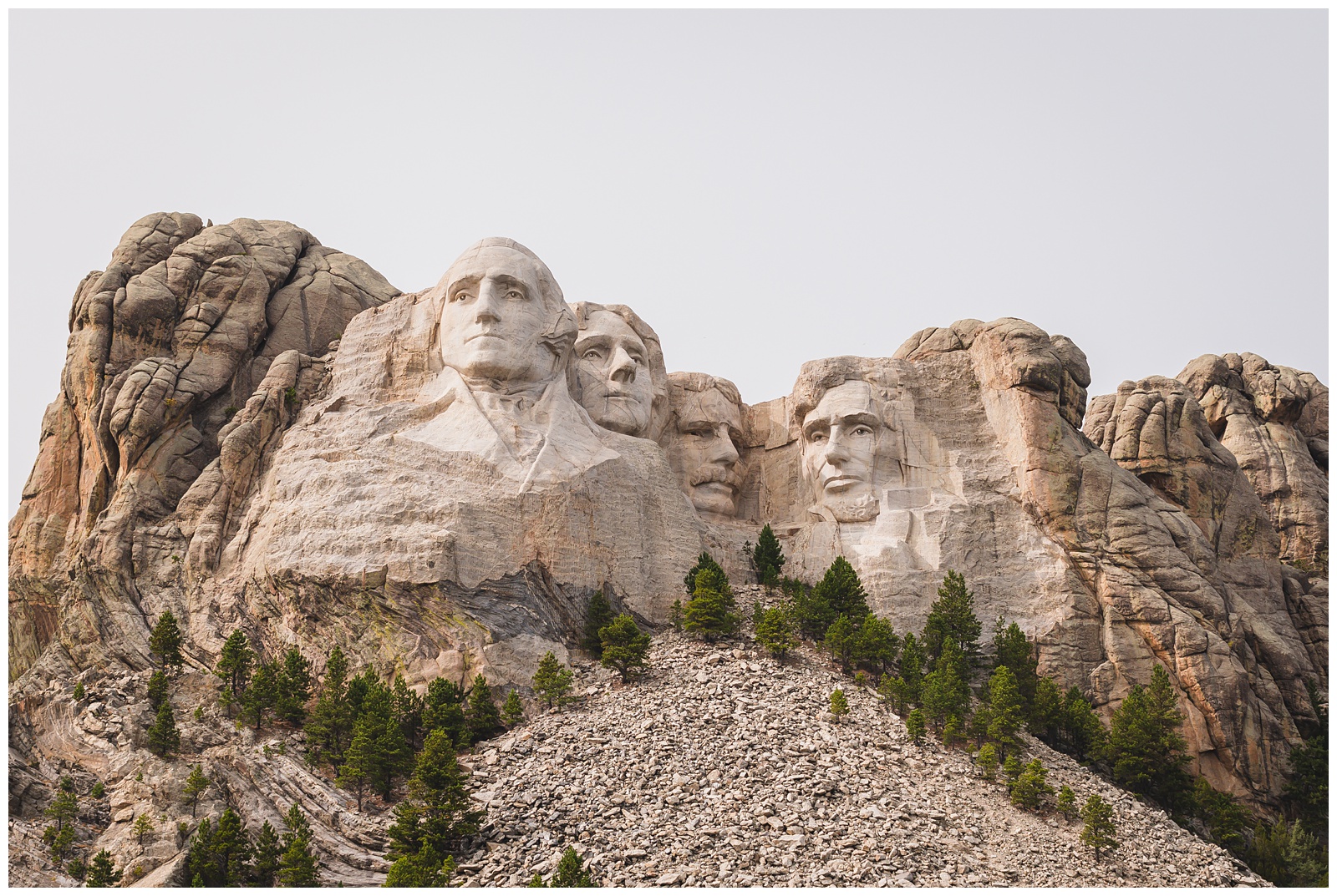
The presidents on Mount Rushmore were chosen to represent the nation’s birth (Washington), growth (Jefferson), development (Roosevelt) and preservation (Lincoln). {Source: National Park Service}
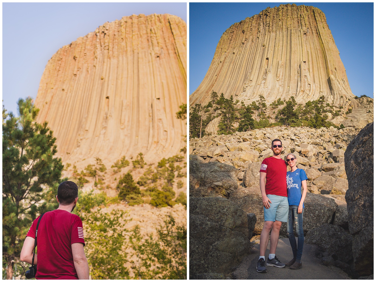
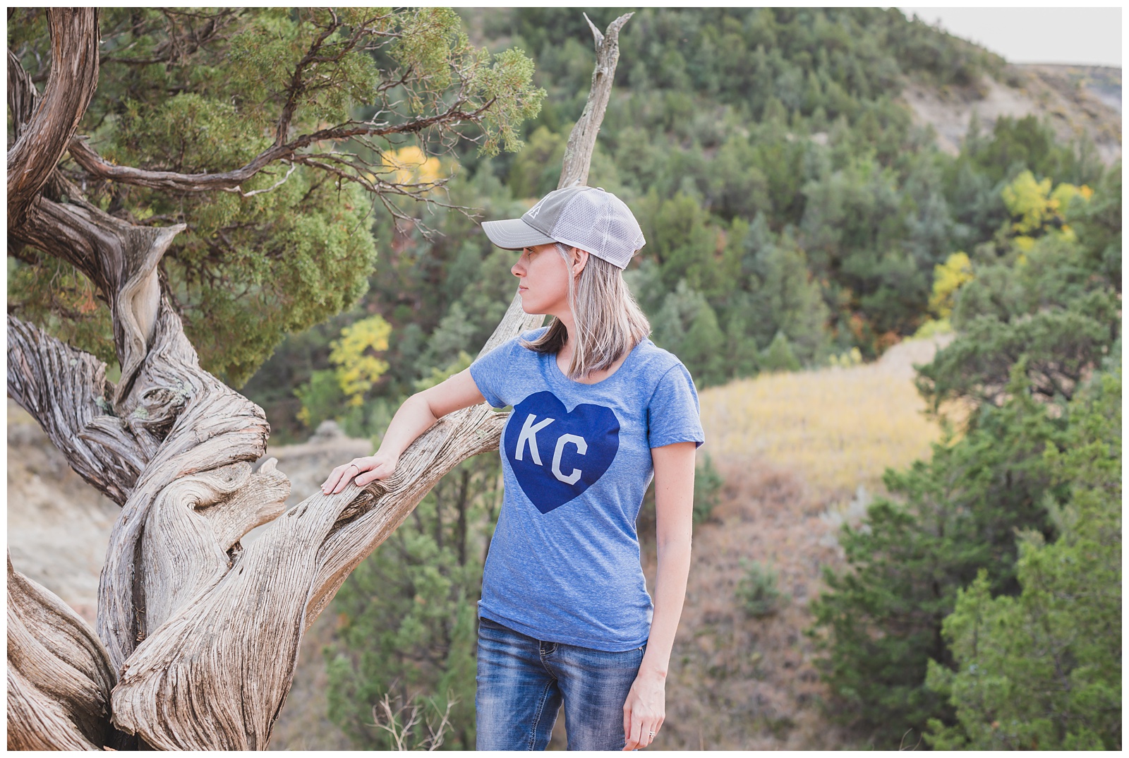
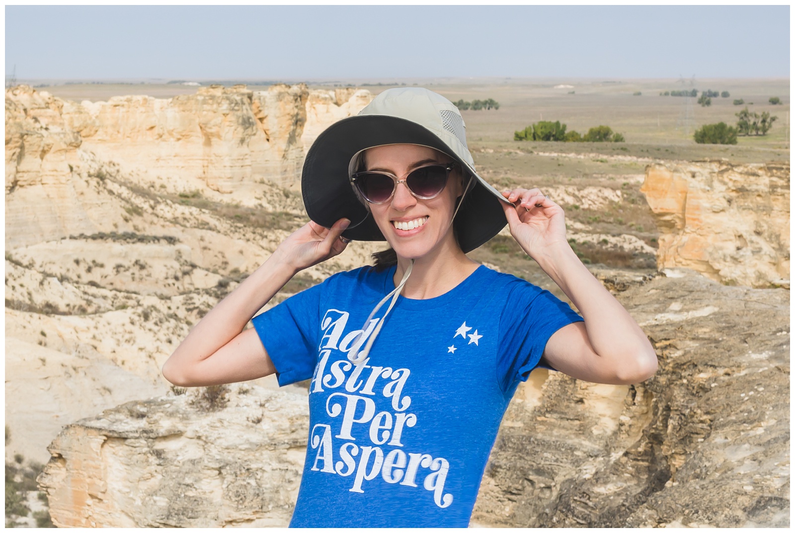
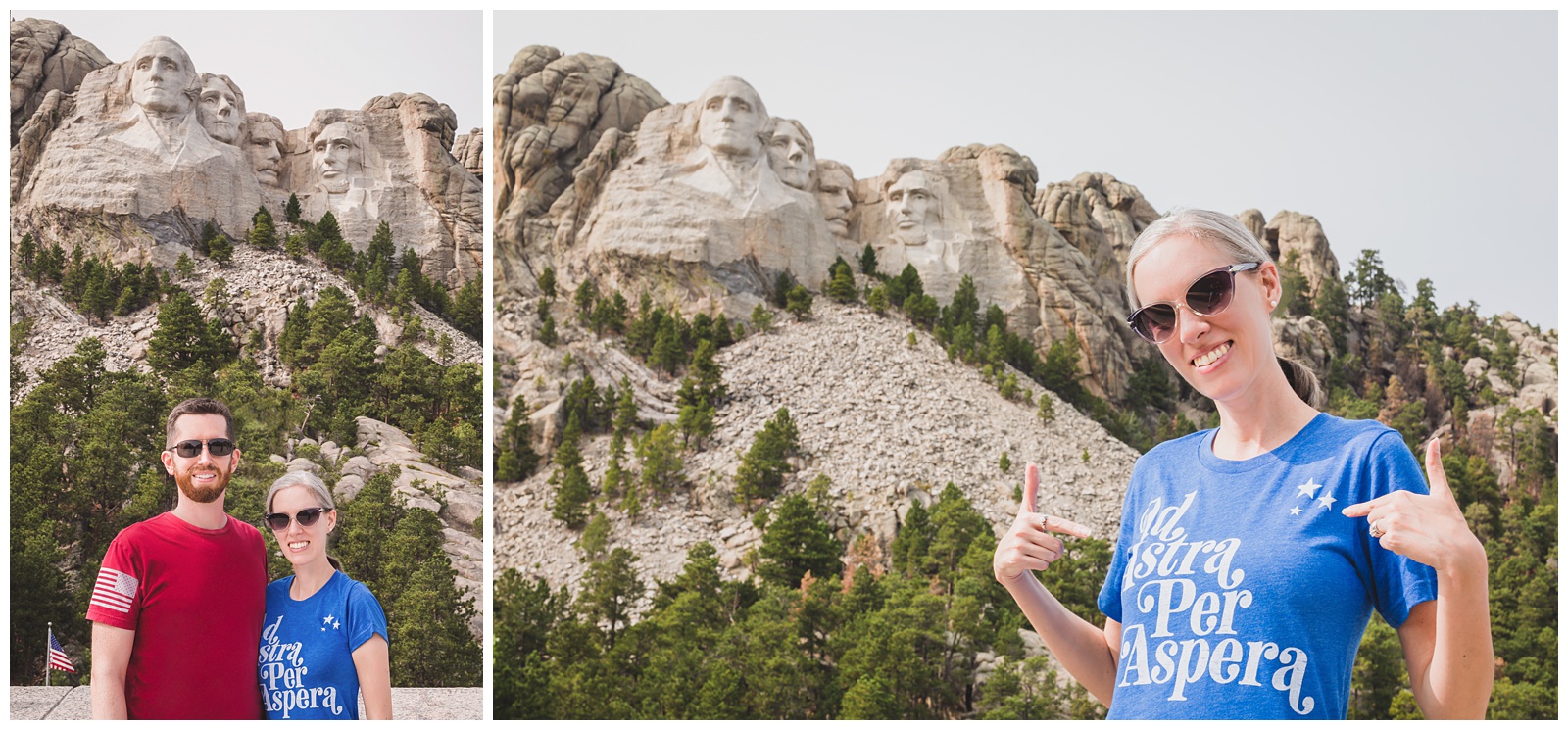 For anyone who’s not a native Kansan: “Ad Astra Per Aspera” — “To the Stars through Difficulties” — is Kansas’ state motto. I thought this shirt (from Kansas company Kinfolk Created) was perfect to wear while visiting Crazy Horse and Mount Rushmore — since making art from a mountain is no small feat!
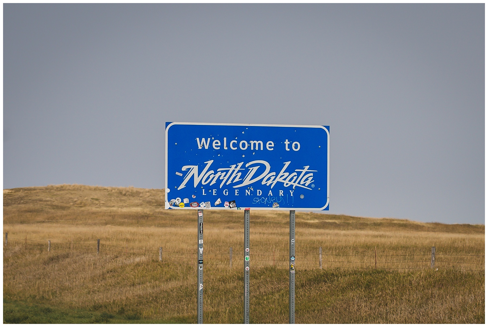
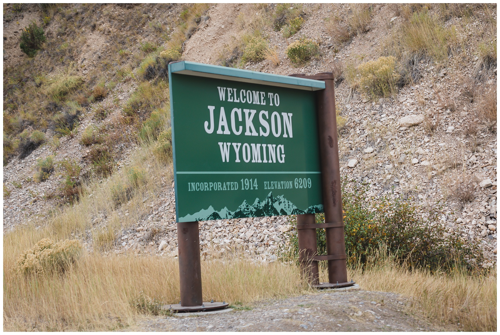
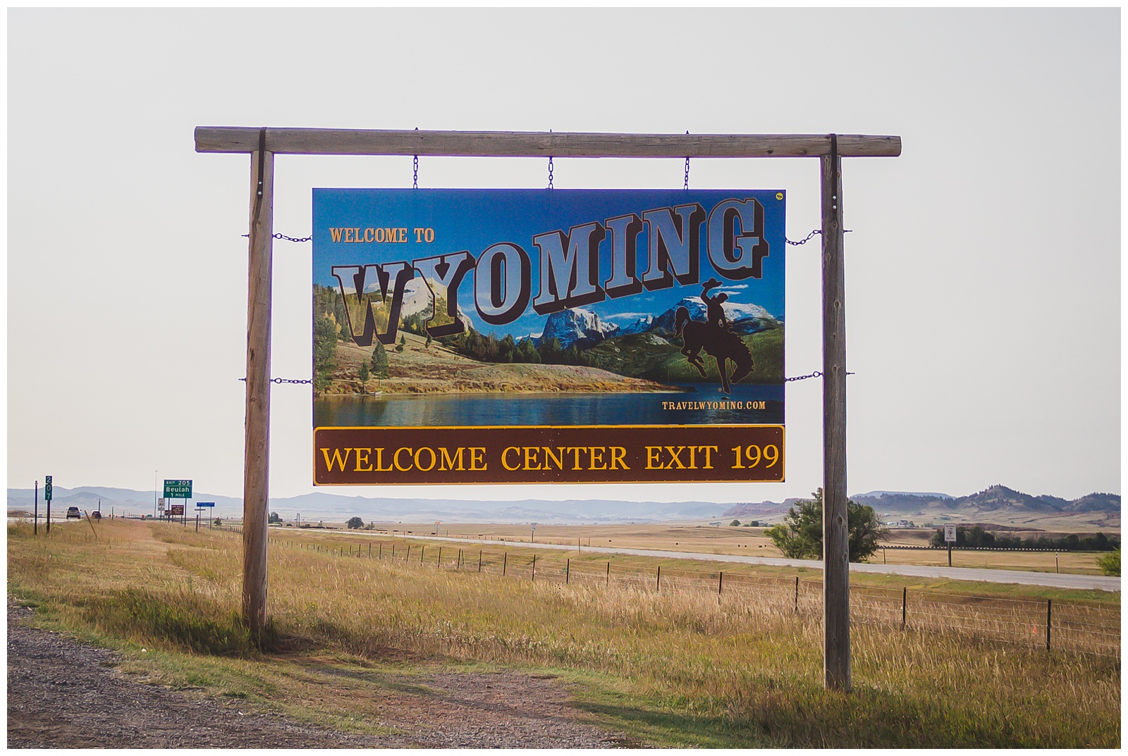 We detoured into Wyoming just briefly to see Devils Tower — and as it turned out, a perk of this was the opportunity to photograph a Wyoming sign (which we wouldn’t have when we returned to the state a few days later, since it doesn’t announce itself in Yellowstone like it does on I-90!).
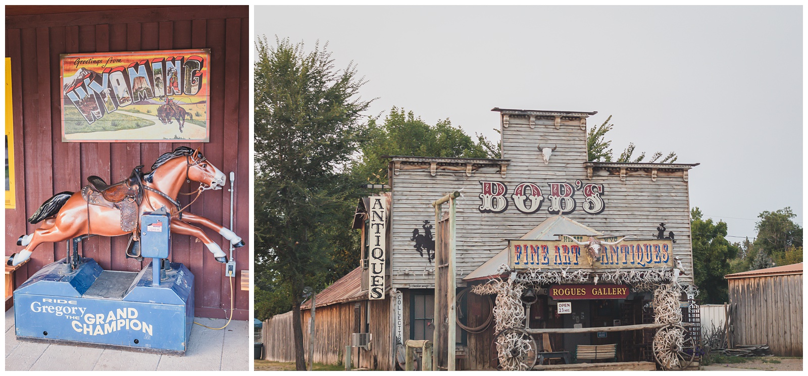
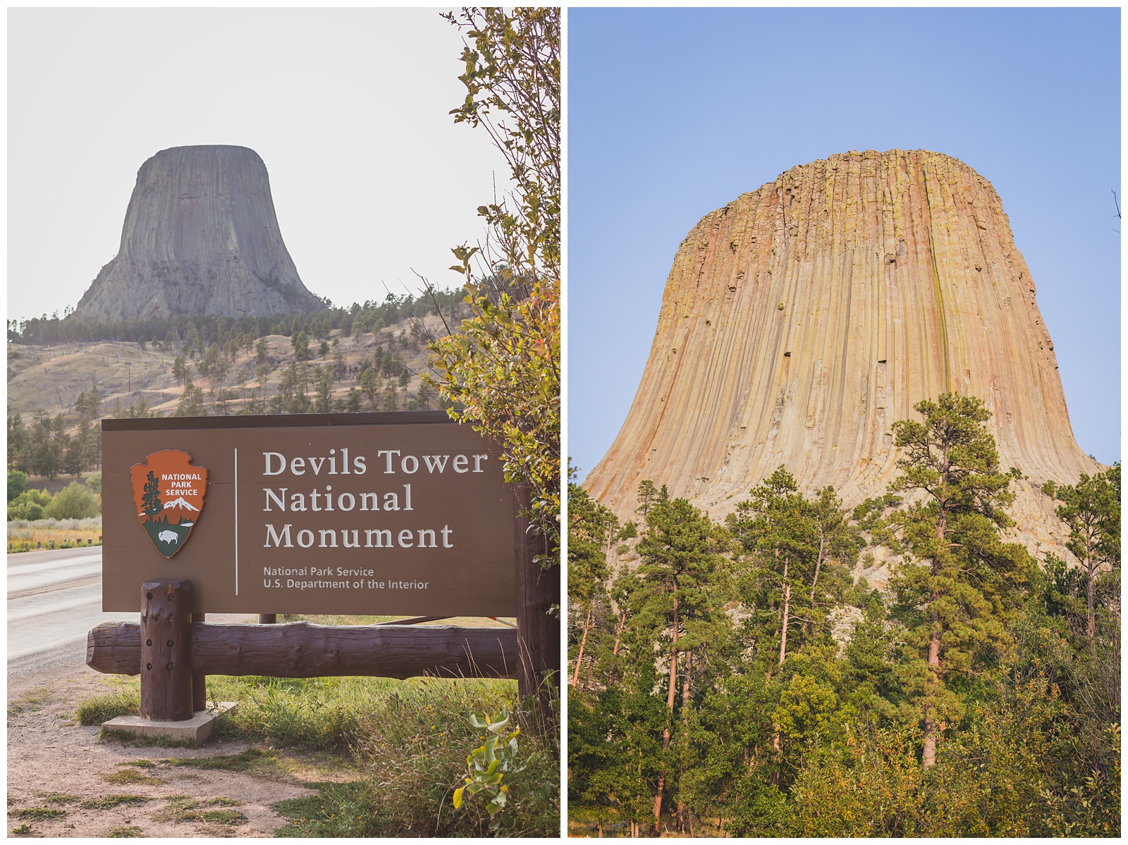 Devils Tower was the first national monument, established 10 years before the National Park Service existed. It was golden hour when we arrived, which was a gorgeous time to see the tower and surrounding landscape.
day 4 • 09.14.20
Belle Fourche, SD >>> Center of the Nation Monument >>> Medora, ND >>> Theodore Roosevelt National Park
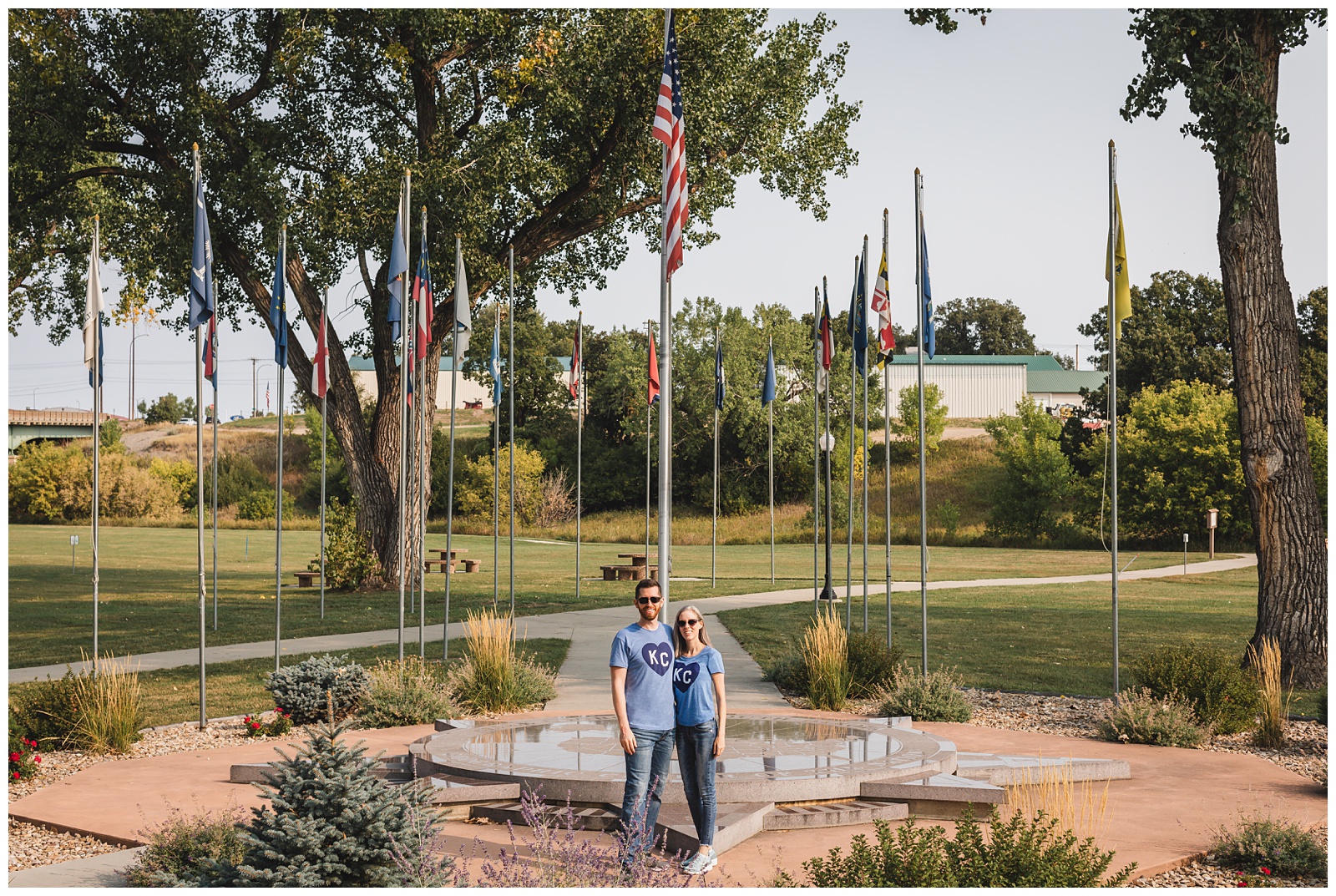
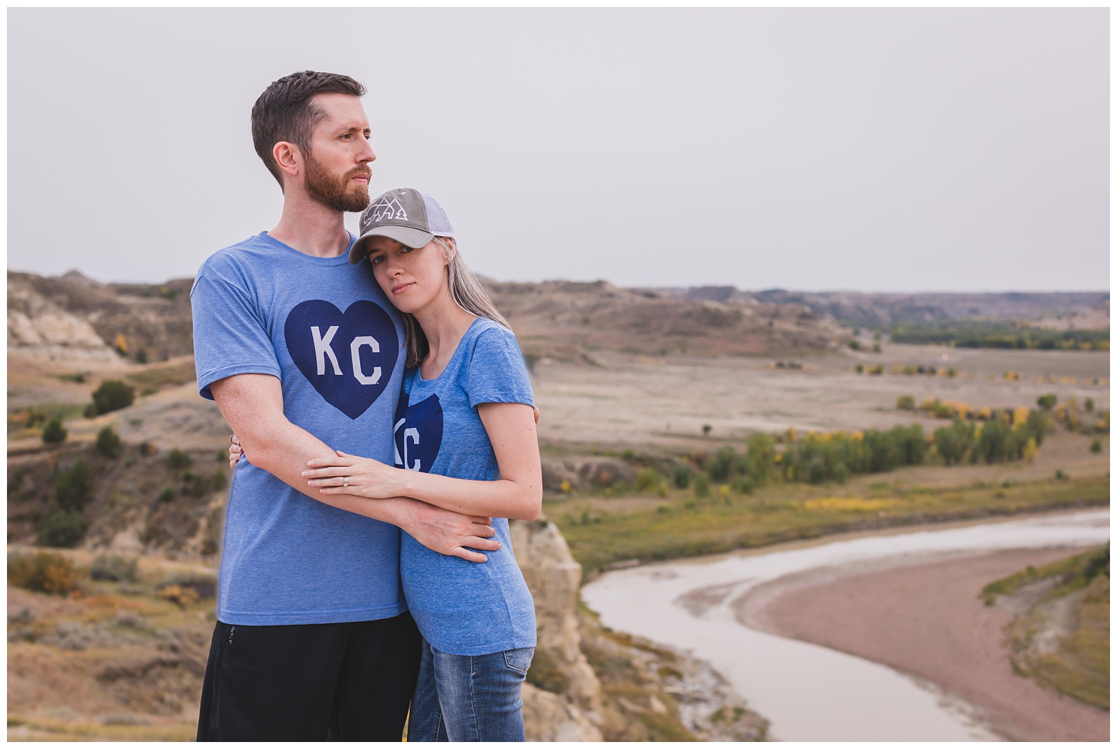
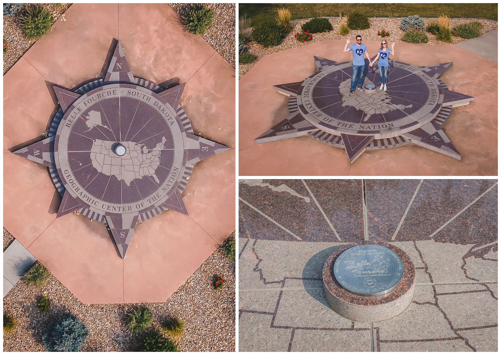 We started this day — which happened to be Seth’s birthday — at the center of the nation (including Alaska and Hawaii). Our drone let us get good shots of it, and this seemed like a good spot to represent Kansas City with our shirts!
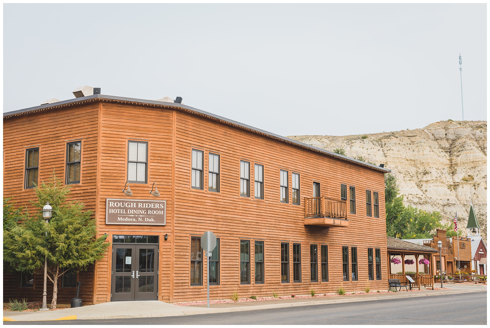
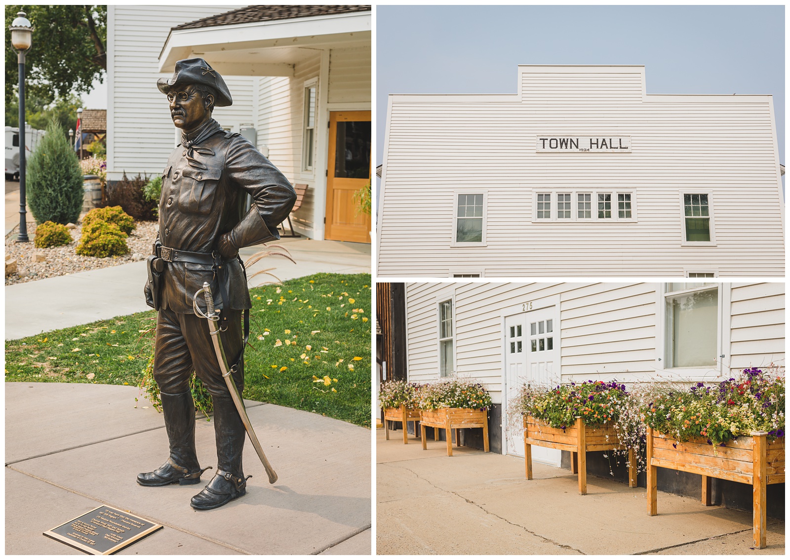
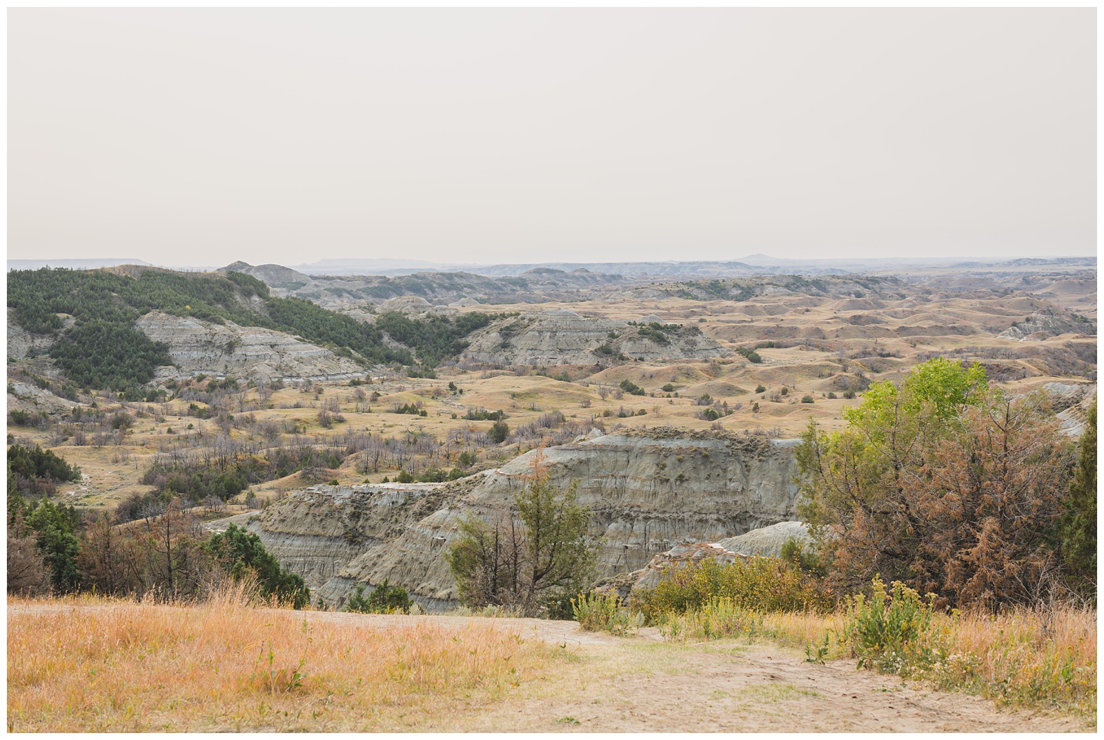
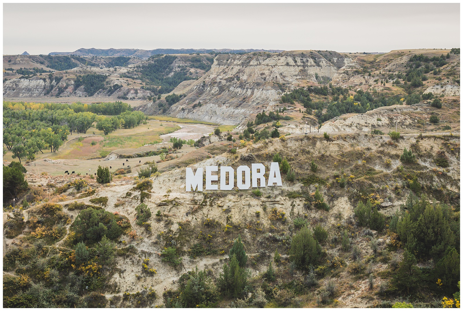 We arrived in Medora, North Dakota, just two days after the end of its tourist season. So it was pretty quiet and felt like having a movie set to ourselves — since the little town looks a lot like something from a Hollywood studio.
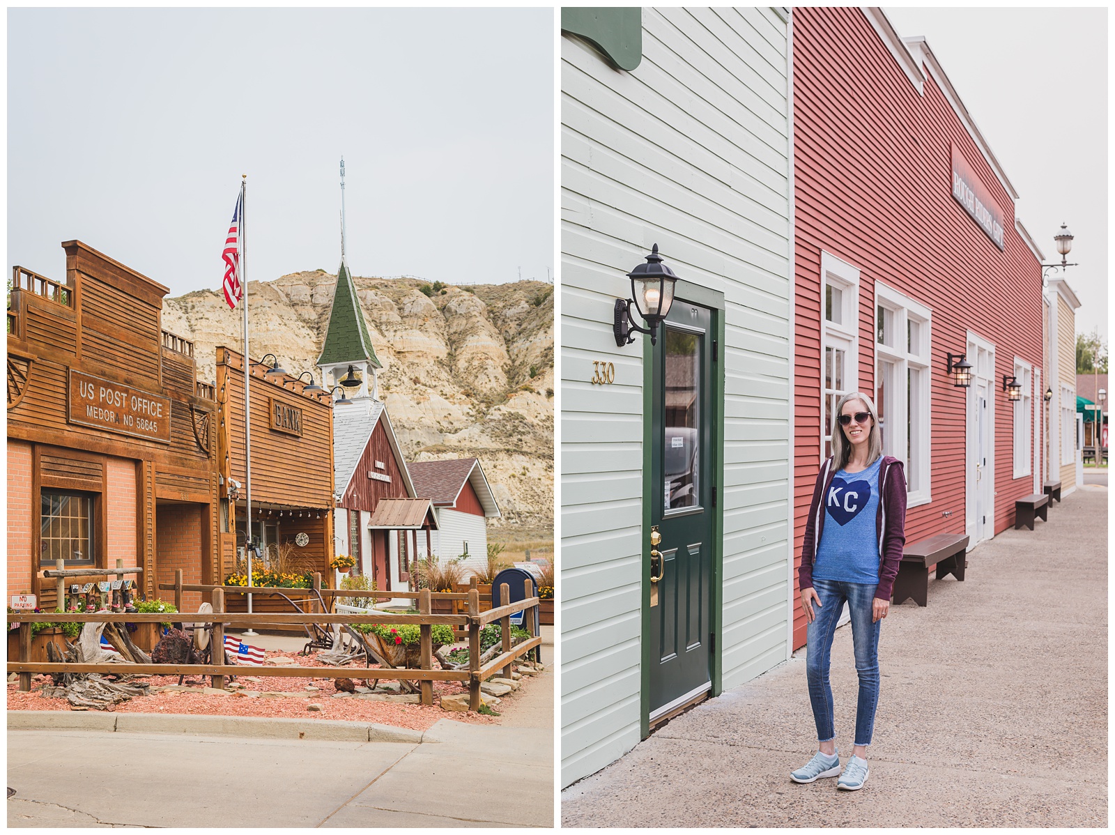
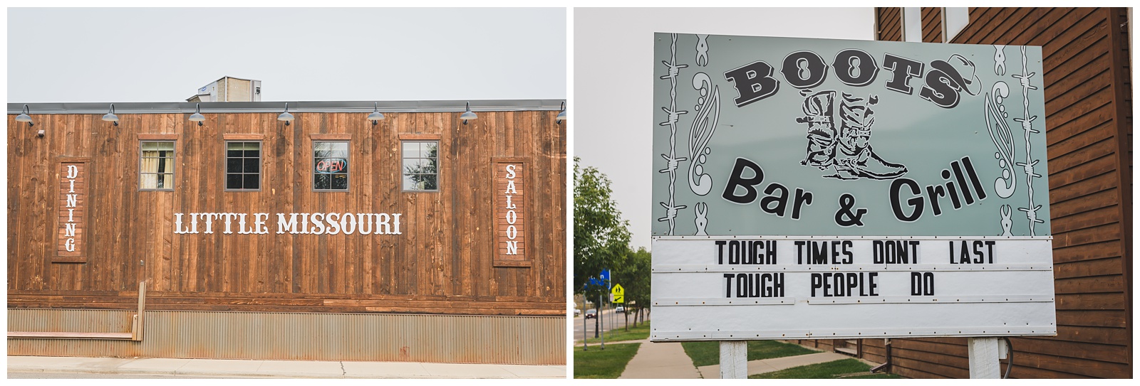 The “Little Missouri” in the business name above comes from the Little Missouri River, a tributary of the Missouri River that runs through this part of North Dakota. Seeing the tributary and places named for it was like finding little pieces of home all these miles away!
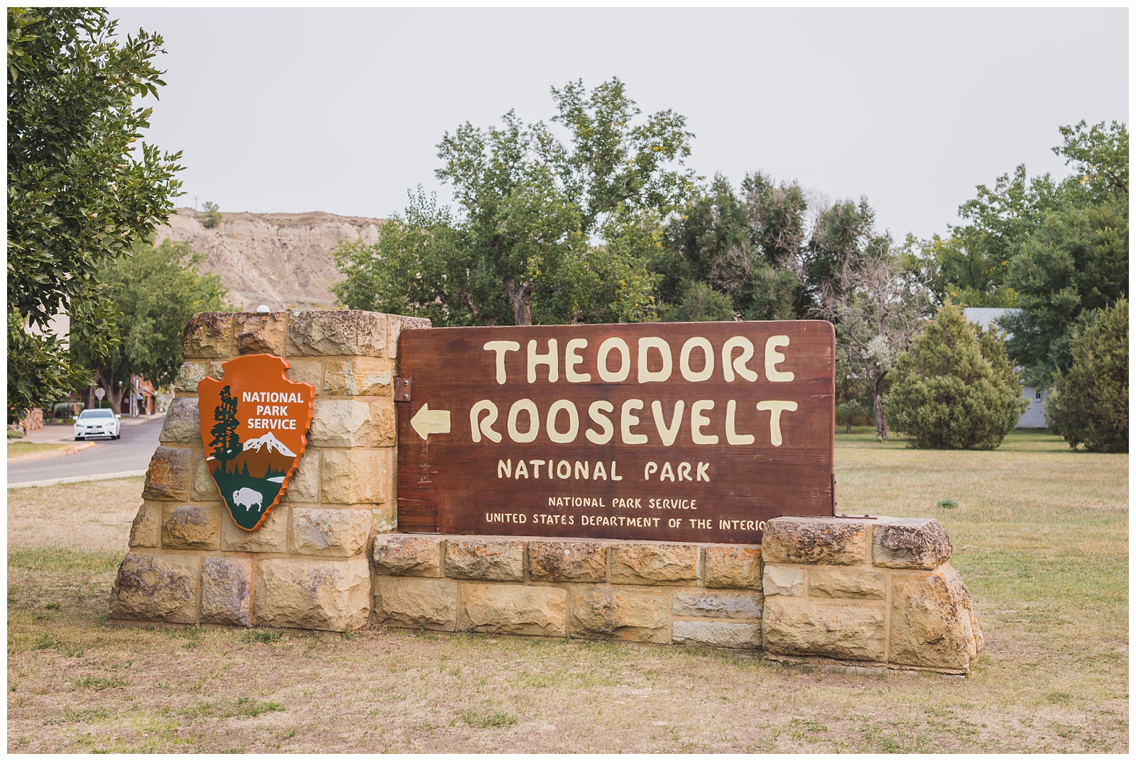 The entrance to Theodore Roosevelt National Park is right at the edge of Medora. And thanks to some timely trivia my mom passed along, we learned that day that our visit to the park fell not only on Seth’s birthday but also on the day Theodore Roosevelt became president in 1901 (due to the assassination of William McKinley).
This is the only National Park named for a person. It was established by Harry S. Truman in 1947 to honor Roosevelt, who lived as a ranchman in the Dakota Territory in the 1880s and, as president, conserved 230 million acres of public land for future generations. {Source: Mental Floss}
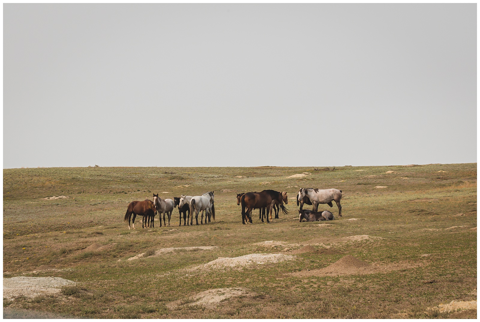
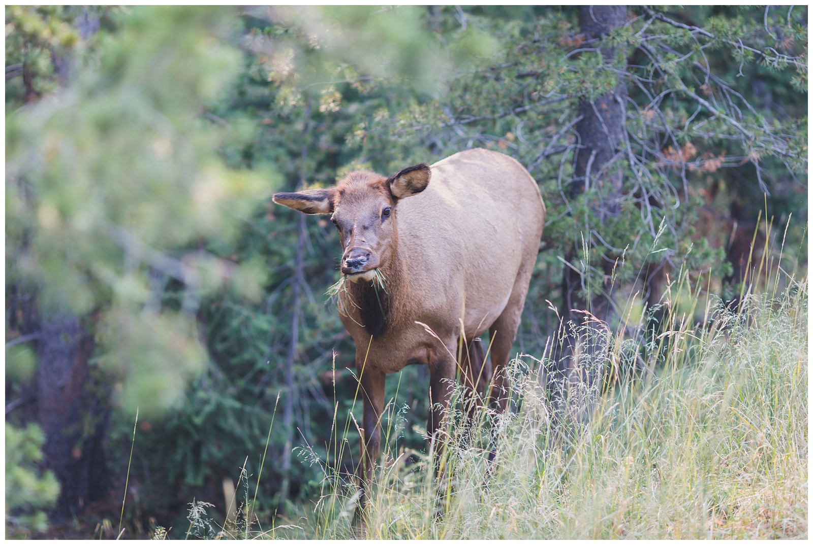
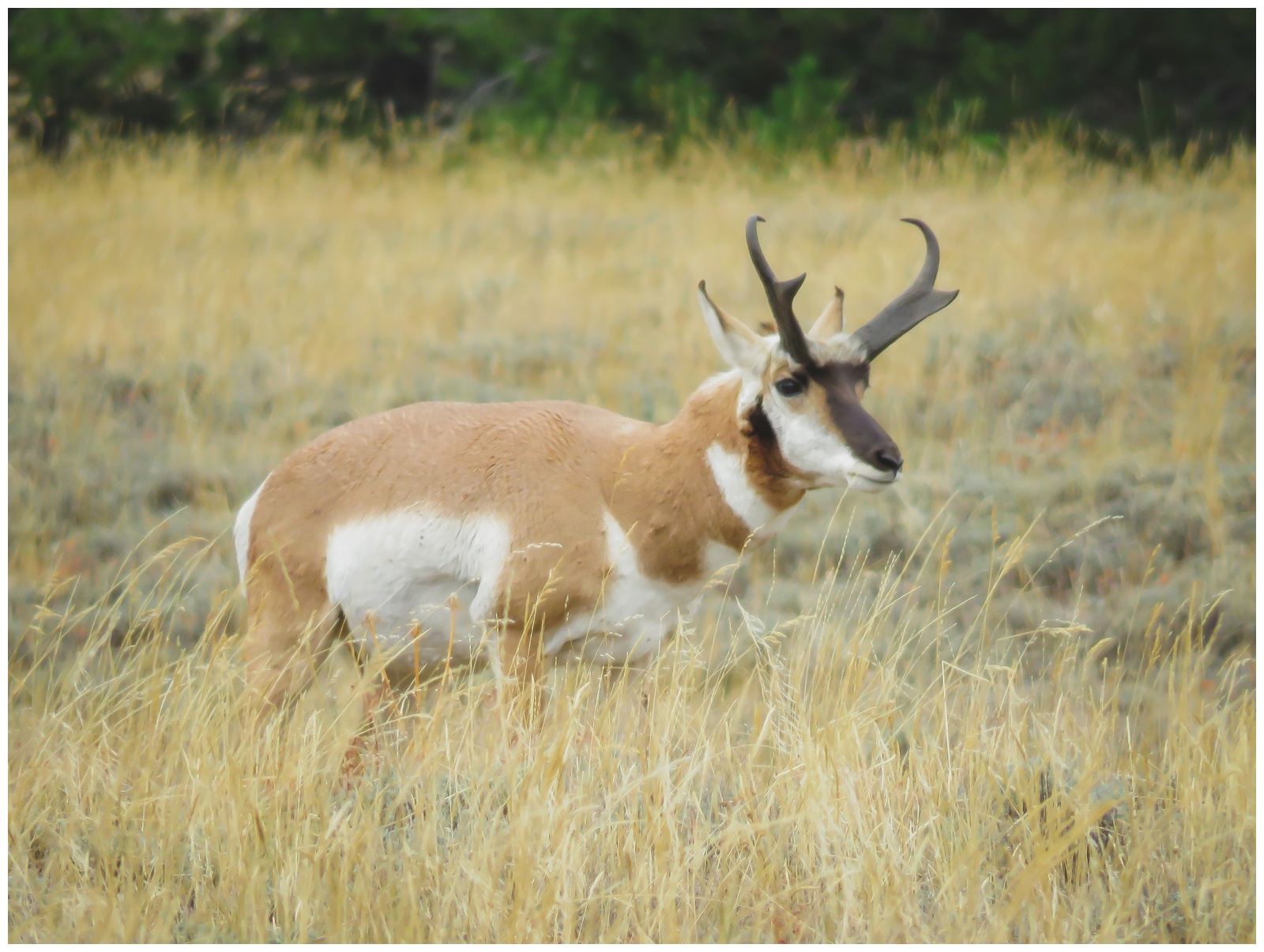
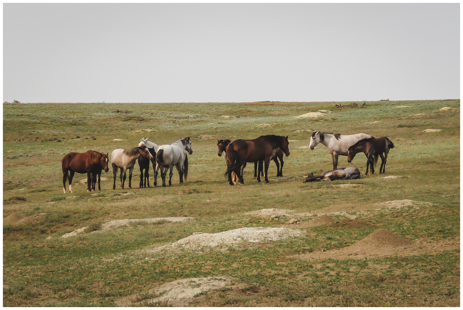 Our first exciting sighting in the park: wild horses! We also found some other animals along the Scenic Loop Drive:
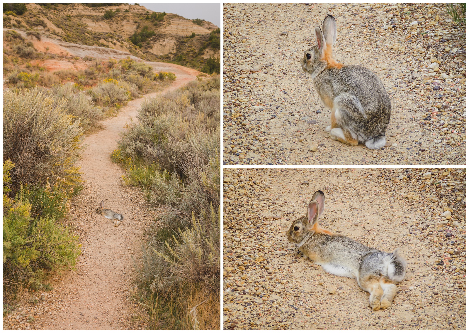 Hiking the Coal Vein Trail, we came across this rather tame rabbit.
 From “pretty normal” to “proud of my new hat” in just a couple shutter clicks. 😂
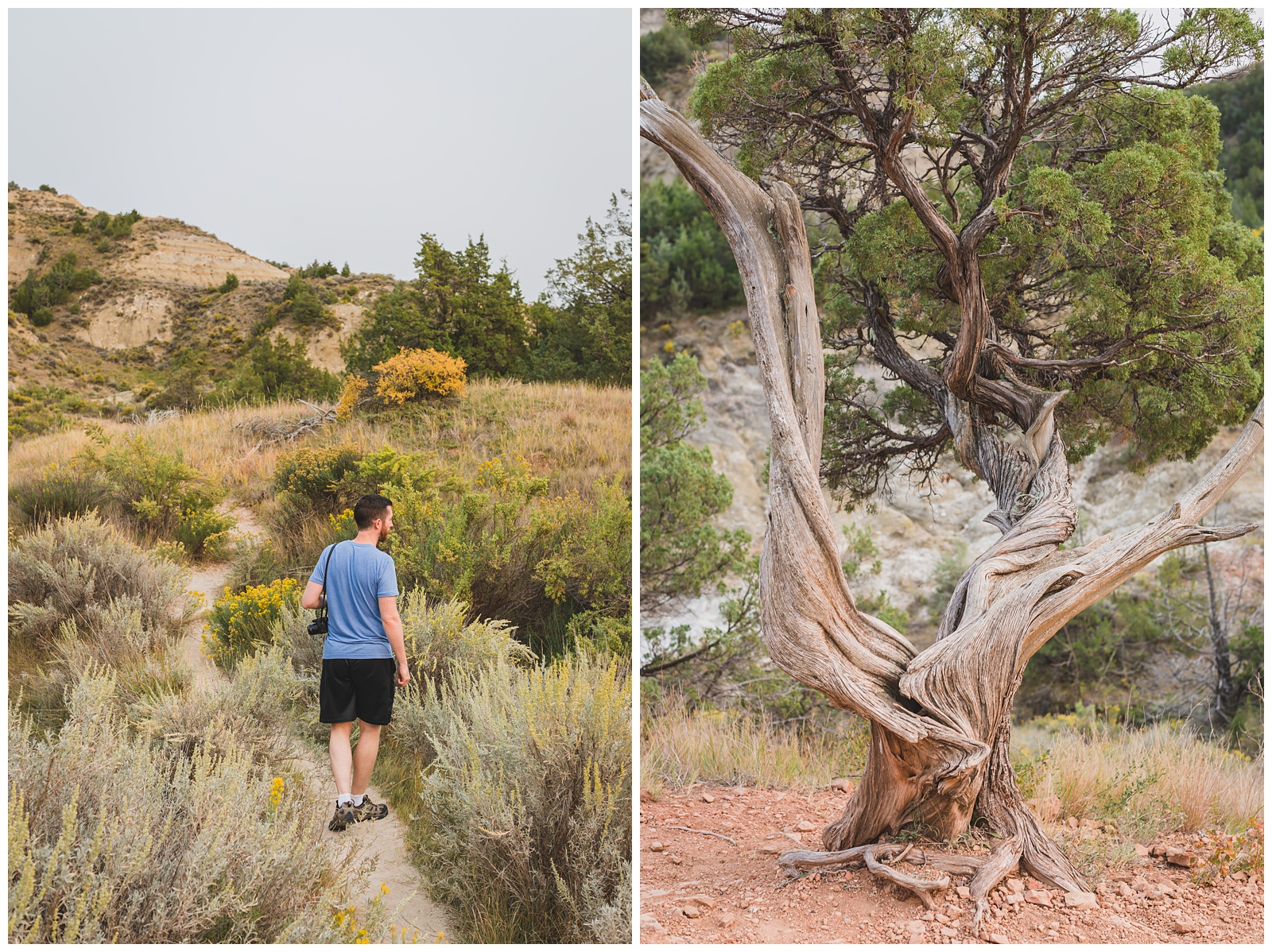
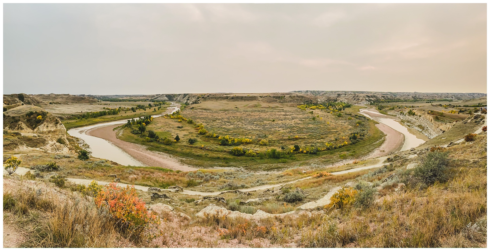
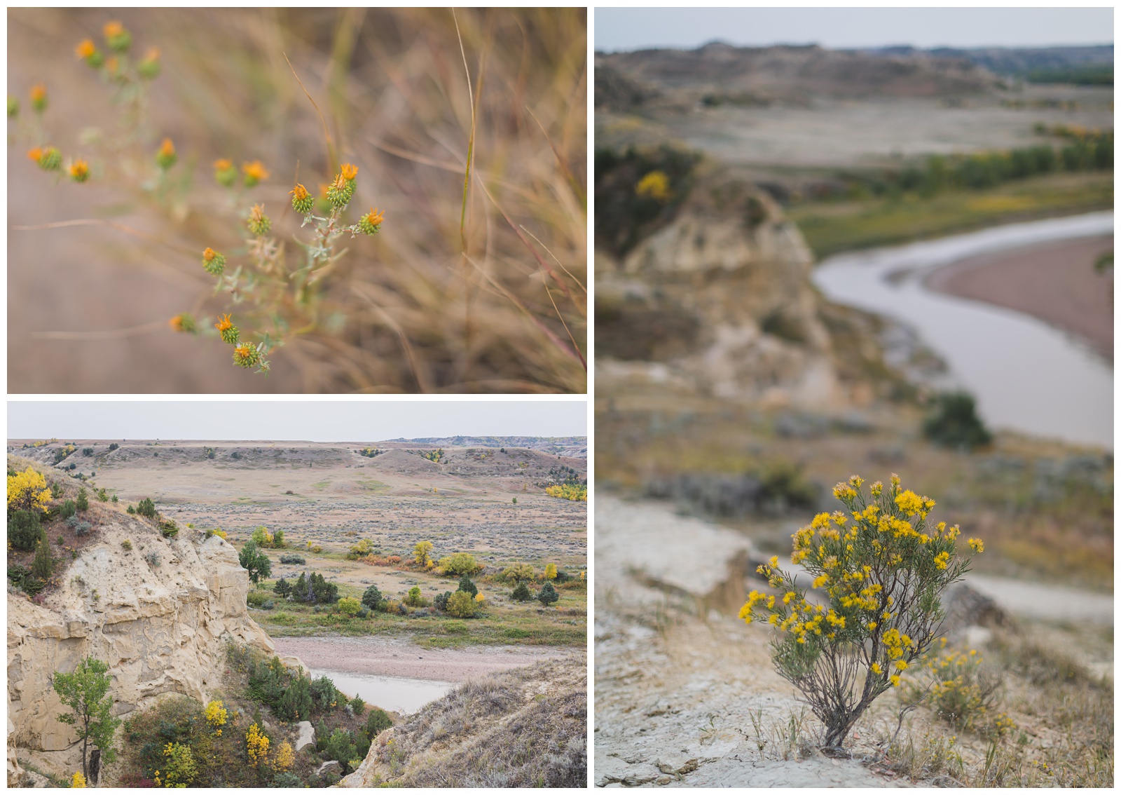 We also hiked Wind Canyon Trail, which gives views of a gooseneck in the Little Missouri River.
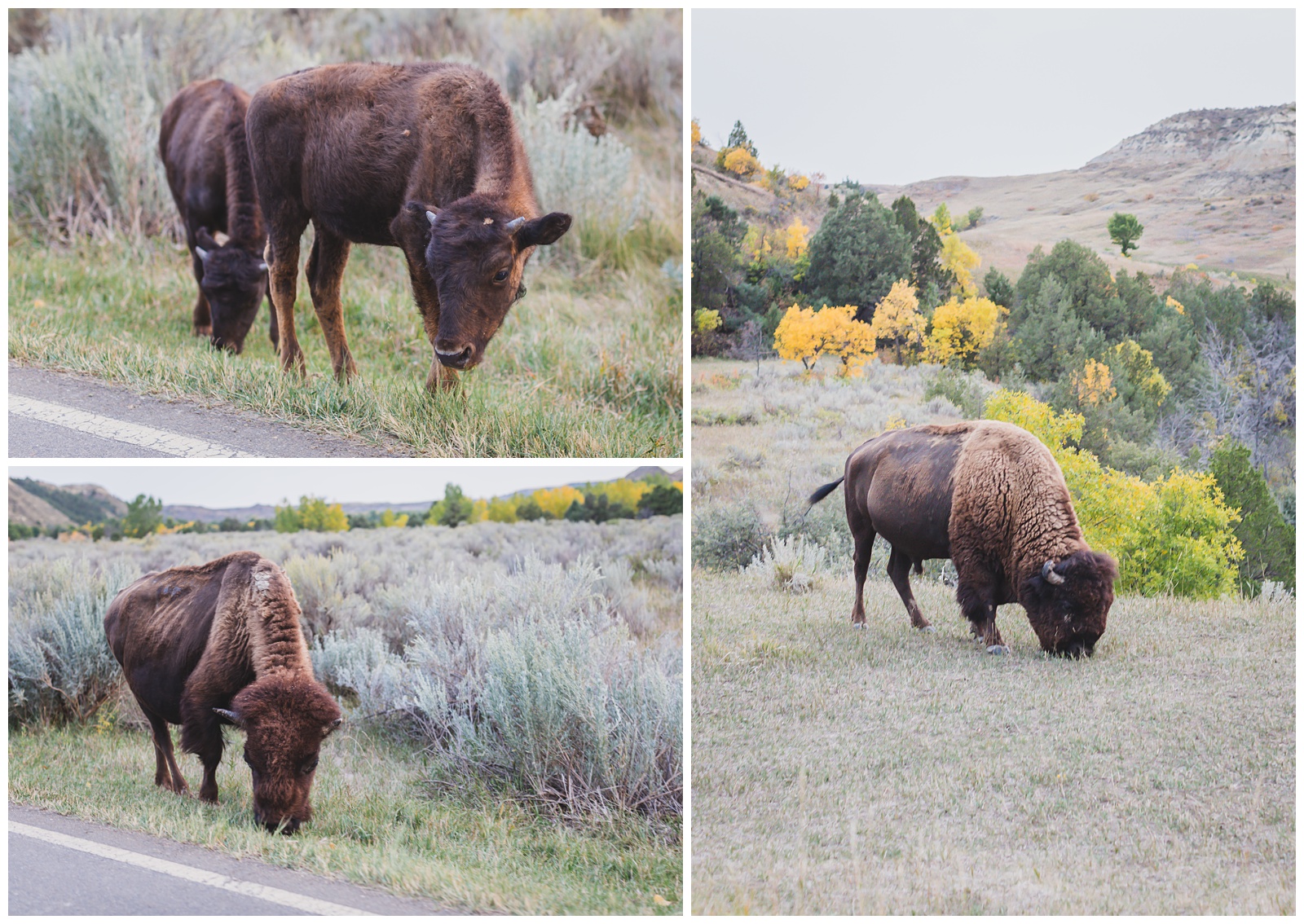
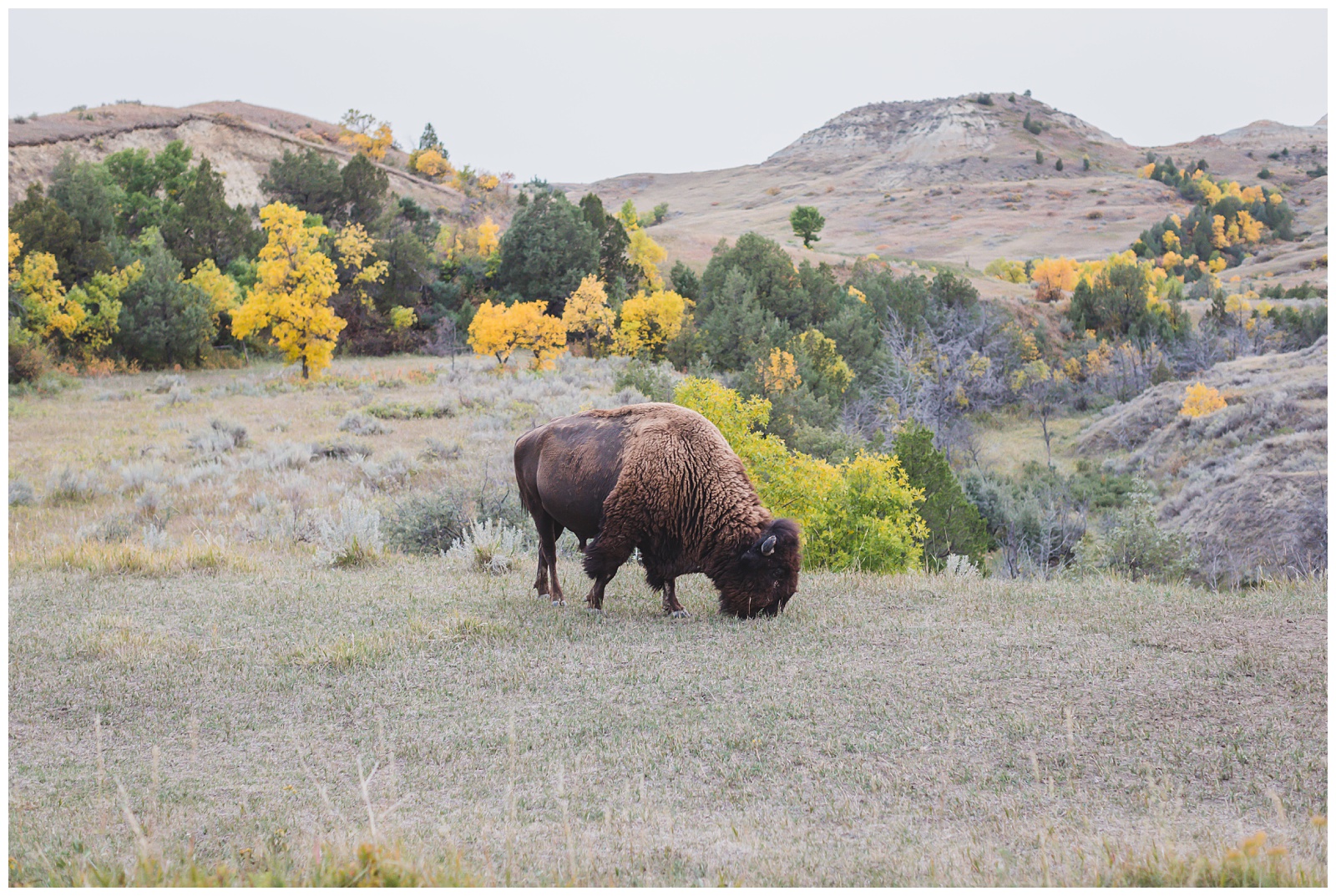
 On our way out of the park at dusk, we saw several bison that had come out for dinner.
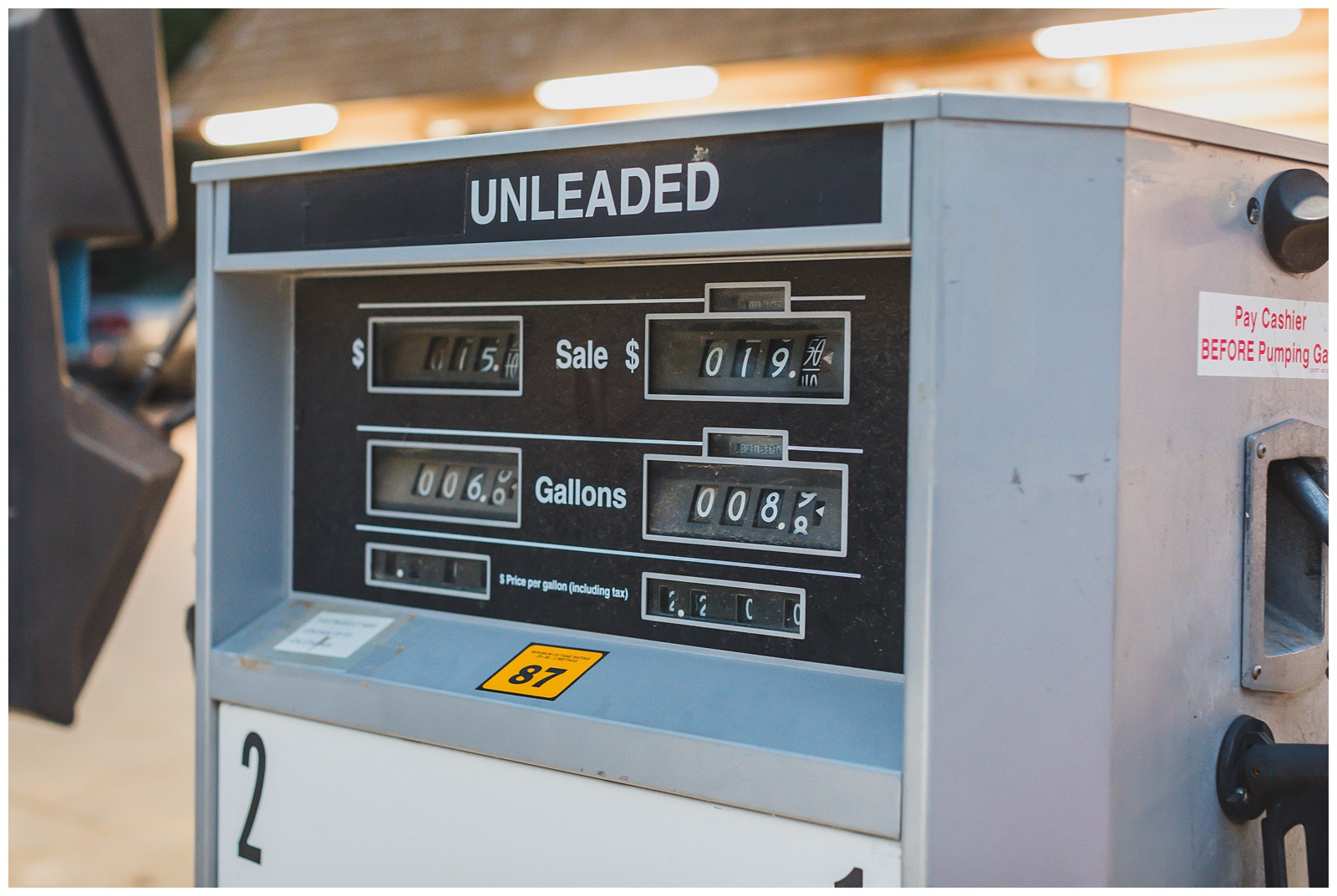 Back in town, we stopped for gas at the oldest gas pump we’d ever seen!
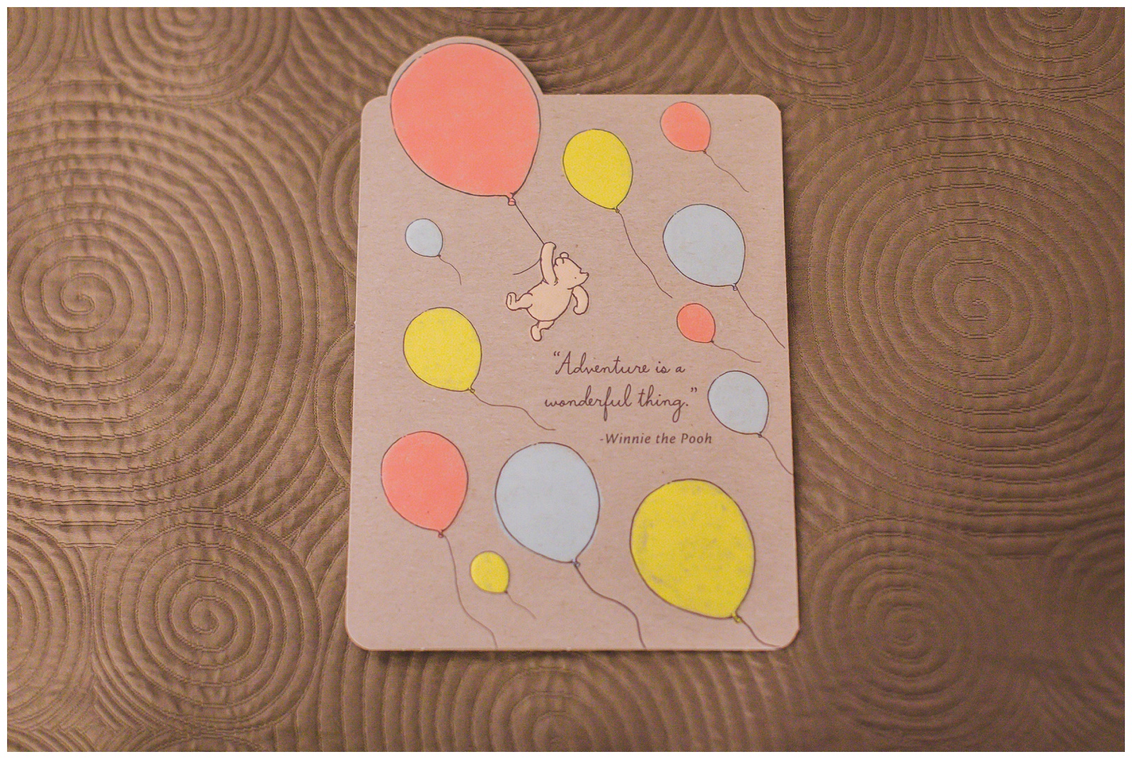
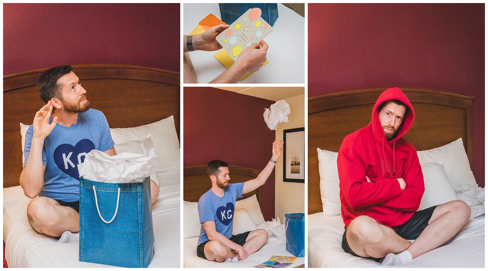 We finished the day celebrating the birthday boy. His gift from me was a National Parks hoodie, and of course I had to get a matching one for myself! They came in handy when we had cooler weather later in the trip. And I thought his birthday card also was especially appropriate:
day 5 • 09.15.20
Medora, ND >>> Gardiner, MT
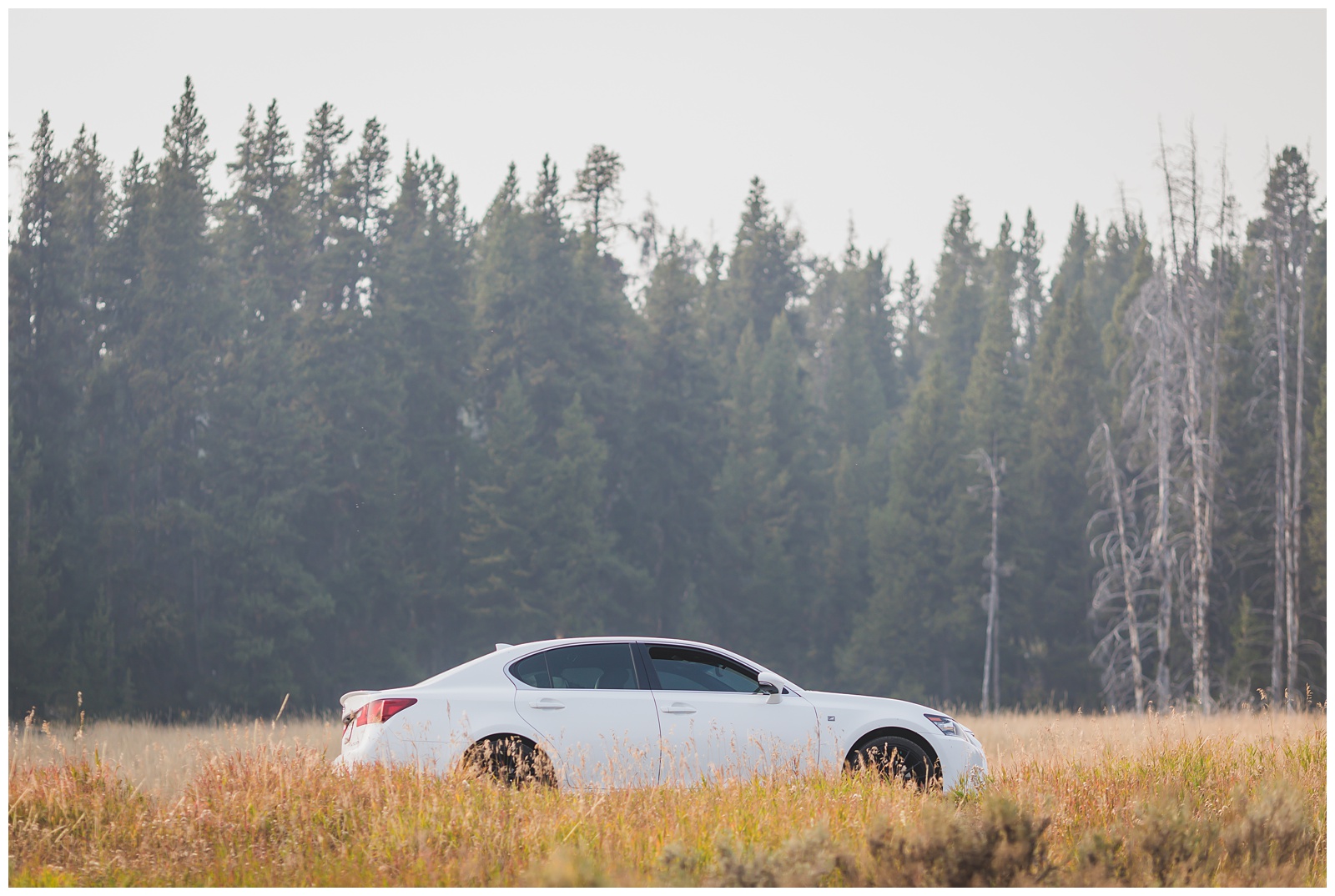
 On our way across Montana, we stopped in Billings to give Gus (so named because he’s a Lexus GS 😊) a much-needed bath.
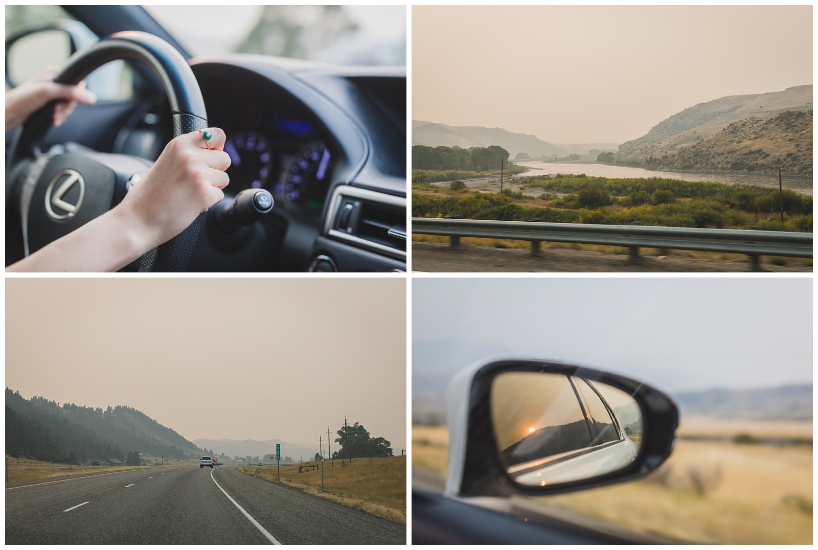
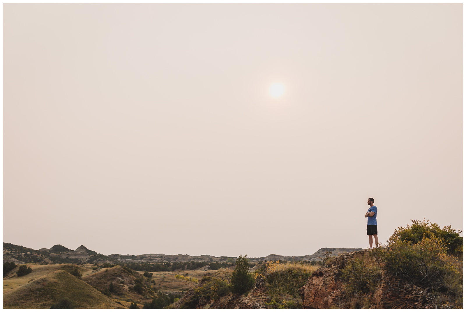
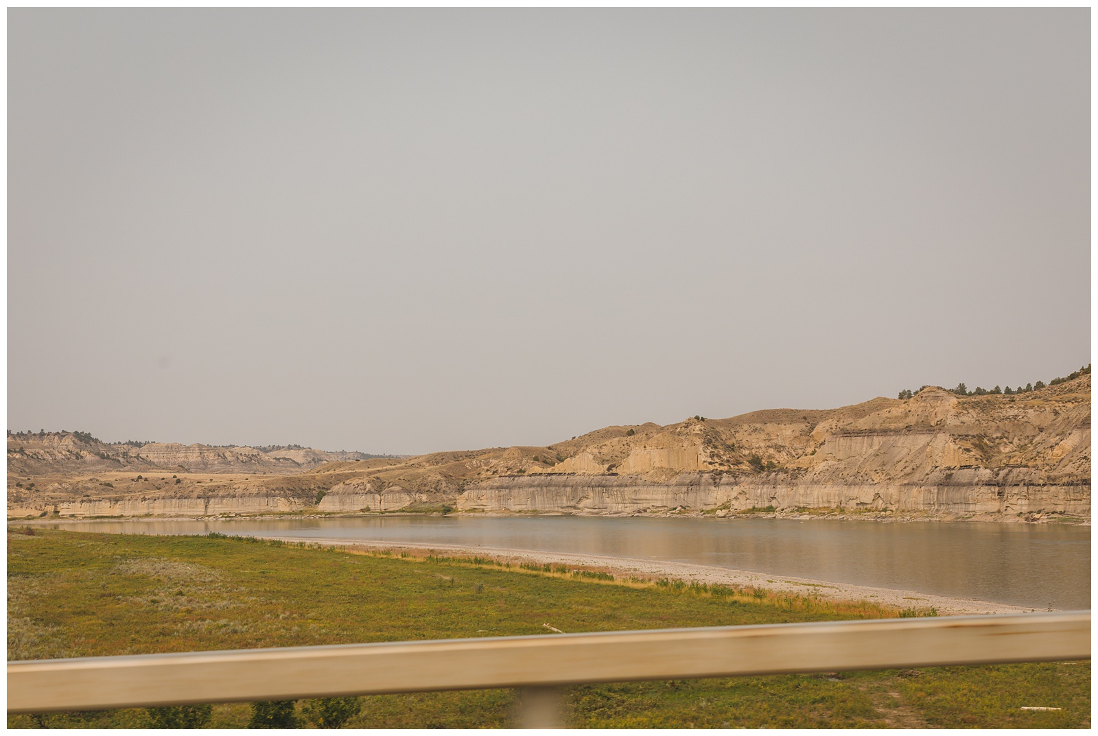
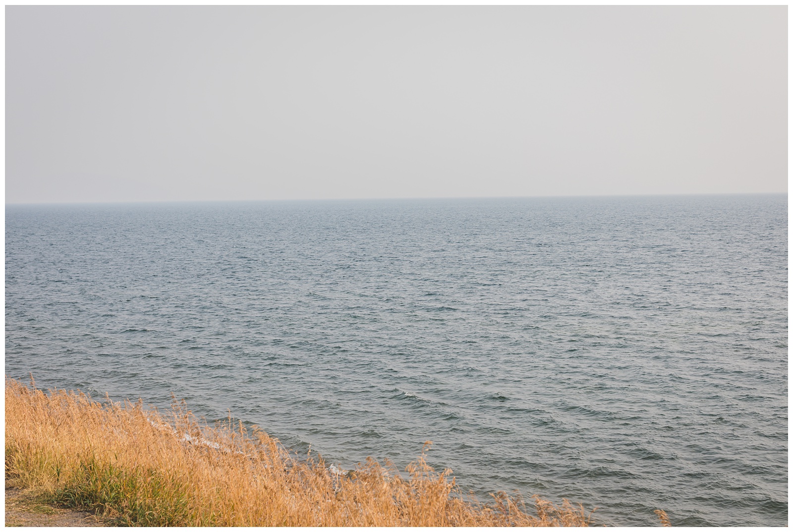
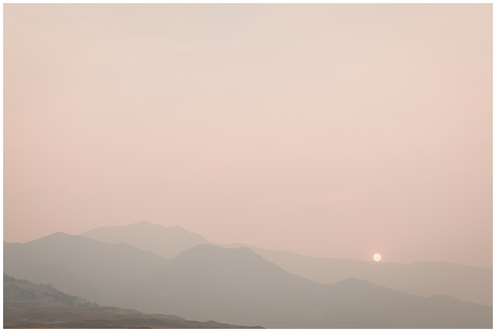 We’d noticed some haze from the California wildfires for the previous couple of days, but it became increasingly thick as we drove across Montana. Above is the view we had upon arriving at our hotel in Gardiner.
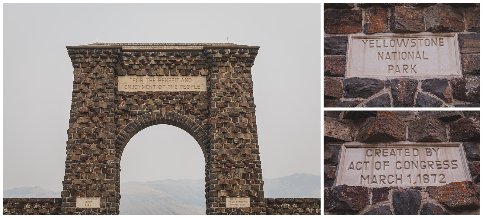
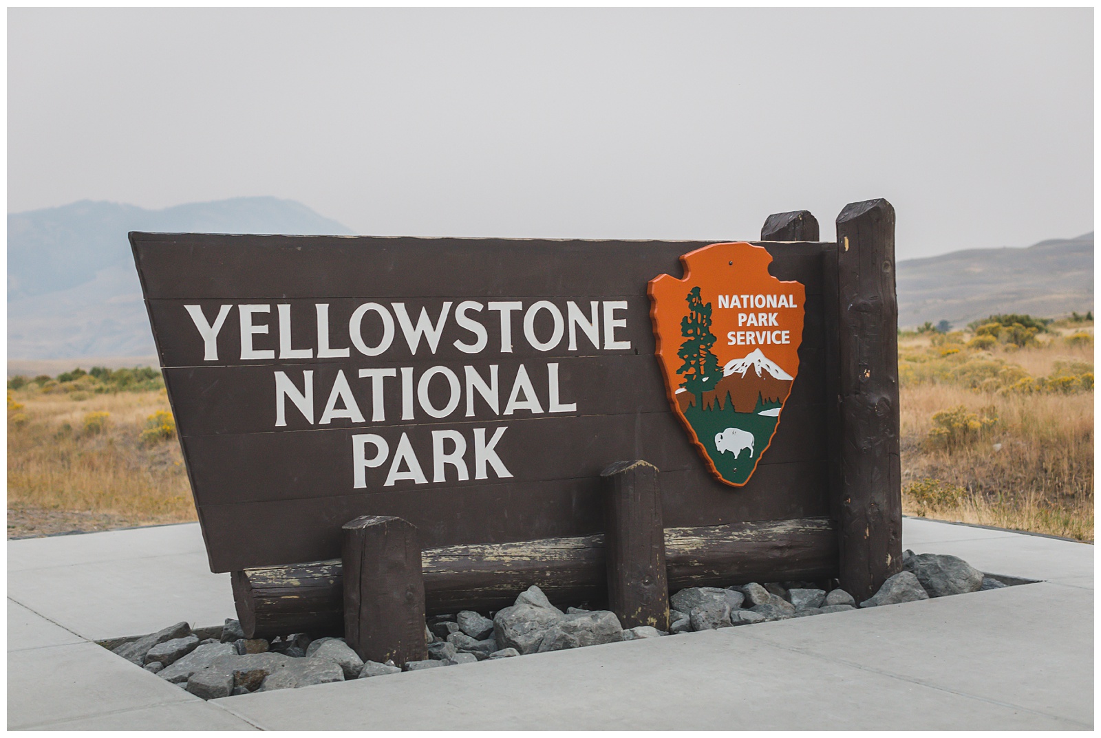
 Gardiner wasn’t officially founded until 1880, but the area has served as a main entrance to Yellowstone since the park’s creation in 1872. It holds the status of being the oldest known place name in the Yellowstone region. {Source: National Park Service}
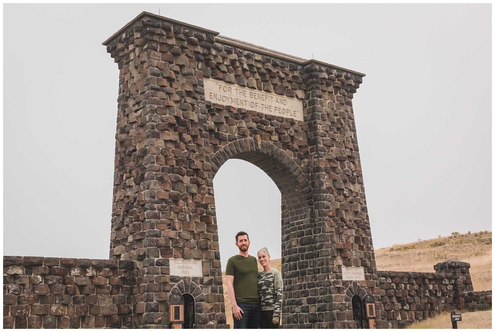
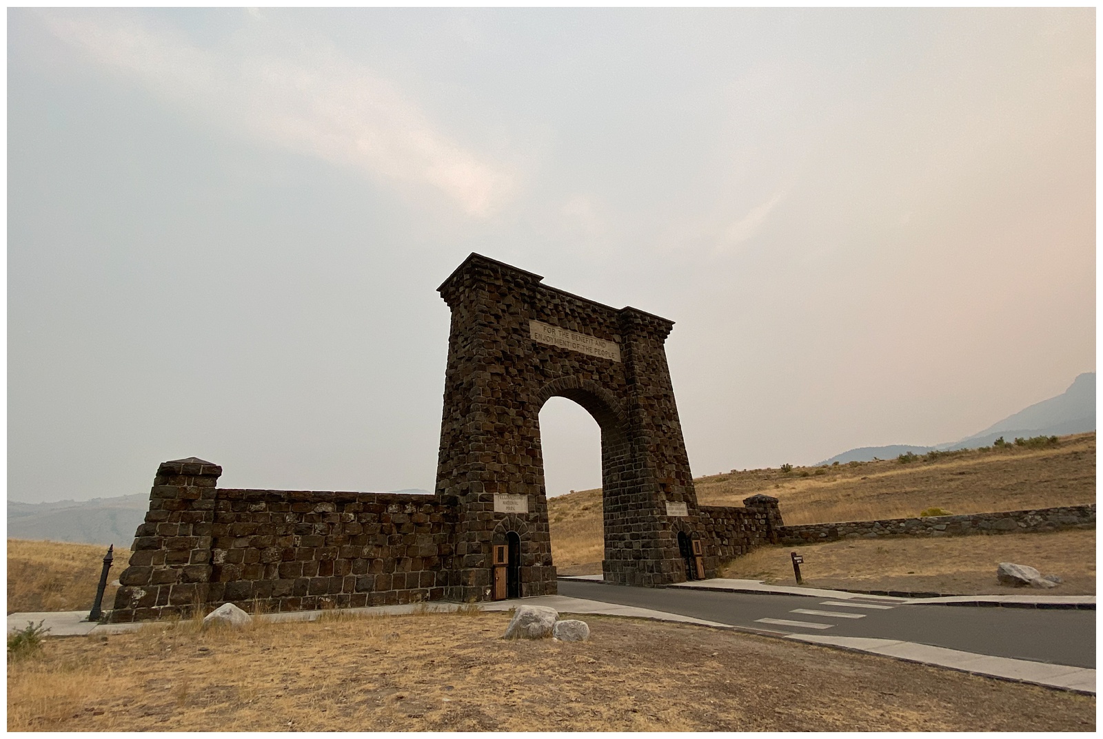 Our first stop after checking into our hotel was the iconic Roosevelt Arch at Yellowstone’s north entrance. We walked through it to officially set foot in Yellowstone, excited to explore the park over the next few days!
day 6 • 09.16.20
Yellowstone National Park
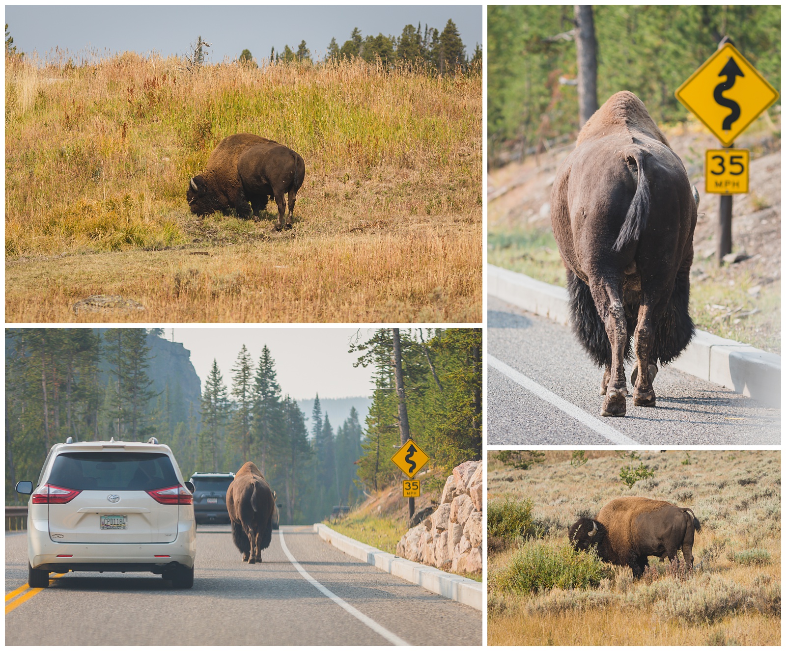 Yellowstone was the very first National Park and encompasses 3,472 square miles, which makes it larger than Rhode Island and Delaware combined. It is home to the largest concentration of mammals in the lower 48 states (67 species), as well as 285 species of birds. There are more than 1,800 known archaeological sites within the park, as well as 1,000 miles of hiking trails and 290 waterfalls. {Source: Yellowstone Forever}
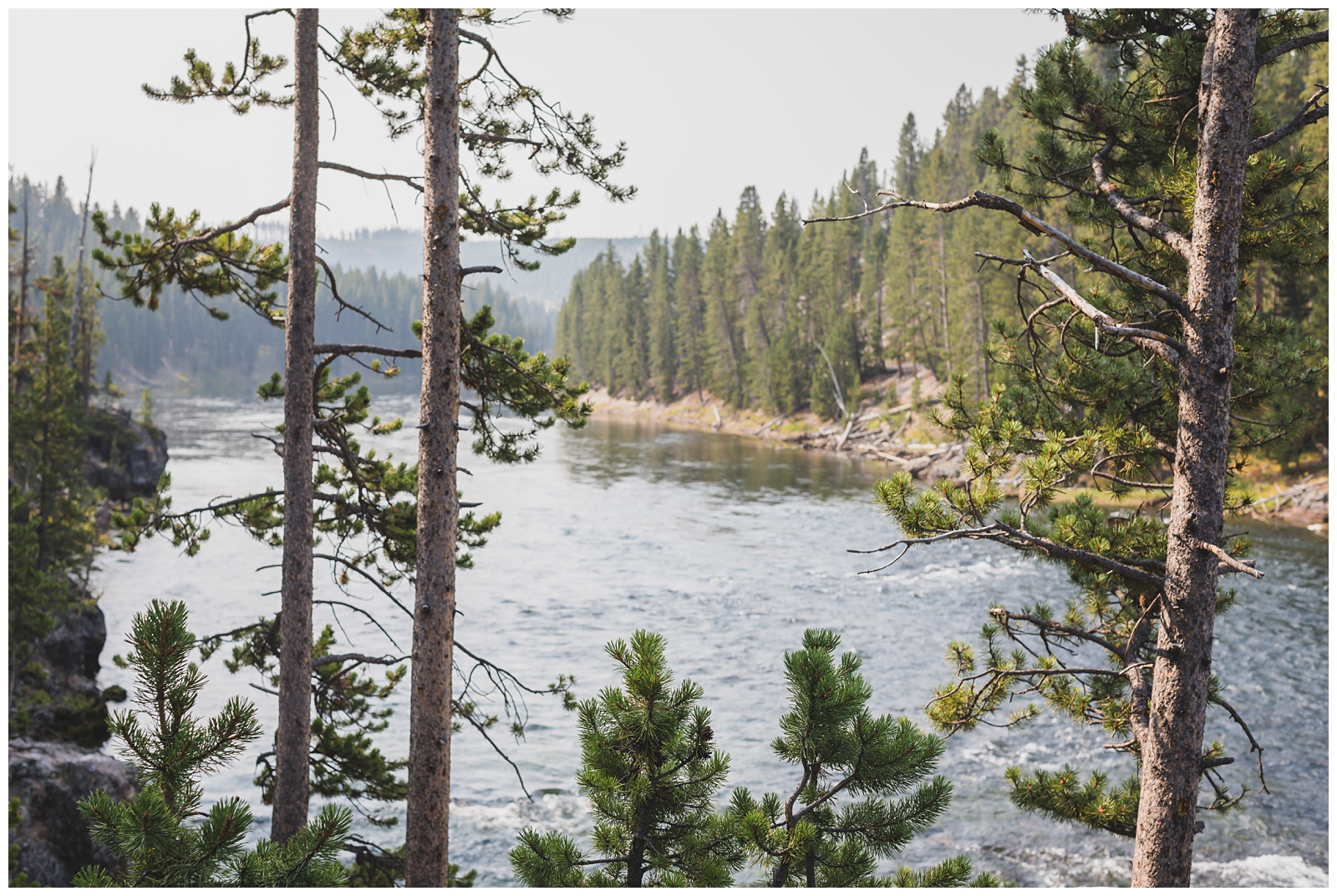
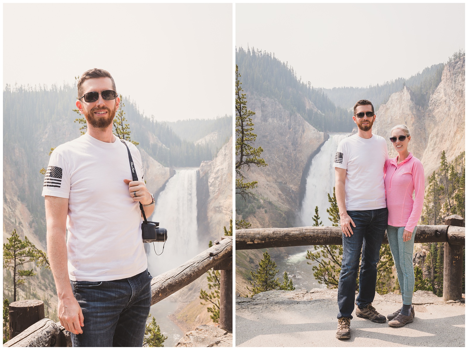
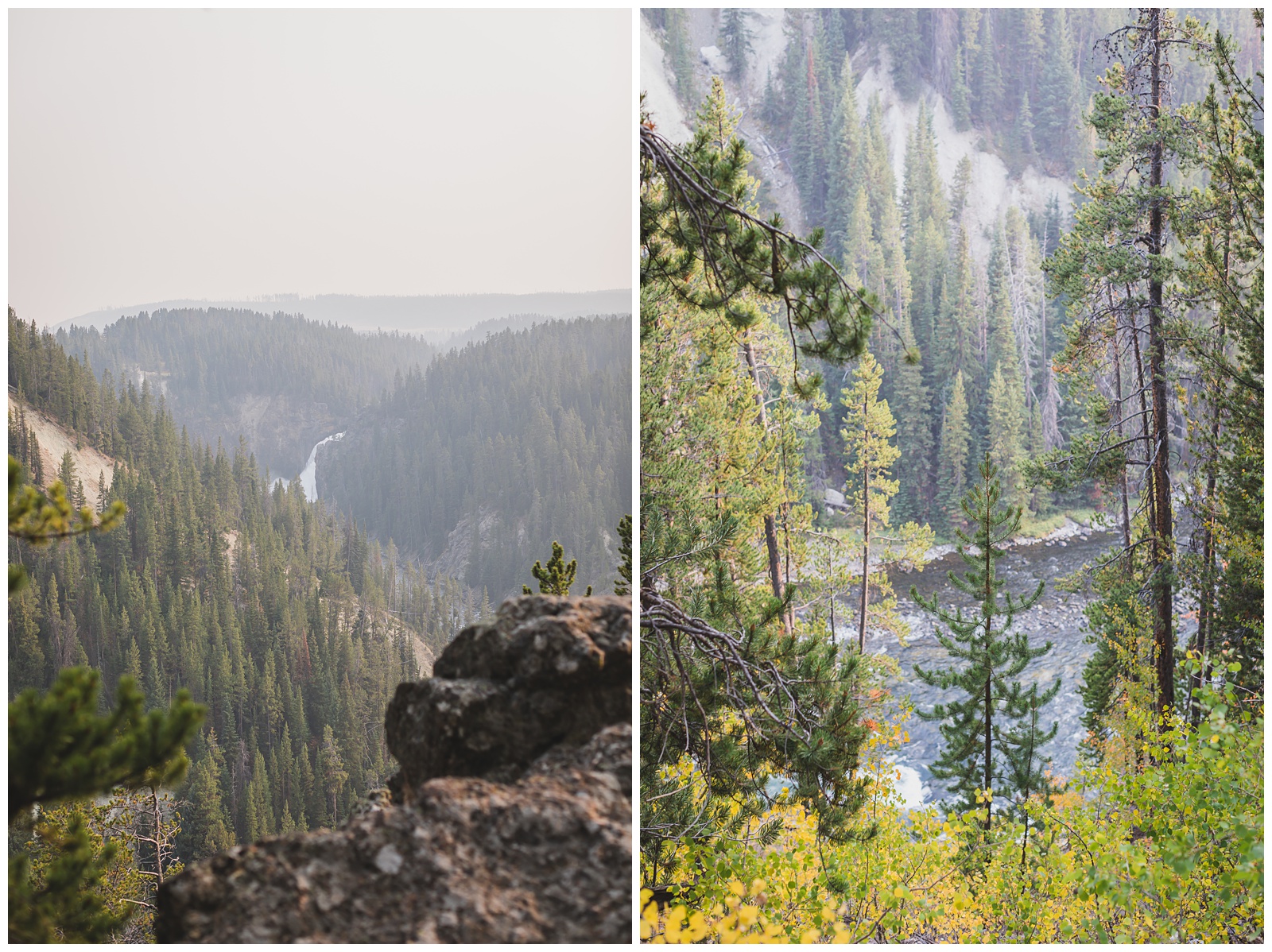
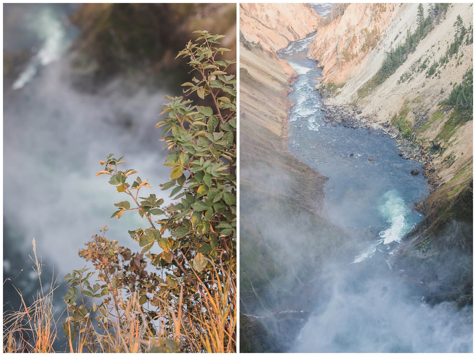
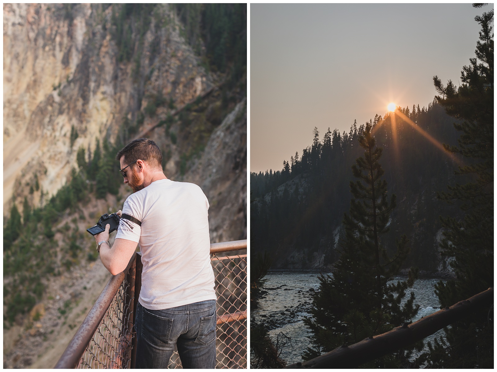
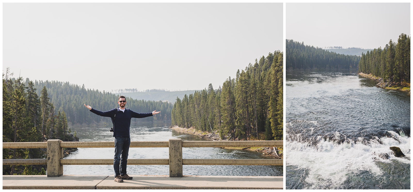 We’d started seeing the Yellowstone River hours east of the park the day before, which only built my excitement to see it in its namesake place! I really love mountain rivers, and this is easily the most awesome I’ve experienced.
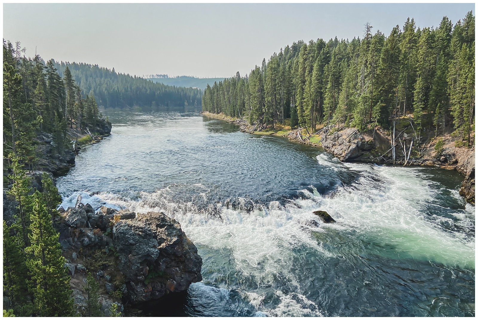
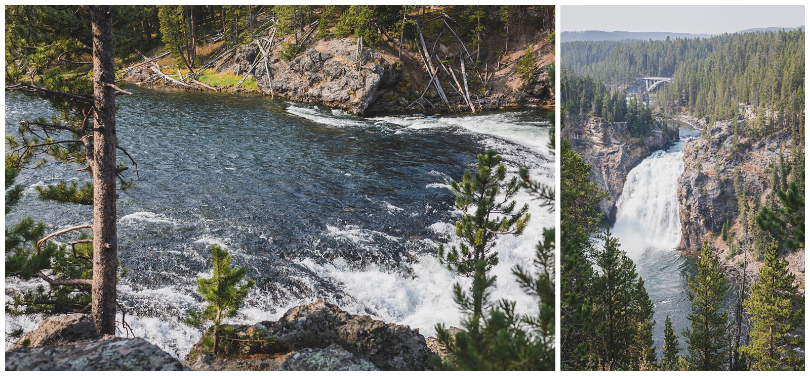
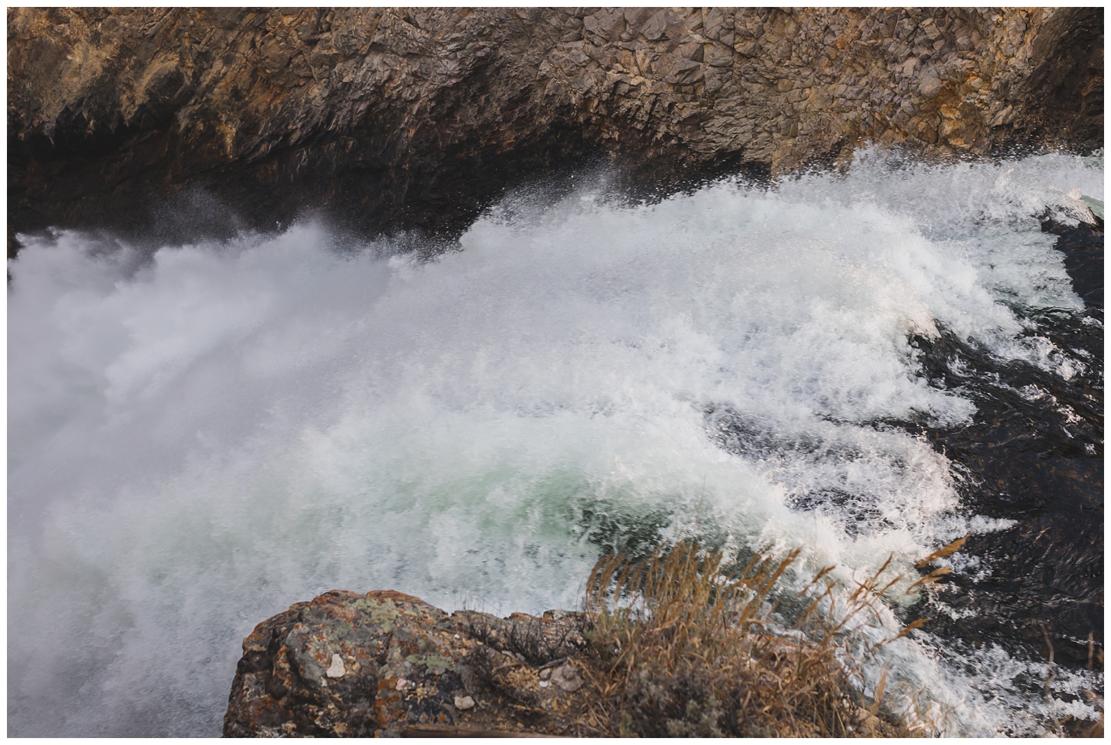
 I also couldn’t wait to see the Grand Canyon, Upper Falls (shown here) and Lower Falls of the Yellowstone River, so the Canyon area was our first destination on this first day in the park. Despite all the photos I’d seen of it ahead of time, it didn’t disappoint!
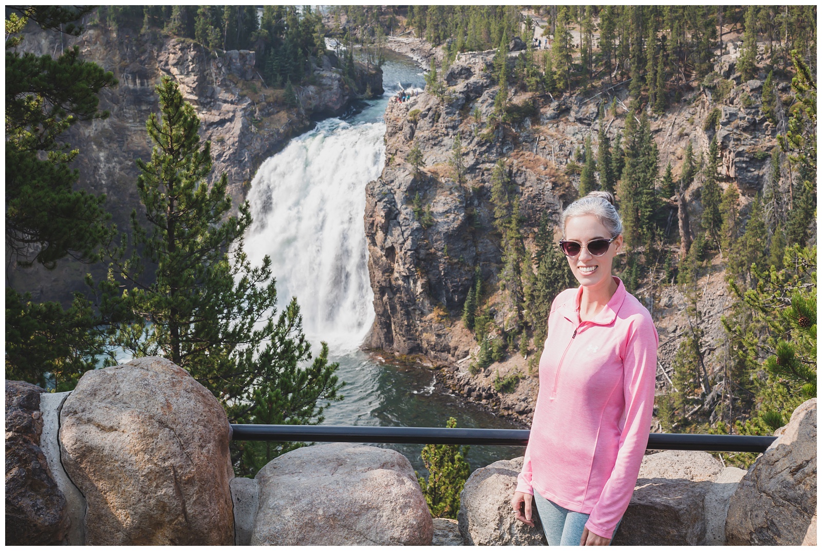
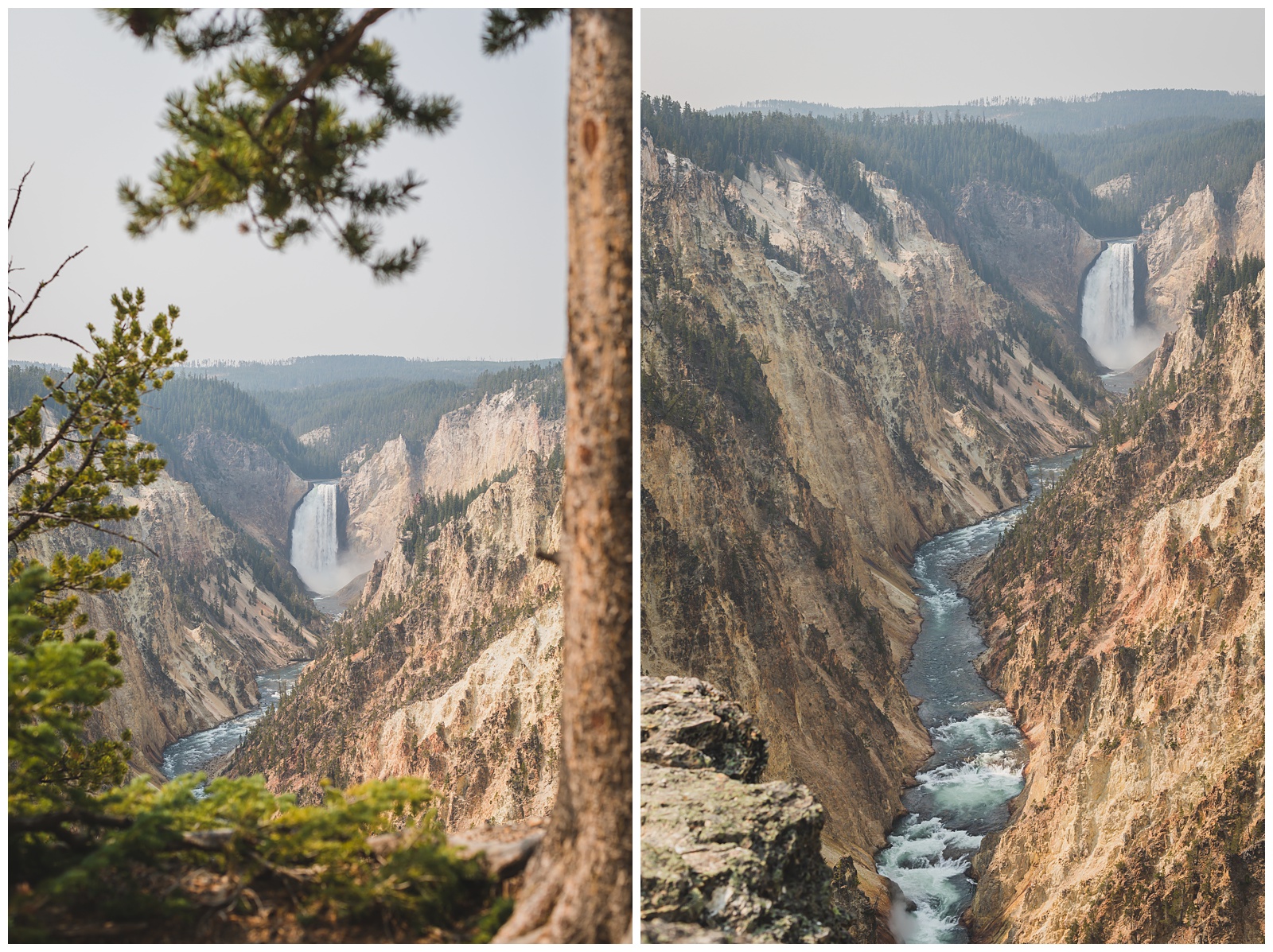 Artist Point is known as one of the most picturesque spots for viewing the Lower Falls, and after visiting it, we could see why.
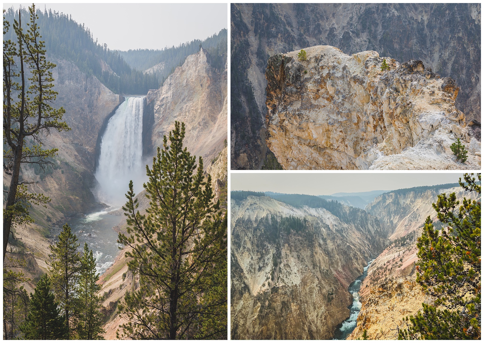 We also viewed the Lower Falls and the river from Inspiration Point and Lookout Point, then made the steep hike farther into the canyon to see the falls from Red Rock Point.
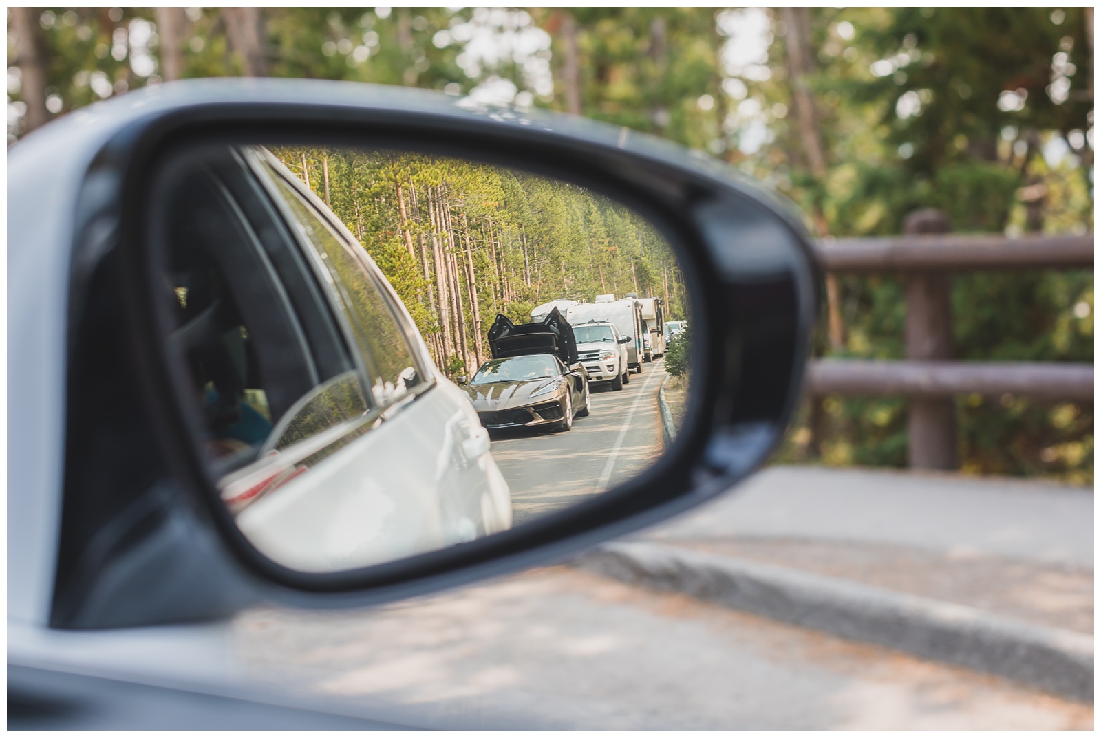 After exploring the canyon that morning, we drove down to Yellowstone Lake for lunch (and found some friends to photograph along the way!).
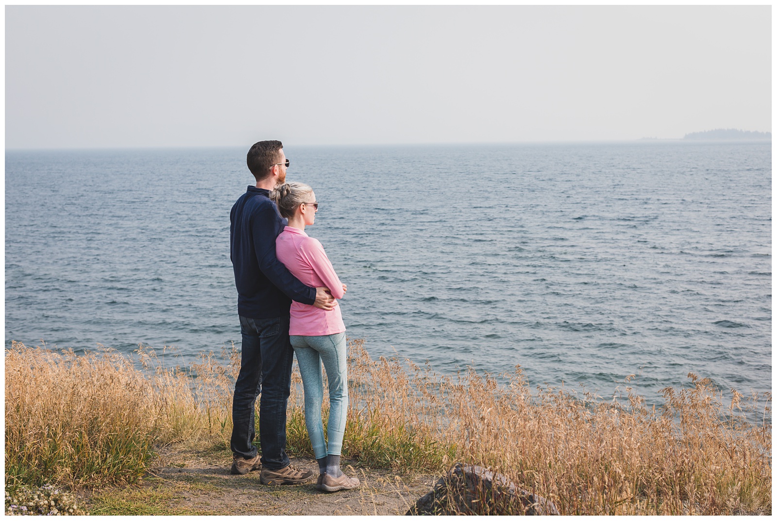 Soaking in the vastness of Yellowstone’s largest lake.
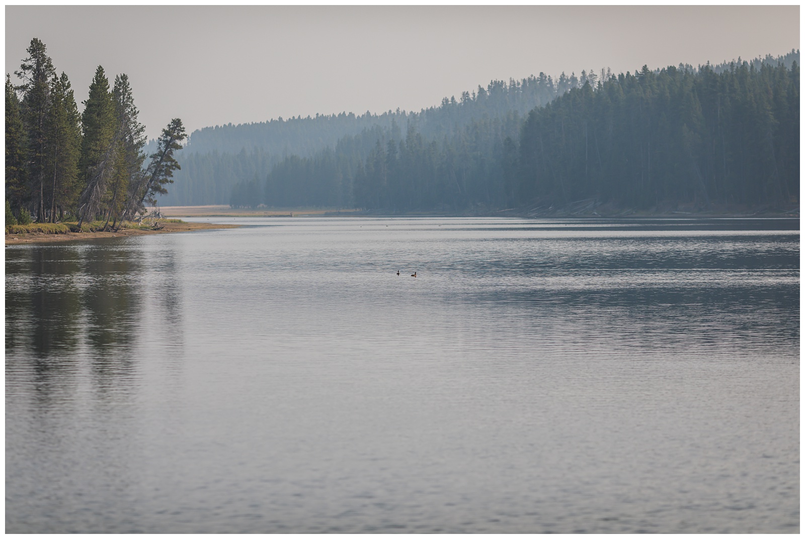
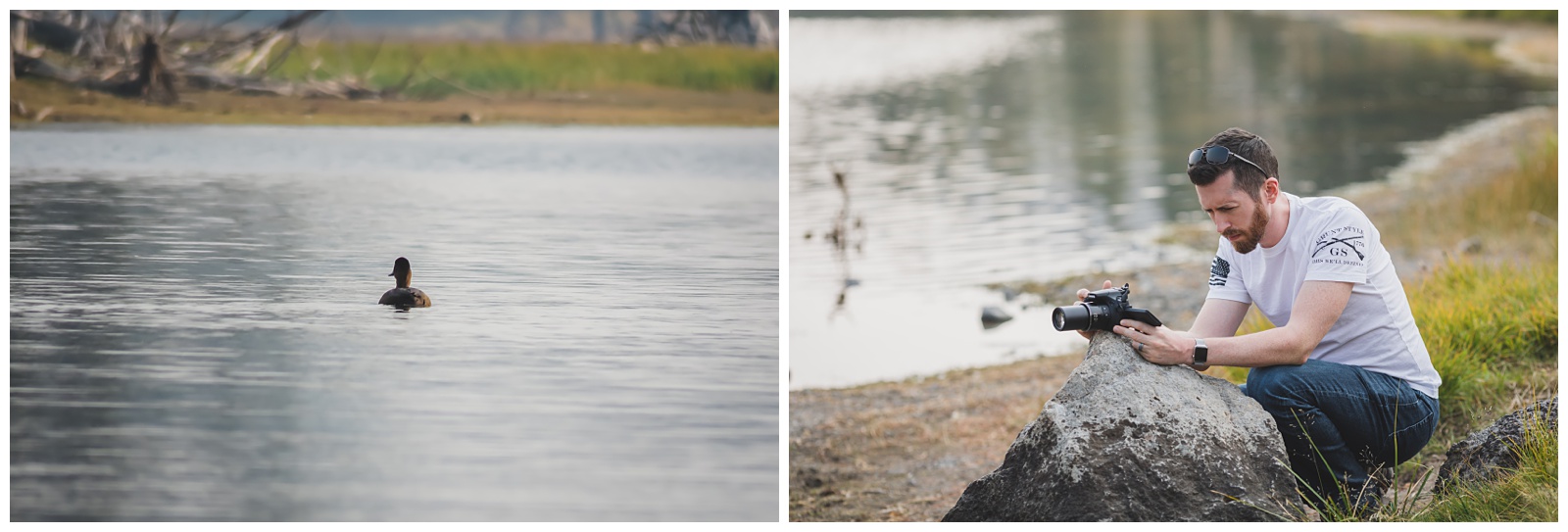
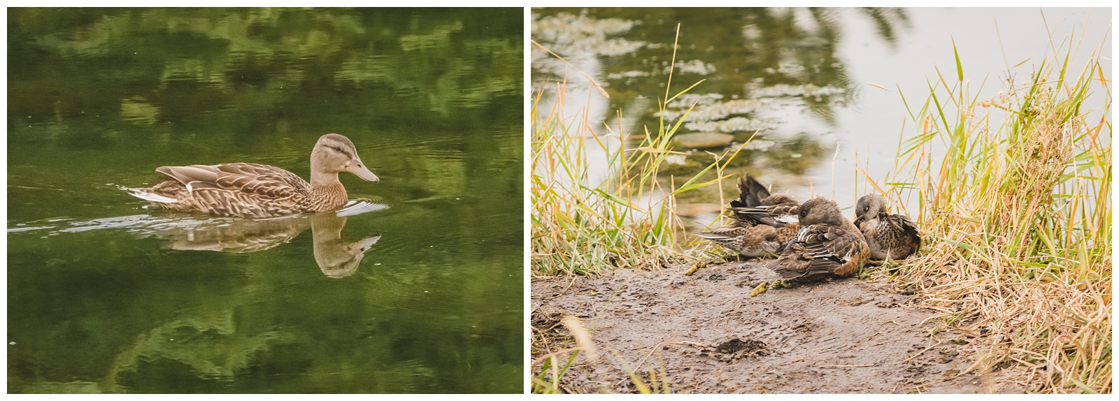
 Later that afternoon, we headed back north (since we were staying in Gardiner again that night) and stopped somewhere Seth hoped we’d see bears. We didn’t, but ducks made decent alternate photo subjects!
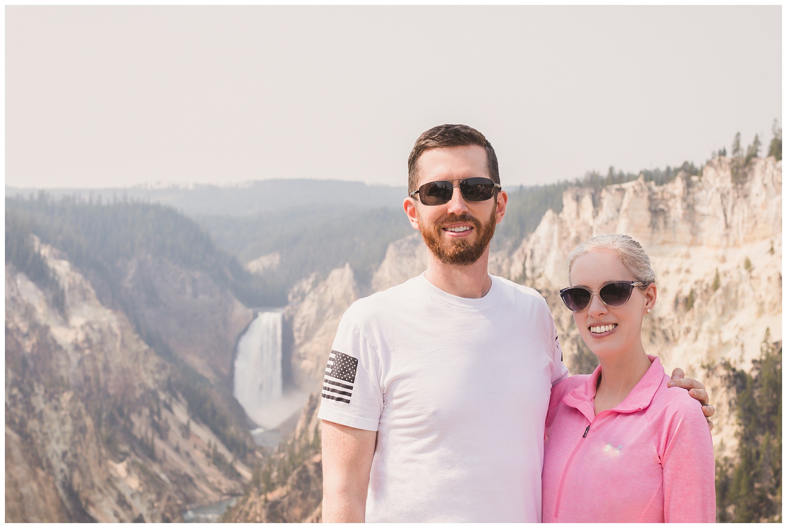
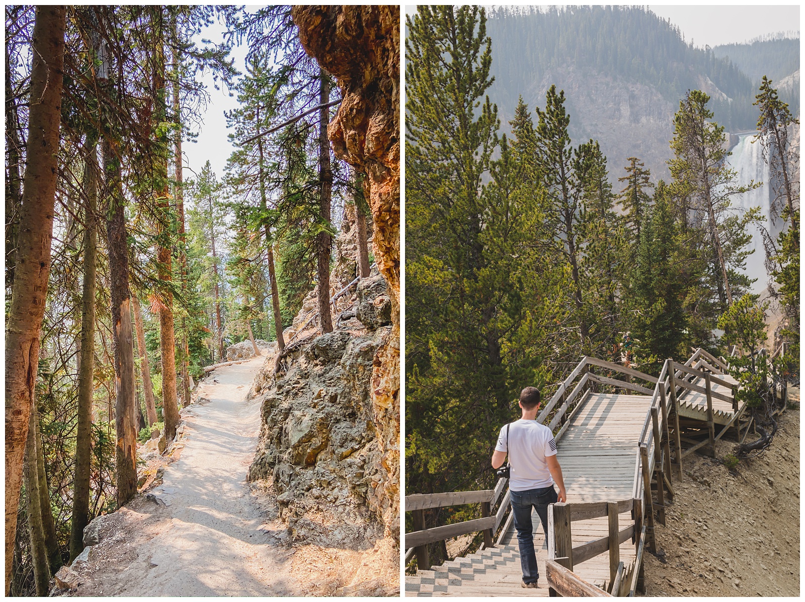
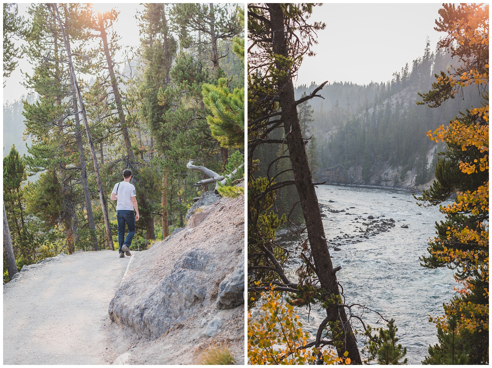
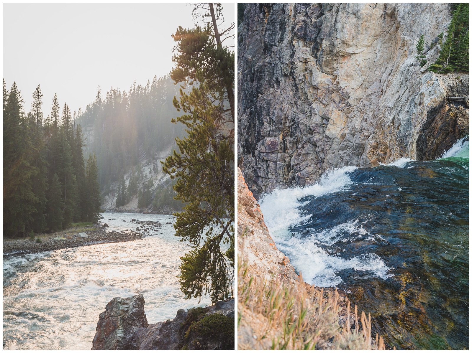
 Before leaving the park that evening, I wanted to see the Grand Canyon of the Yellowstone one more time — because I really could never get enough of it! So we decided to hike to the brink of the Lower Falls, which we hadn’t been able to do earlier in the day due to a lack of available parking at the trailhead. Being that close to the river and the falls was one of the highlights of the entire trip for me and definitely a great way to end Day 1 in Yellowstone!
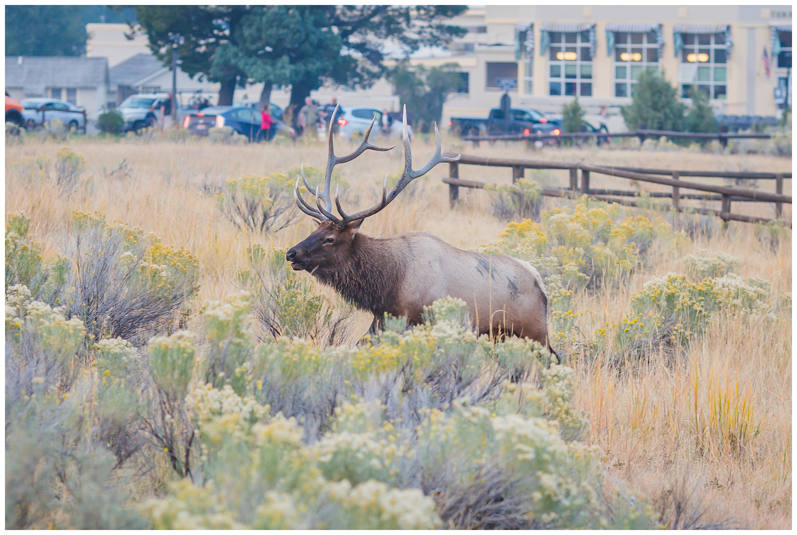
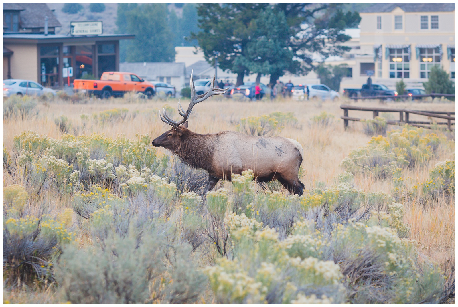
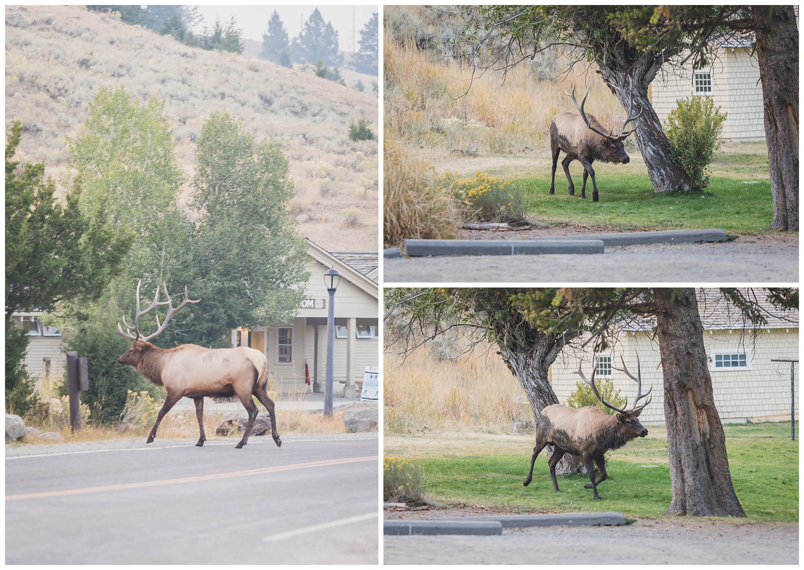
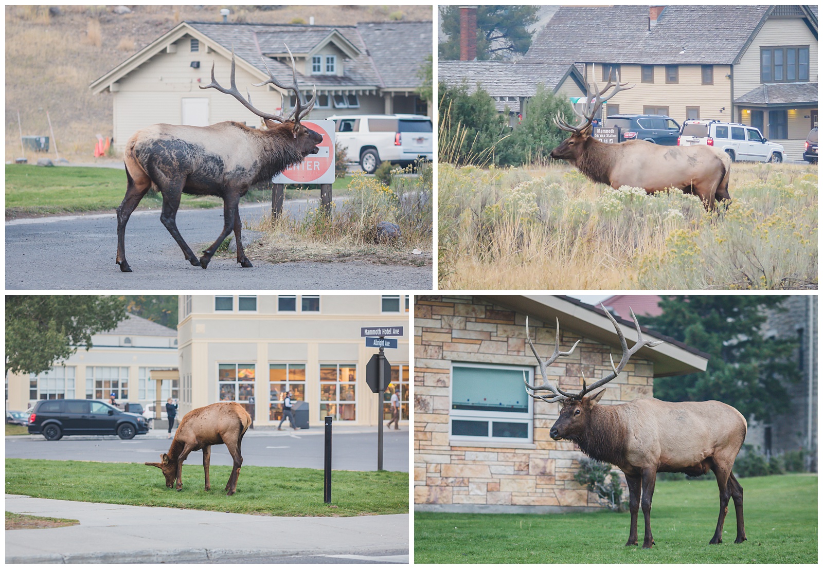
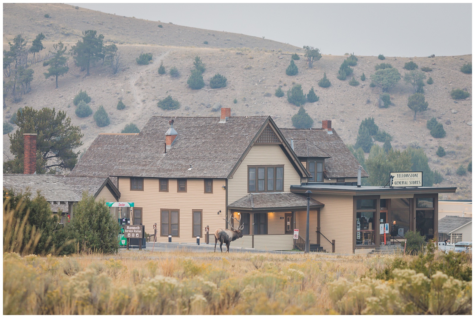
 We saw one more bison on our way to the park’s north entrance — and upon reaching the Mammoth Hot Springs Area, we had another eventful wildlife sighting in the form of a riled-up bull elk. We talked to a fellow onlooker who said this guy had just battled another bull in a fight that broke part of a fence.
day 7 • 09.17.20
Yellowstone National Park

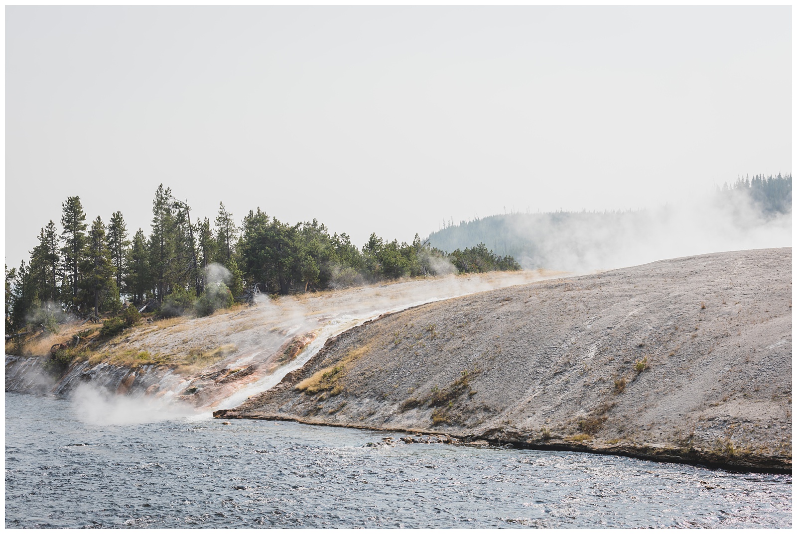
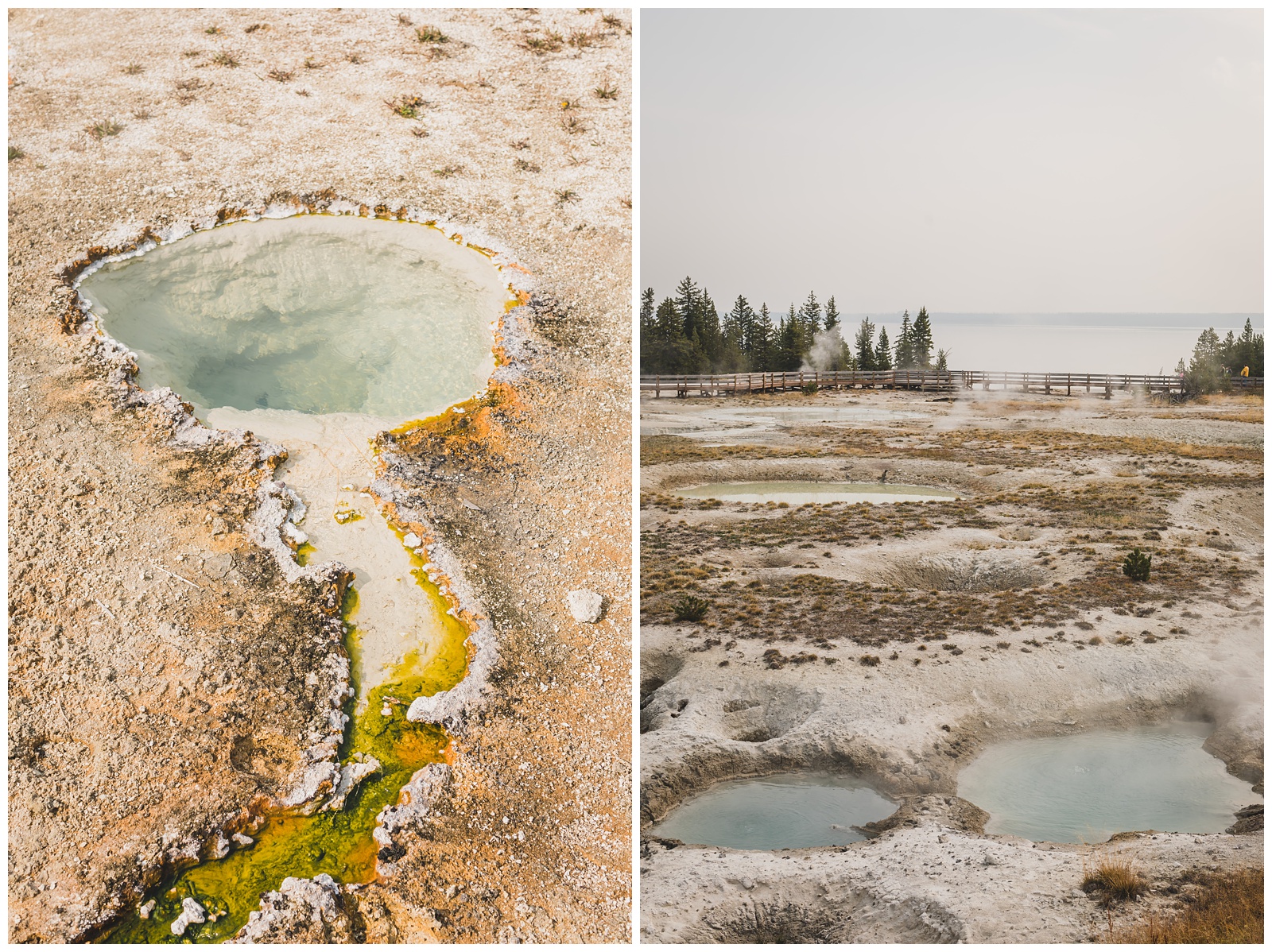
 We dedicated this day to seeing Yellowstone’s most famous hydrothermal features. Both mornings we woke up in Gardiner, we could smell the sulphur from them at our hotel!
Yellowstone has more than 10,000 hydrothermal features in the forms of geysers, hot springs, mud pots and fumaroles. Among these are more than 500 active geysers (more than half the total number in the world). These are fueled by the lava chamber below the park (containing enough magma to fill the Grand Canyon 14 times). {Source: National Park Service}
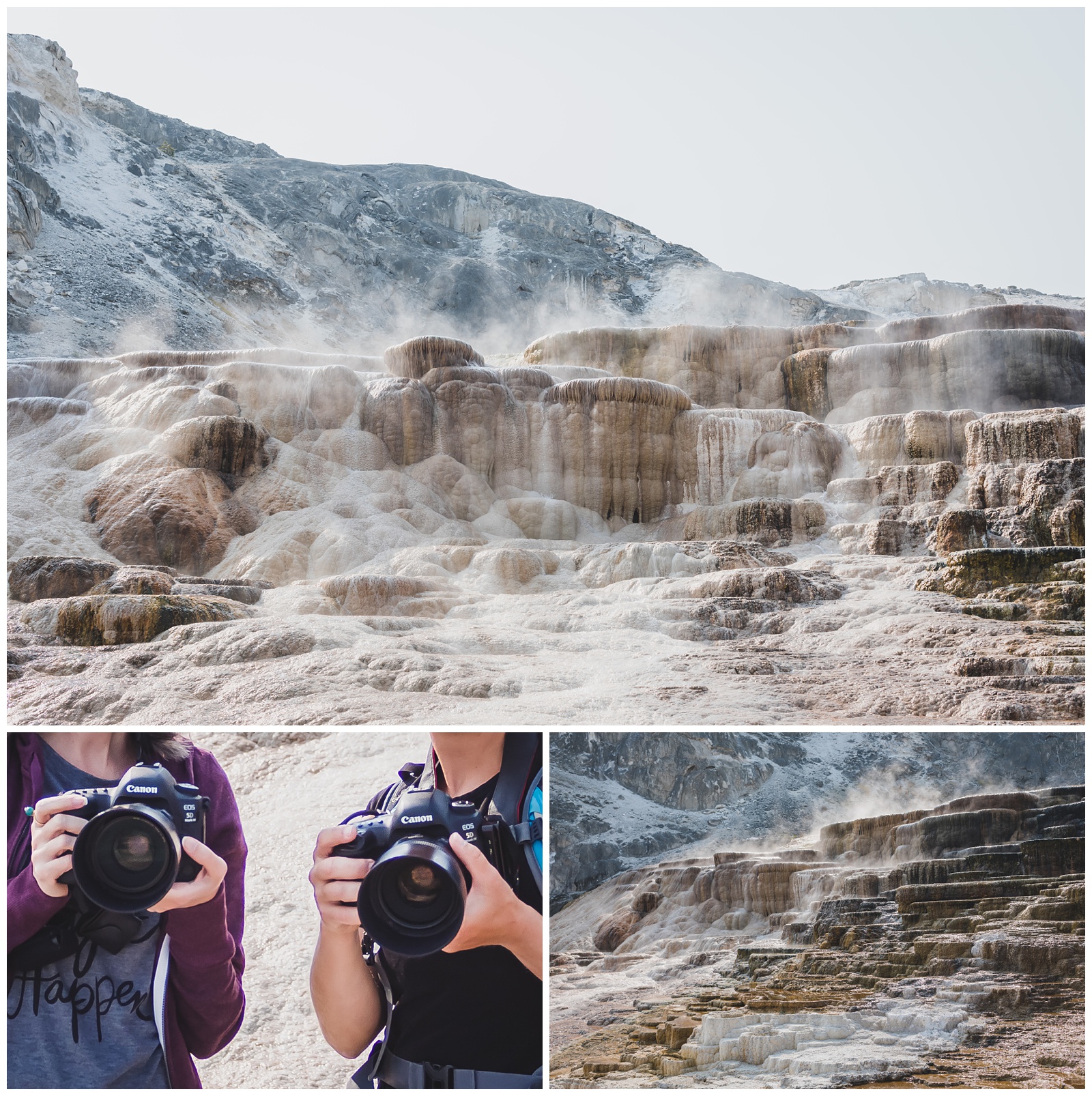 First up on our itinerary was Mammoth Hot Springs, but before I could really take in the springs, I spotted a woman with the exact same camera and lens setup I was carrying (a Canon 5D Mark IV with a 50mm f/1.2L)! We chatted a little about camera gear, and then of course I had to ask her to take a photo with our twinning equipment.
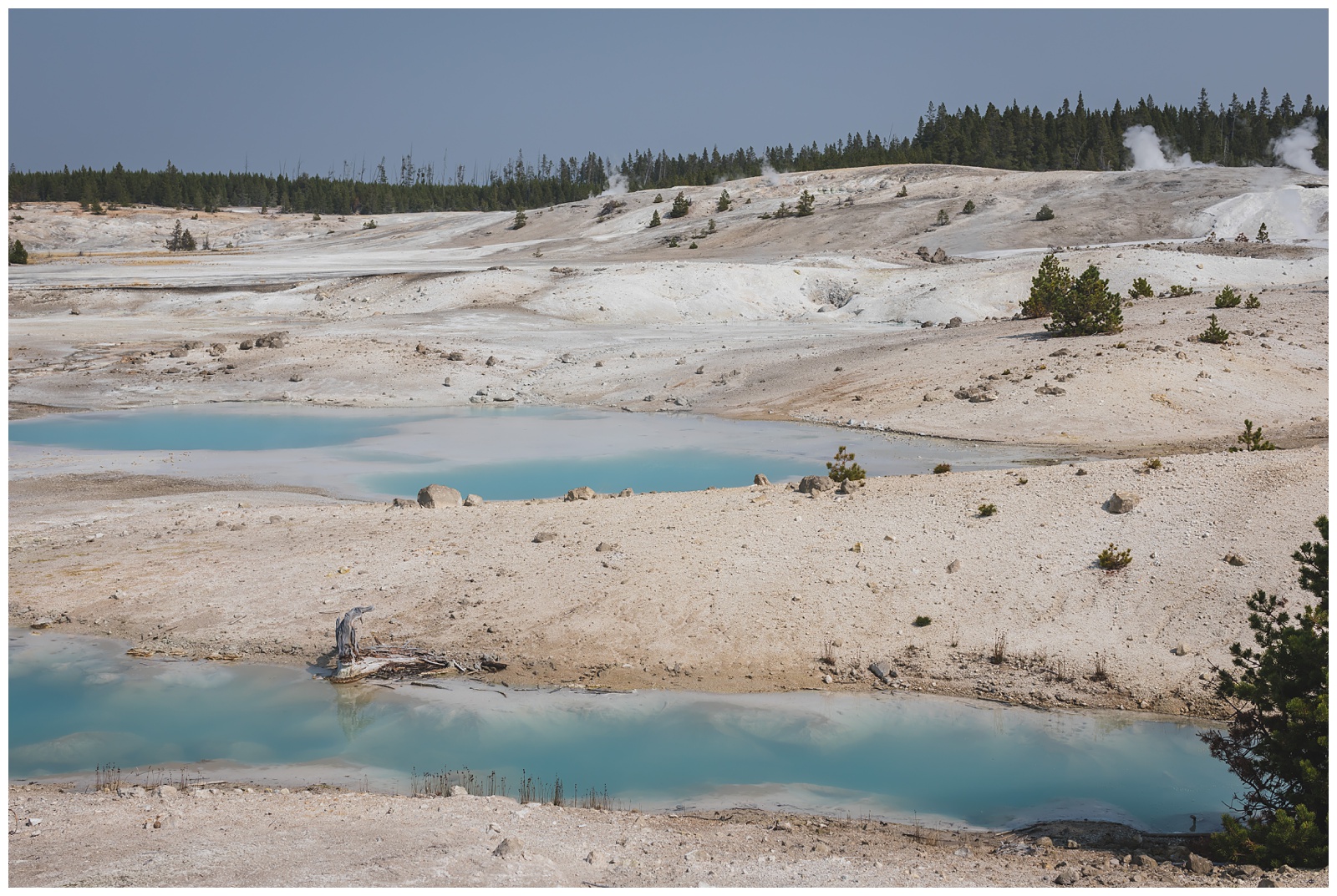
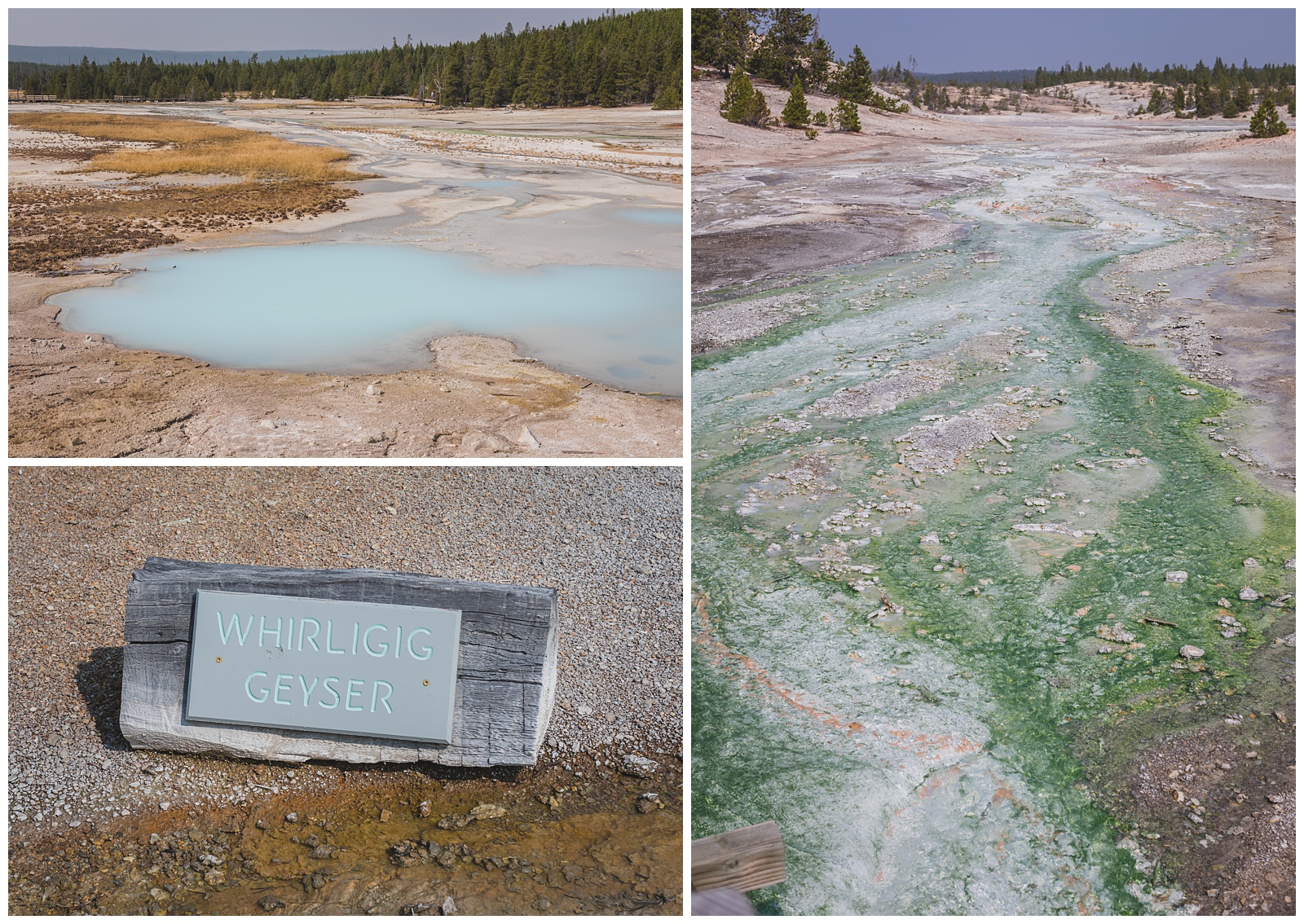
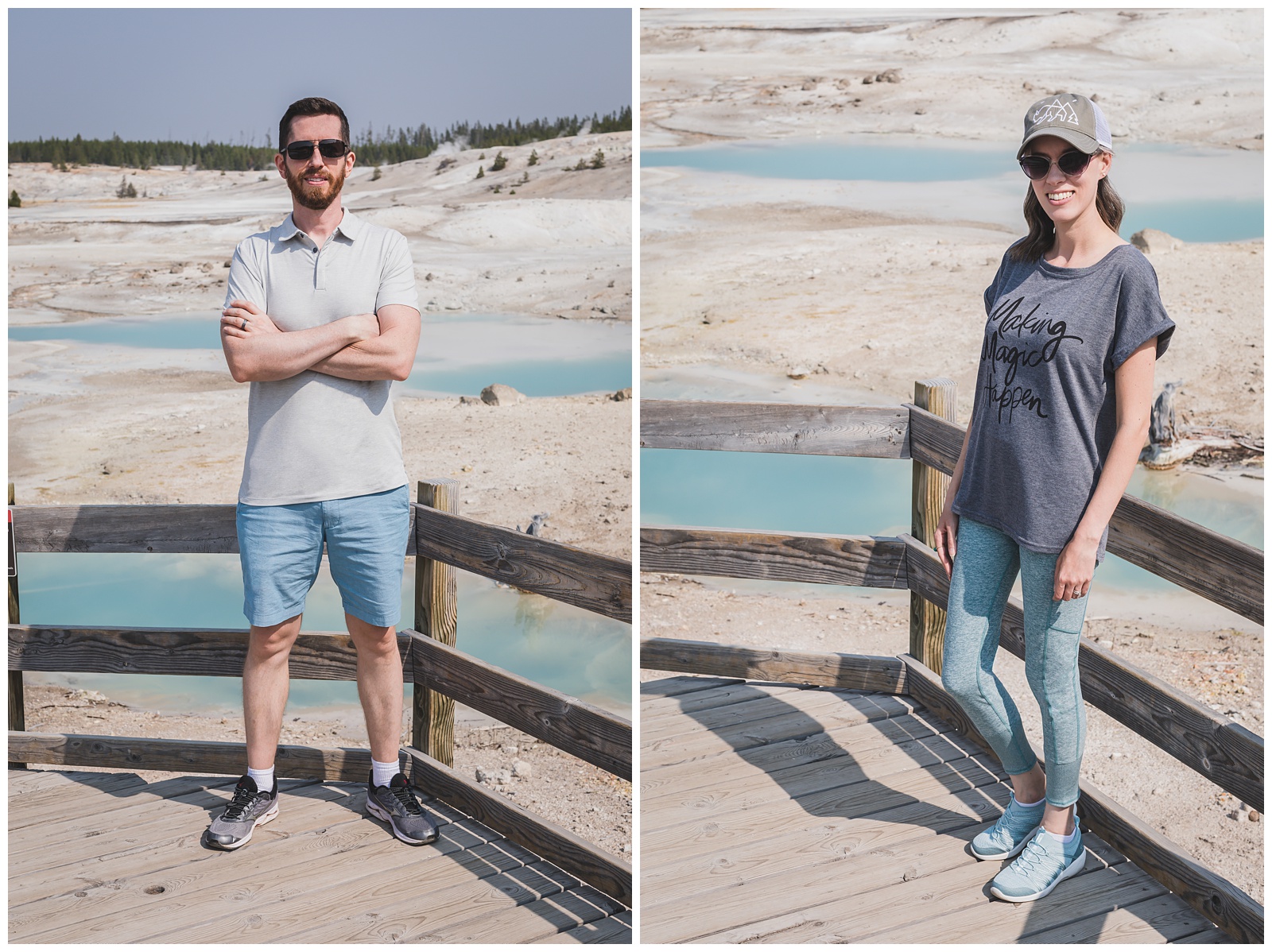 We unintentionally dressed to match Norris Geyser Basin.
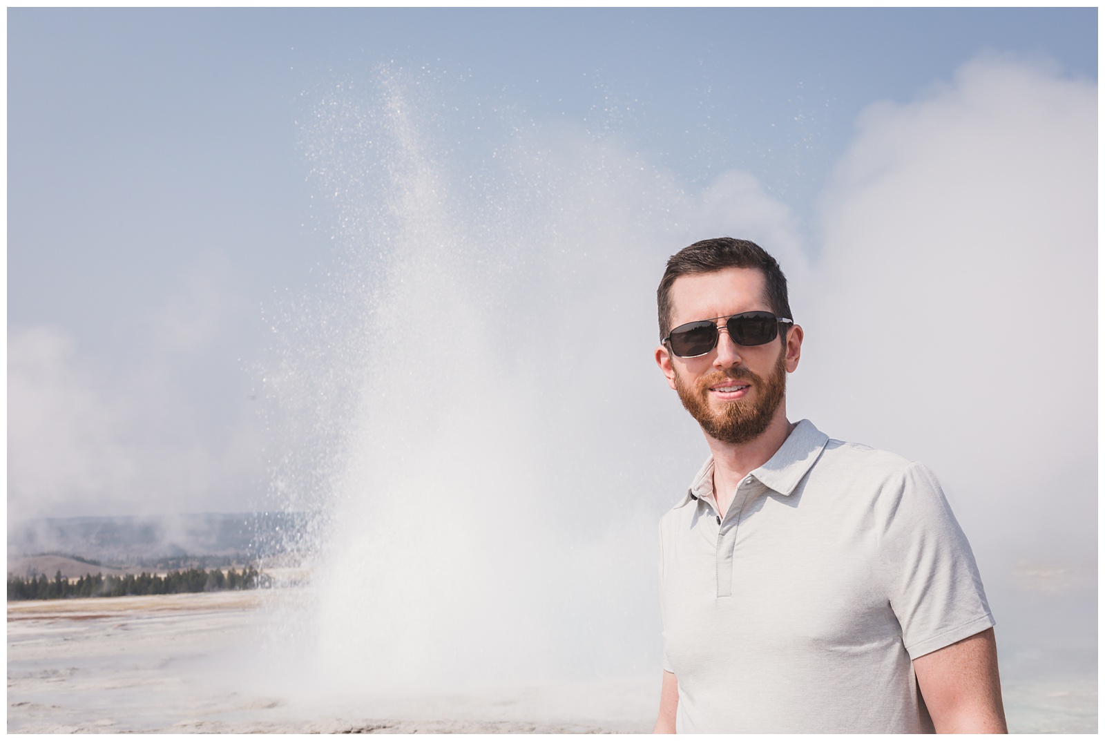
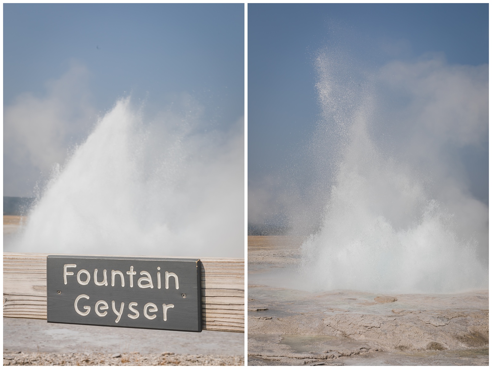 In the Fountain Paint Pot area of the Lower Geyser Basin, we were fortunate to see Fountain Geyser erupting. It goes off only about every four to six hours (with some intervals lasting up to 12 hours), so we really did feel like we got lucky there! Plus, it turned out to be one of Seth’s favorite features in all of Yellowstone and even in the entirely of our trip.
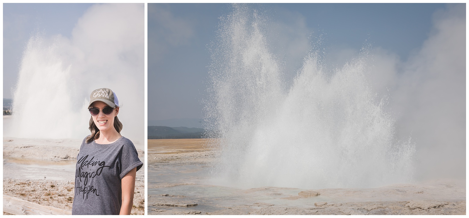 Although I obviously can’t take credit for any of Yellowstone’s magic, my “Making Magic” tee still seemed pretty fitting for all we saw this day!
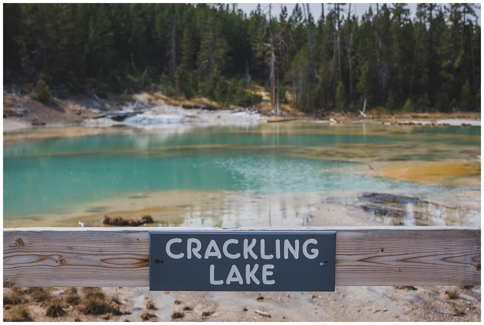
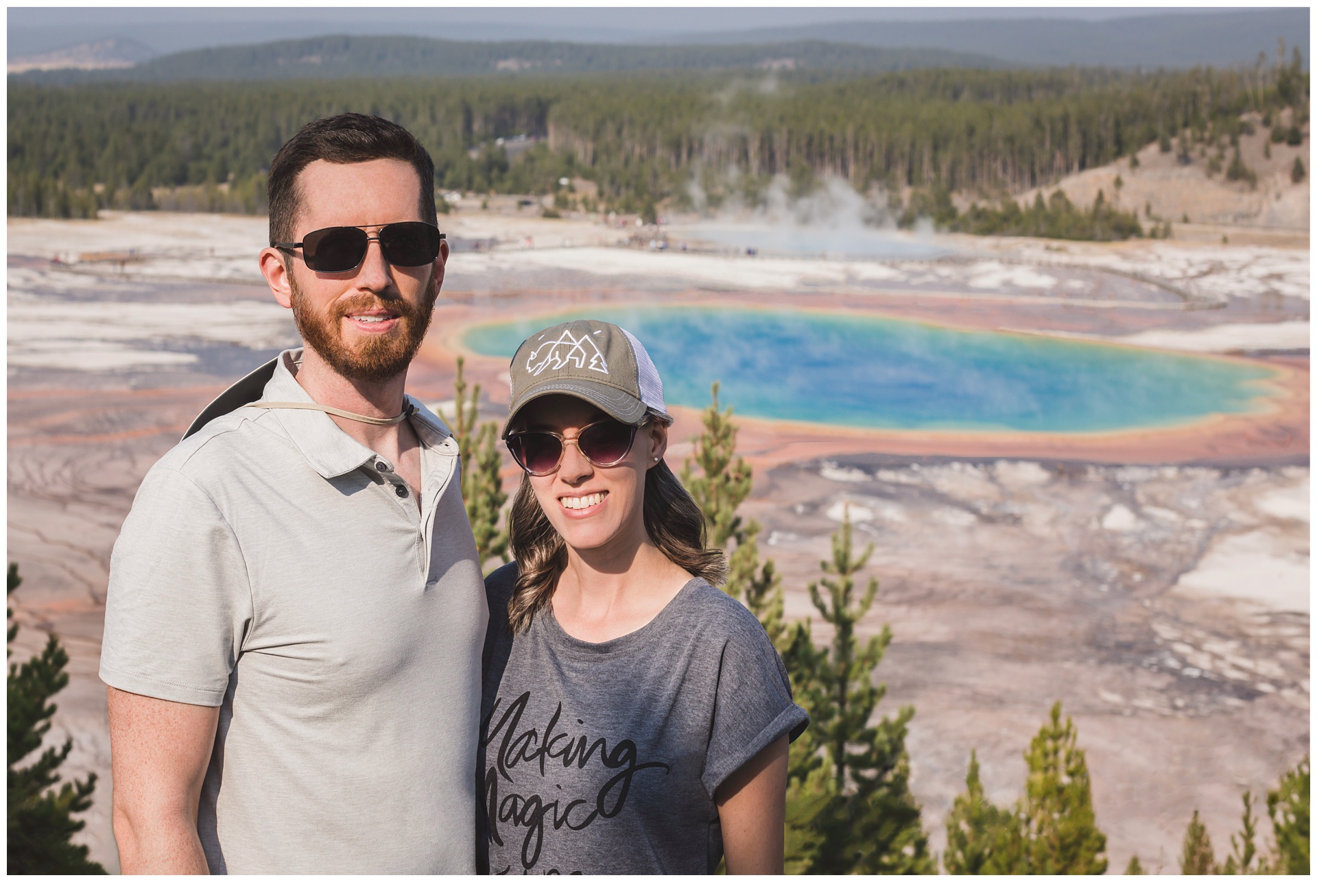
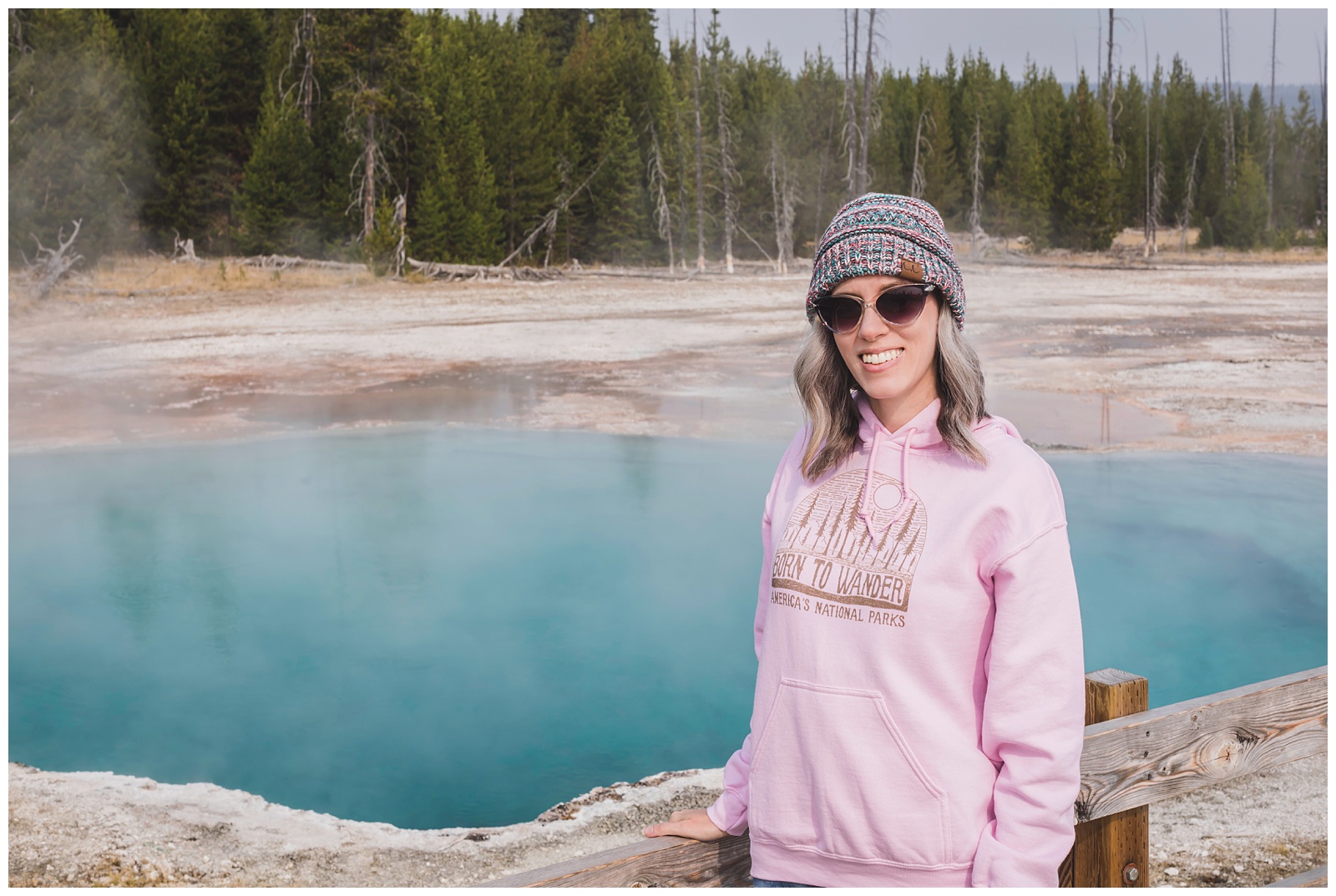
 One of my favorite parts of the park was the Grand Prismatic Spring area, which also features some other otherworldly sights like this one:
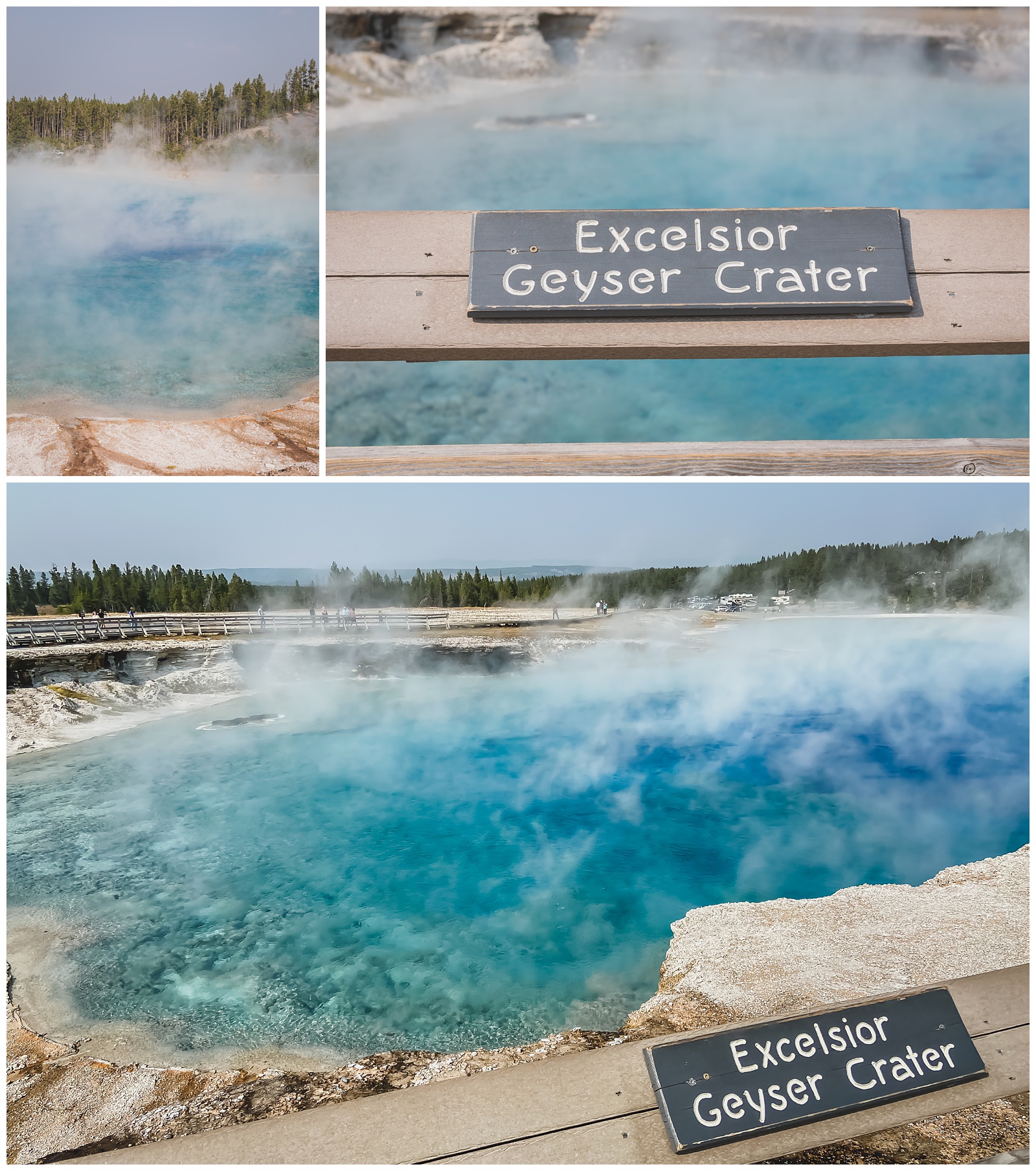
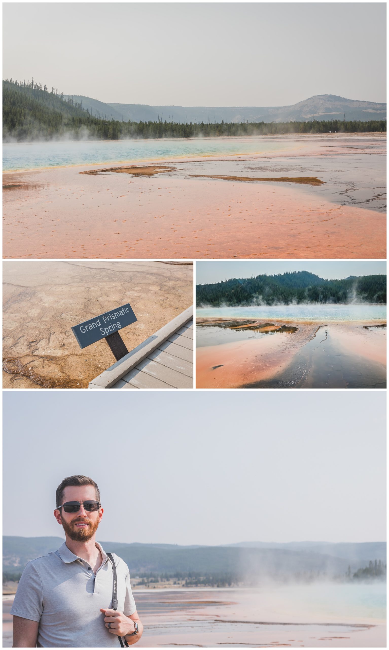
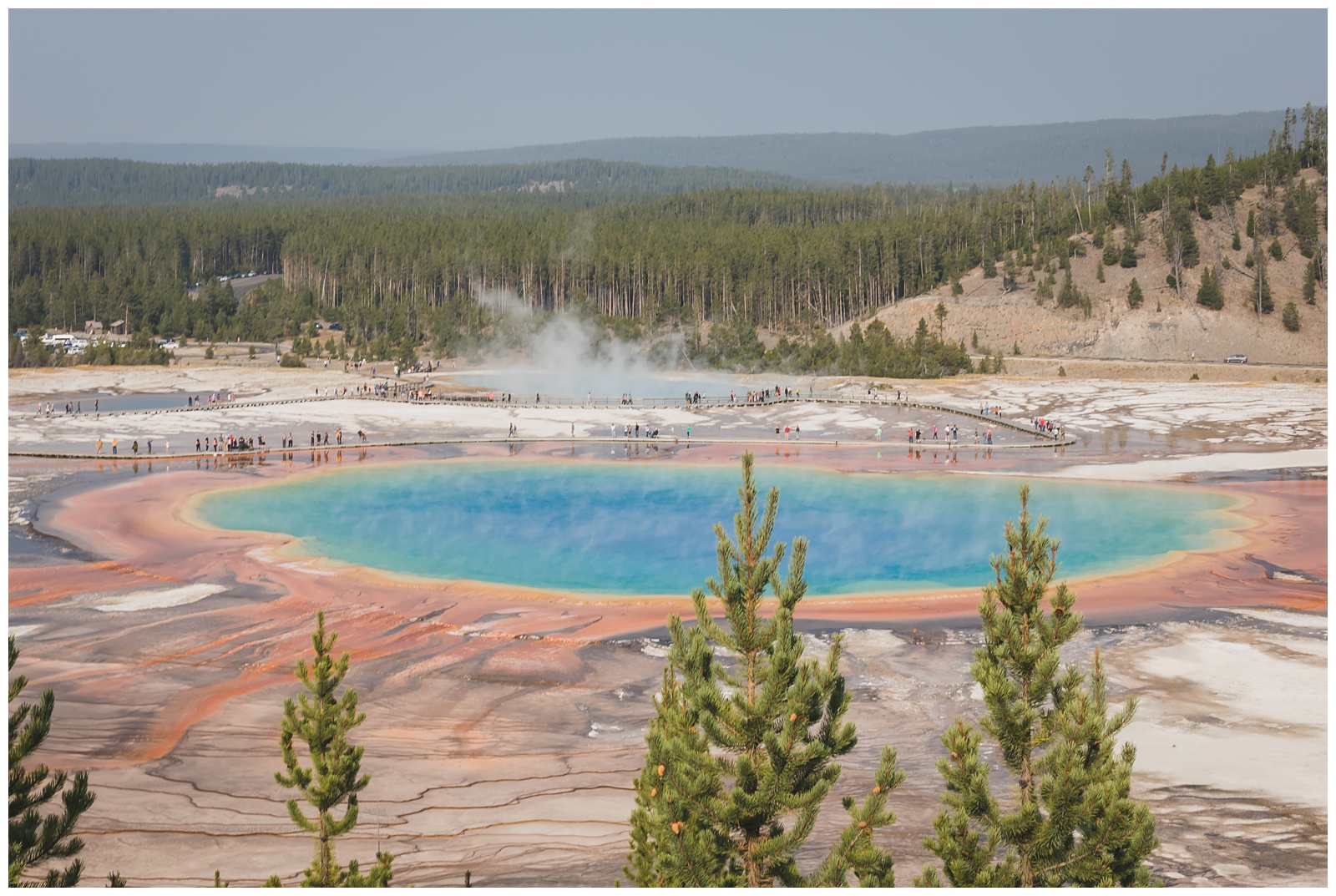 But in my book, the Grand Prismatic Spring really does take the cake. Seriously, just look at it — how is it even real?! (We arrived at this awesome overlook by hiking part of the Fairy Falls Trail.)
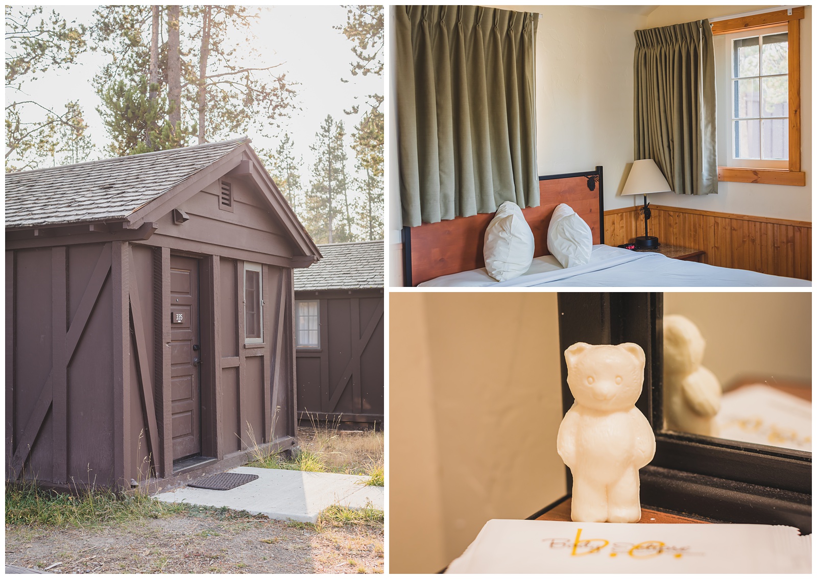
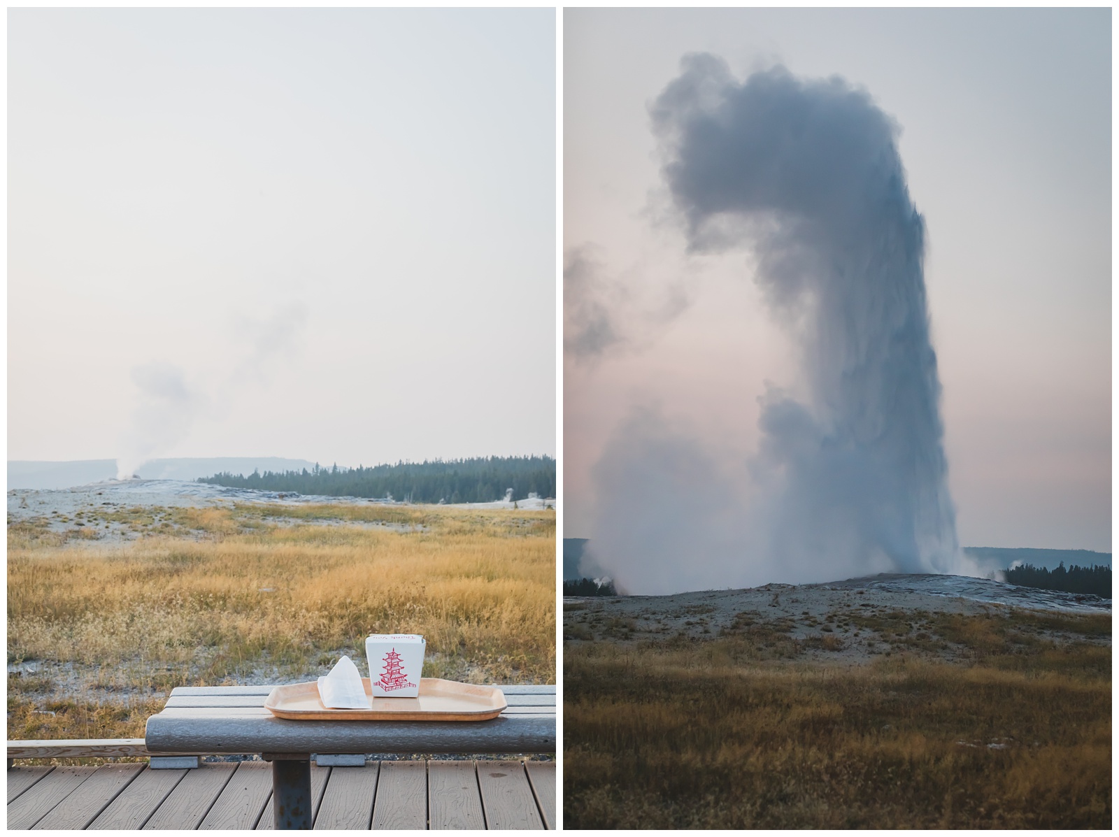
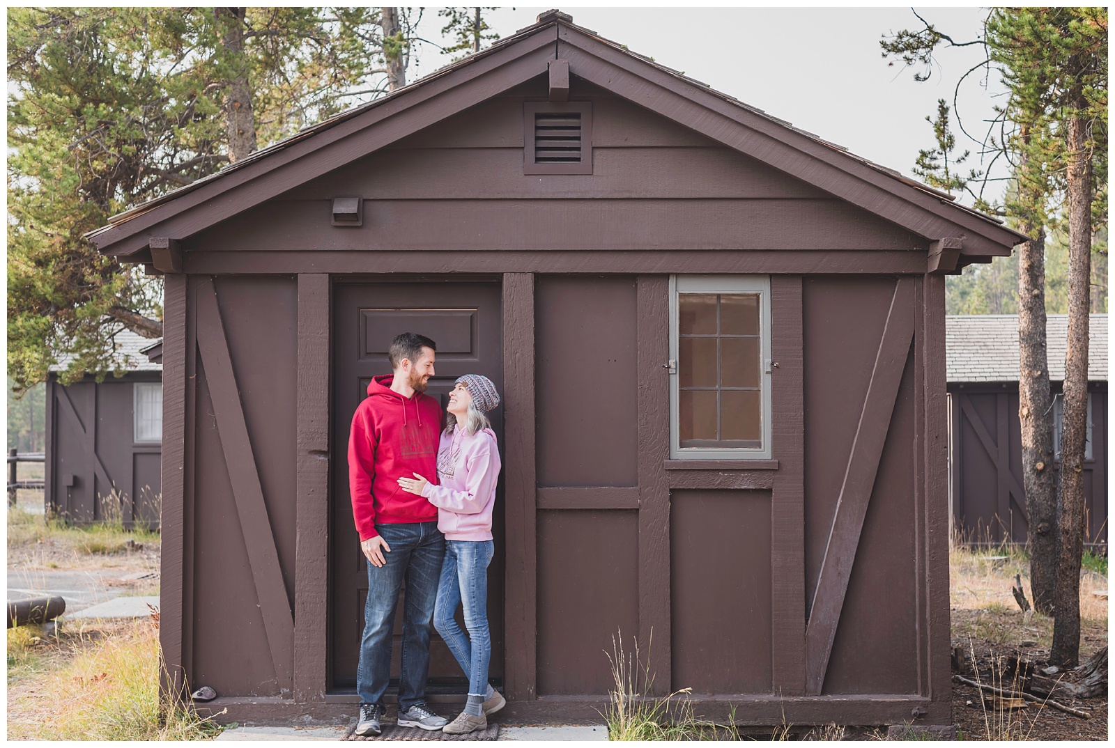
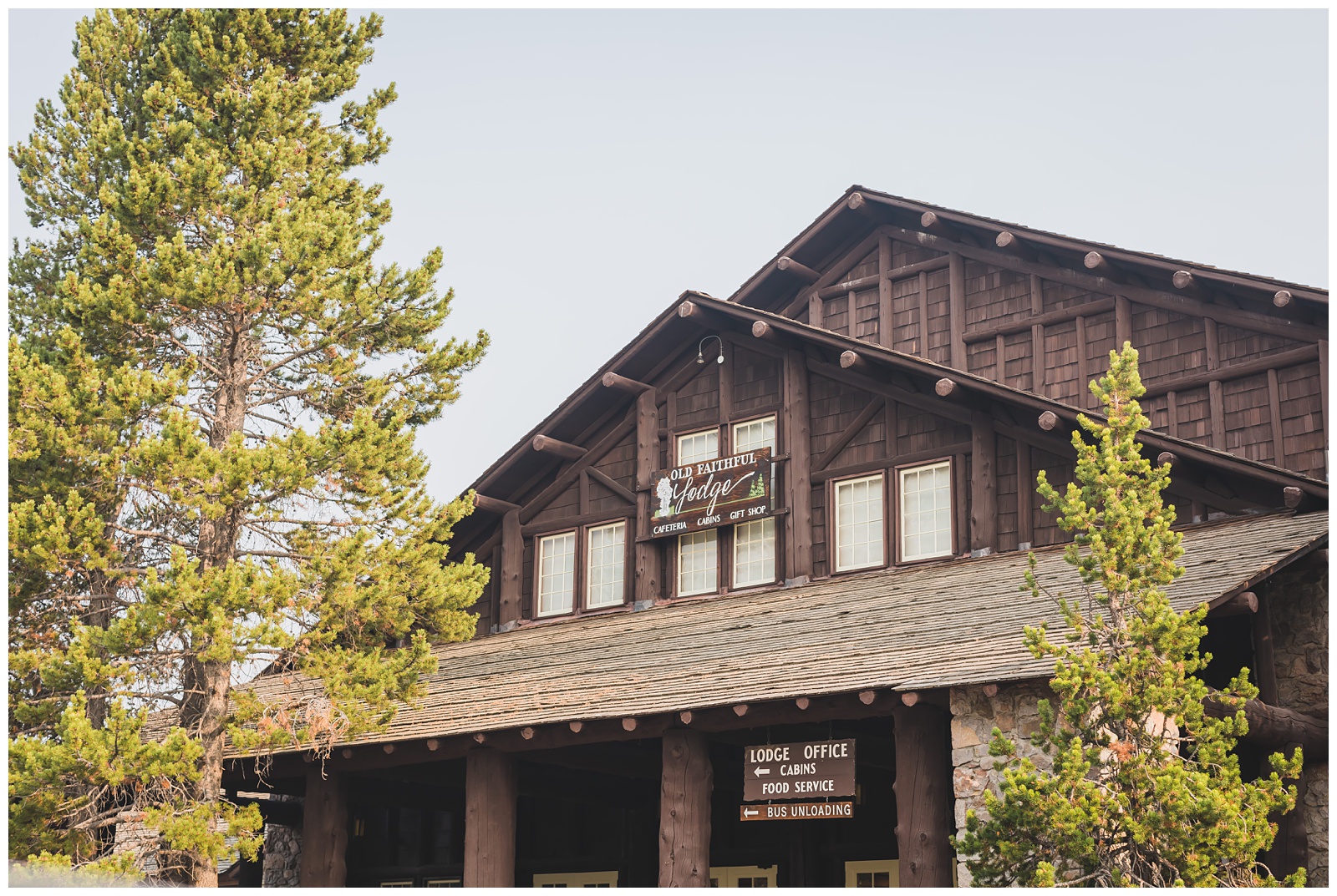 From the Grand Prismatic Spring, we made our way south to Old Faithful Village, where we’d booked a cabin for the night. It was only about a quarter-mile from the famous geyser.
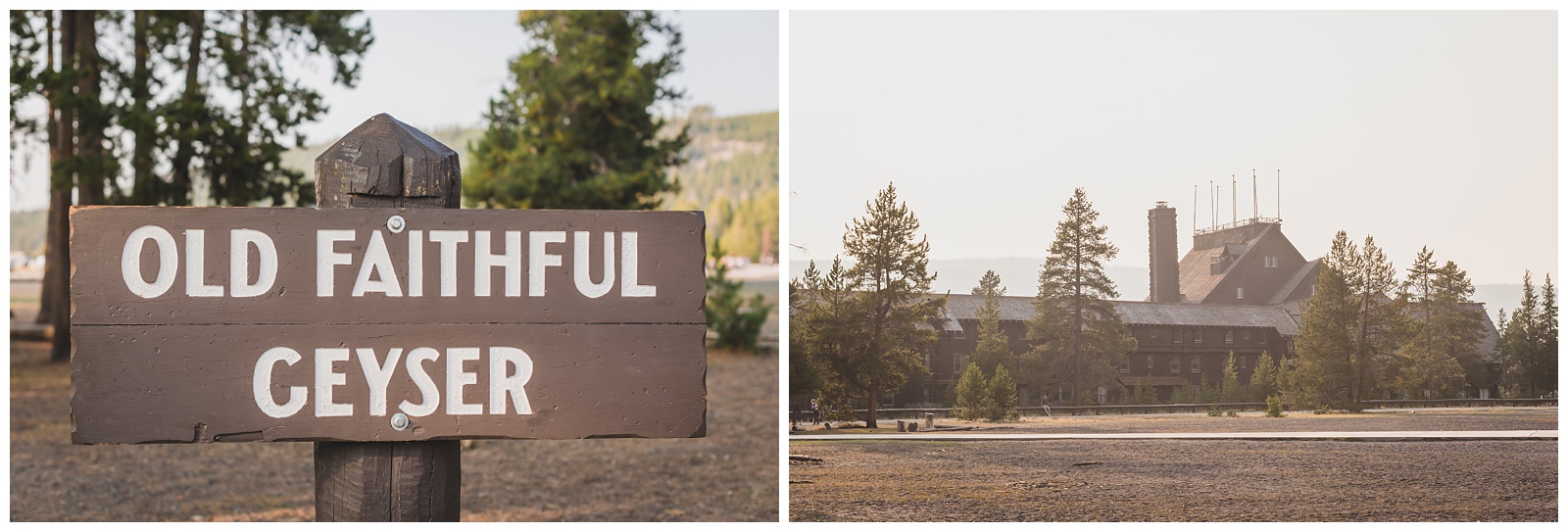
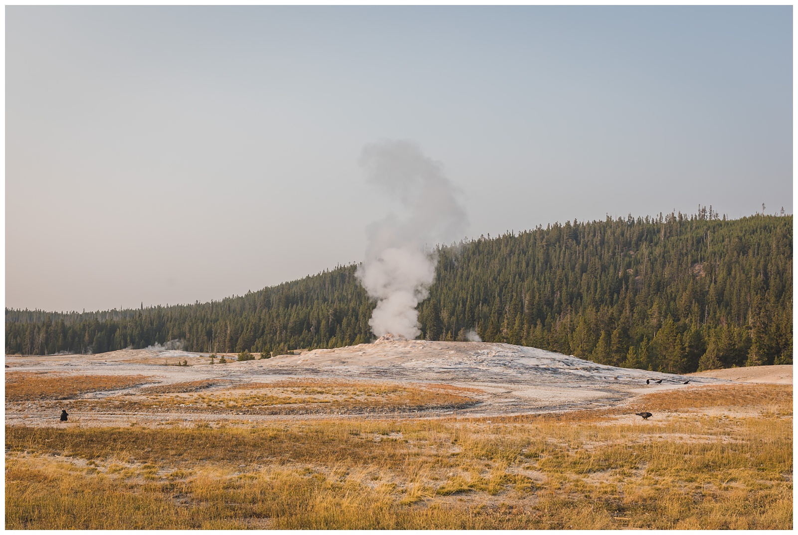
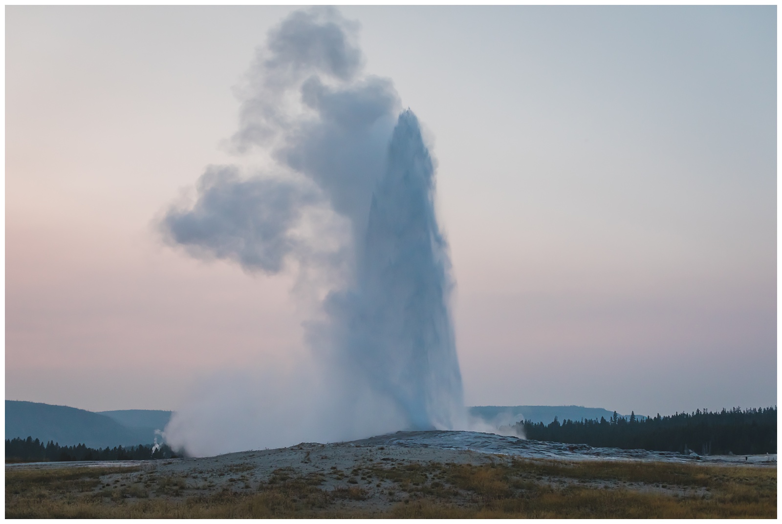
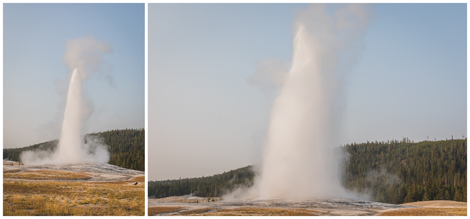 Our first viewing of Old Faithful was in the golden hour before sunset, which was undoubtedly one of the prettiest times to see it! It shoots more than 18 stories high, with 350-degree steam.
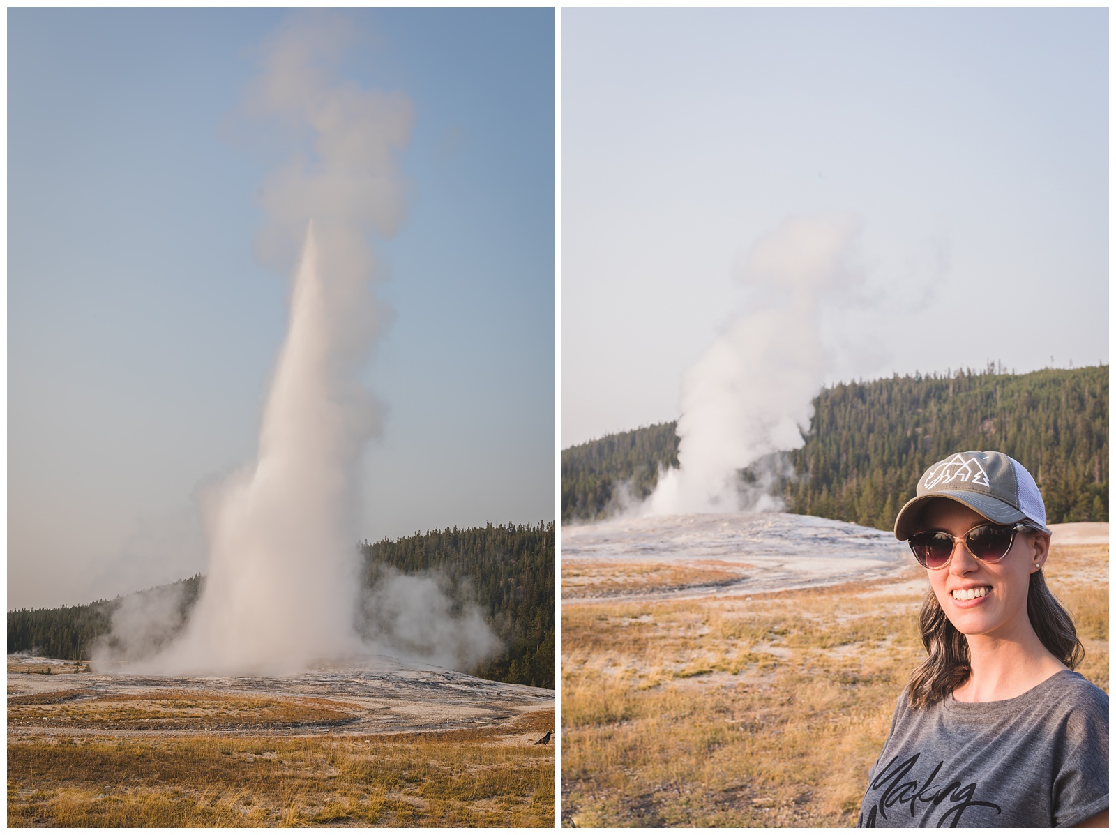
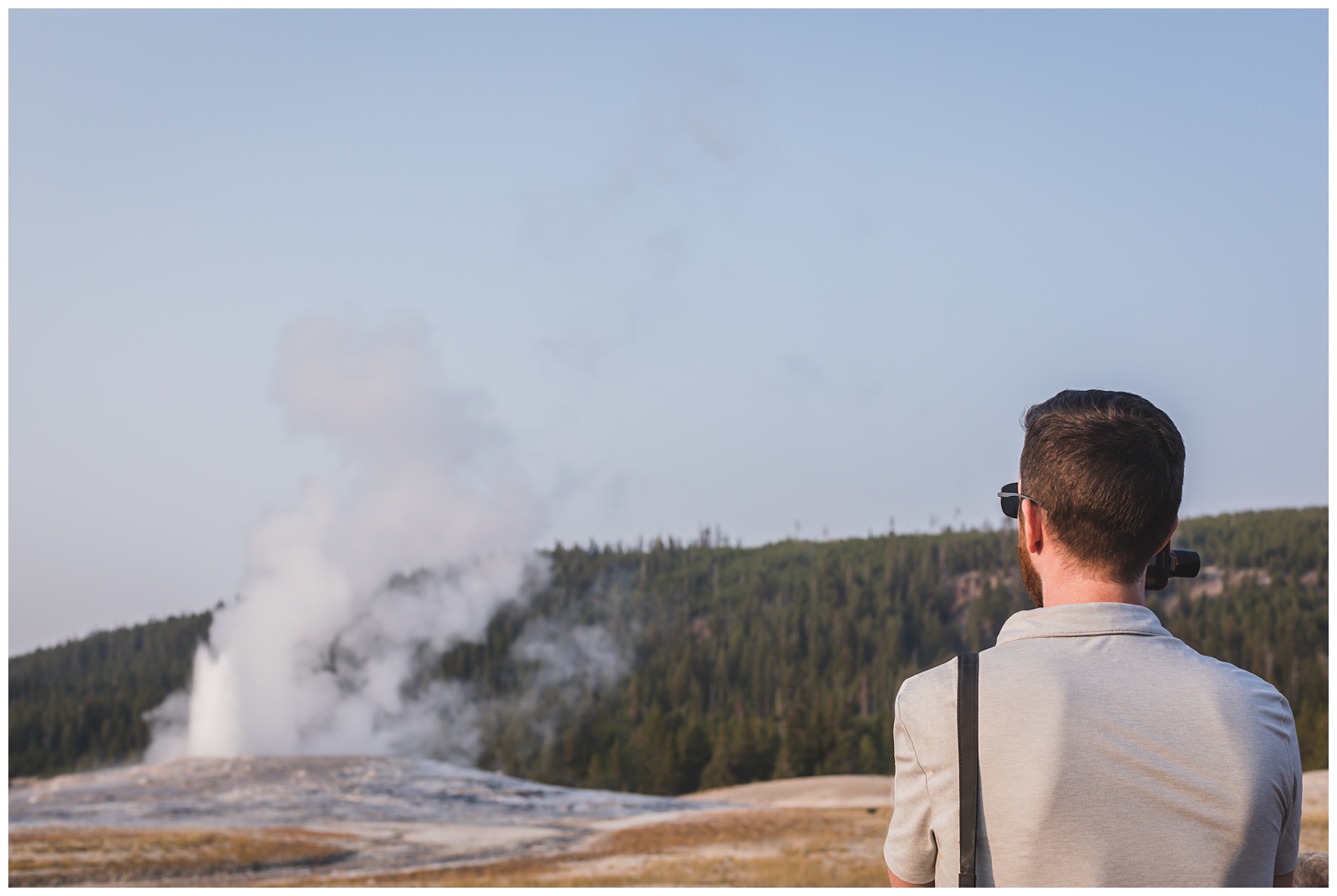
 After watching Old Faithful the first time, we picked up dinner in the cafeteria at Old Faithful Lodge, then returned to the geyser to get front-row seats for seeing it again. At least in our experience, we can say it does in fact erupt every 90 minutes!
day 8 • 09.18.20
Yellowstone National Park >>> Grand Teton National Park >>> Jackson, WY
 We finally broke out our Seth’s-birthday sweatshirts, then said goodbye to our little cabin as we headed farther south in Yellowstone on our way to Grand Teton.

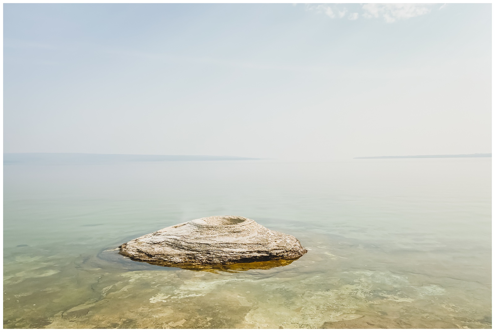
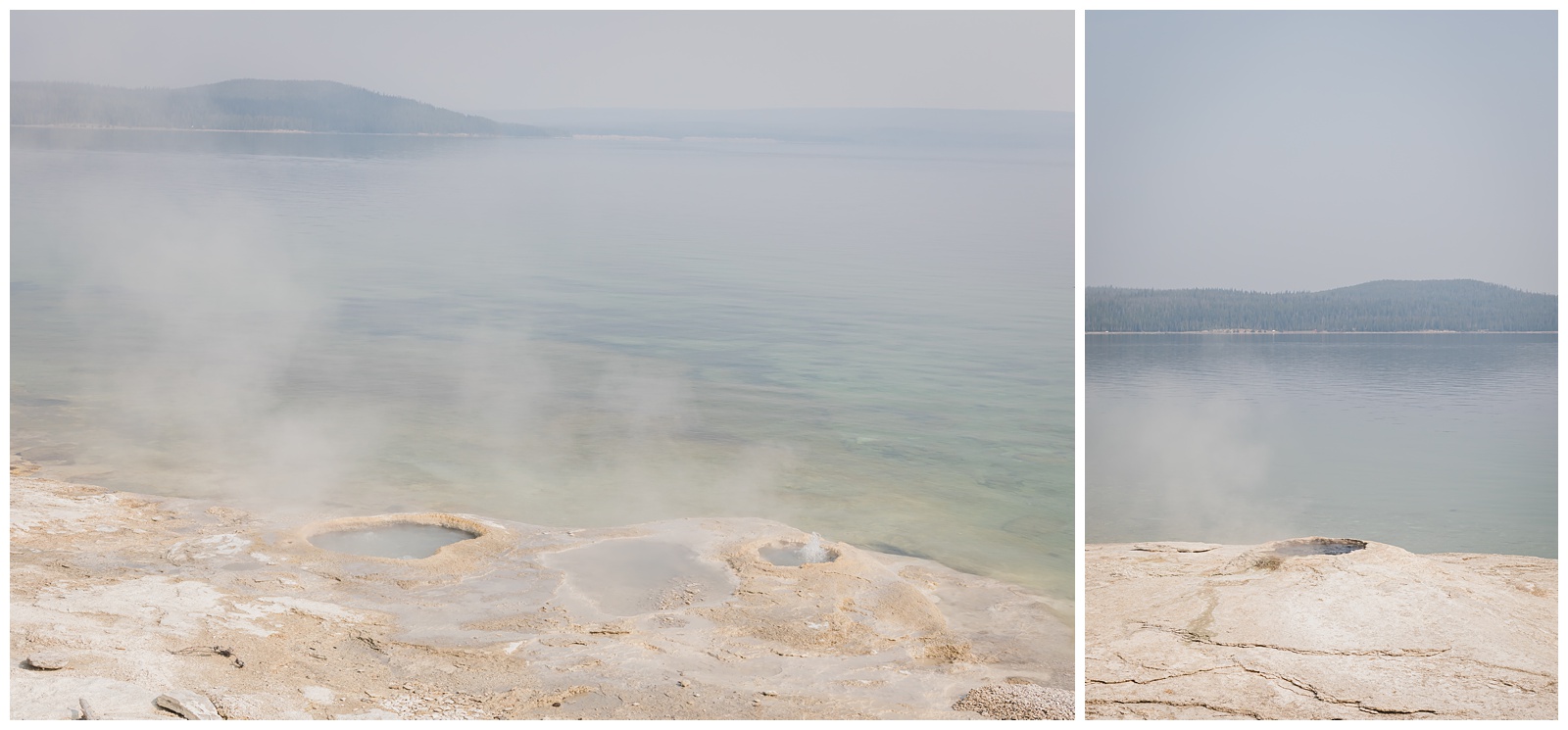 Before leaving the park, we stopped at West Thumb Geyser Basin — which has these amazing thermal features at the edge of Yellowstone Lake’s West Thumb.
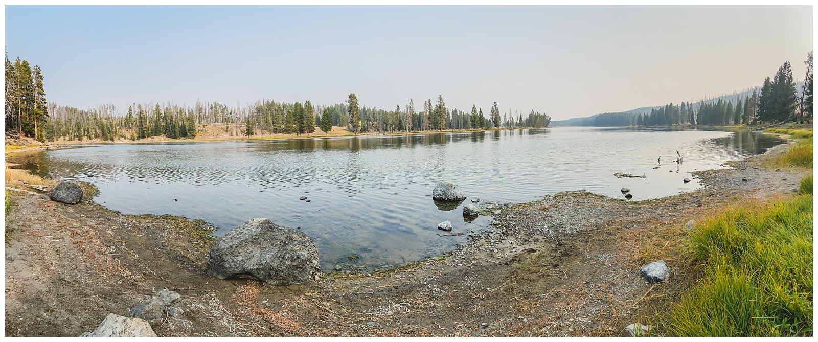
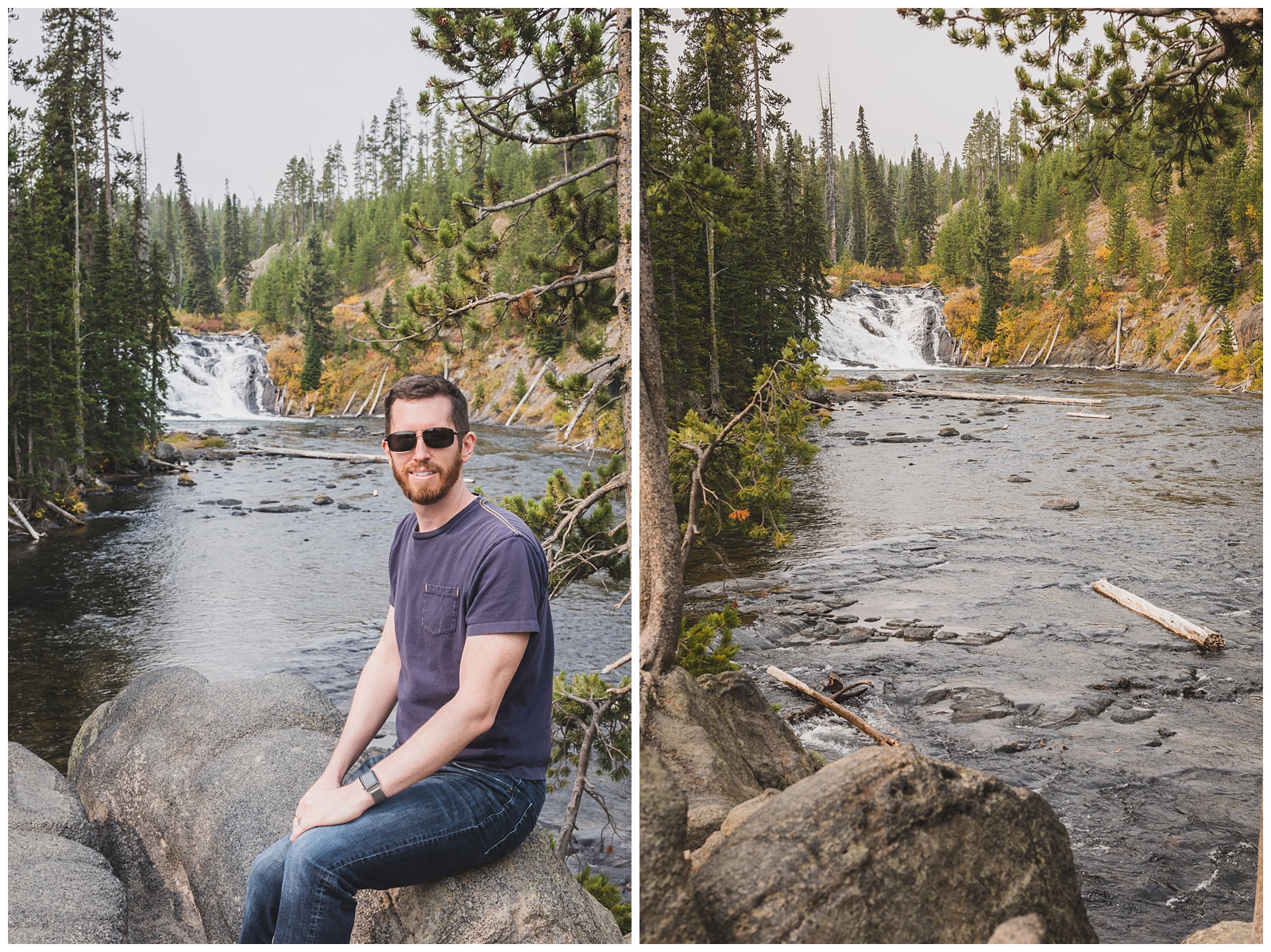
 We also saw Lewis Lake and Lewis Falls at the south end of the park. Since our Day 1 in Yellowstone had focused on lake, river and waterfall features and our Day 2 had focused on thermal features, it seemed appropriate to end our time in the park on Day 3 with a mix of both!
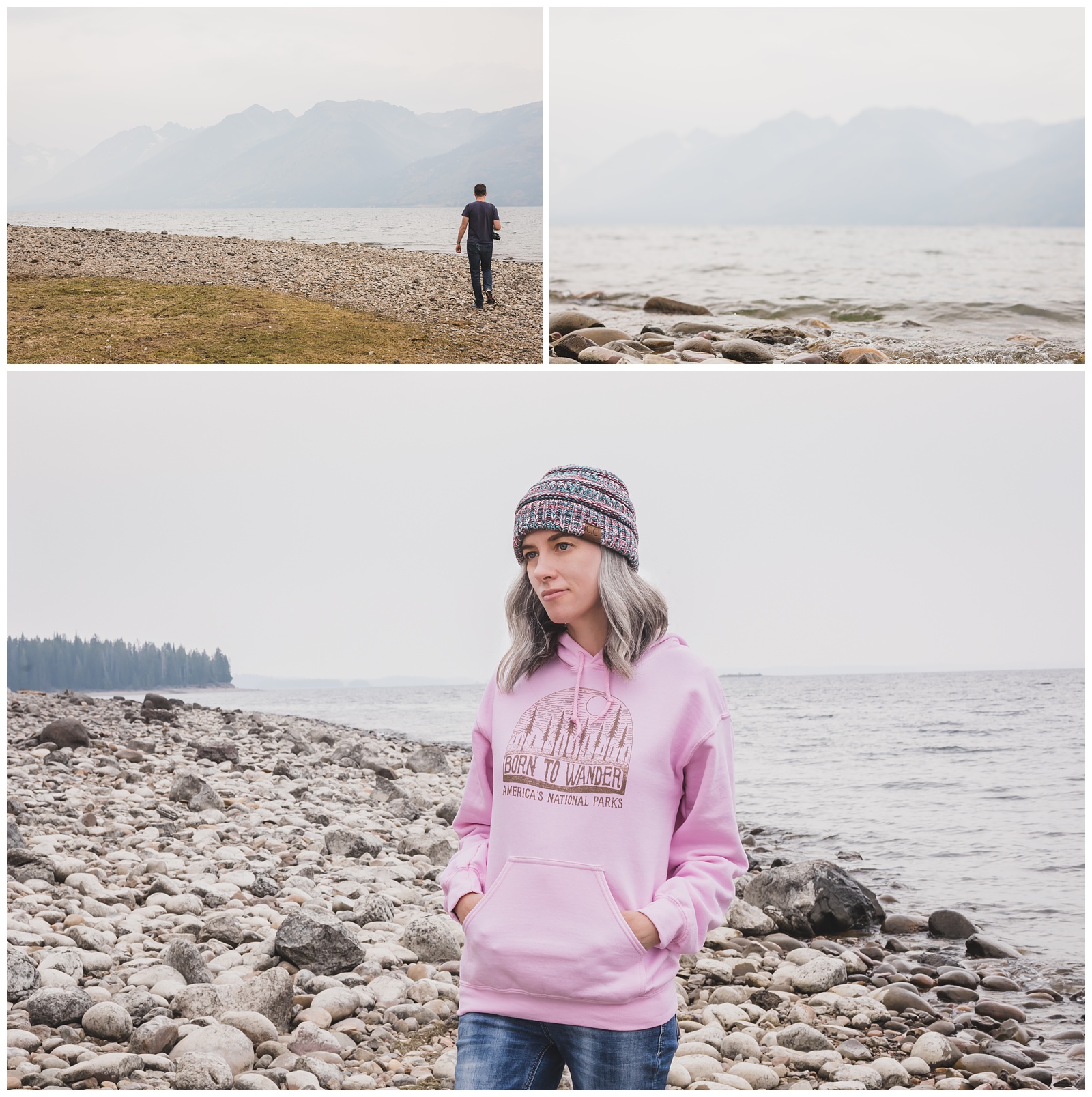
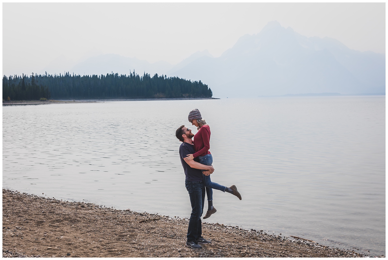
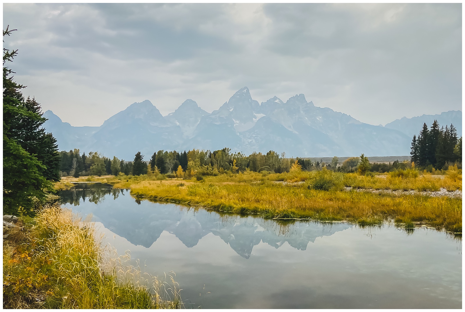
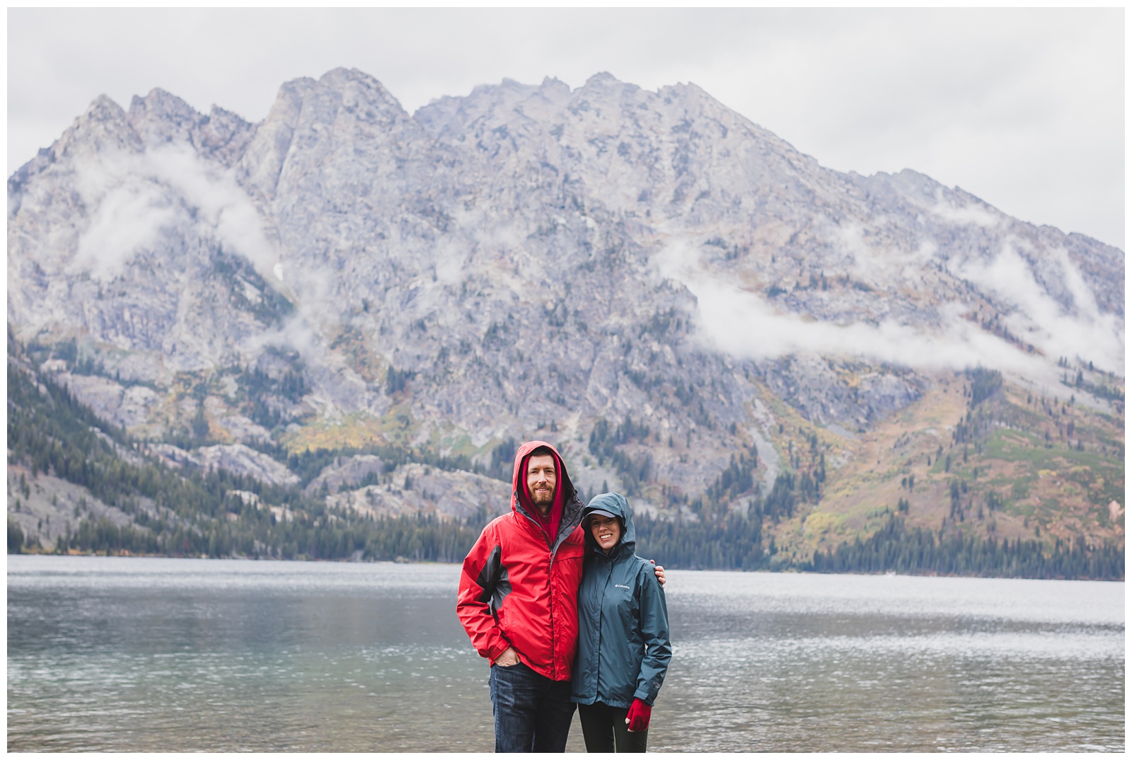
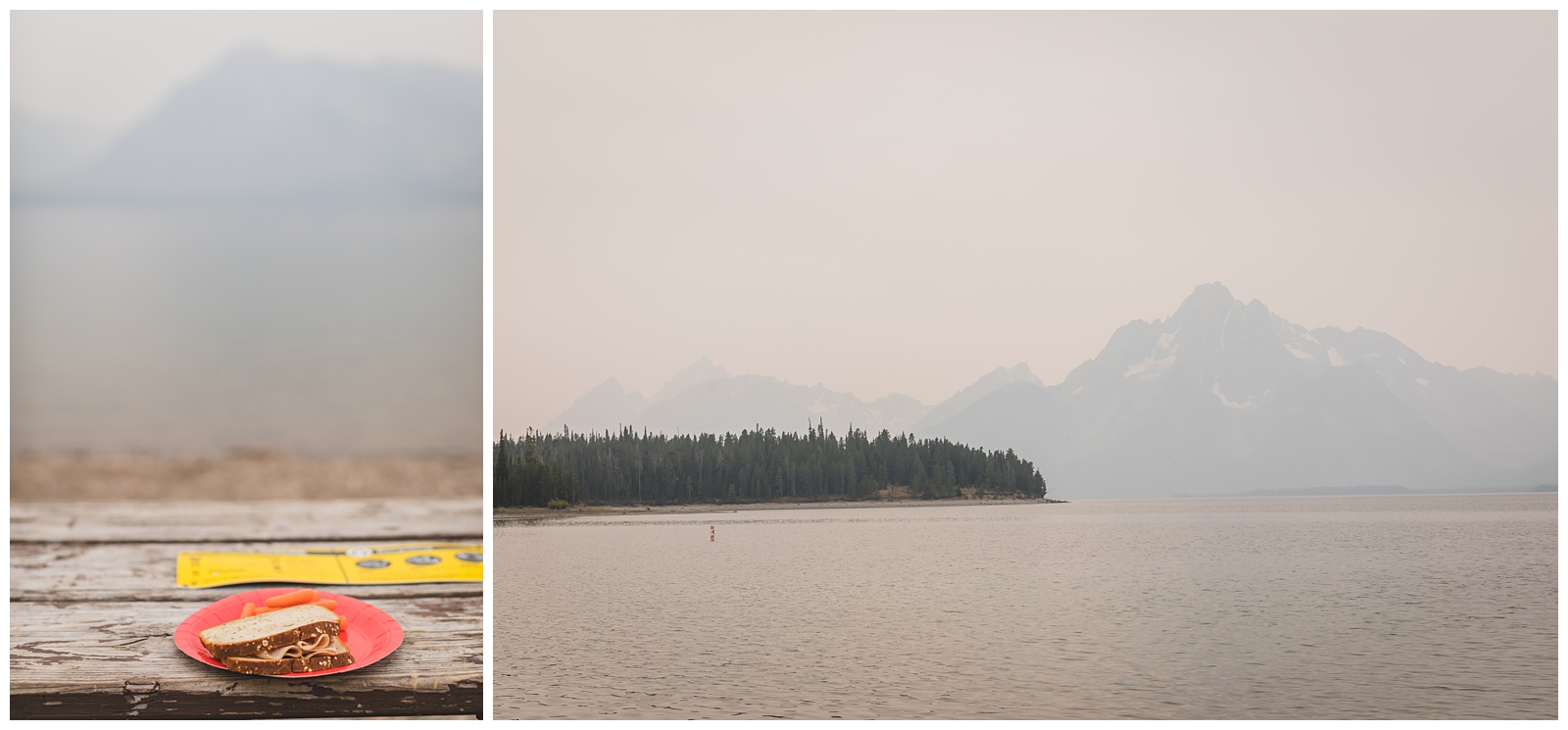 We arrived in Grand Teton to find a ton of wildfire haze. We had lunch at Colter Bay, which is part of Jackson Lake and is supposed to be one of the most beautiful spots for seeing the mountain range and photographing its reflection in the water. Obviously we had a more muted view than the norm, but it still ranks high on the list of views we’ve had while eating turkey sandwiches!
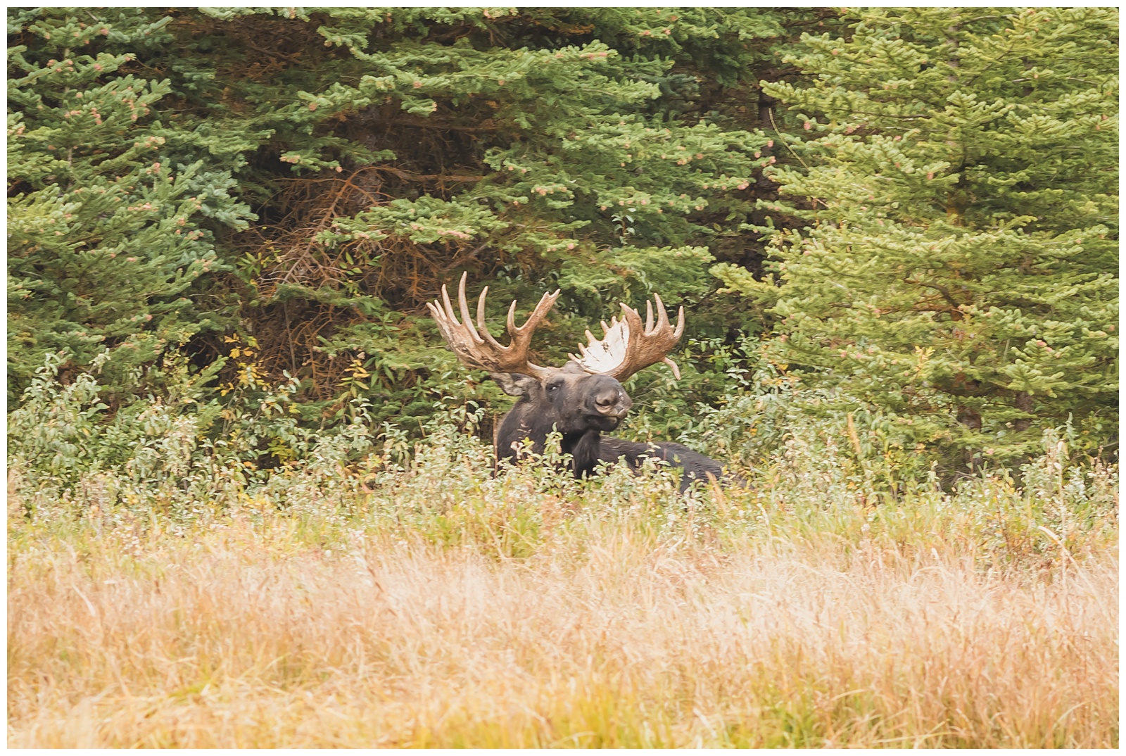
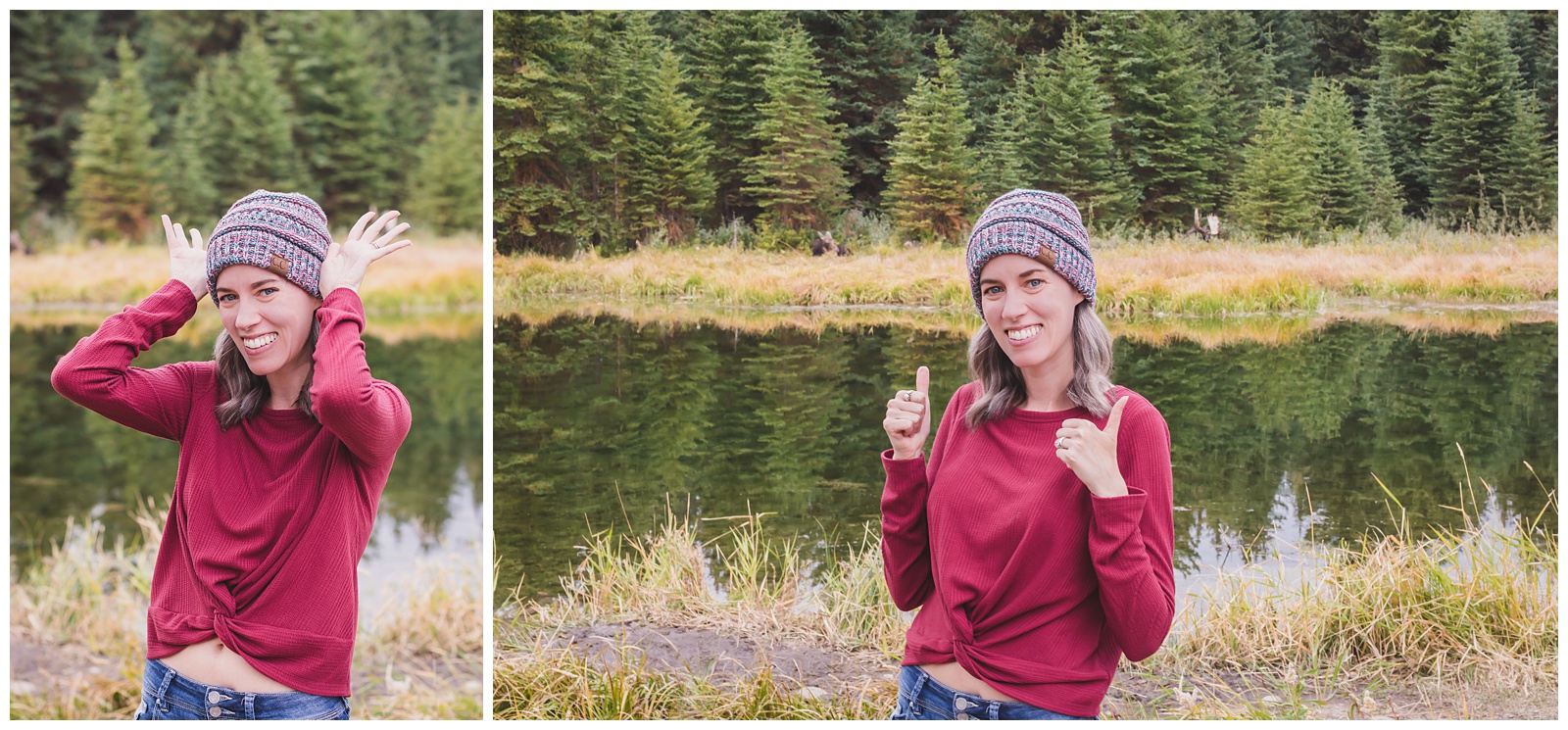
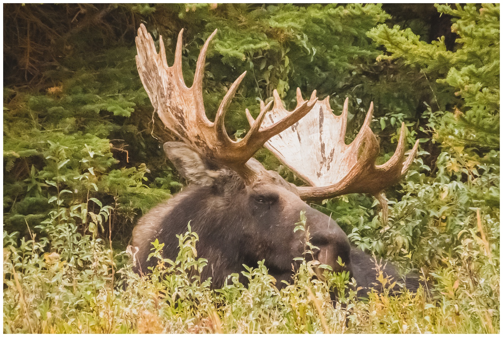
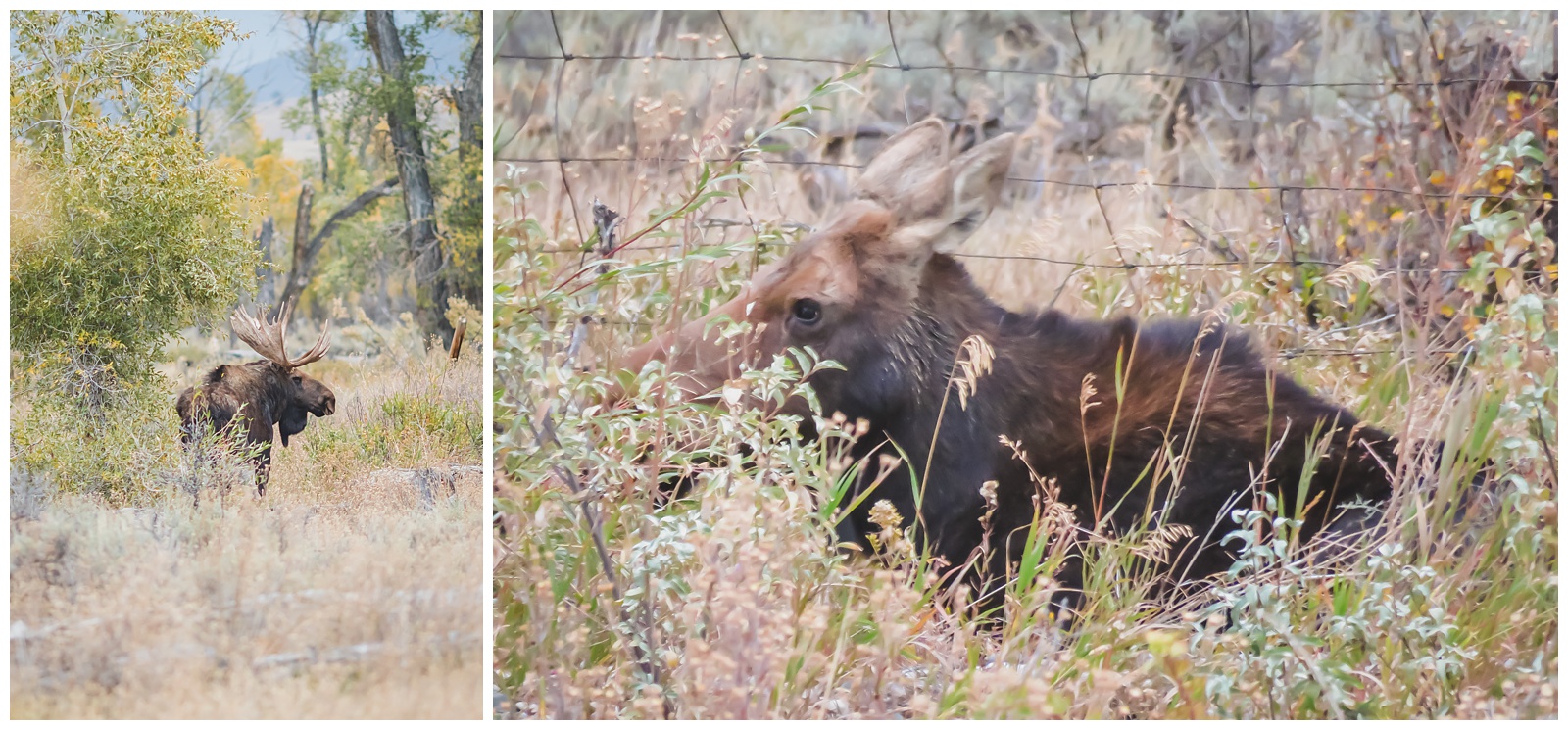
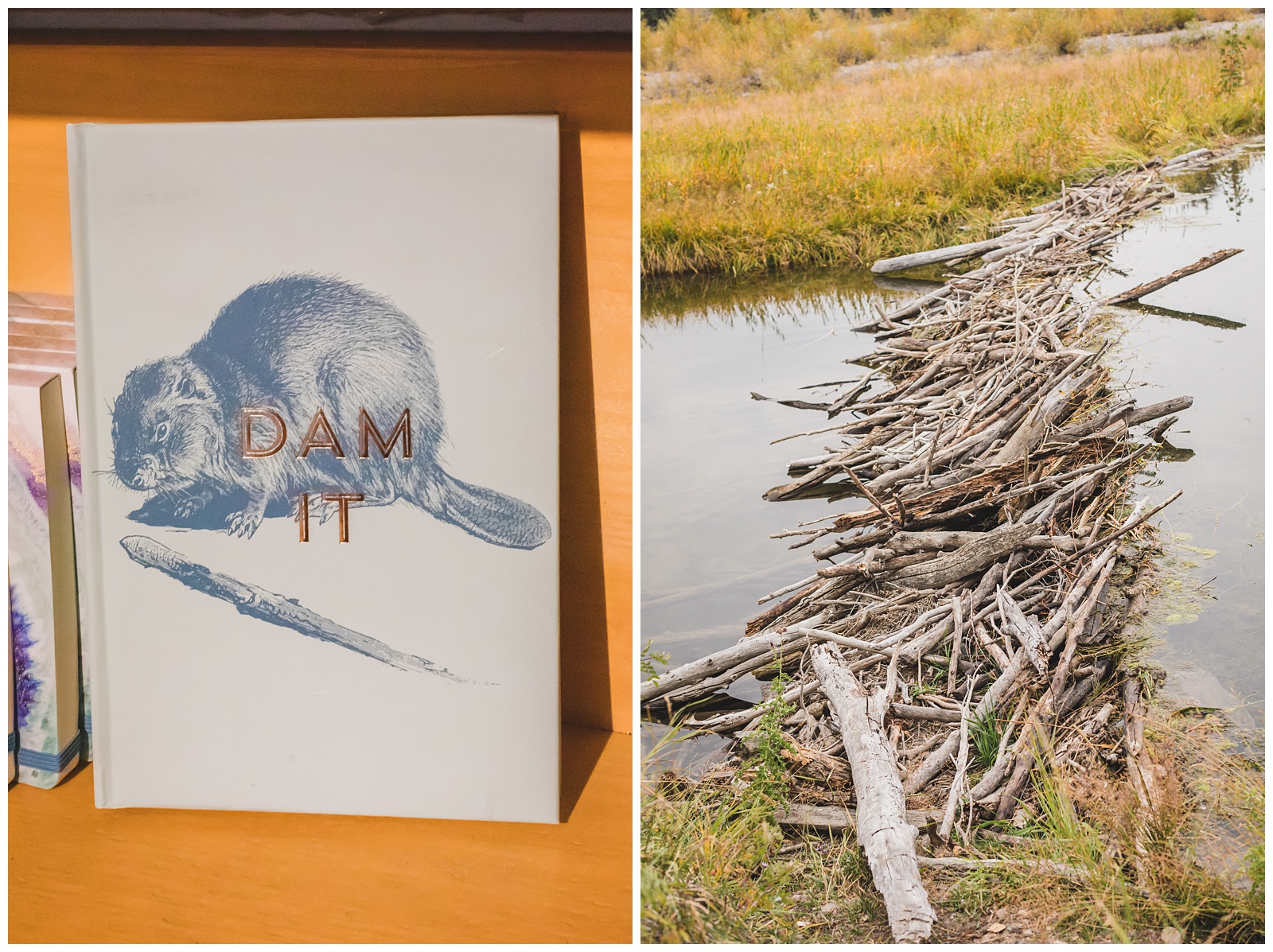 One of my highest hopes for this trip and for this park specifically was to see a moose, so we were super excited when someone told us she’d seen two at Schwabacher Landing. We were about a 20-minute drive from there, then upon arriving, didn’t know exactly where to look. But we did finally get a pretty awesome view of the Teton Range’s Cathedral Group (as well as of a beaver dam that paired nicely with the above photo I’d taken at the Colter Bay Visitor Center 😂).
Fortunately, the nice lady who took this photo was also able to point us in the direction of the moose, which had evidently (and luckily for us) been lounging in the same spot for at least an hour. So we booked it over there and were at last able to fulfill my dream of a moose sighting!
 So excited. (At right, you can see the moose over my shoulders.)
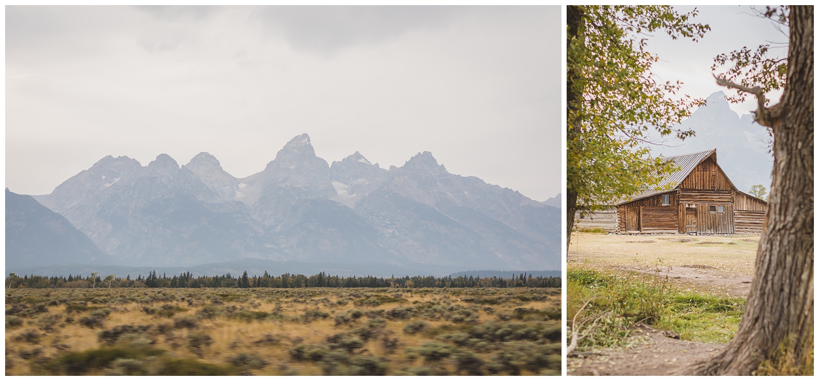
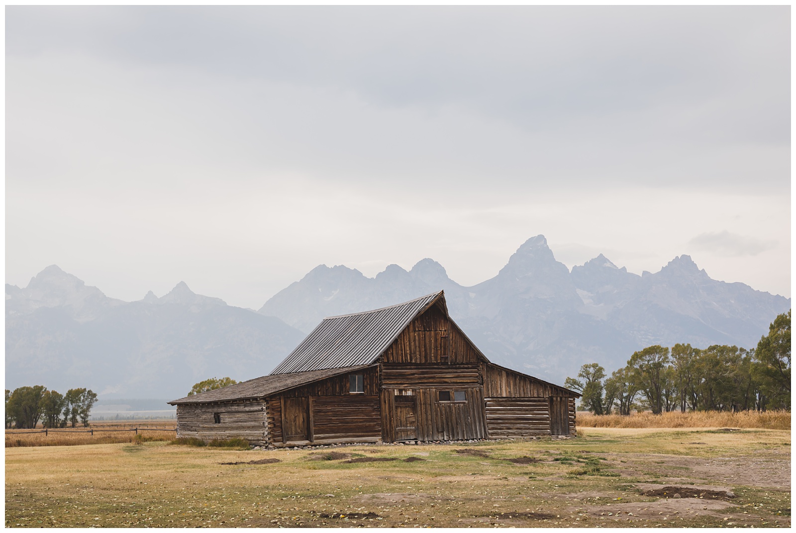 We hated to leave the moose but had other sights to see, including the iconic barn on Mormon Row (with its roofline meant to mimic the mountains behind it), as well as the Chapel of the Transfiguration.
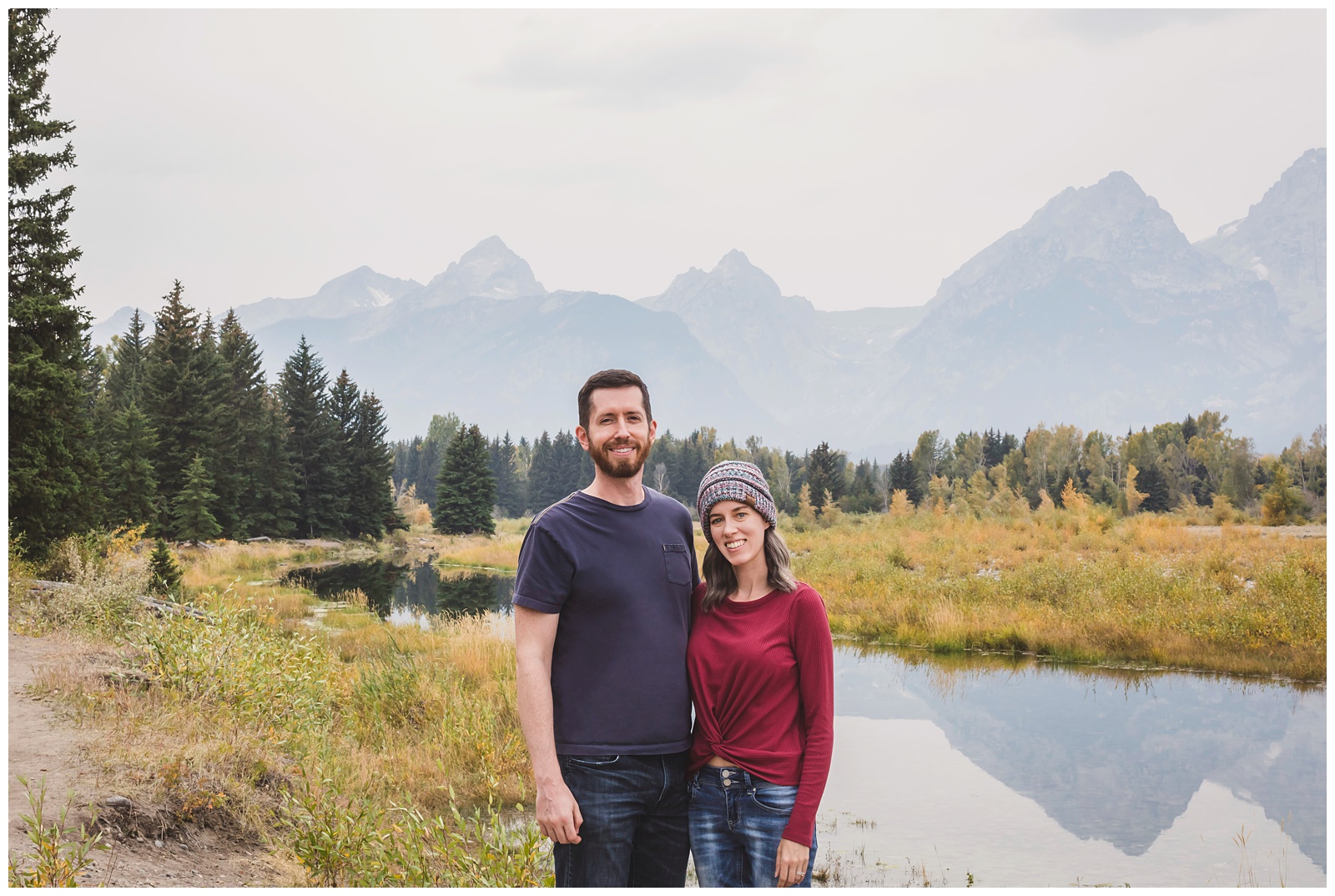
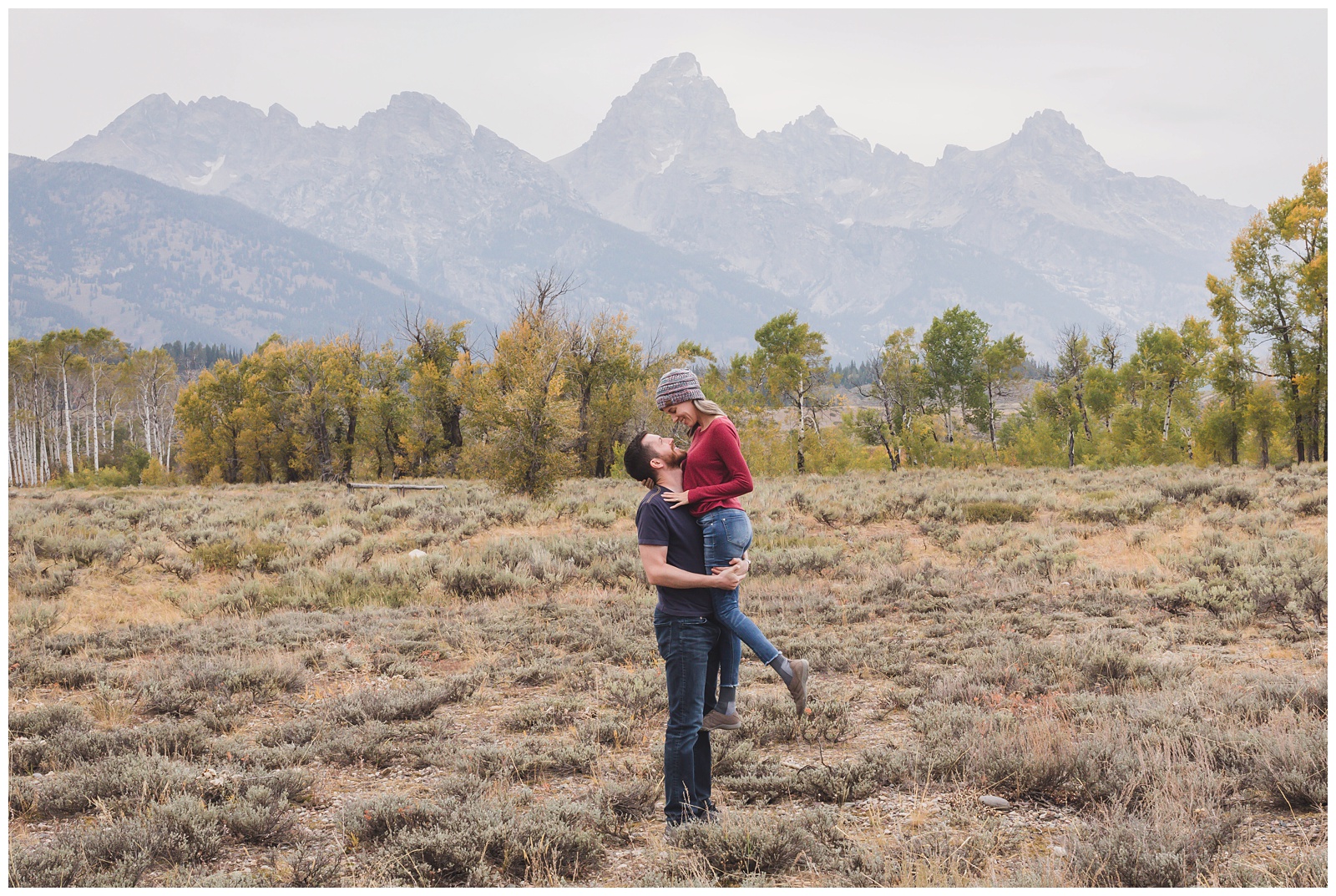
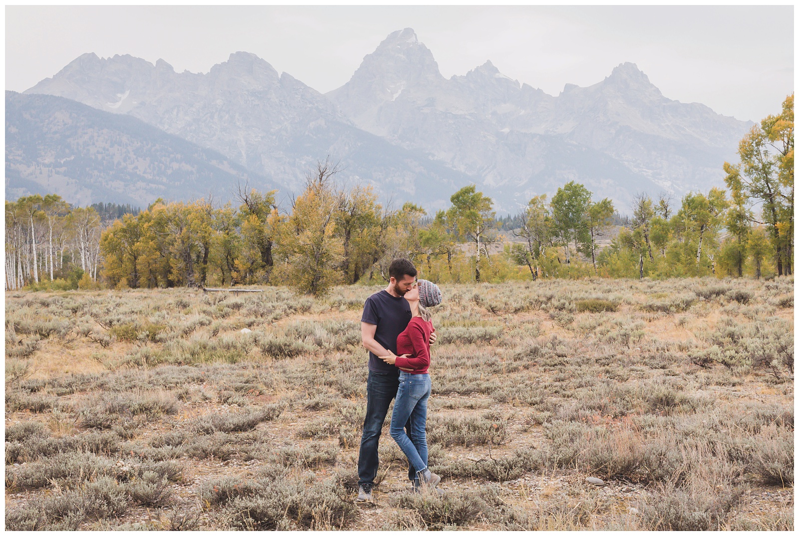
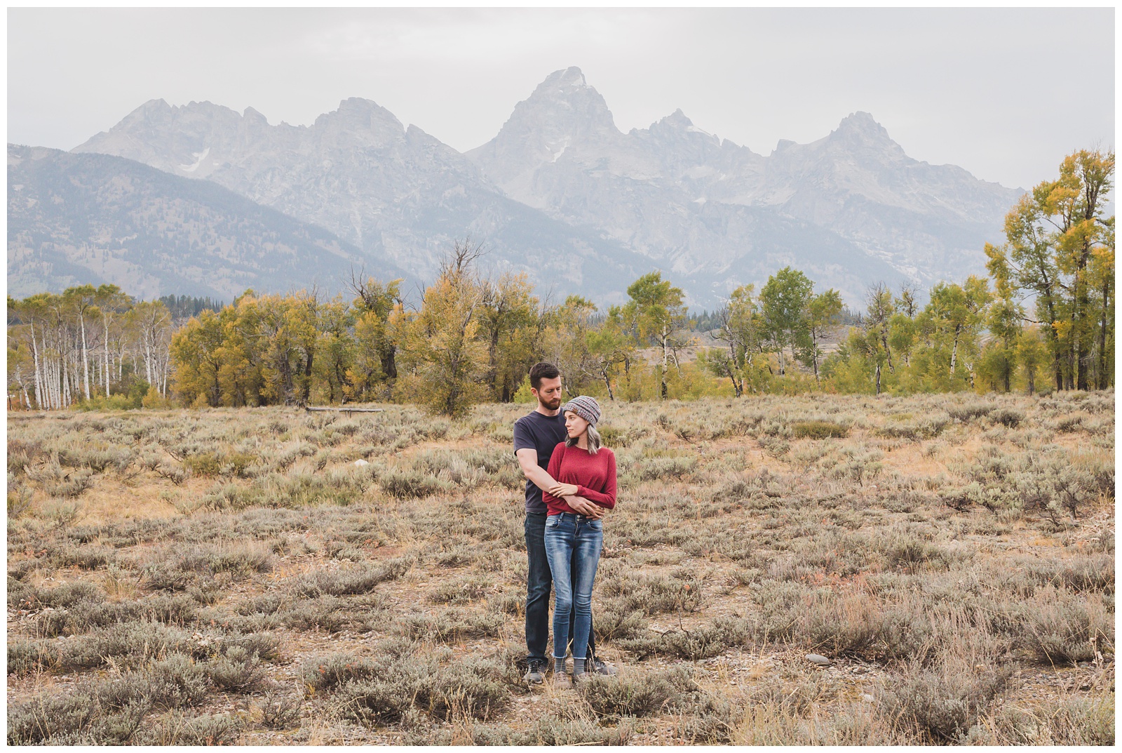
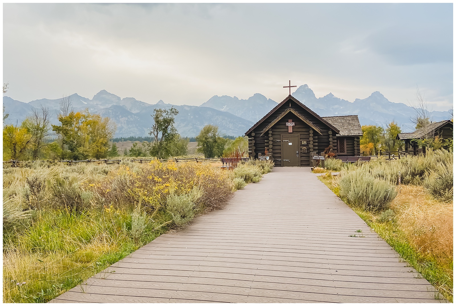 The chapel is closed currently, but we were still able to enjoy the beautiful view behind it and to do a little impromptu photo session with the Cathedral Group as a backdrop.
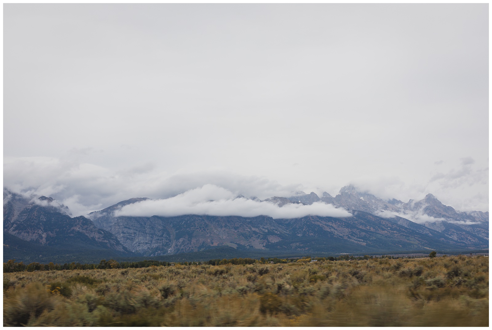
 Earthquakes gave rise to the 40-mile Teton Range, which sits on a fault line. The Tetons are the youngest range in the Rocky Mountains and some of the youngest mountains in the world. Eight peaks towering above 12,000 feet exist within the park, and the highest peak, Grand Teton (centered in the shot above), rises 13,700 feet above sea level. {Source: Natural Habitat Adventures}
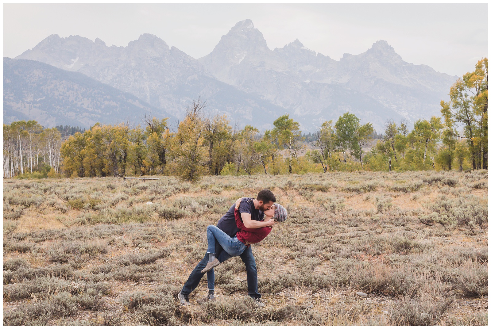
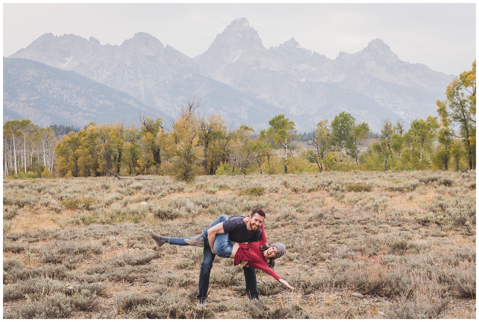
 Seth deserves credit for several of these pose ideas … I’m not sure why he doesn’t use them as prompts with our wedding clients! (We call this one “The Mountain Man.”)
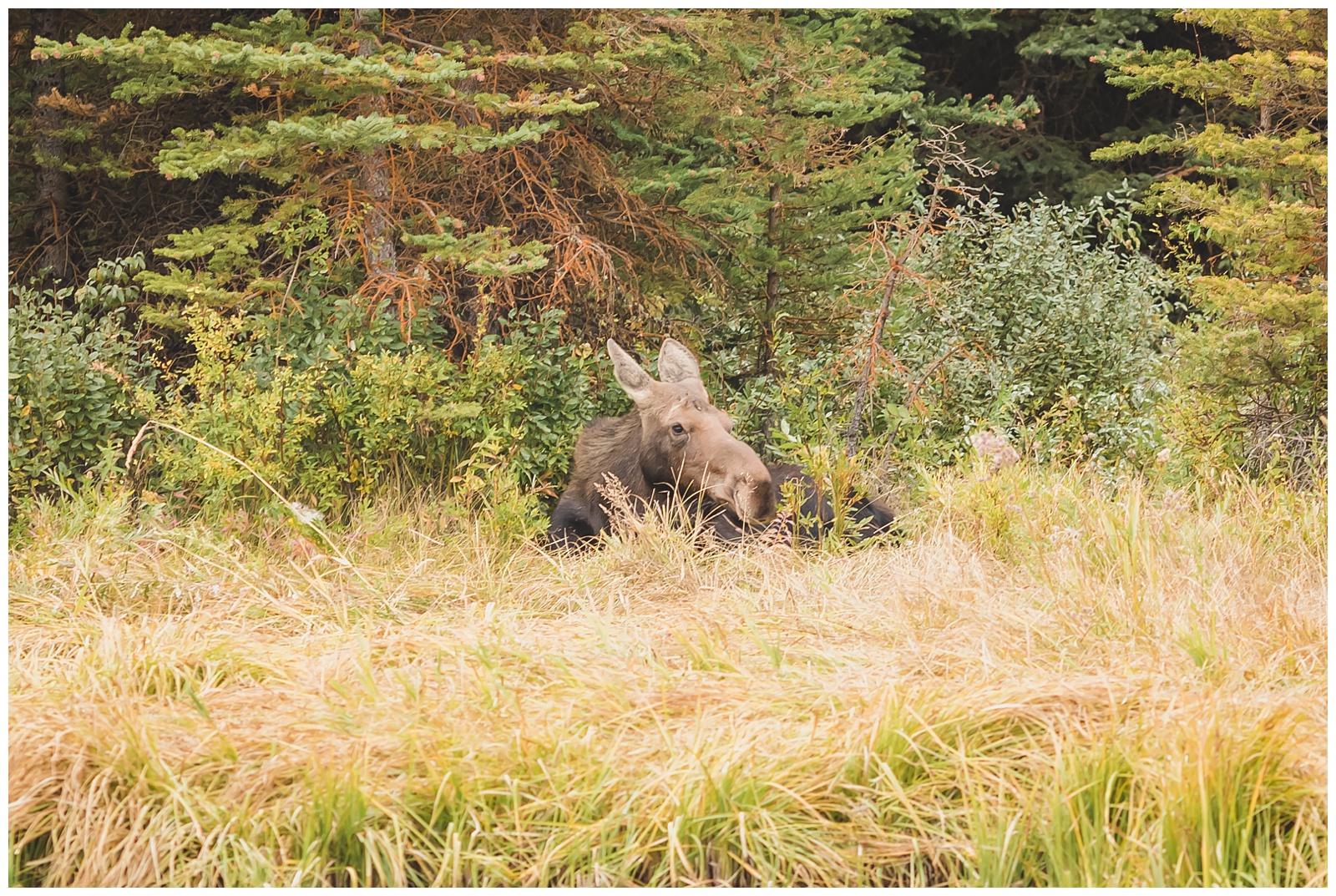
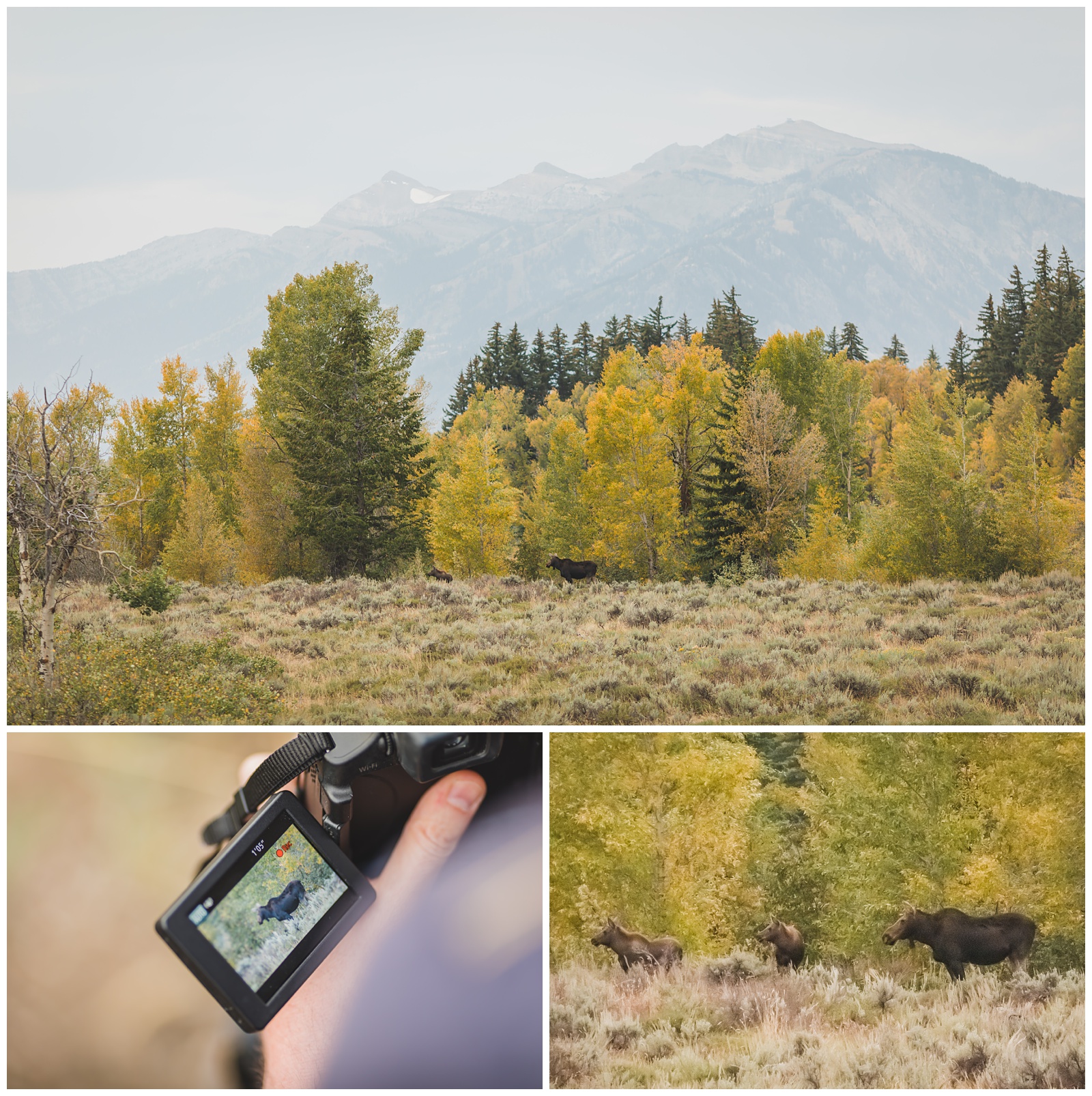 We thought we were done in the park for the day, but as we made our way south toward Jackson, we were pleasantly surprised by another moose sighting! This time, a cow with two calves.
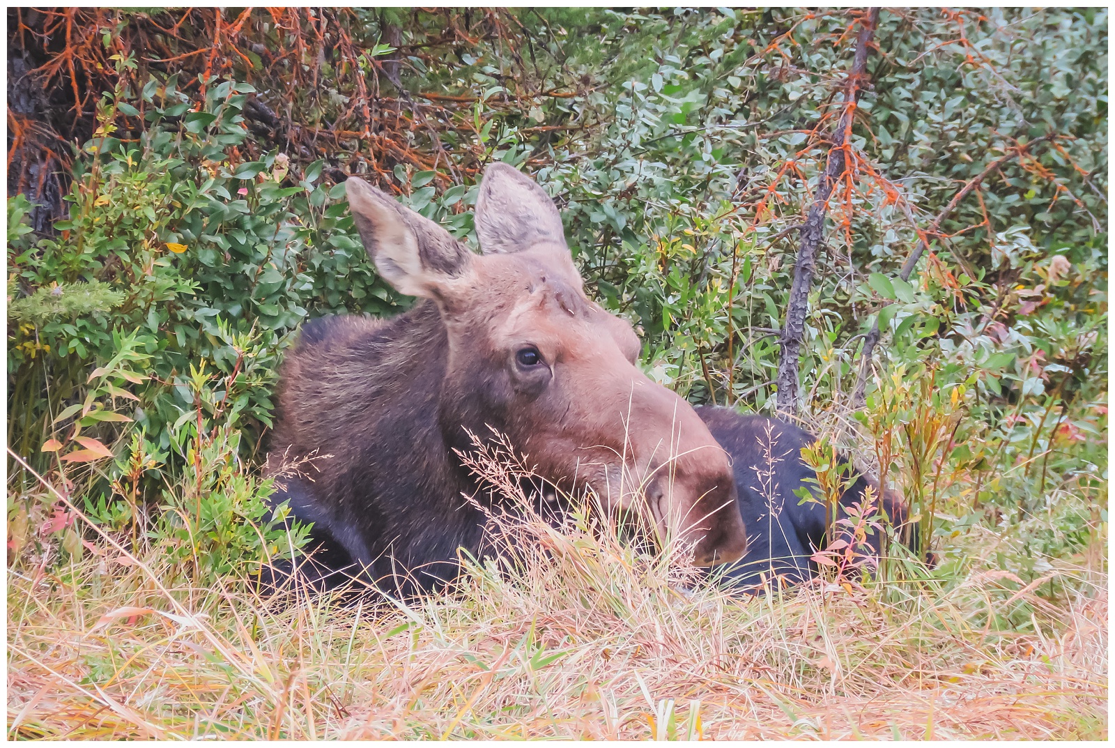
As if that weren’t enough for my moose-loving heart, a little farther along our route we spotted a lot of cars pulled over. We didn’t know why, as whatever was happening was at least a half-mile from the road. But we ventured out anyway and were rewarded with another two moose (including the big guy below)!
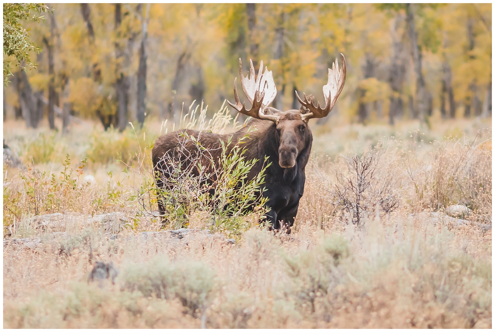
 I’d started the day hoping to see a single moose and had ended up seeing seven! So absolutely no complaints from me about wildfire haze or any other inconveniences; in my book, this day was completely perfect.
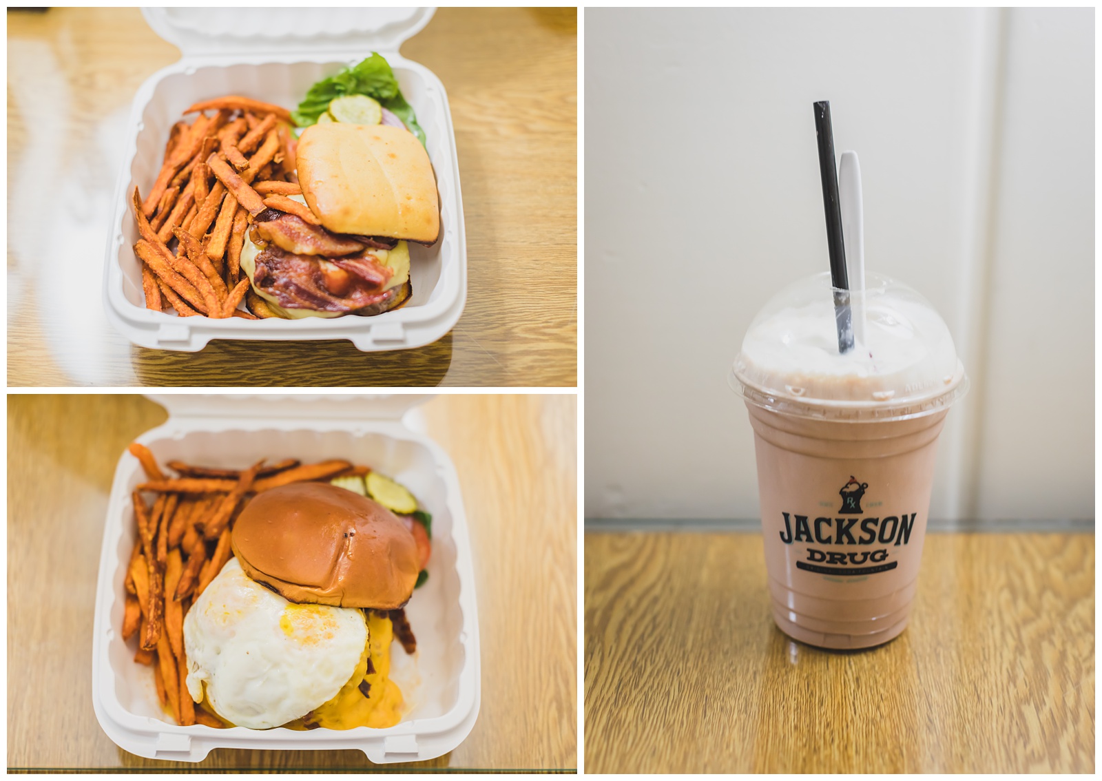
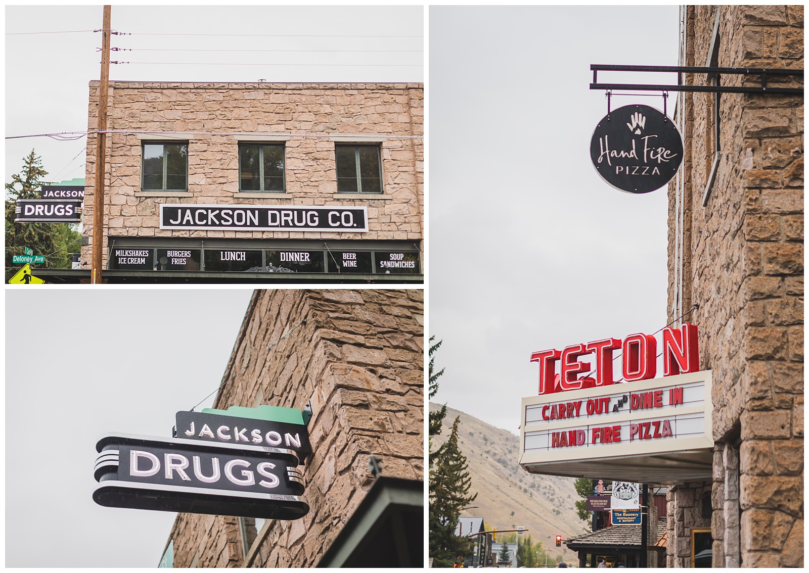 After arriving in Jackson, we got takeout from Jackson Drug, which has been on Jackson’s Town Square since 1919.
day 9 • 09.19.20
Jackson, WY >>> Grand Teton National Park >>> McCammon, ID
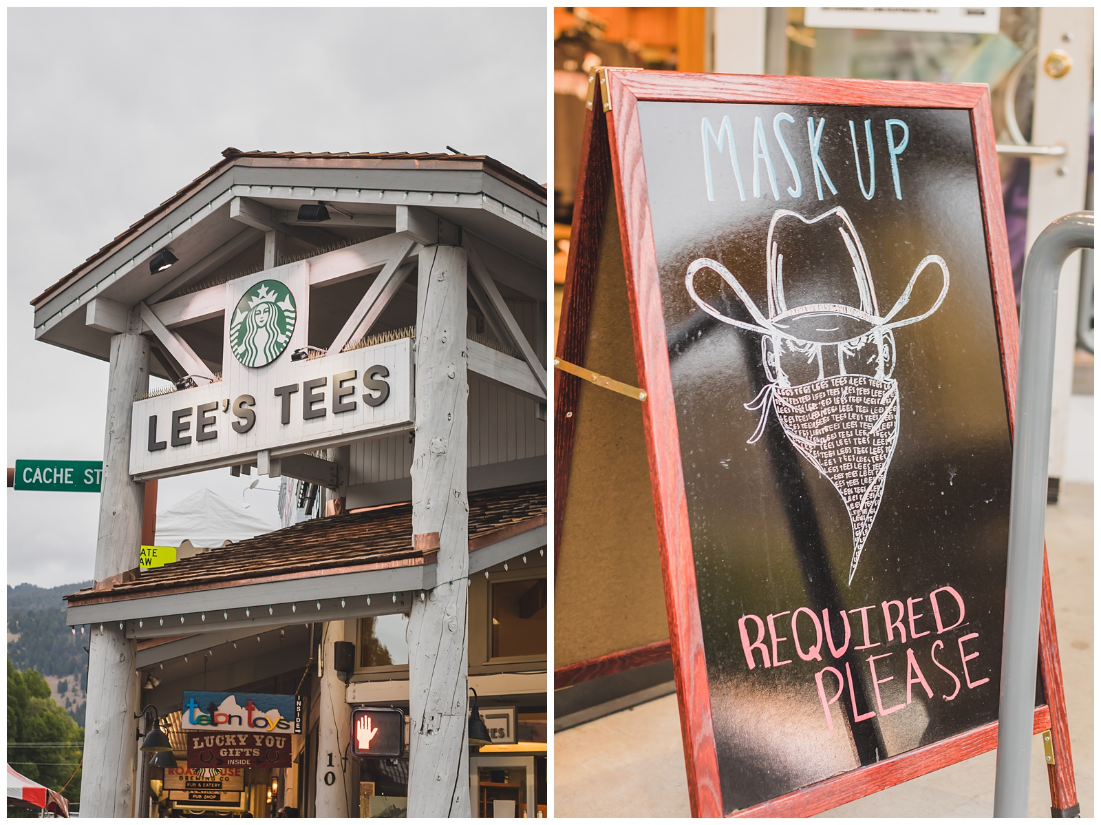
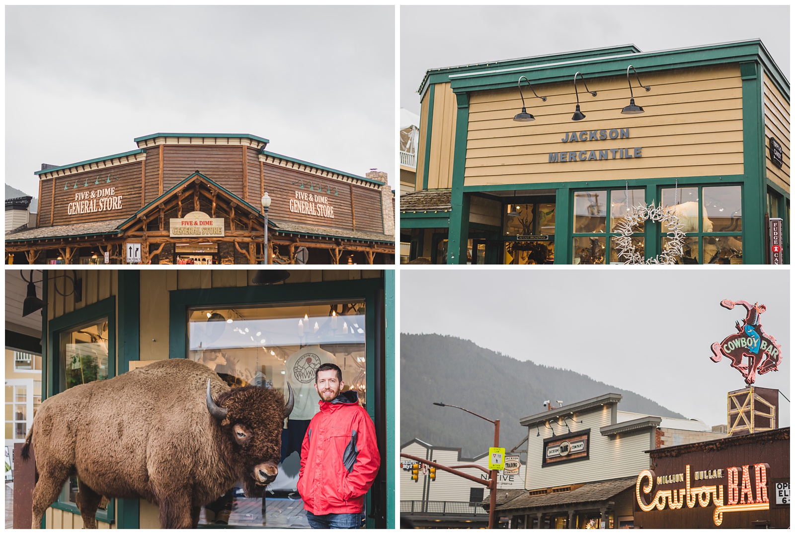
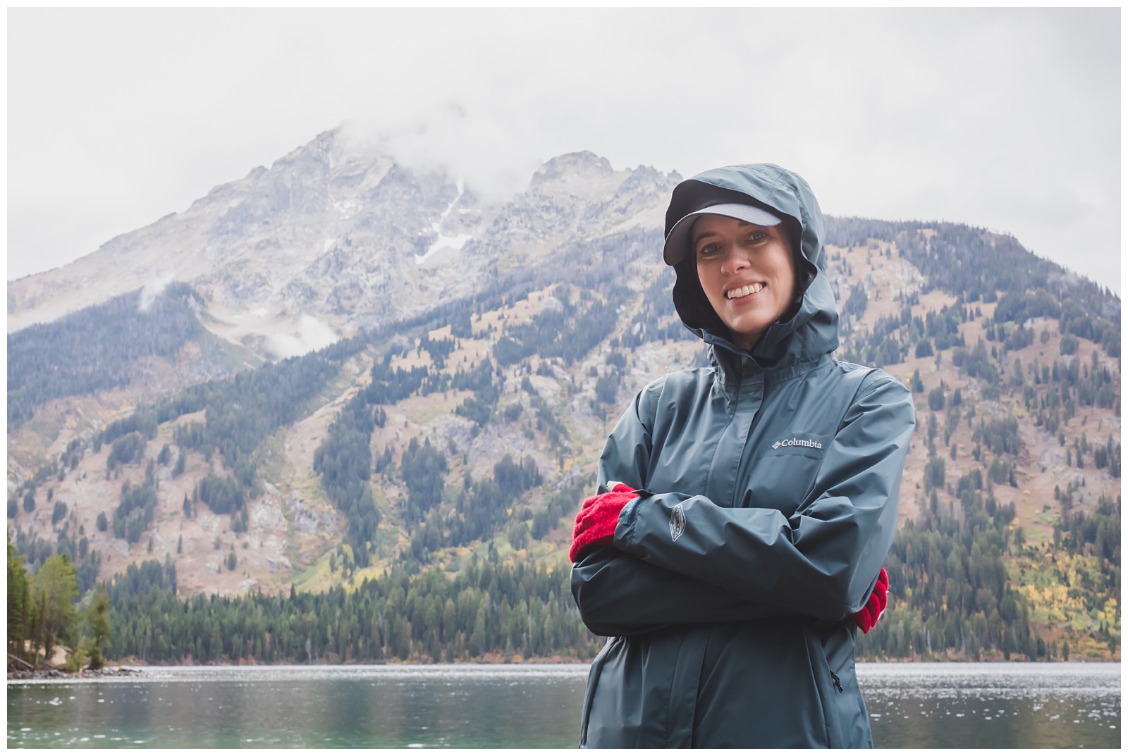
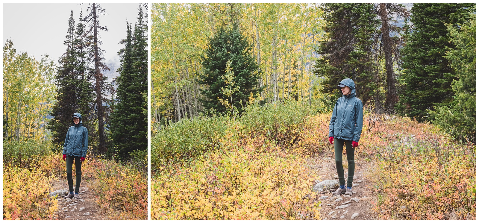
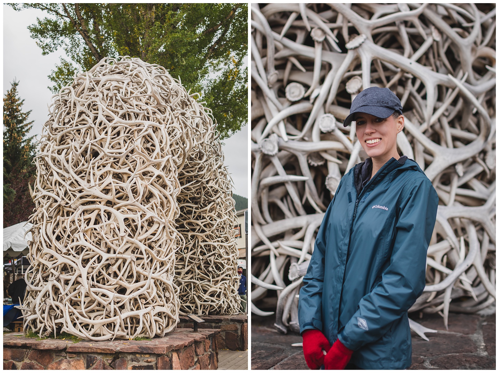 We woke up to a cool, rainy morning but still ventured out to see more of Jackson’s Town Square before heading back into Grand Teton. (And for those who wonder, as we did, about Jackson vs. Jackson Hole: Jackson Hole refers to the entire valley, whereas Jackson is its main town, located at the southern end of Jackson Hole.)
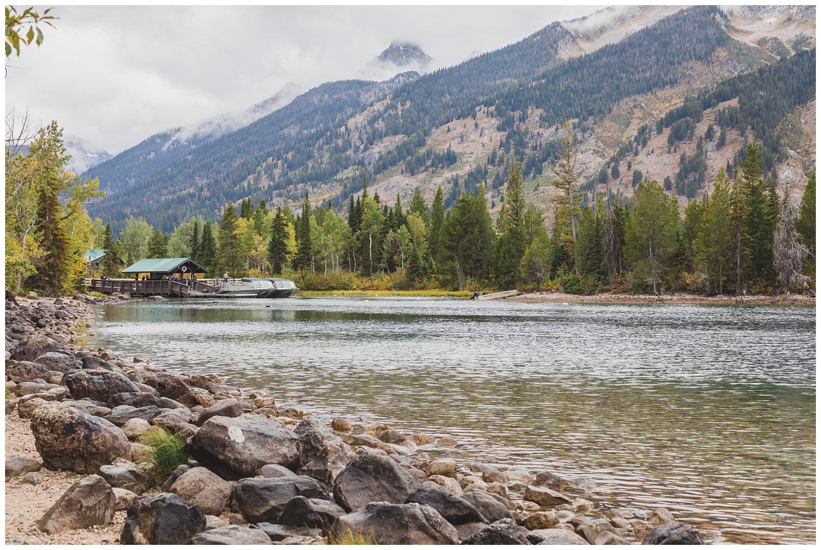
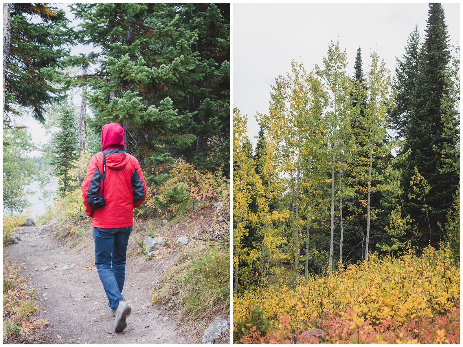
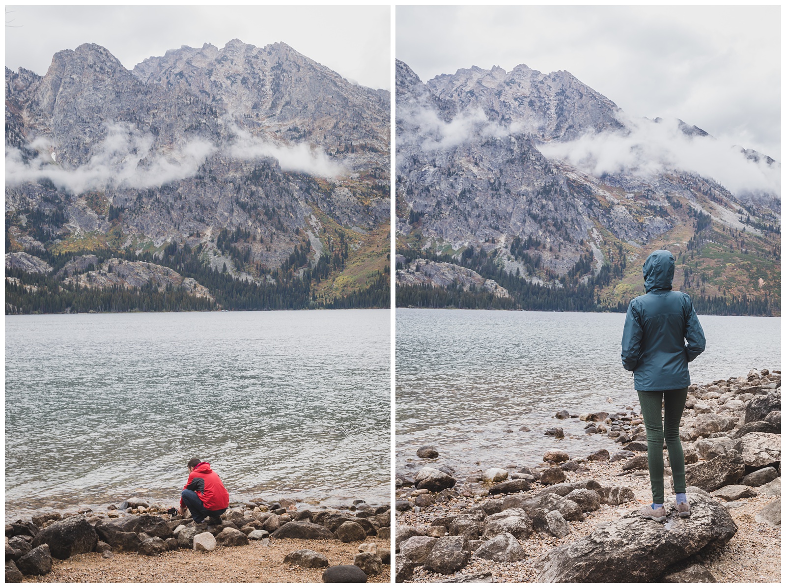
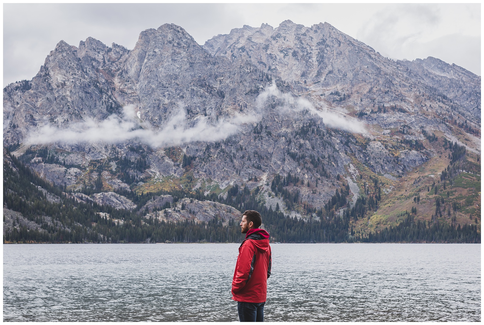
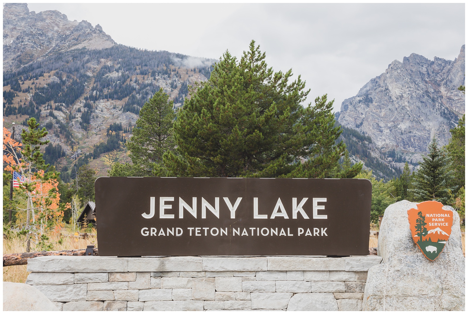 On this second day in Grand Teton, we visited Jenny Lake and thought everything looked exceptionally beautiful in the rain and clouds. Covering 1,191 acres and 423 feet deep, Jenny Lake is the second-largest lake (after Jackson Lake) in the park. {Source: Teton Hiking Trails}
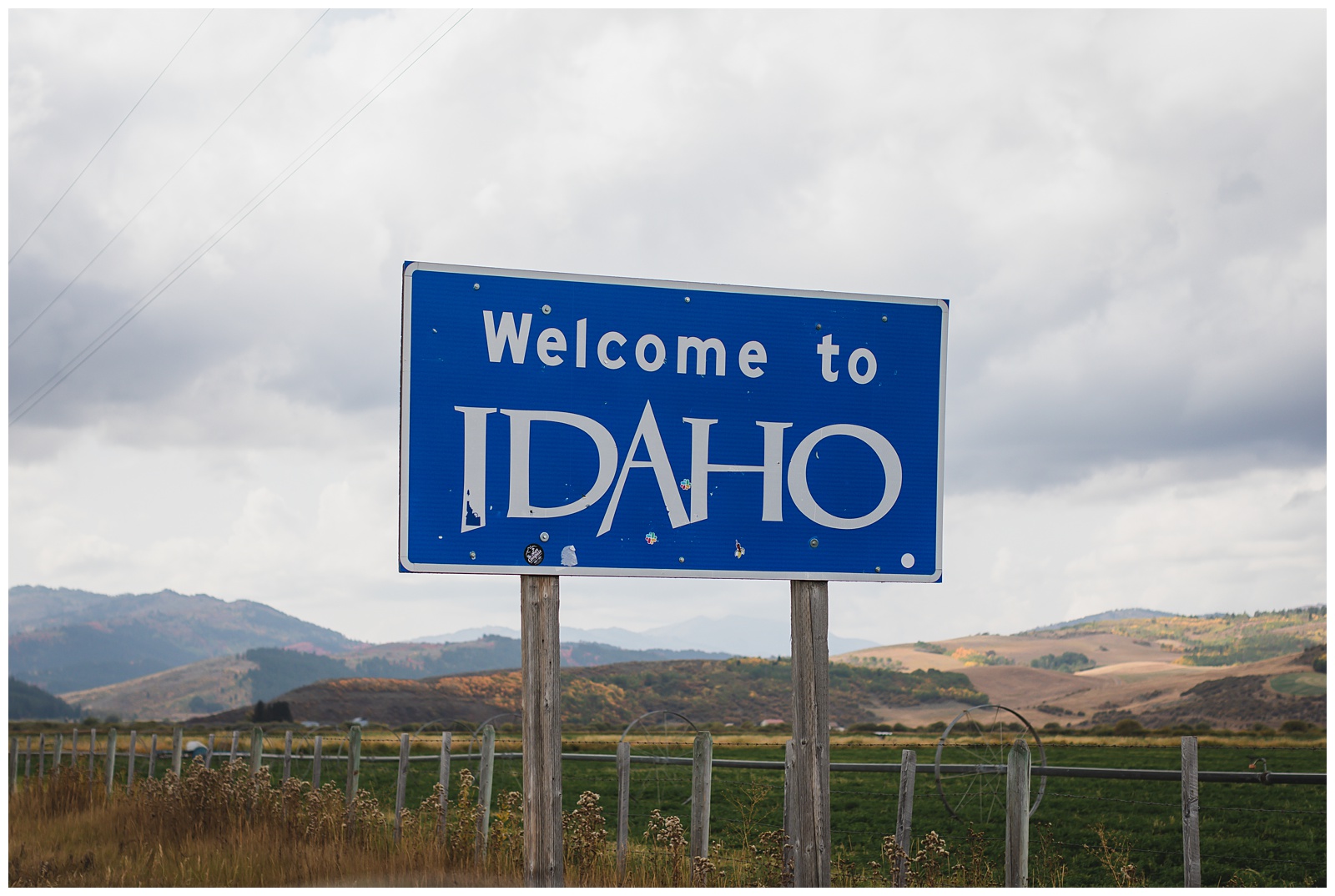
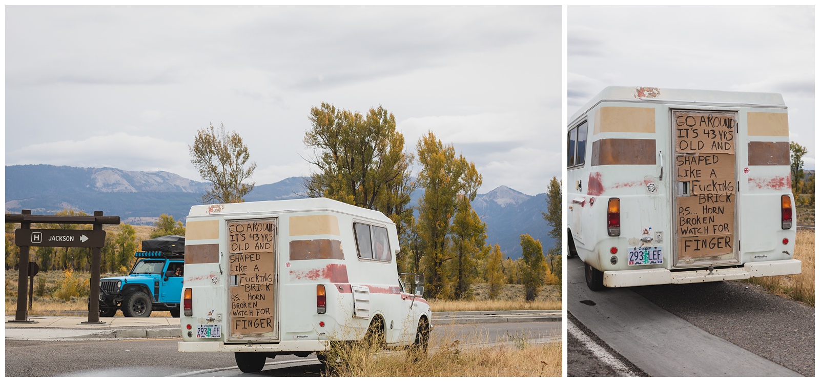 We left the park that afternoon to make the next leg of our trip, to Idaho. But we didn’t get very far before coming across this gem (Excuse the expletive).

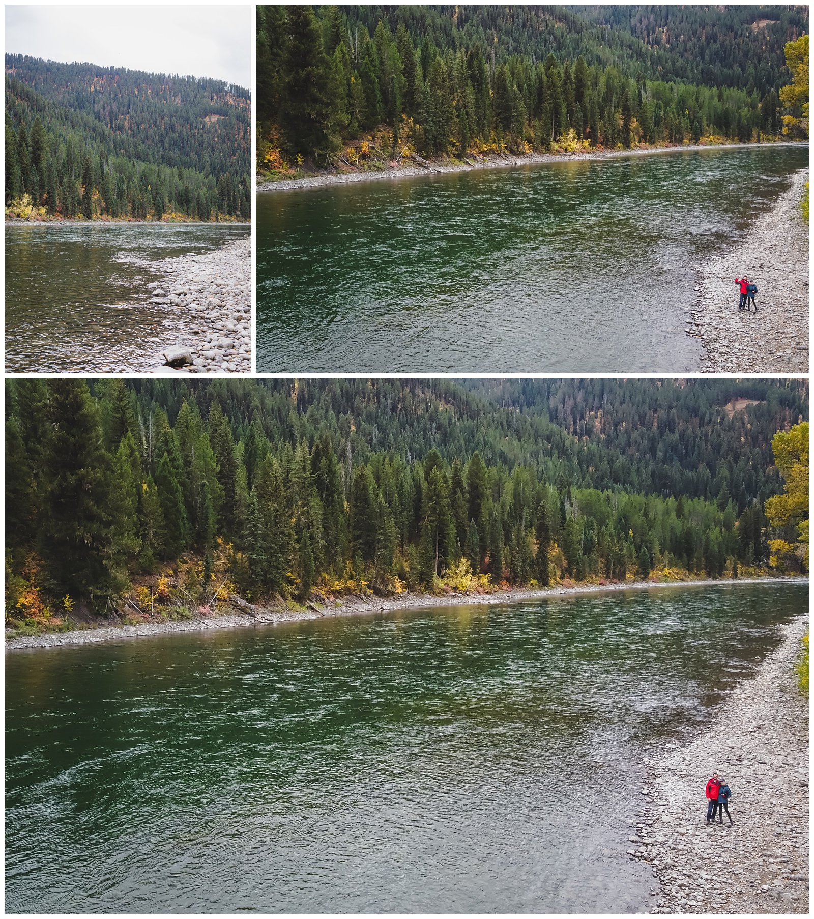
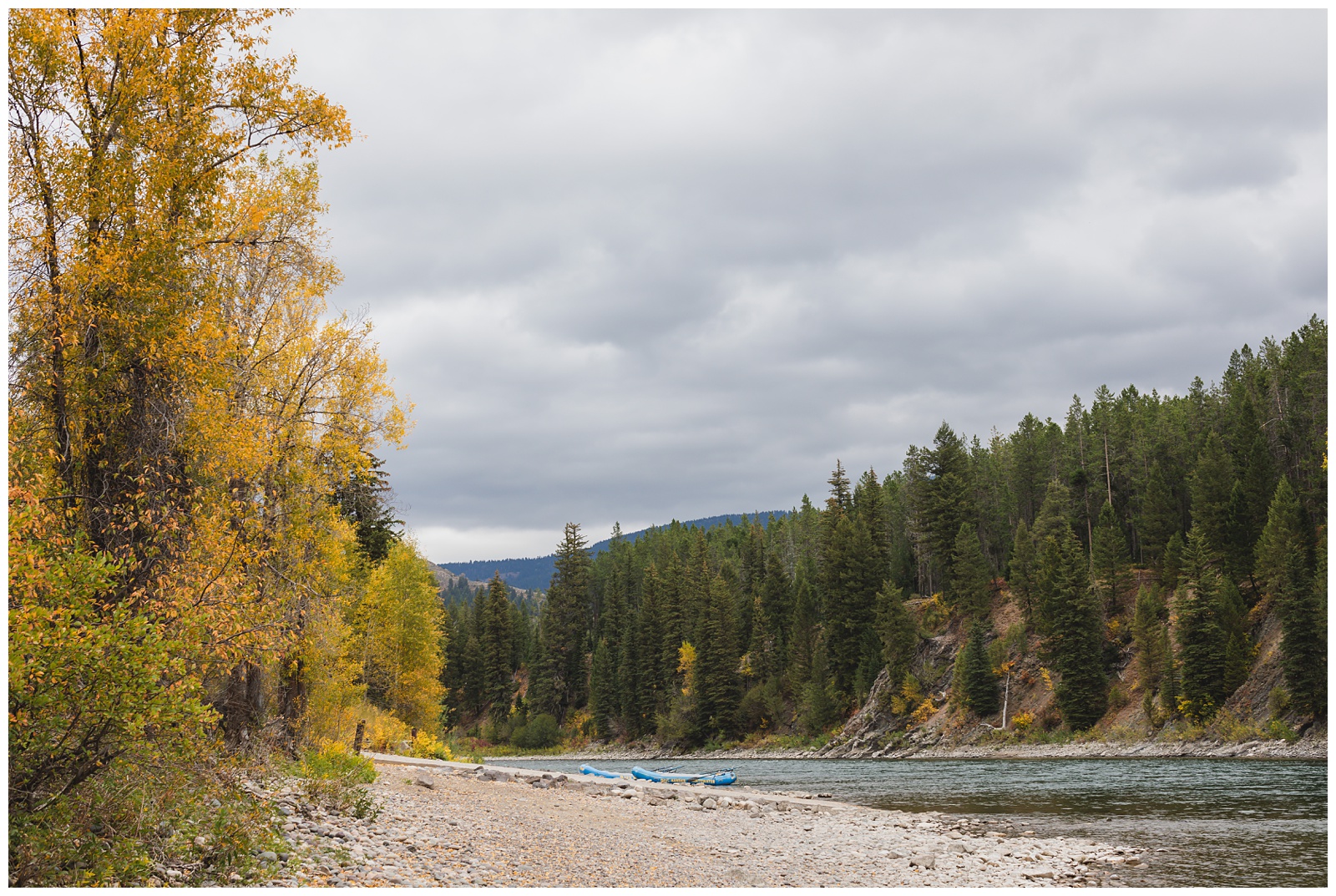 A little past Jackson, we stopped at the Snake River to fly our drone. Drones aren’t allowed in National Parks (or a number of other areas), so we had to take advantage of pretty places where we could fly one! And although we didn’t get them on camera, we saw two bald eagles fly over this spot.
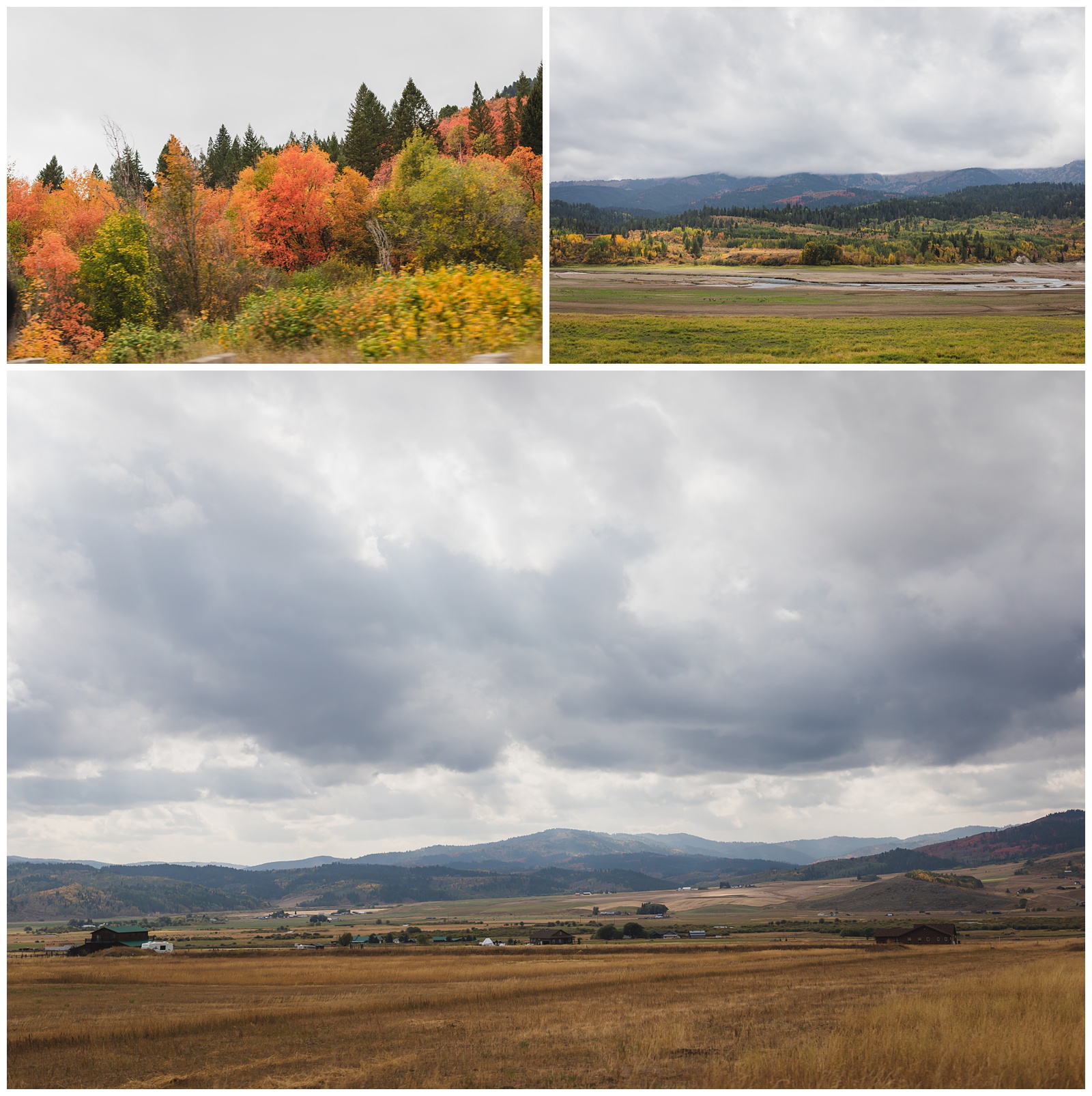
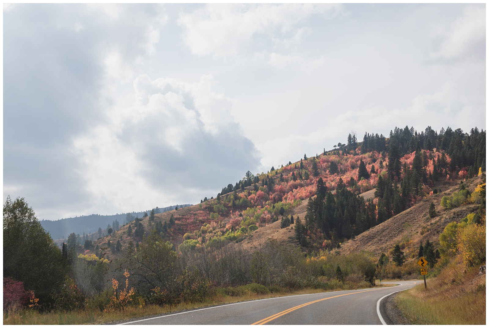
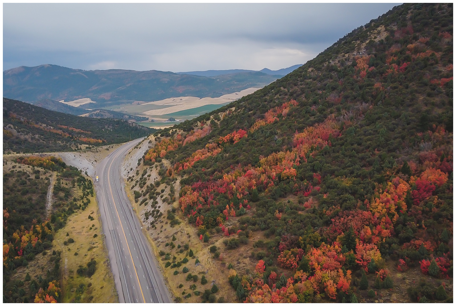
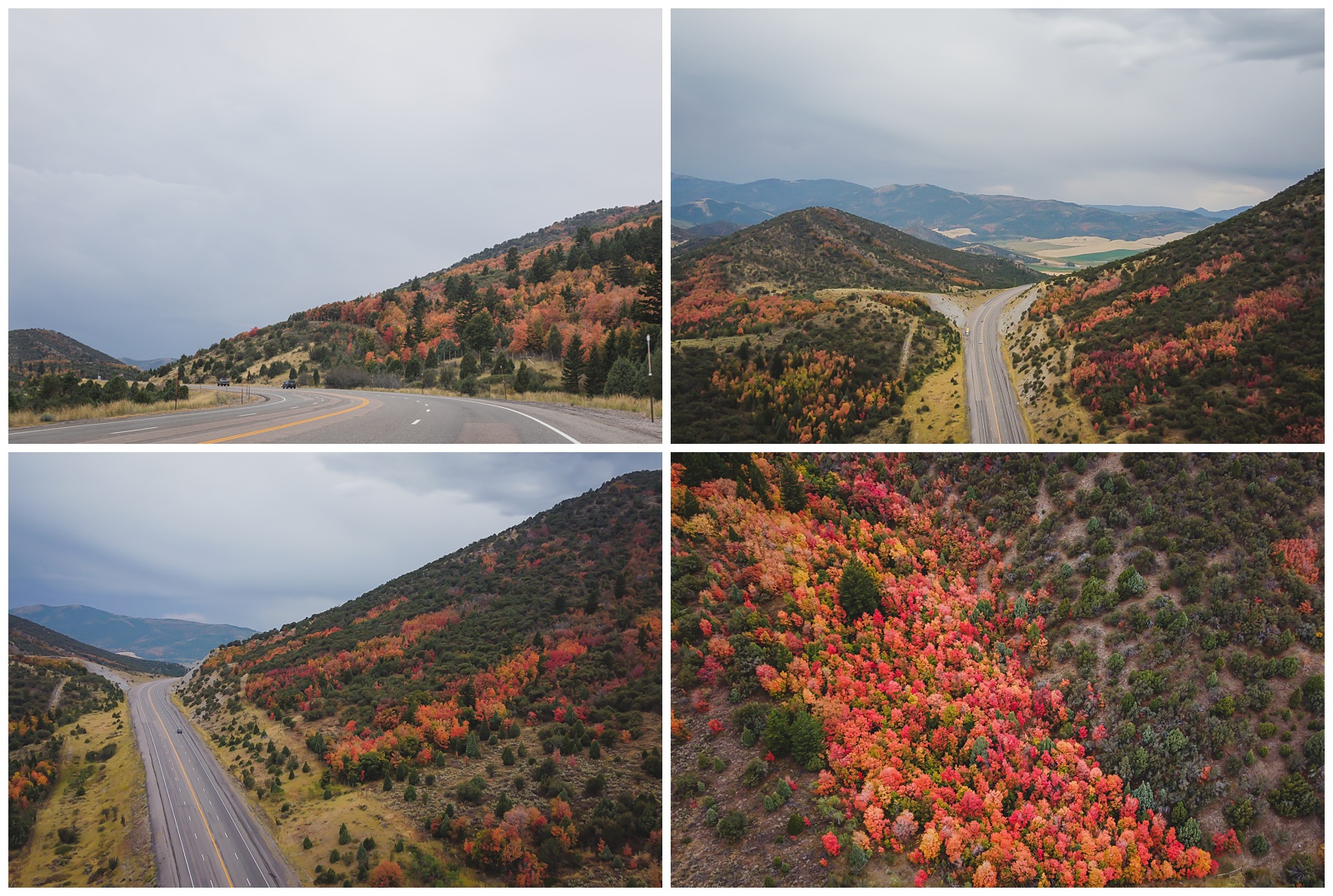
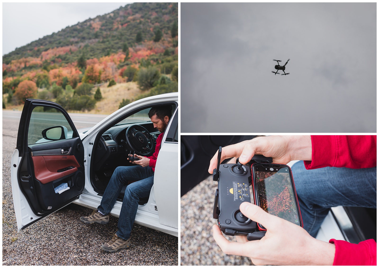 We also stopped to fly the drone shortly after crossing into Idaho — because look at that fall foliage (even though it wasn’t yet officially fall)!
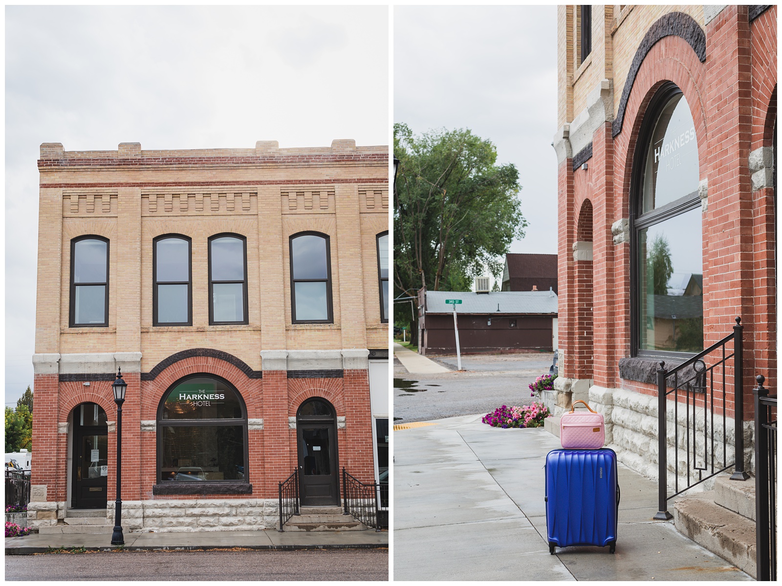
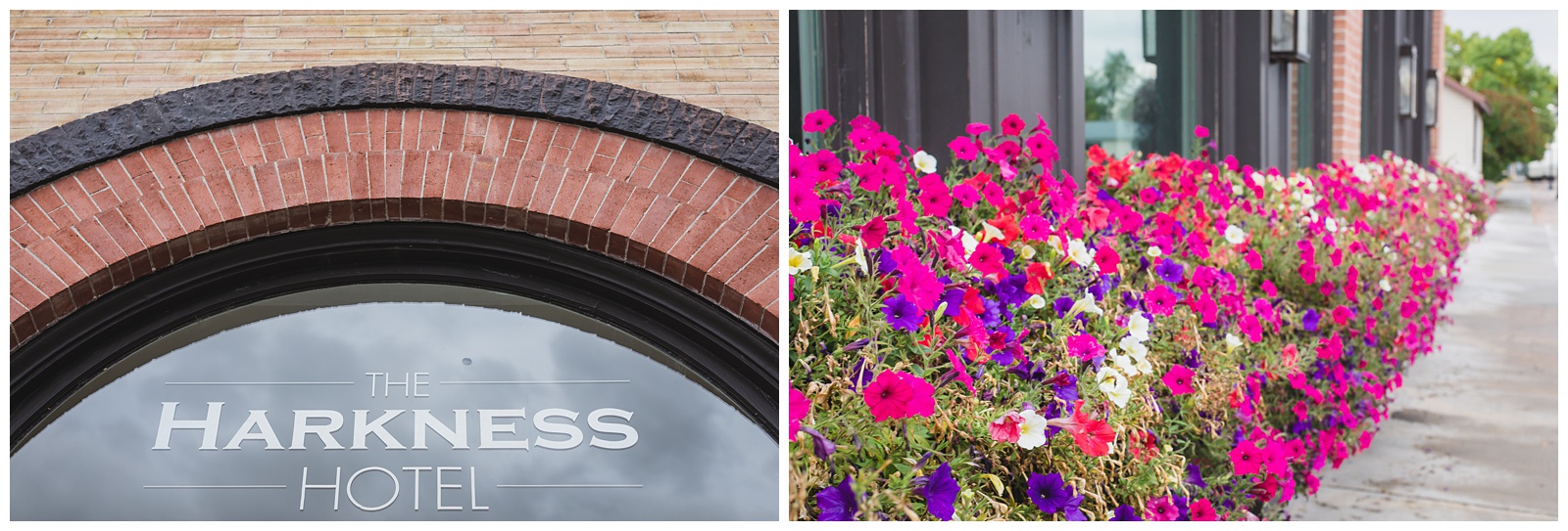
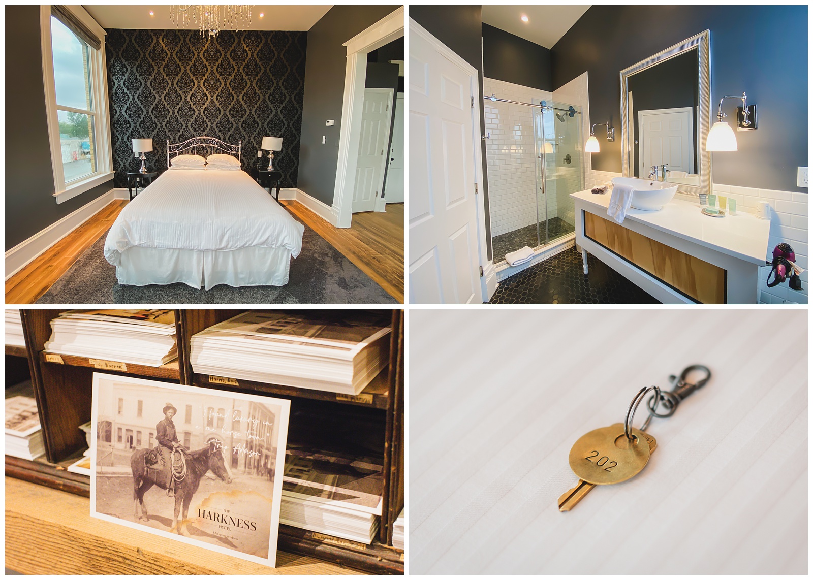
Our home for the night was The Harkness Hotel in the tiny town of McCammon, Idaho. It was one of my favorite lodging spots this trip — being a historic building that started its life as a bank and that was reincarnated several times before becoming a boutique hotel.
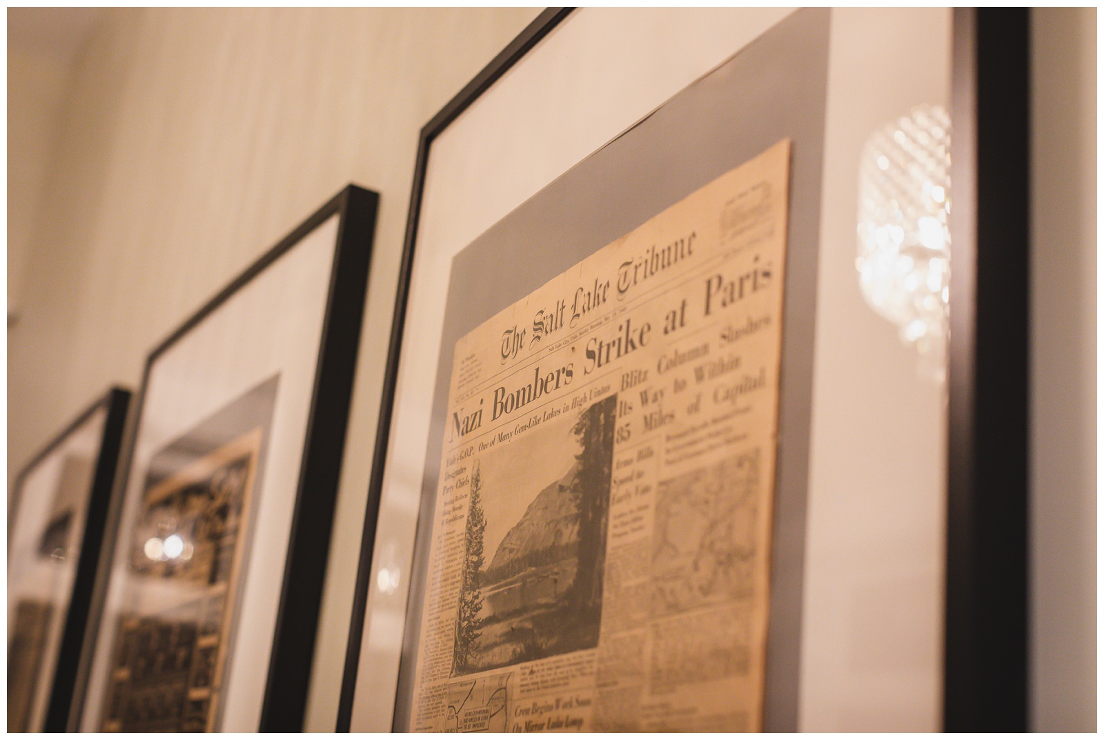 The hotel’s remodeling process revealed old newspapers used as insulation in the walls, and the owner had the genius idea to frame and hang some of them. These were on the wall right outside our room (appropriately named the Ebony Room).

day 10 • 09.20.20
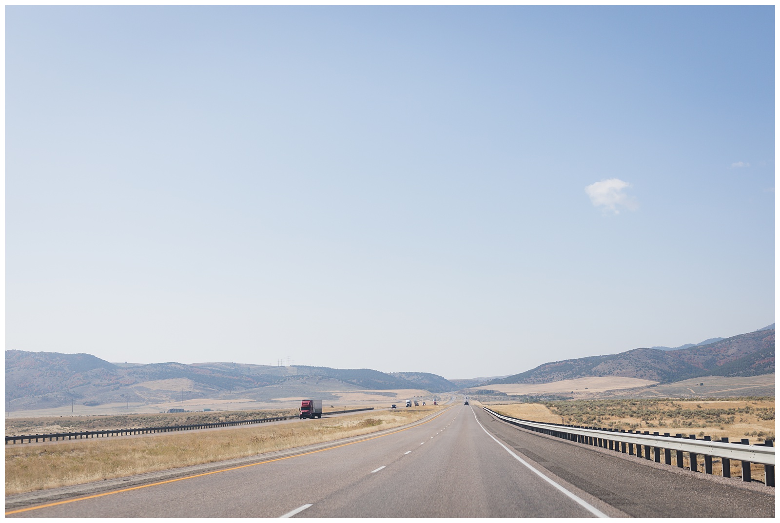
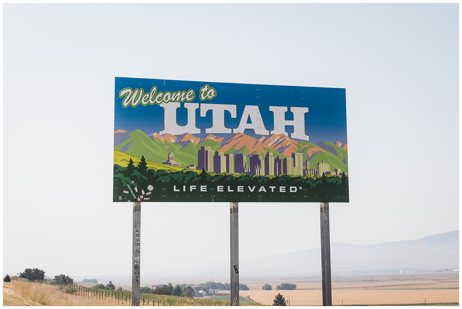
McCammon, ID >>> Great Salt Lake (Antelope Island State Park) >>> Salt Lake City, UT
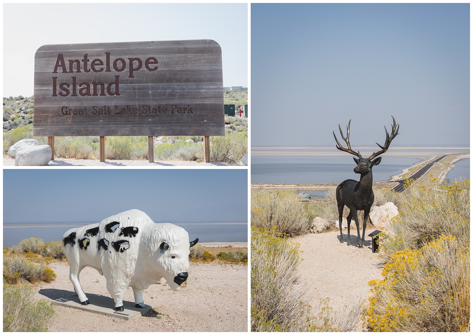
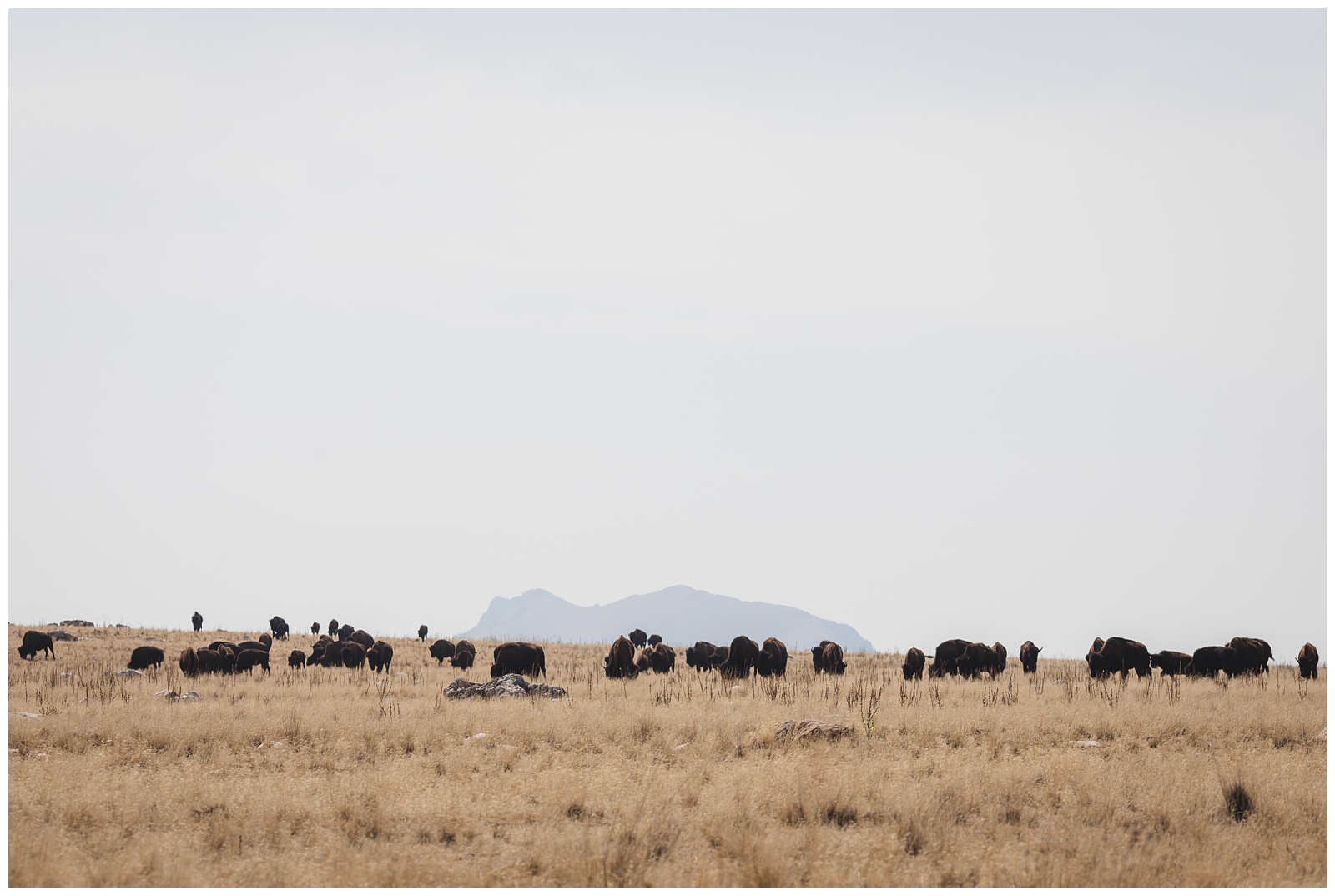
Antelope Island is the largest of 10 islands located within the Great Salt Lake. A small number of bison were introduced to the island in 1893, and the herd now numbers about 700. {Source: Utah State Parks}
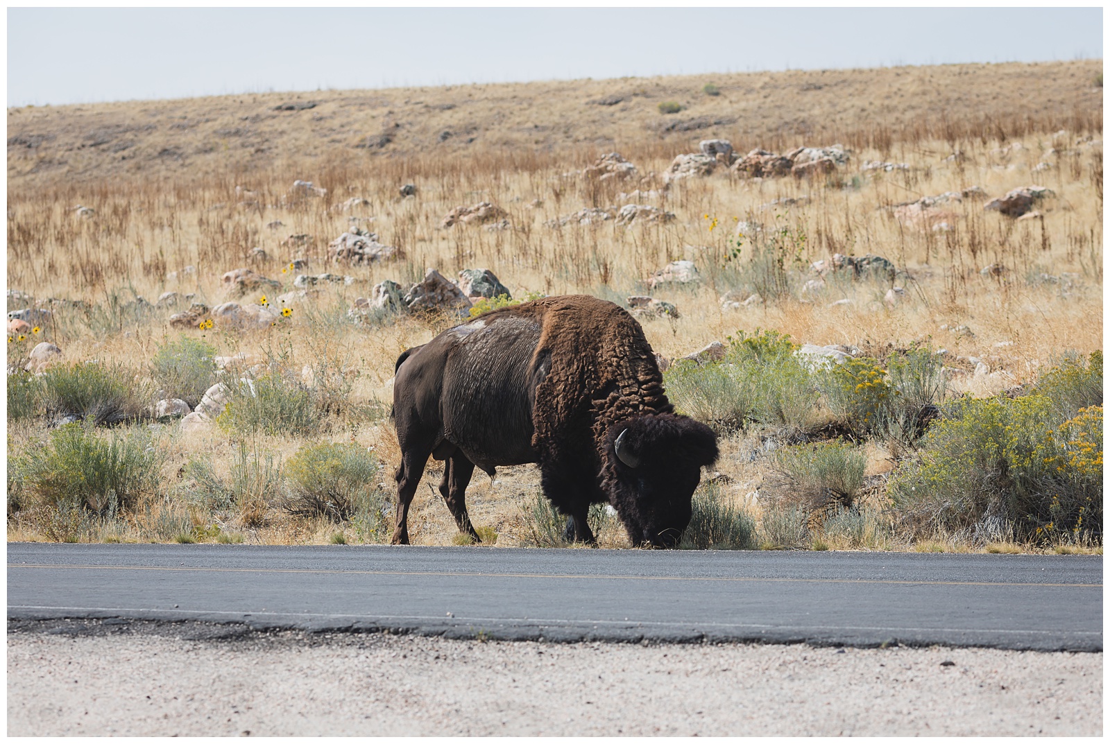
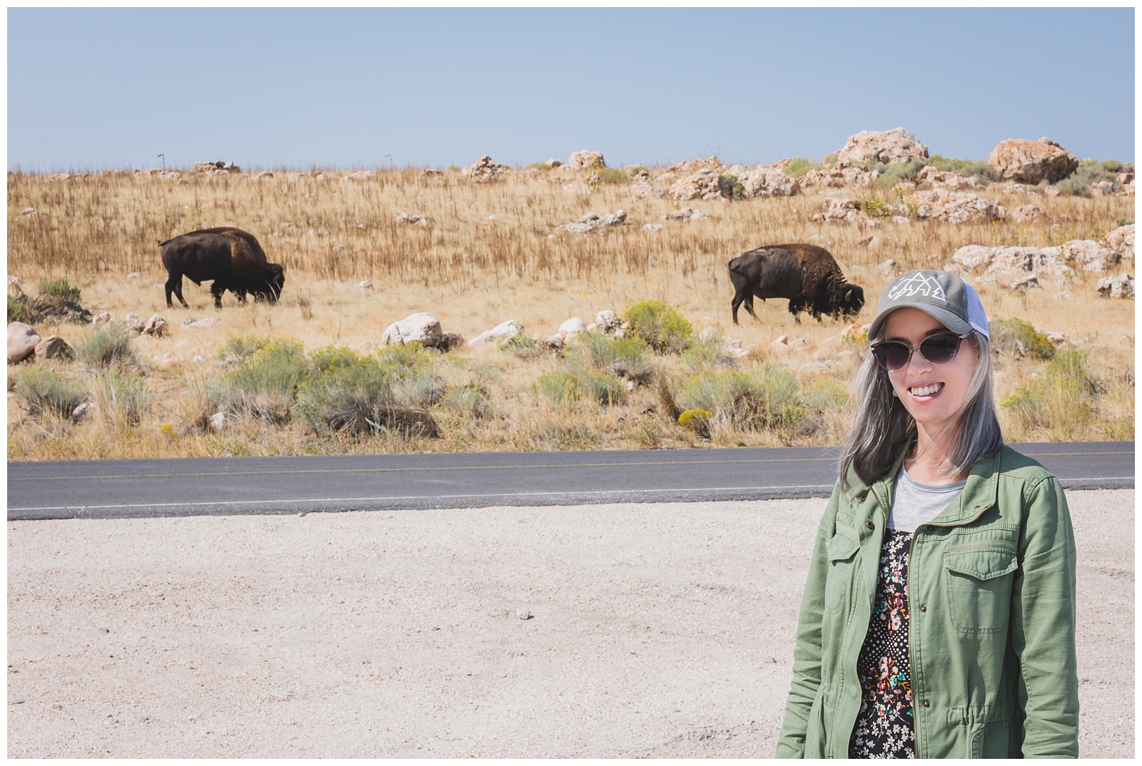
After getting my bison hat at Theodore Roosevelt National Park, I’d hoped to get a photo wearing it with bison in the background — and finally, that opportunity presented itself at Antelope Island!
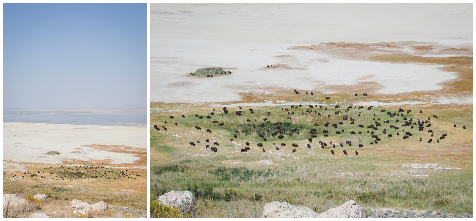
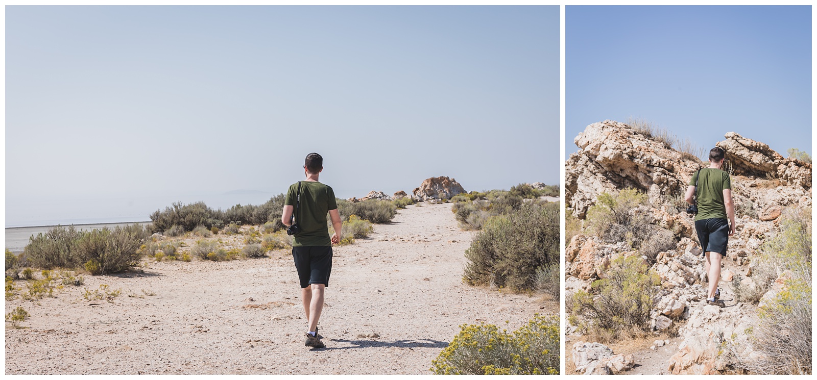
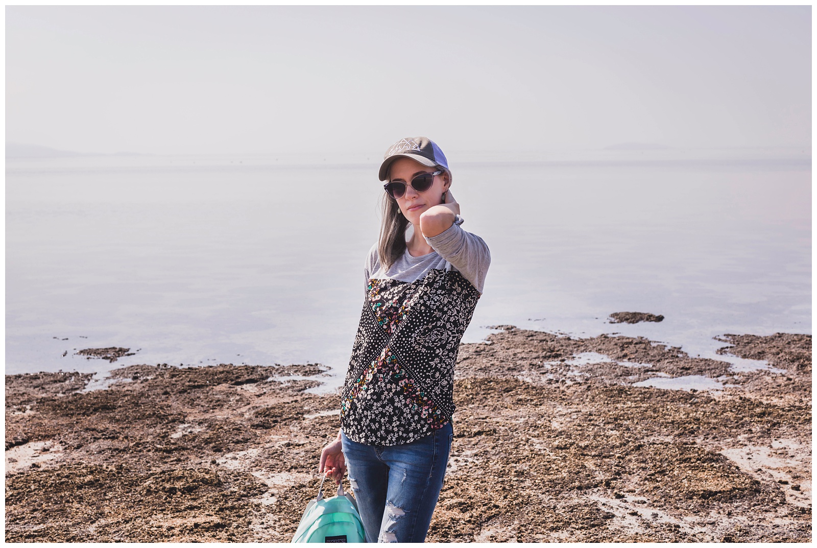
Of course, as awesome as the bison were, the main objective of this stop was to see the Great Salt Lake. Our first hike of the day was to Lady Finger Point.
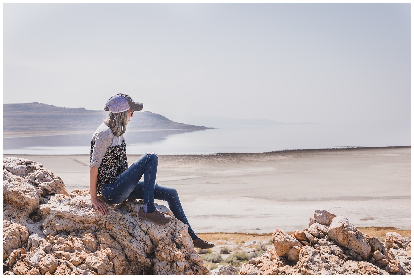
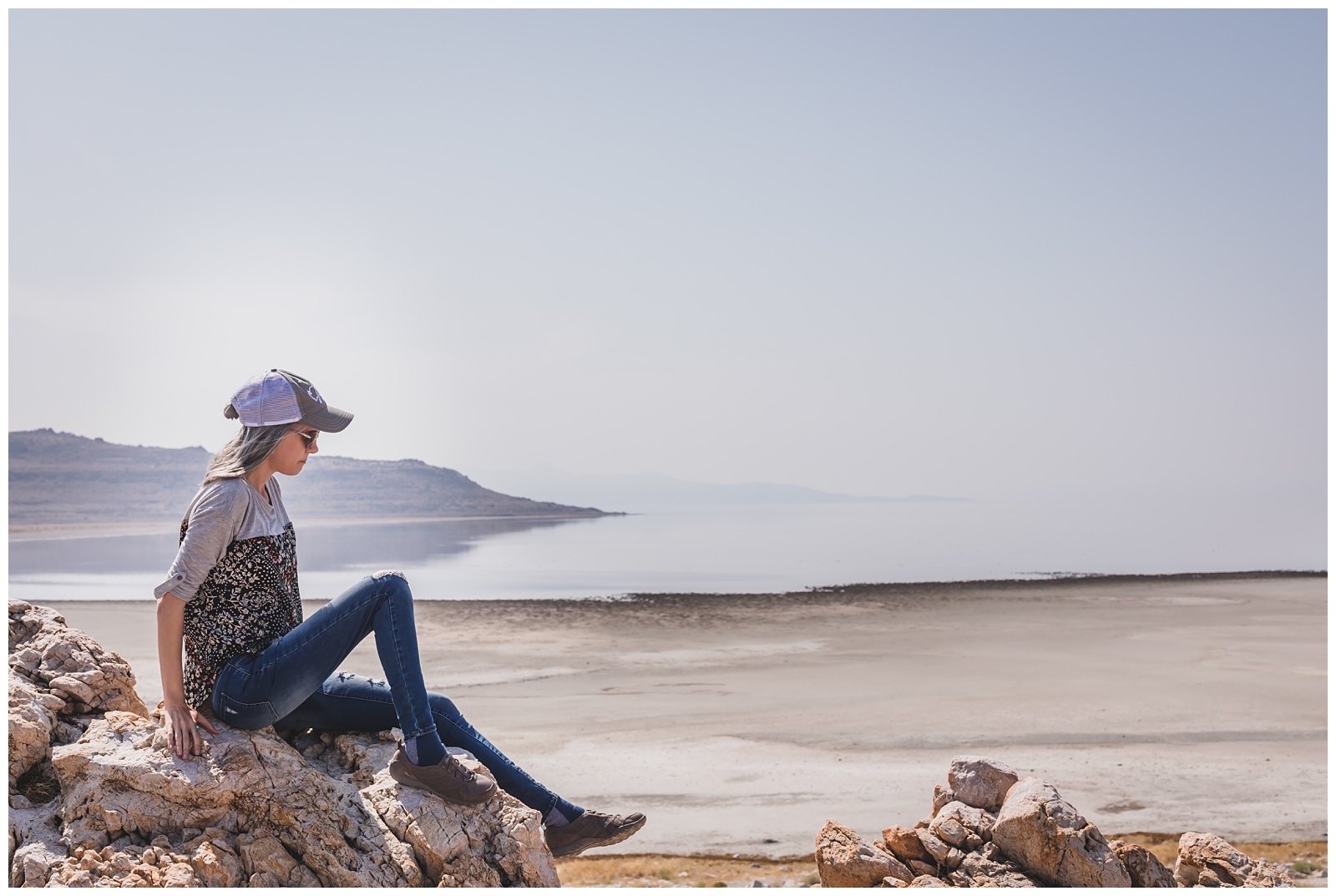
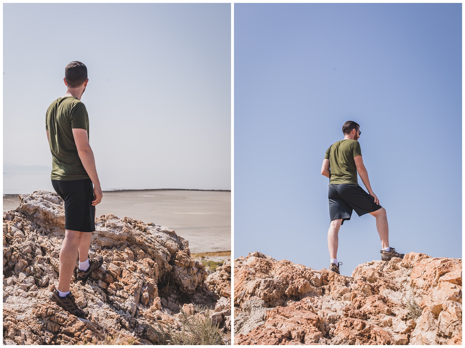
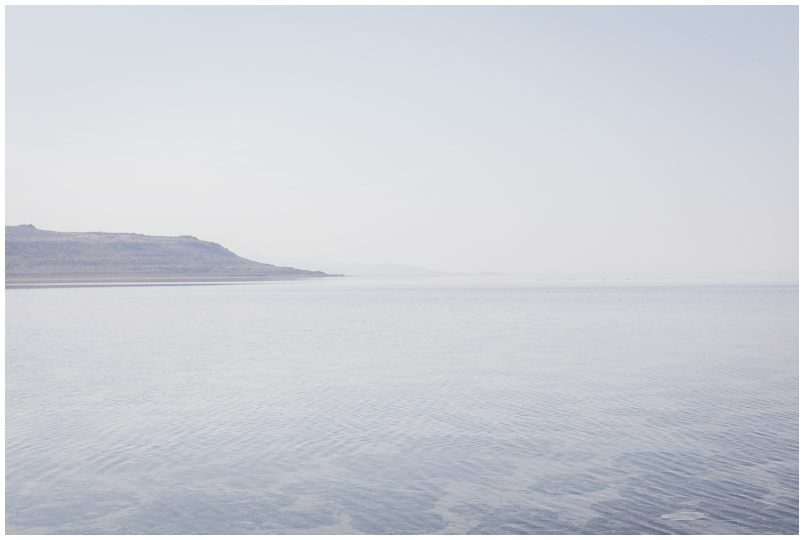
We also made our own trail — sinking well into the sand at some points — to the edge of the lake. The Great Salt Lake is the largest lake west of the Mississippi River and the largest salt lake in the Western Hemisphere. It covers 1,700 square miles and is sometimes referred to as America’s Dead Sea. {Source: Live Science}
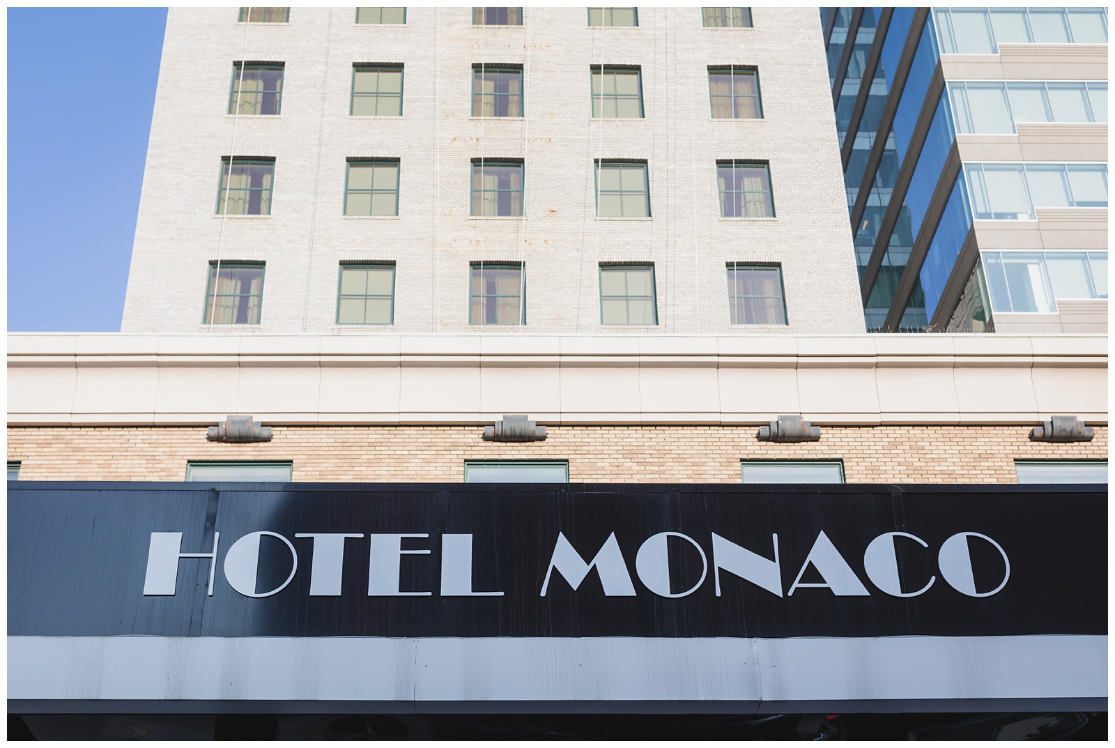
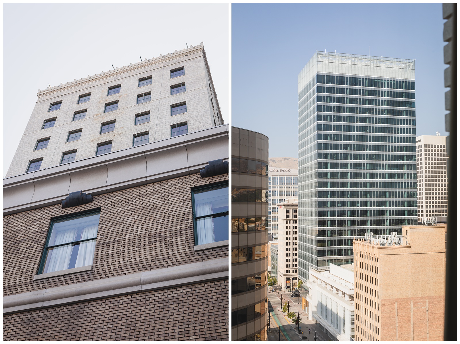
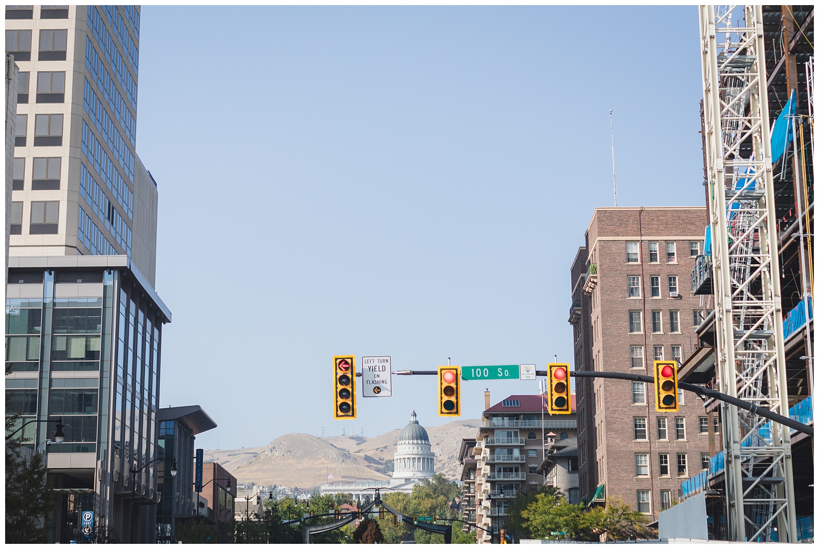
We had a top-floor hotel room in downtown Salt Lake City (Above right is the view from our room). And our hotel was conveniently located within walking distance of the sights we wanted to see, which was great since parking space around them seemed pretty non-existent!
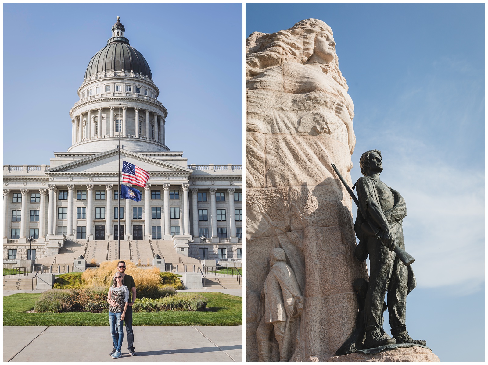 At the Utah State Capitol …
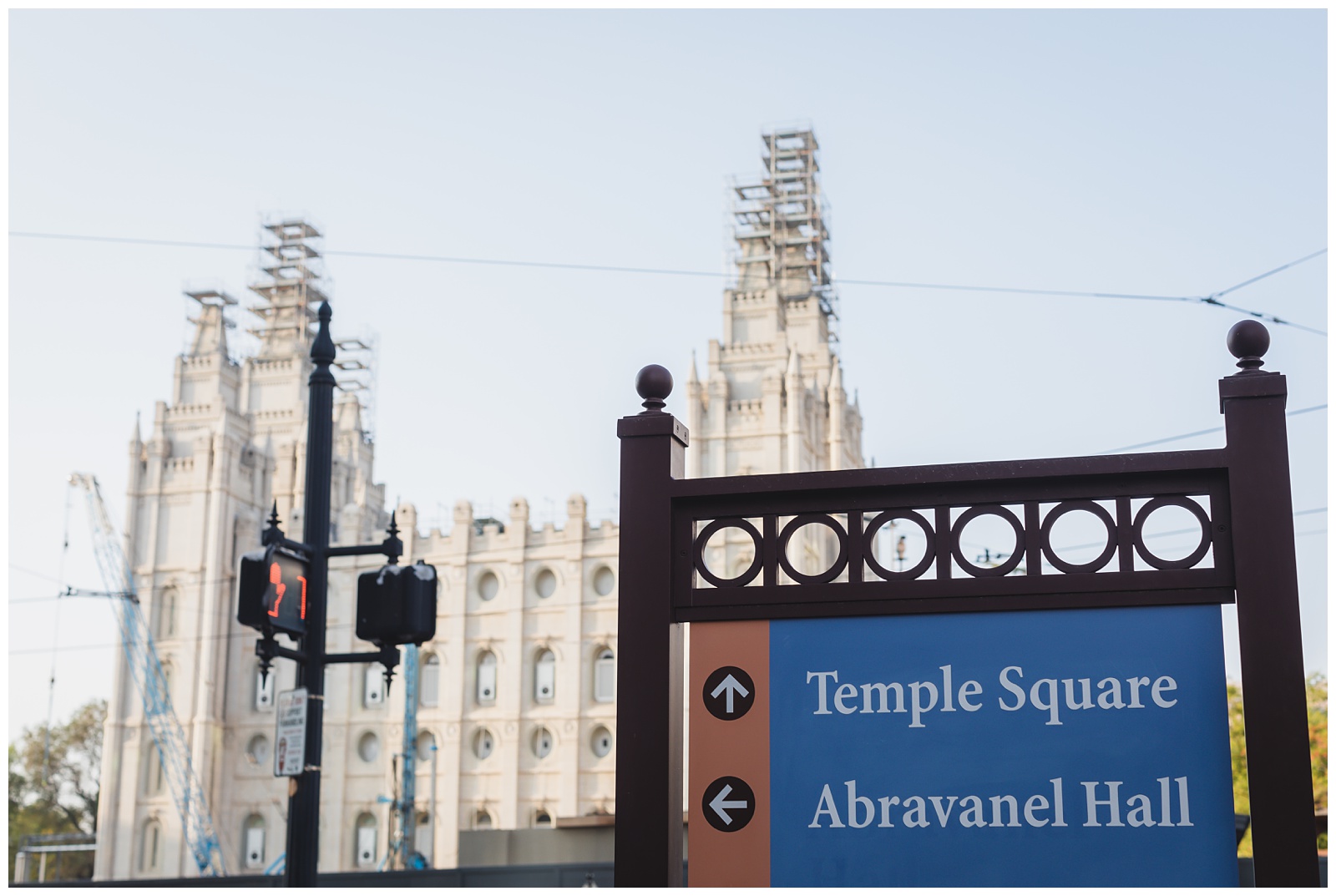 And the Salt Lake City Temple Square. I’ve always found it fascinating that the city’s downtown street system is built around the temple, and addresses indicate where places are in relation to it.
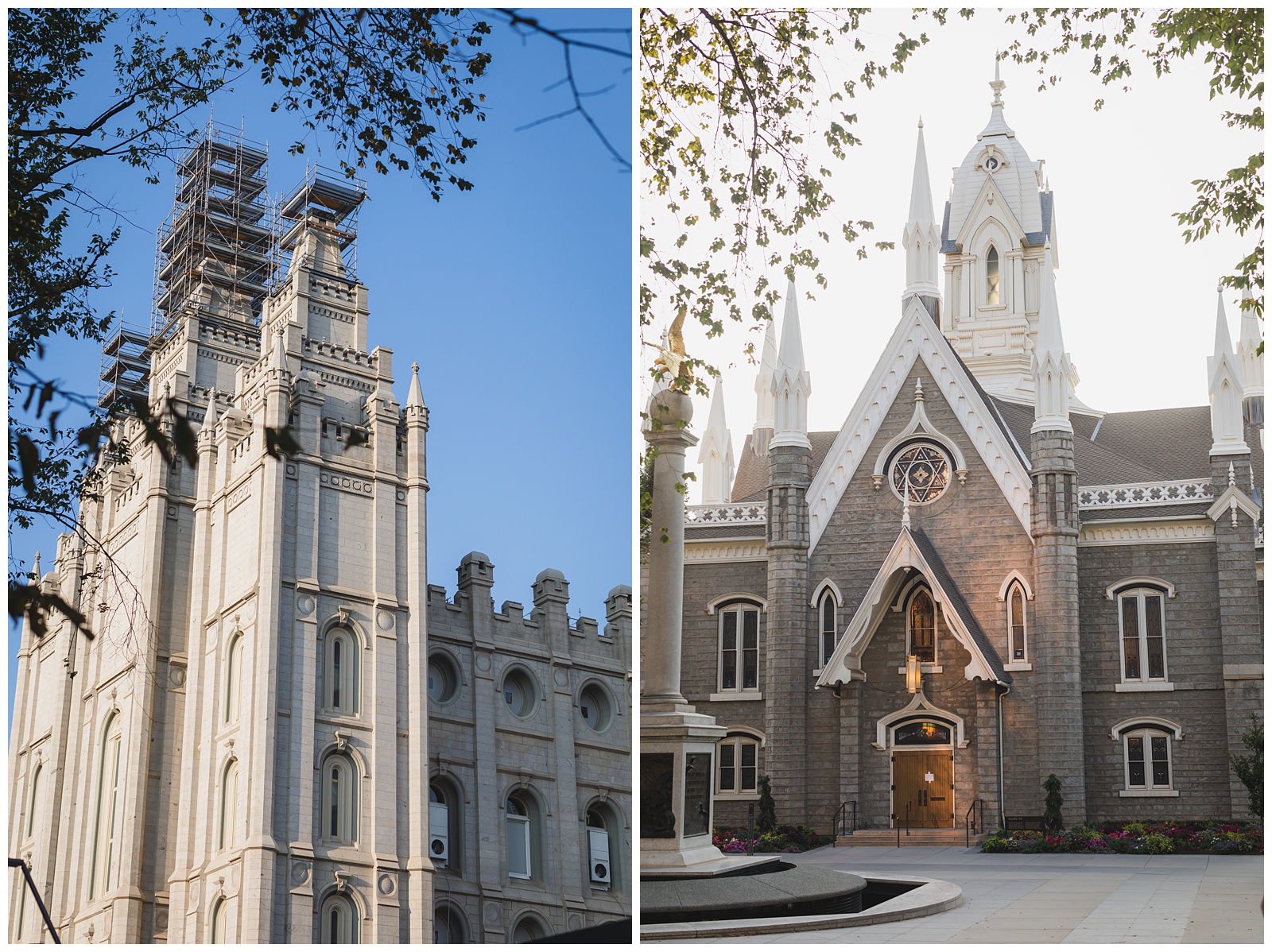
The temple is currently undergoing a four-year renovation process to stabilize the foundation by digging down 40 feet and installing rollers that will protect the building in the event of an earthquake.
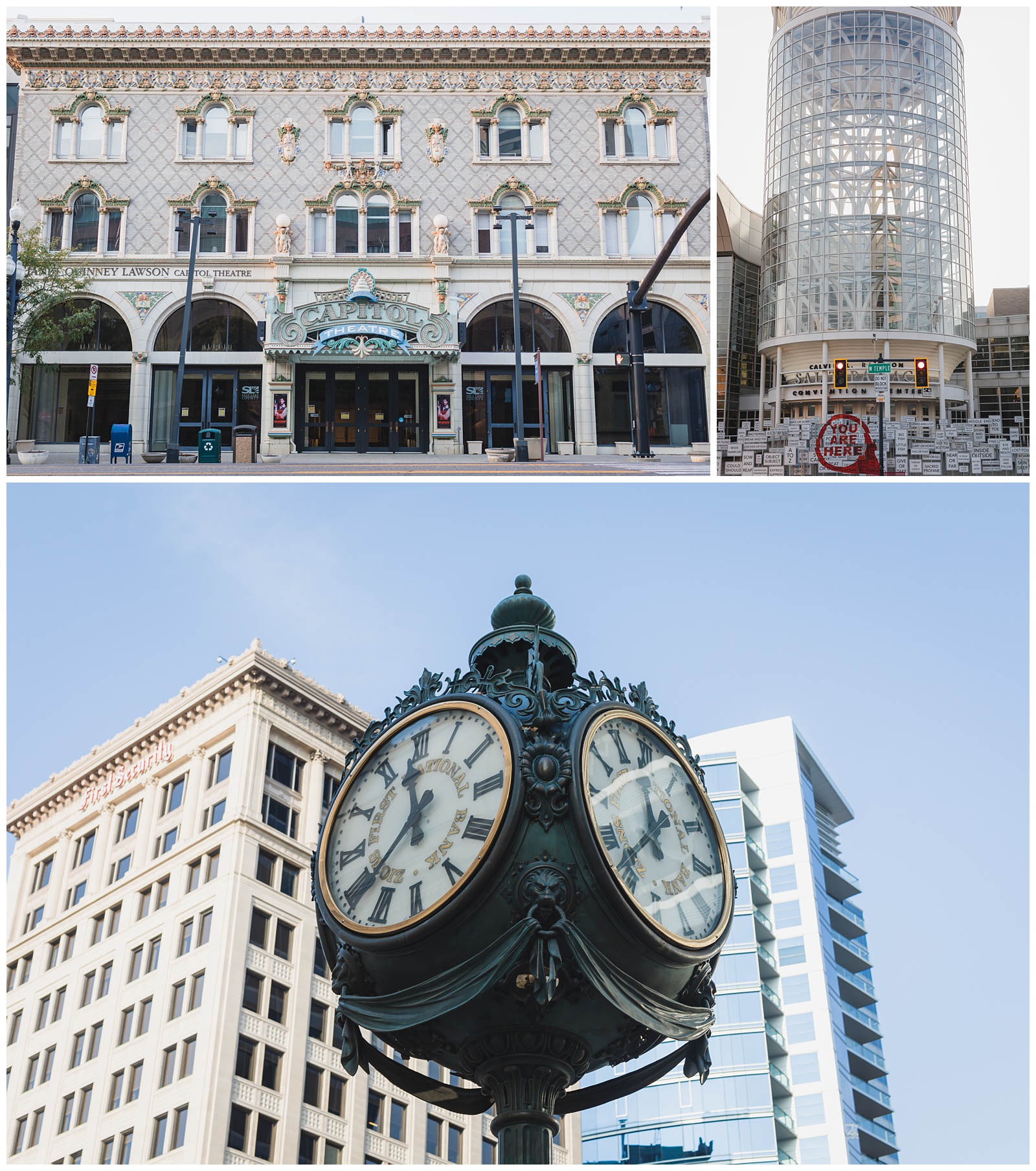
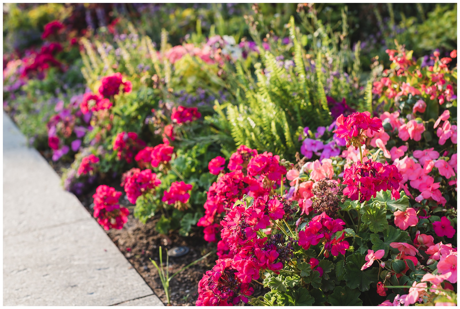 Flowers at the square, and below, a few more sights on our walk back to our hotel.
day 11 • 09.21.20
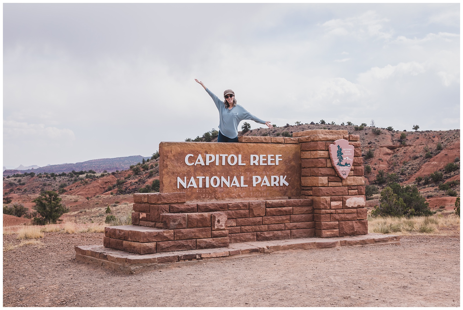
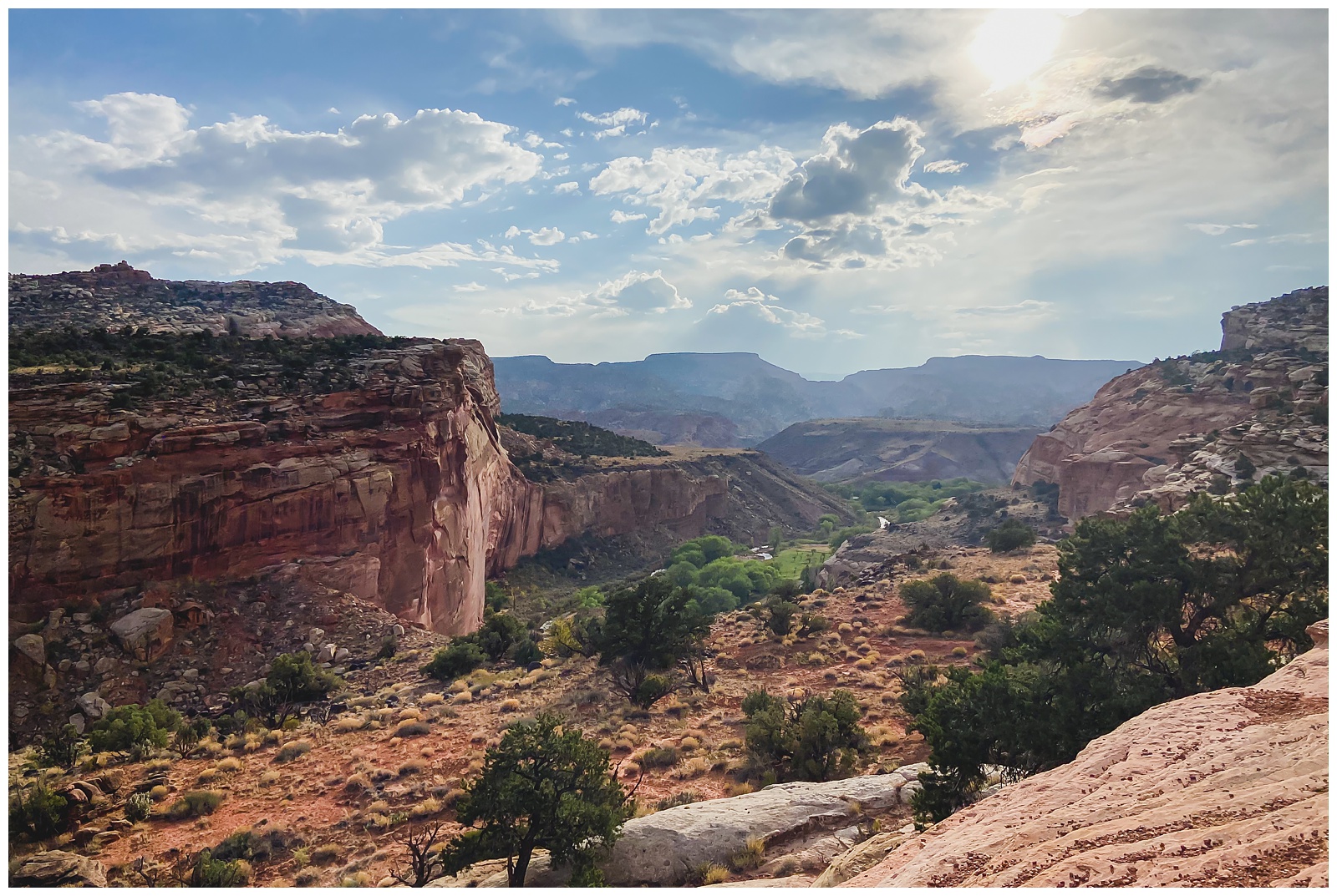
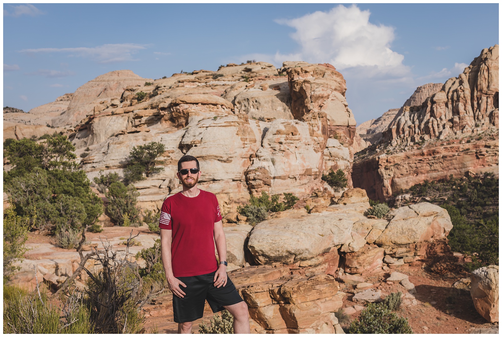
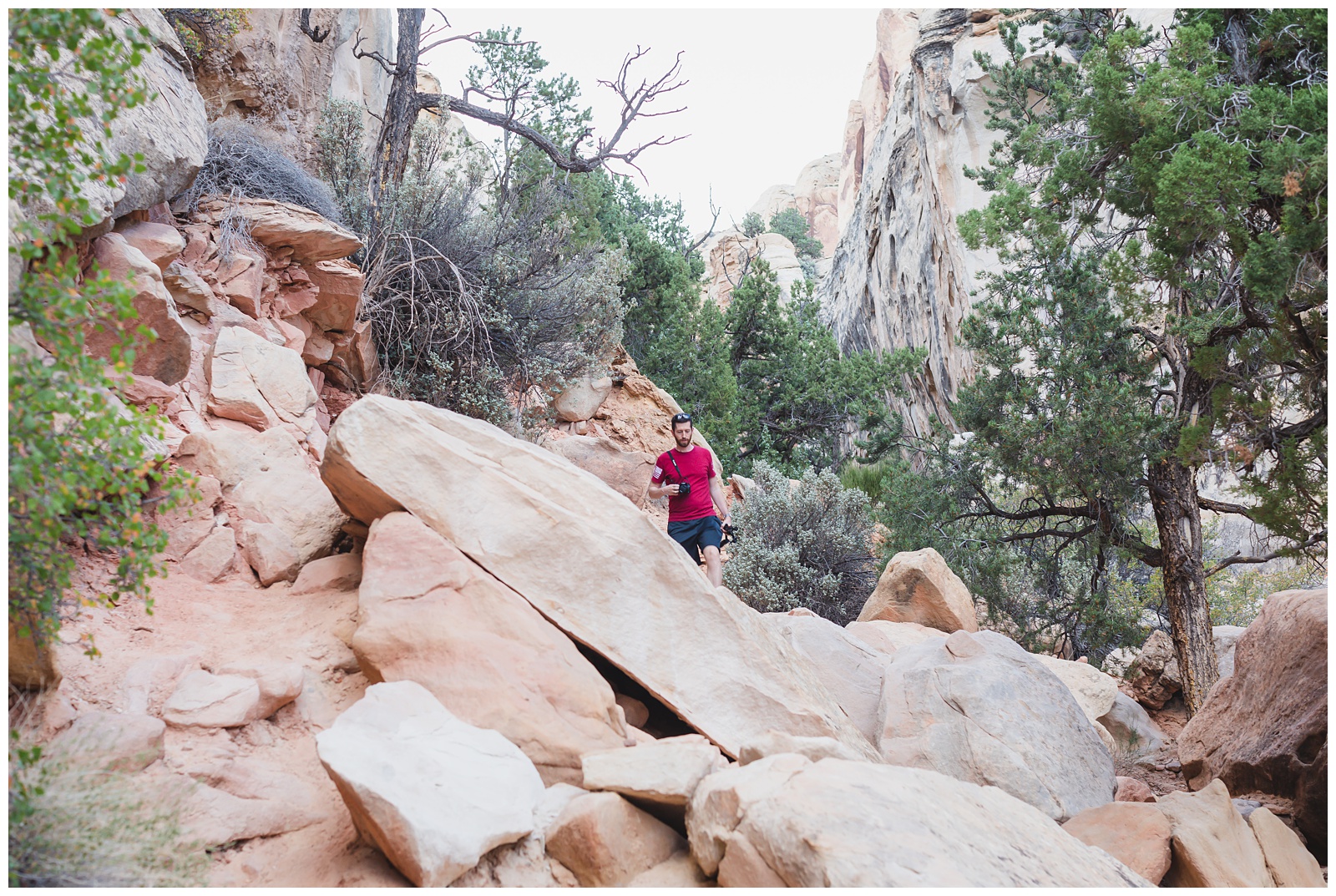
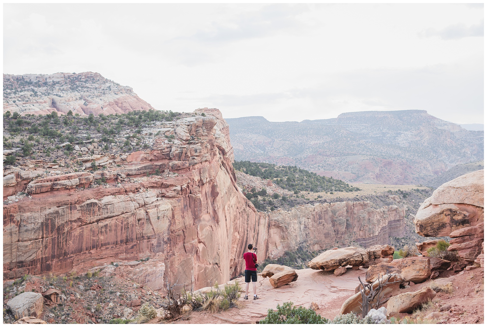
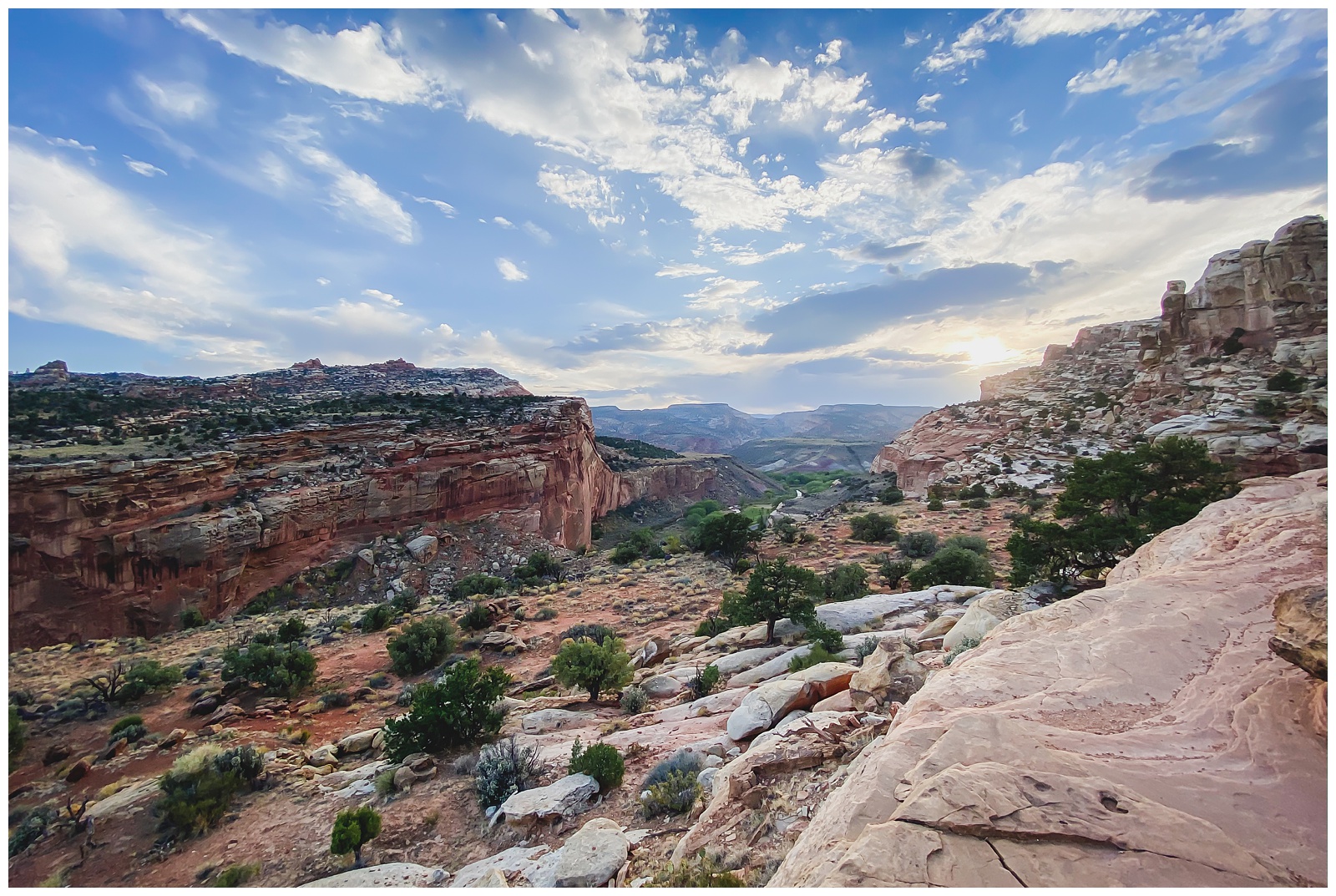
Salt Lake City, UT >>> Capitol Reef National Park >>> Torrey, UT
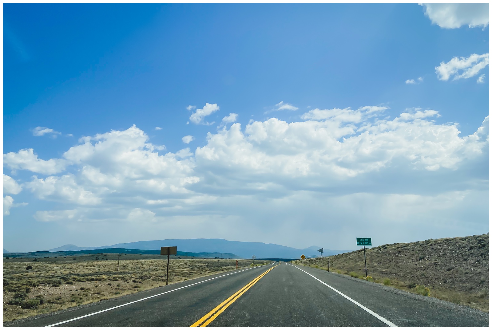
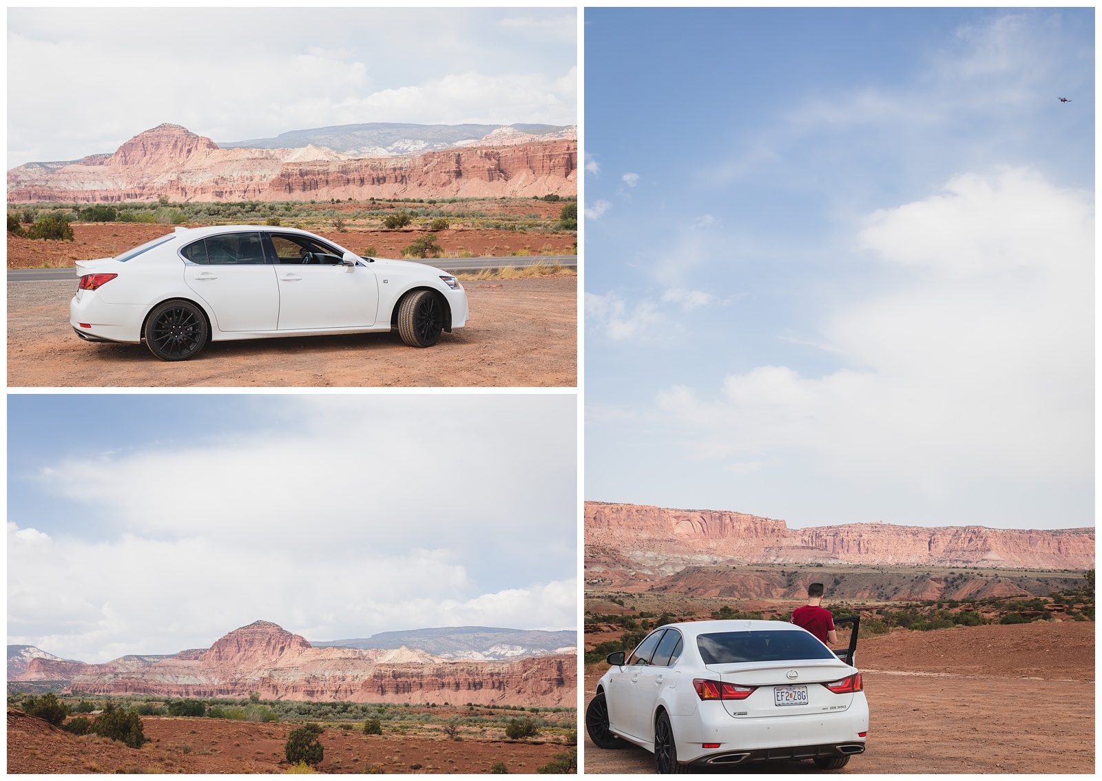
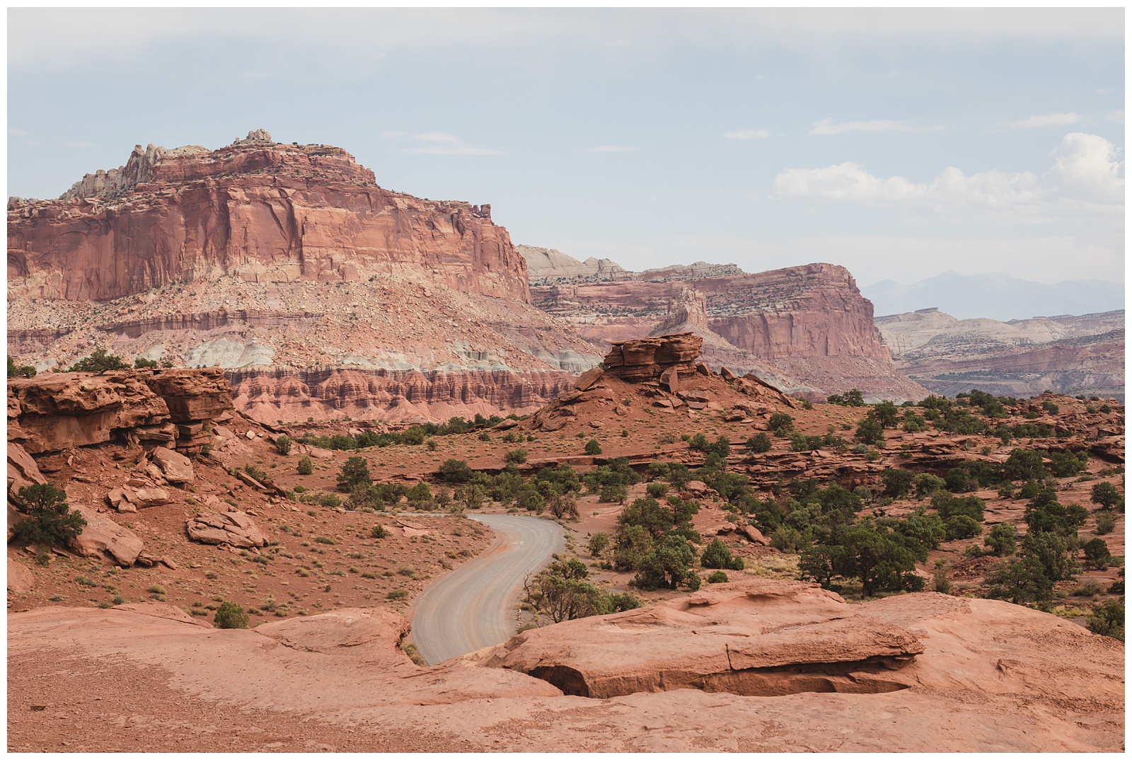
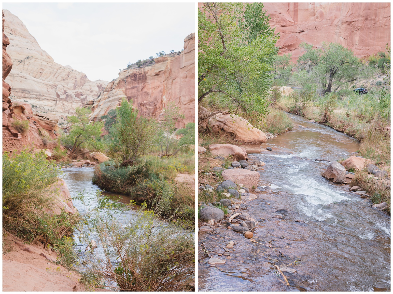
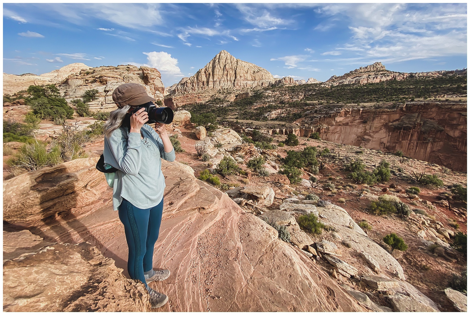
Despite some strong winds, we were able to take the drone up just outside of Capitol Reef.
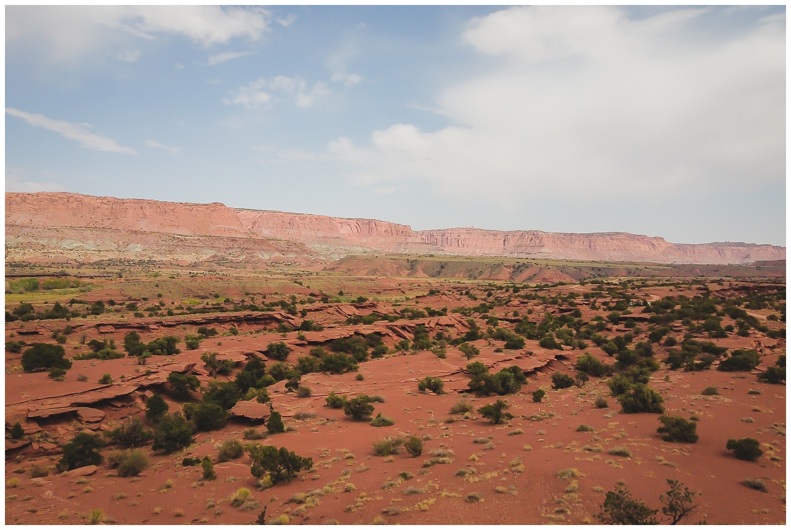
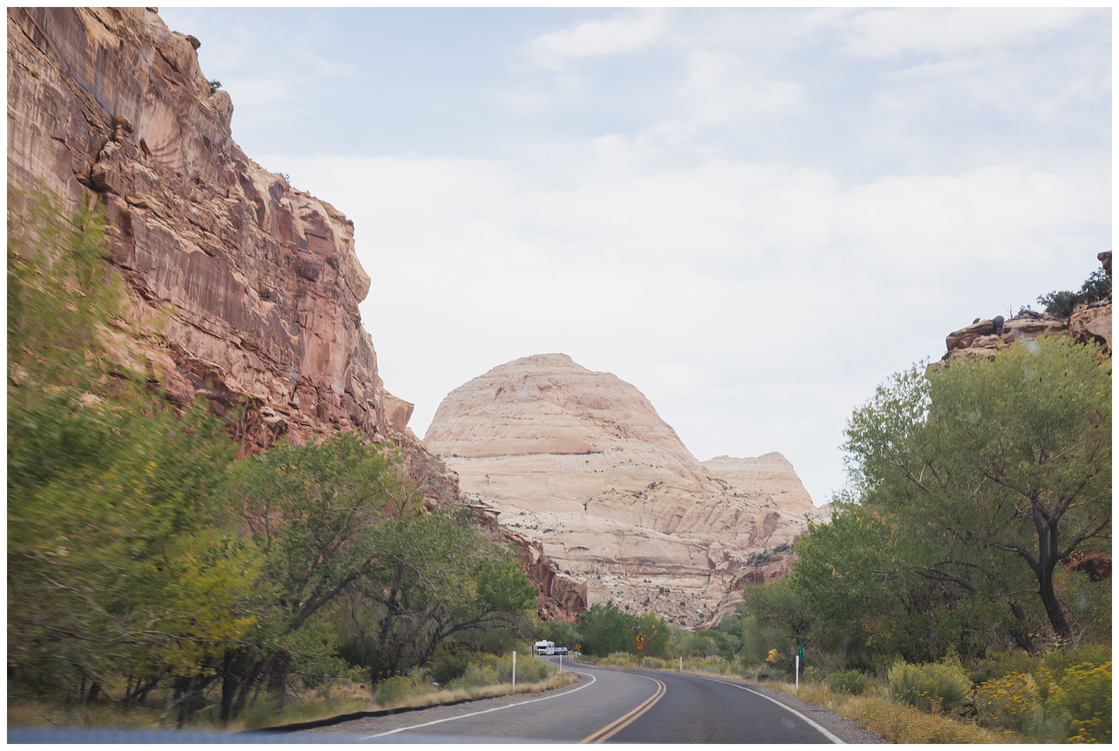
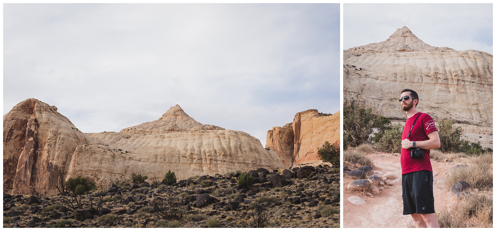
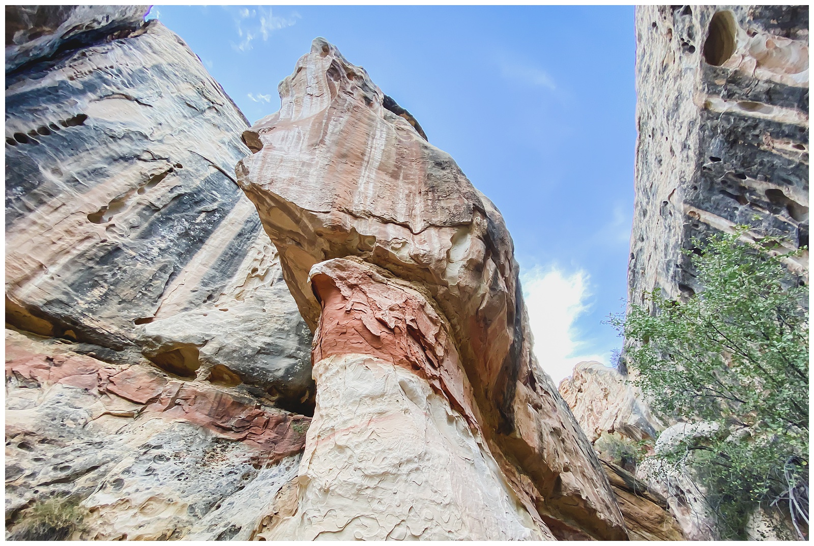
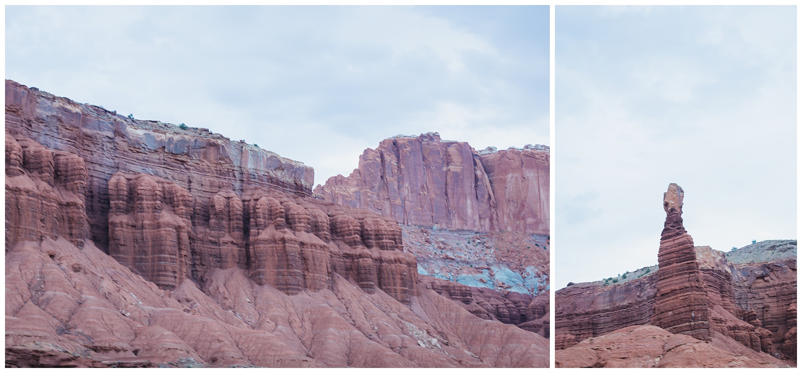
 Capitol Reef is filled with cliffs, canyons, domes and bridges in the Waterpocket Fold, a geologic monocline (a wrinkle on the earth) extending almost 100 miles. Its name comes from its sandstone cliffs resembling capitol domes. {Source: National Park Service}
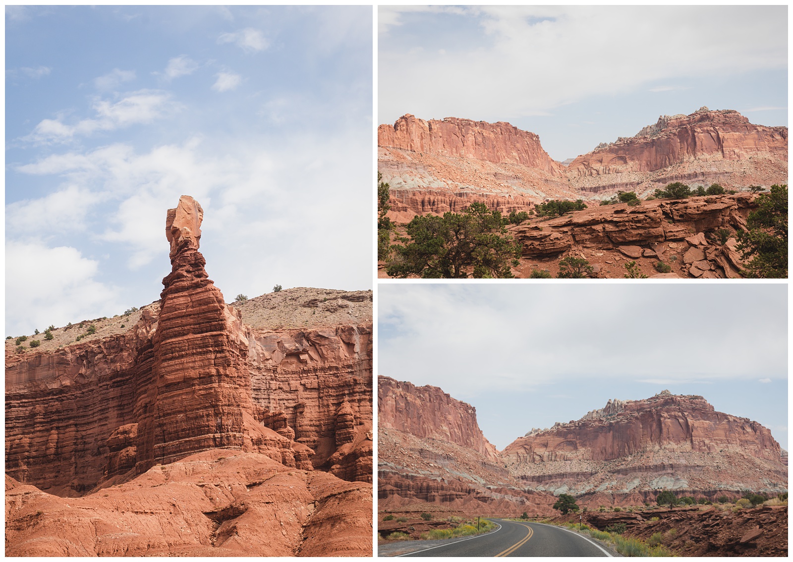
Above left: One of the world’s many rock formations known as Chimney Rock.
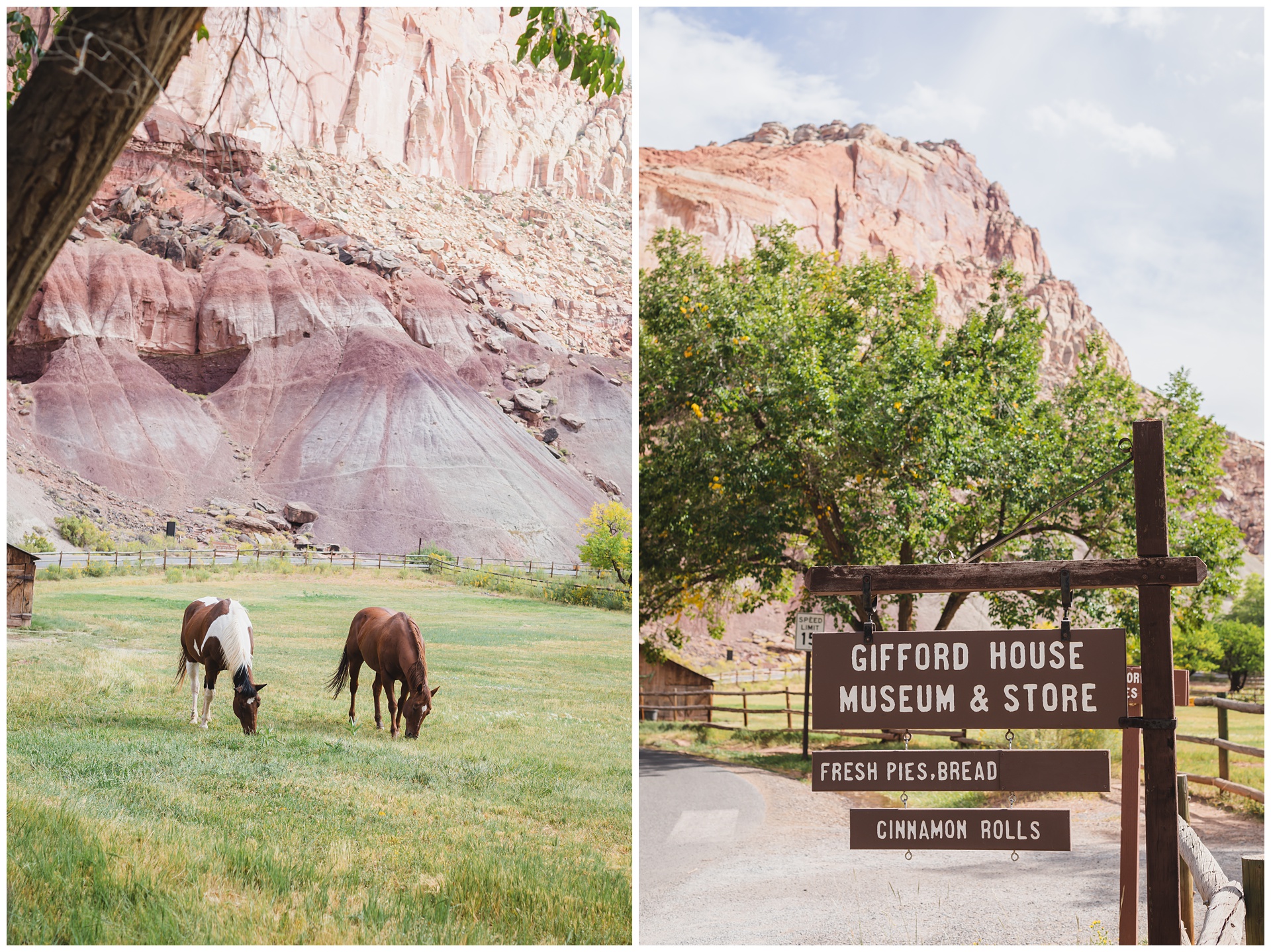
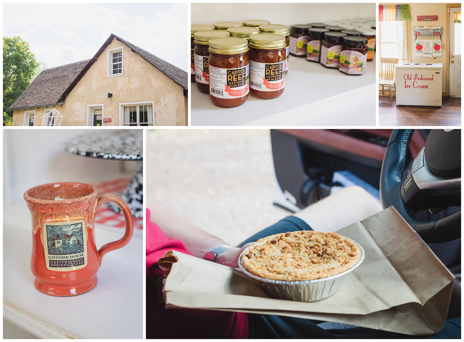
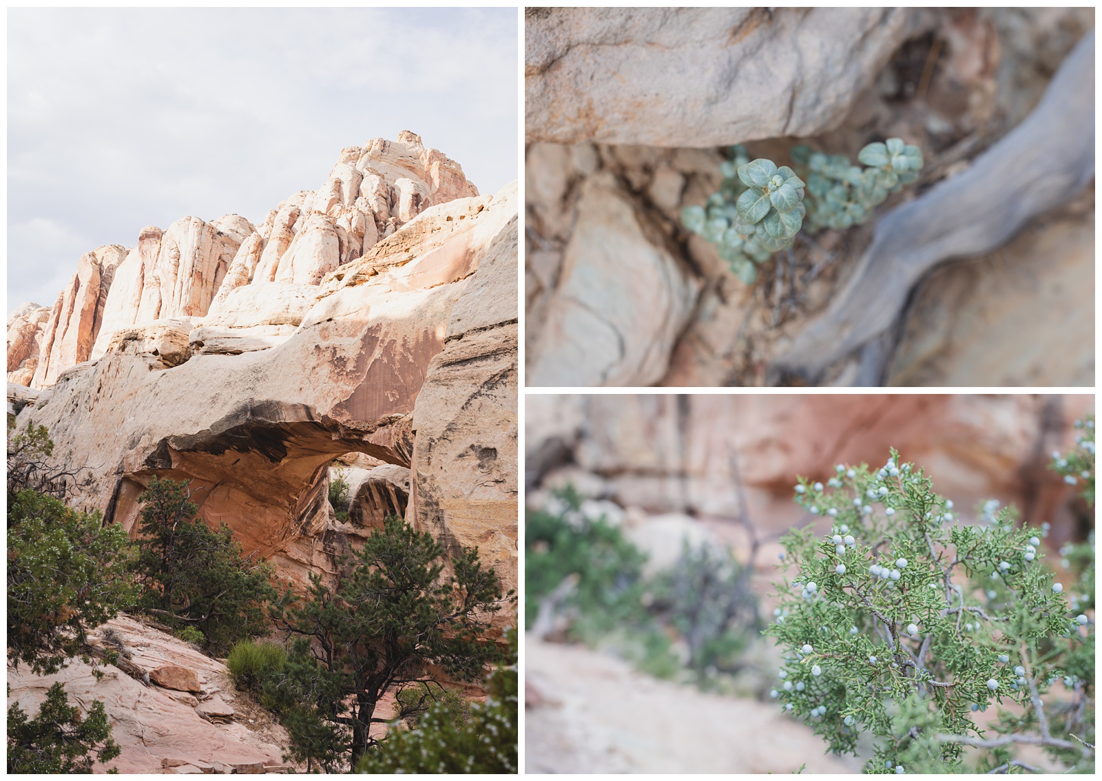
Gifford House is known for pies made with fruit grown in the park’s orchards (the remnants of a historic Mormon community called Fruita). Of course we had to have one to fuel up for a 4-mile hike!
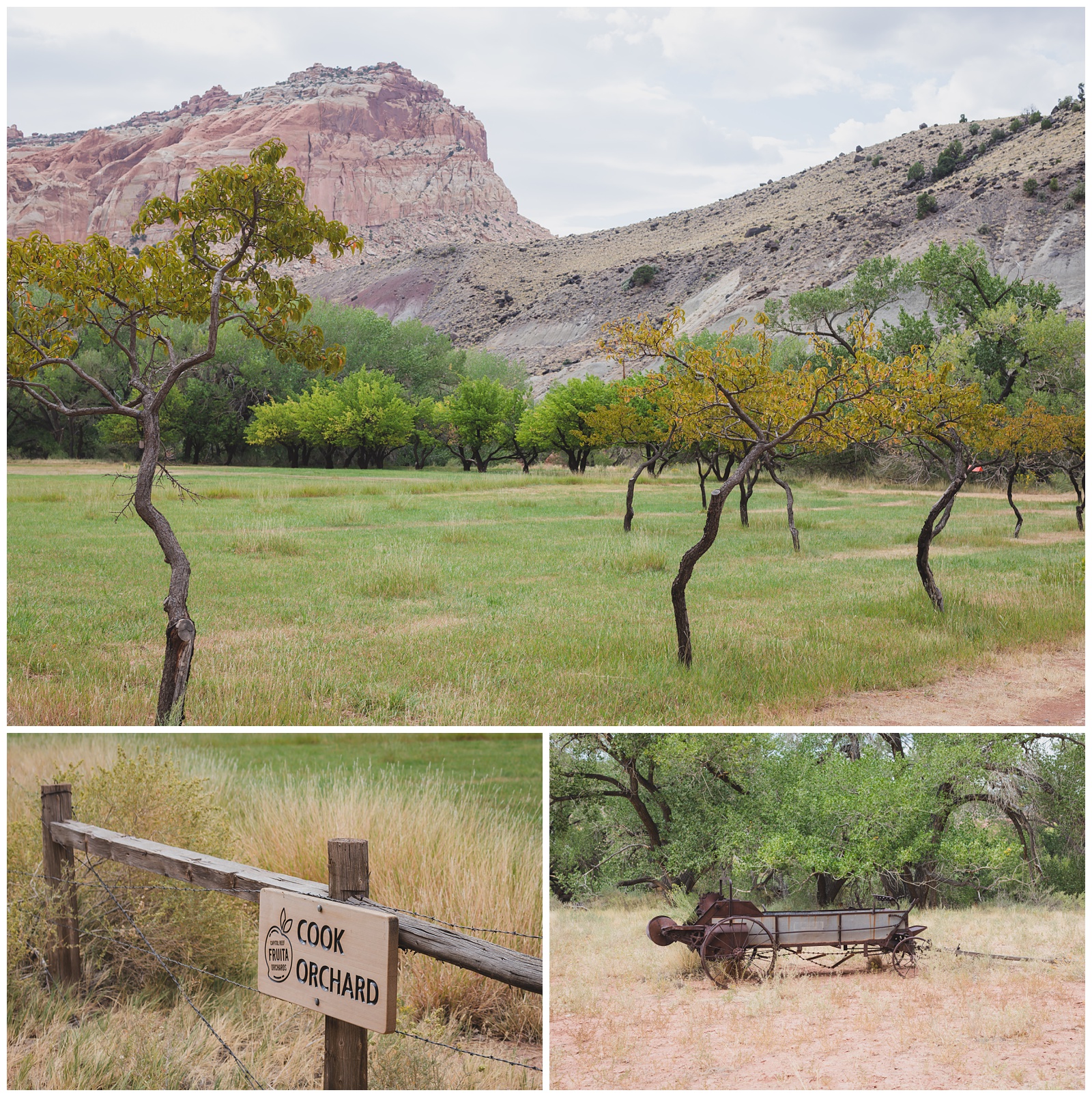 Cook Orchard
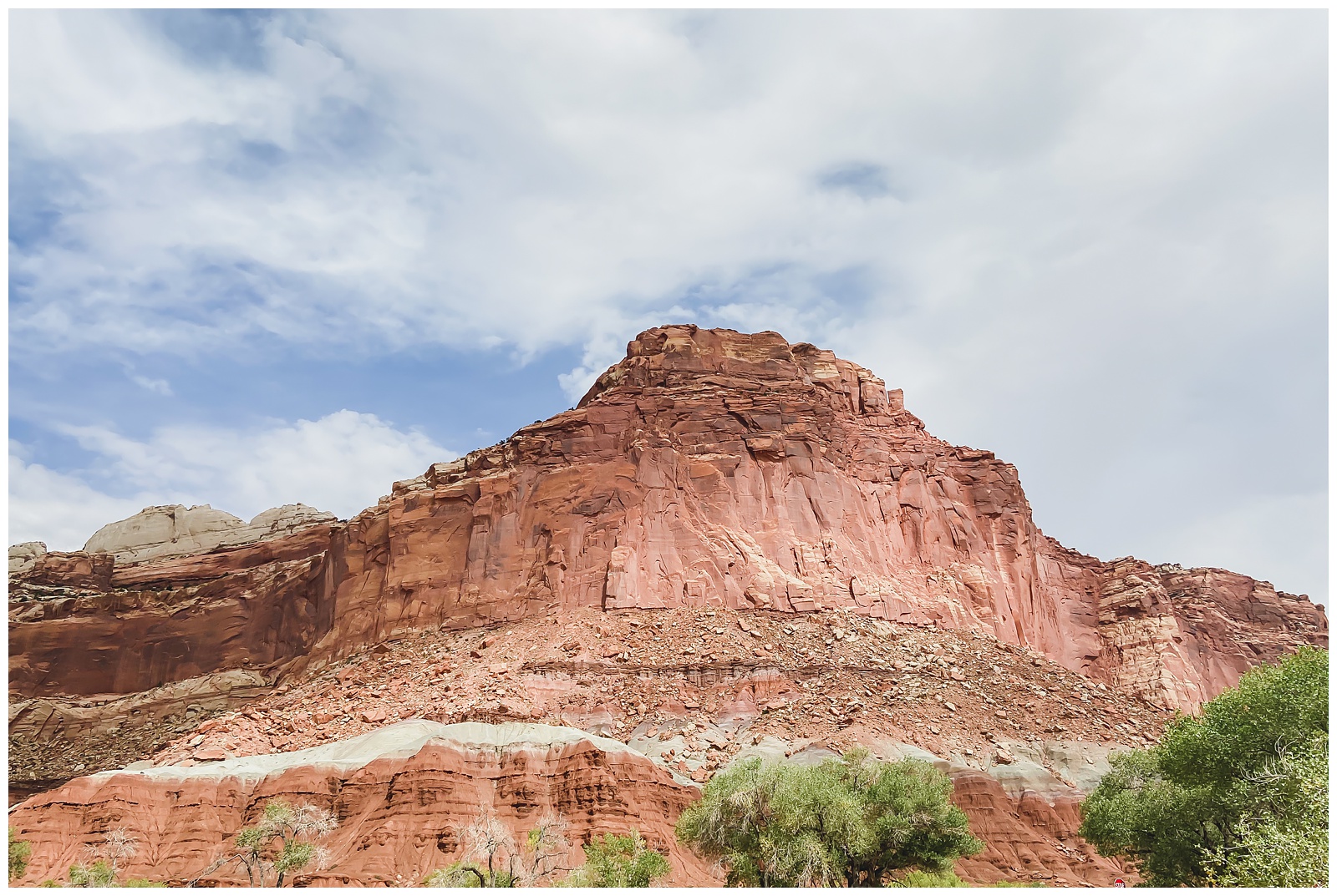
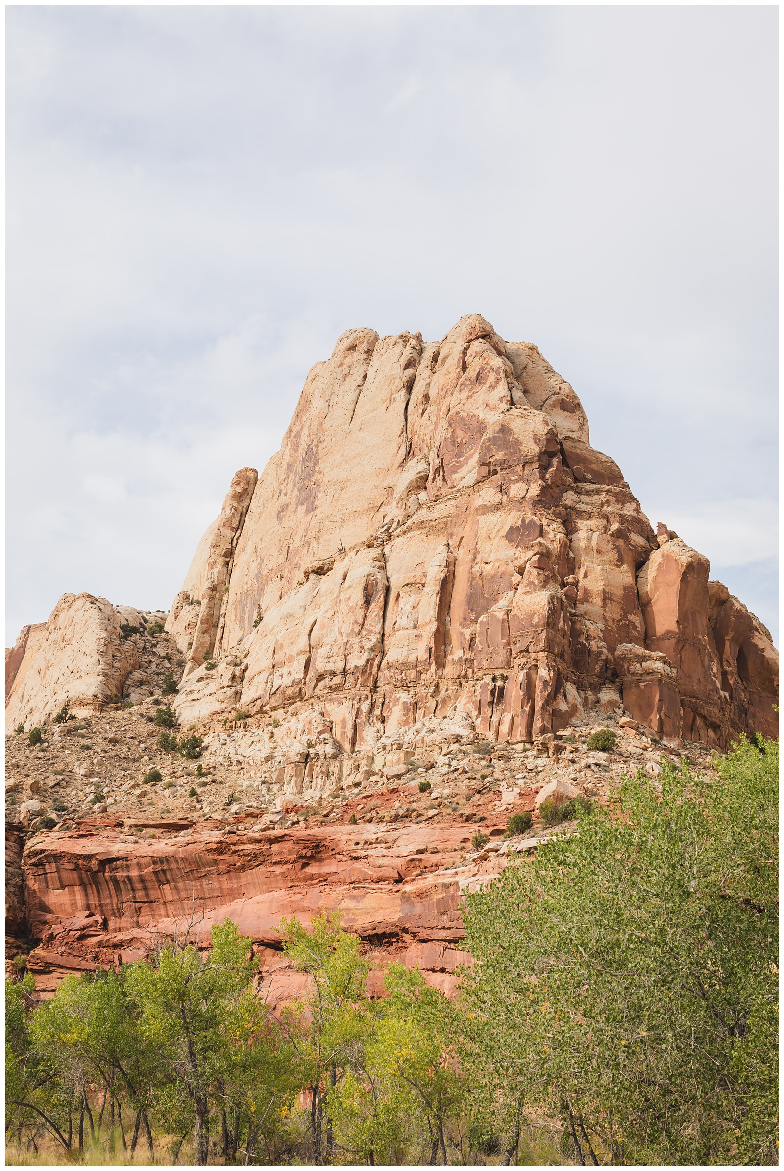
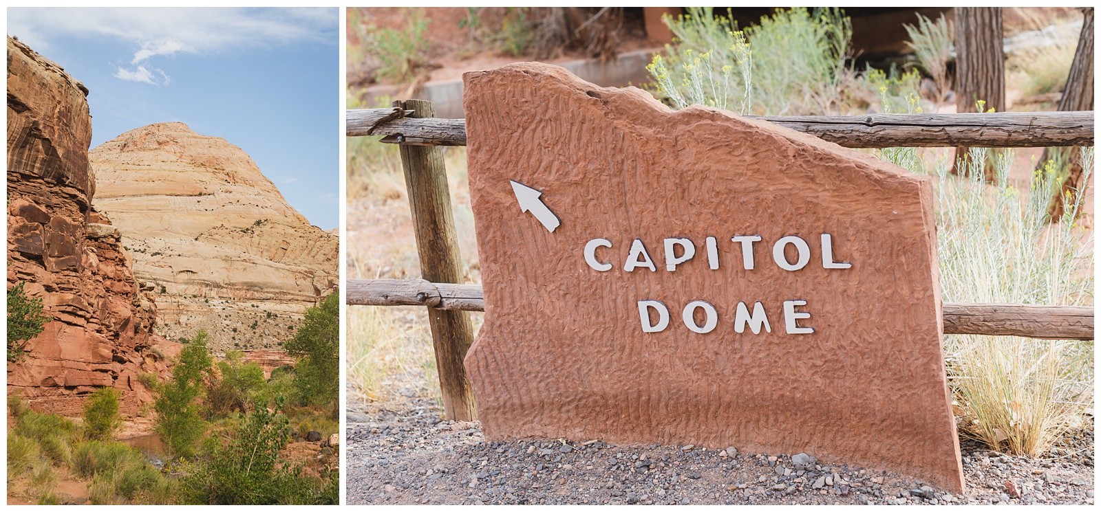
 Capitol Dome
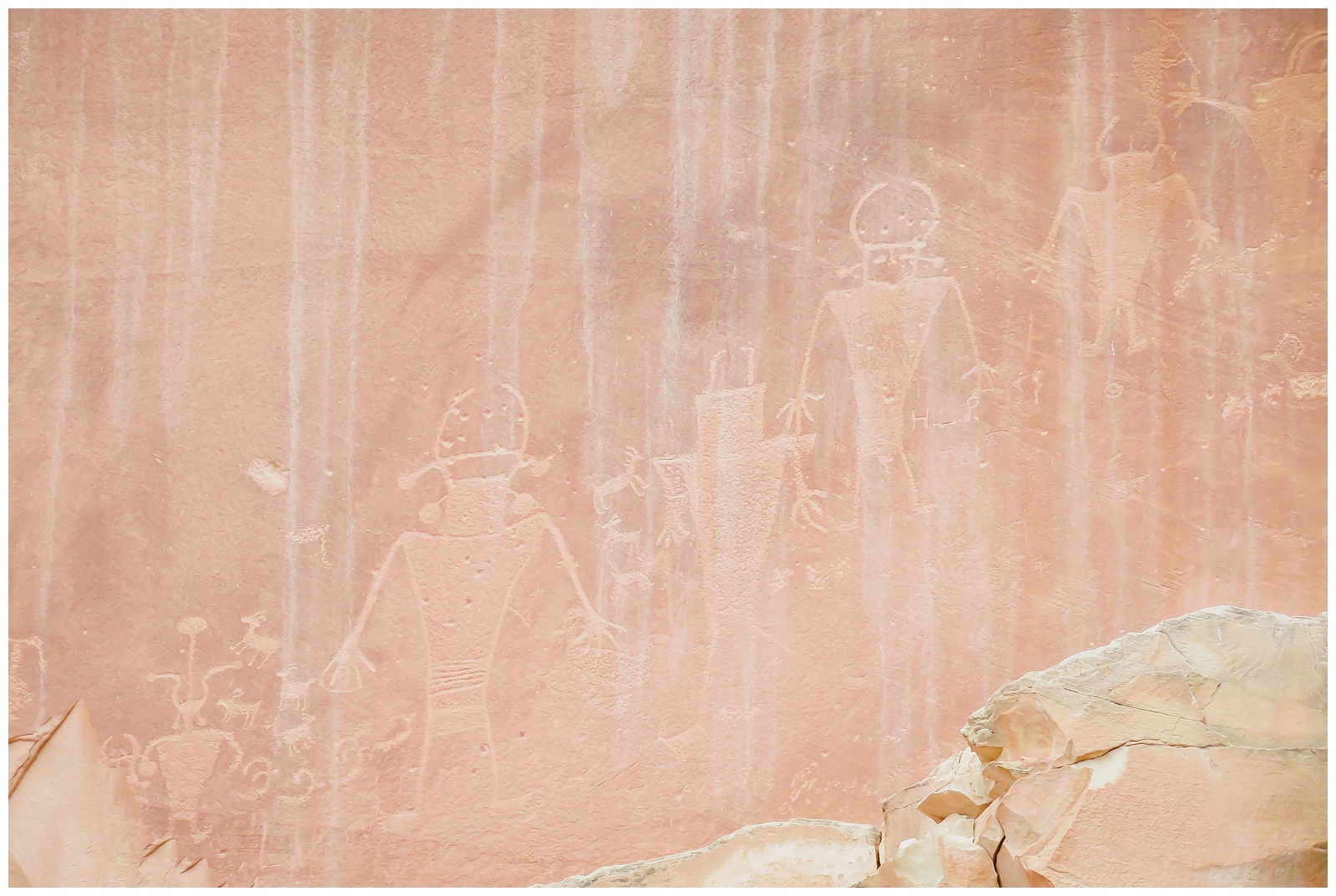
Petroglyphs
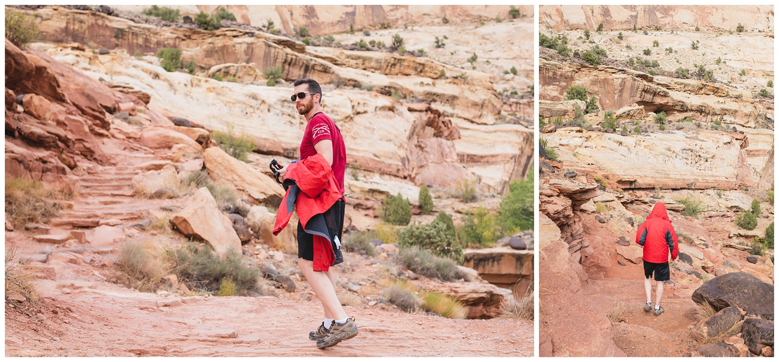
We started the hike to Hickman Bridge three times: The first, Seth returned to the car to get our rain jackets after it started sprinkling (above left). The second, we turned back about a third of the way up because the storm was getting severe (above right). But after waiting out the rain a little while, our third attempt at the hike was the charm!
Navajo Dome
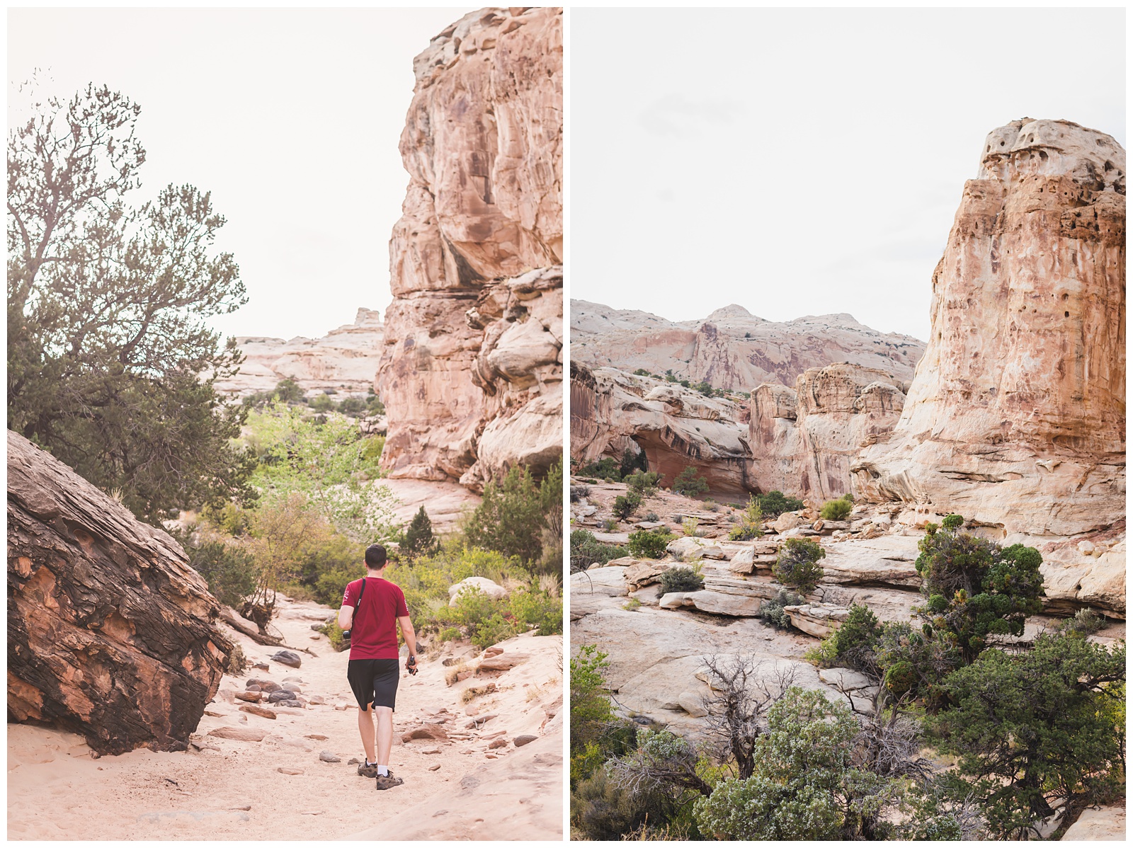
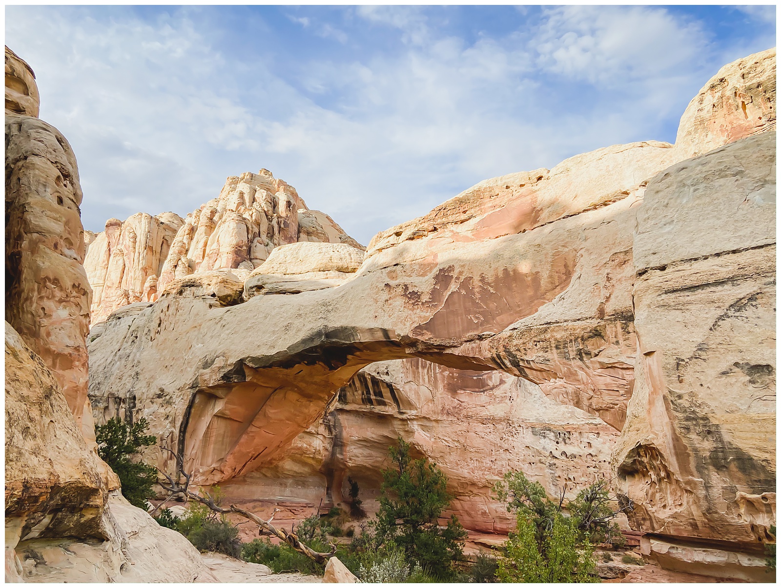
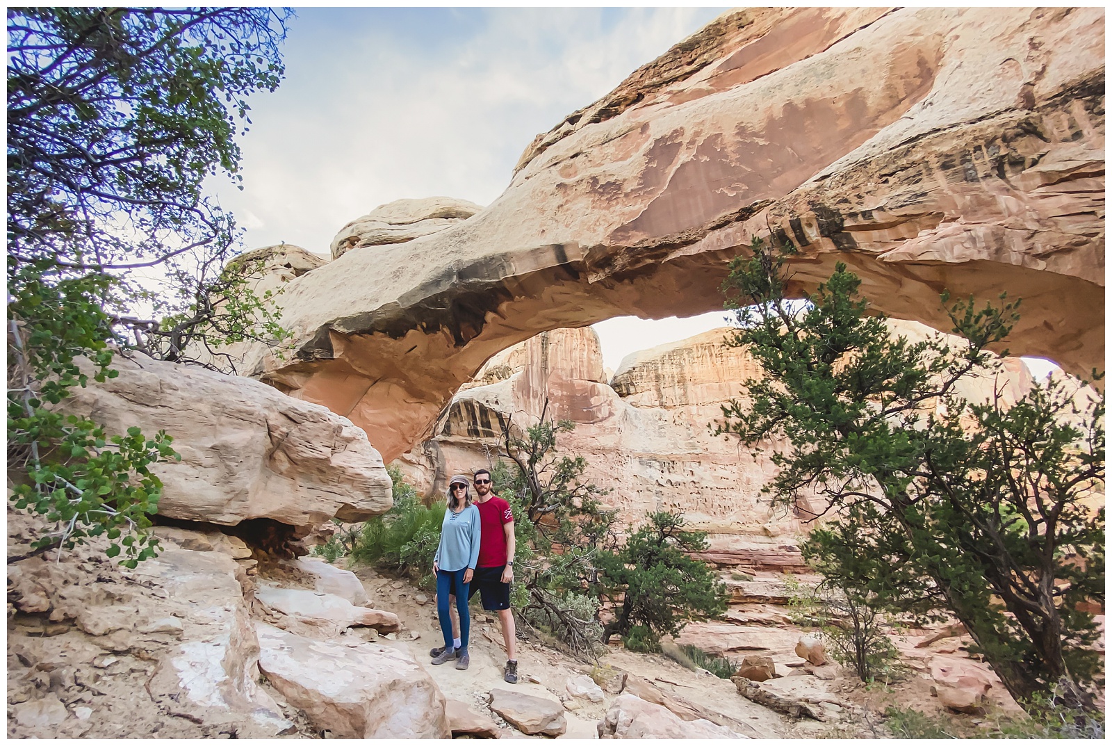
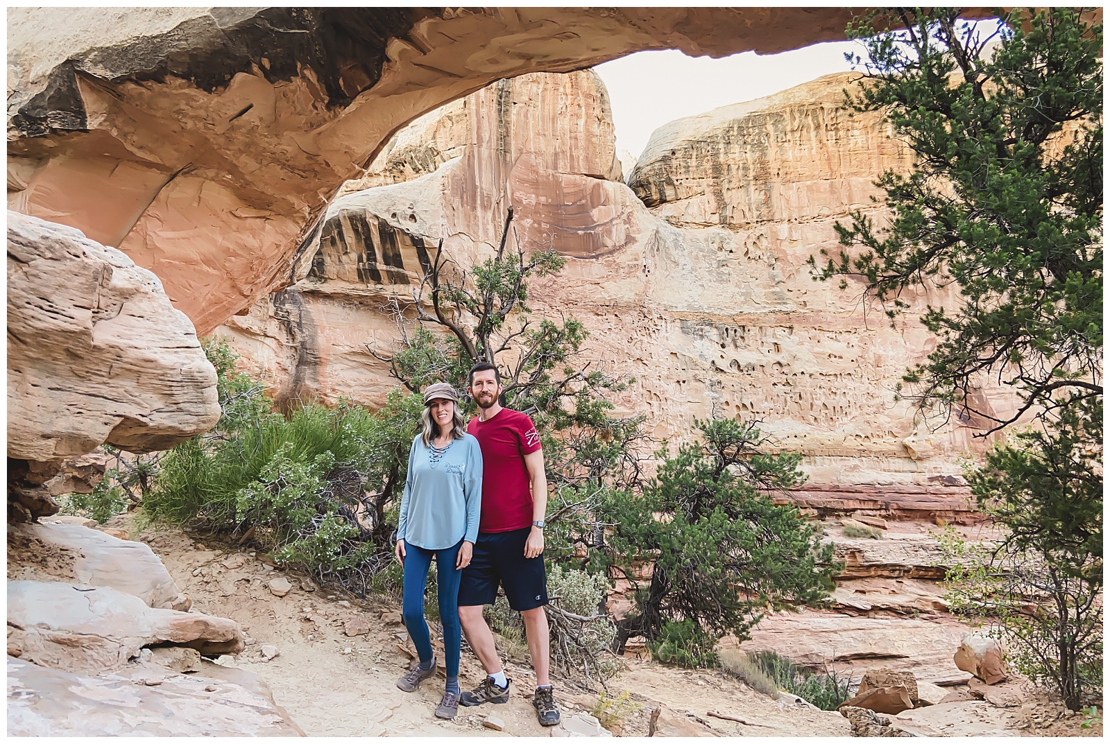
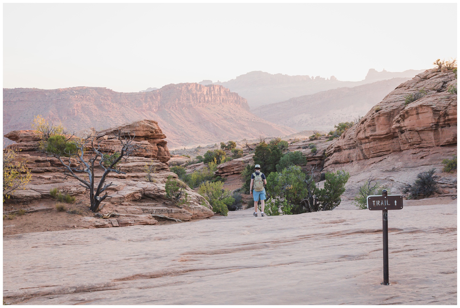
Hickman Bridge. It’s one of the most iconic sights in Capitol Reef, yet we had it largely to ourselves — the benefit of visiting a less-popular park!
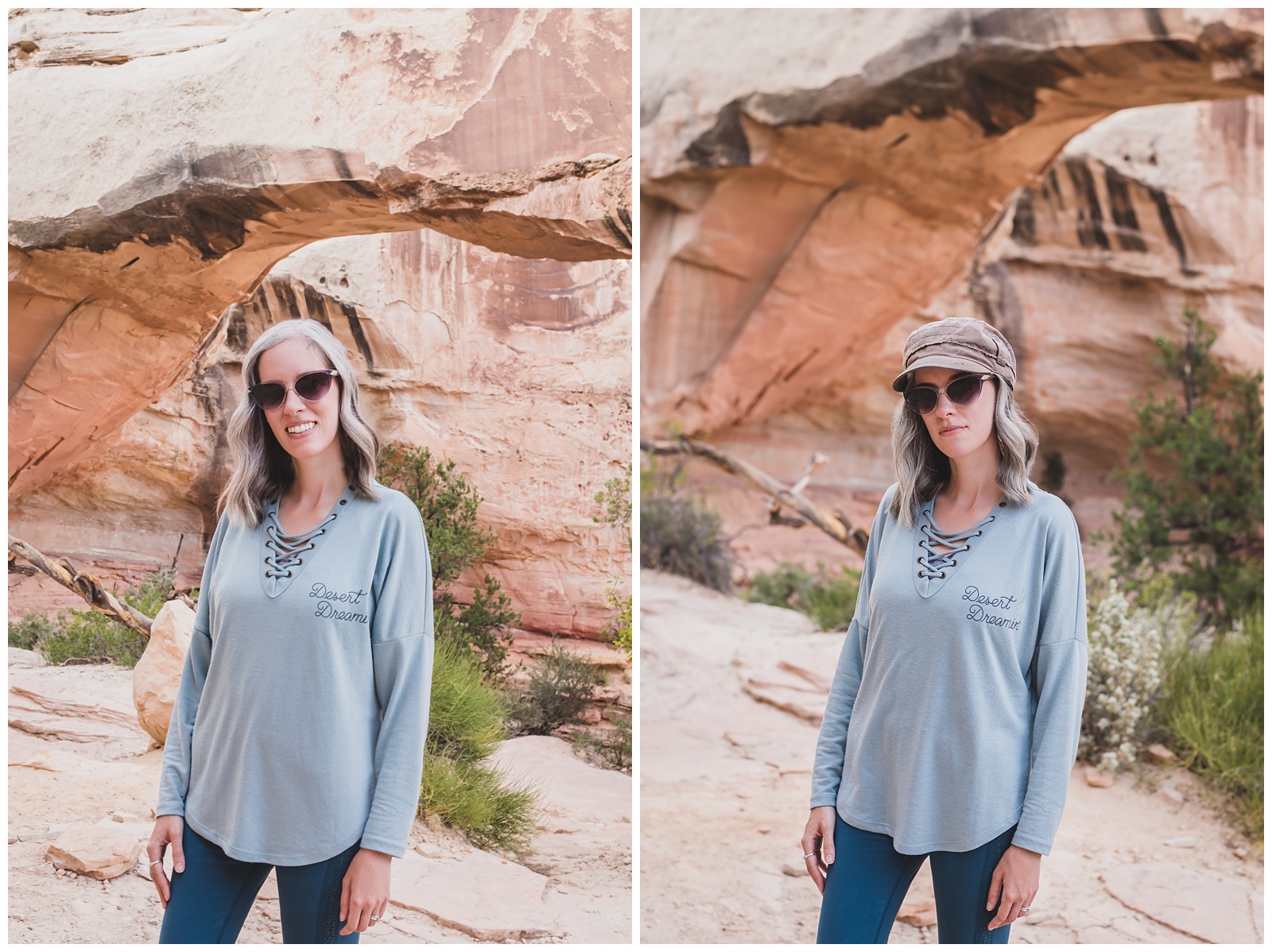
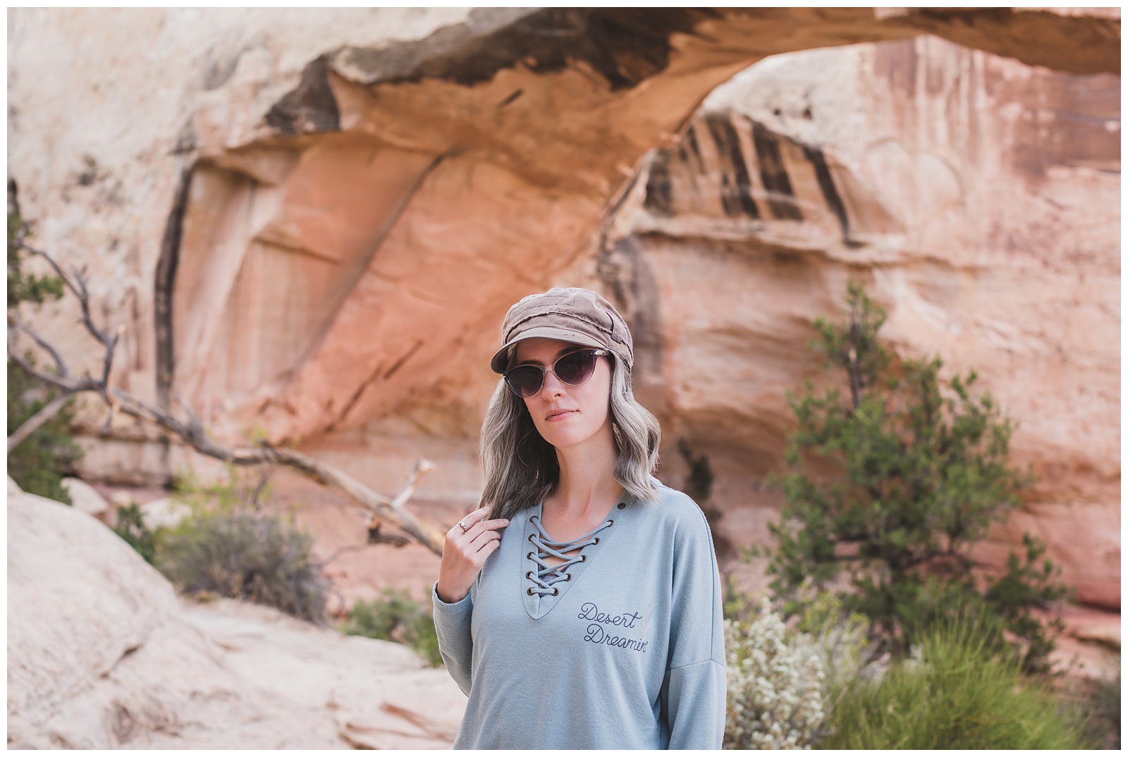
Desert Dreamin’ (as the shirt says ☺️).
That moment you realize you’ve lost the trail …
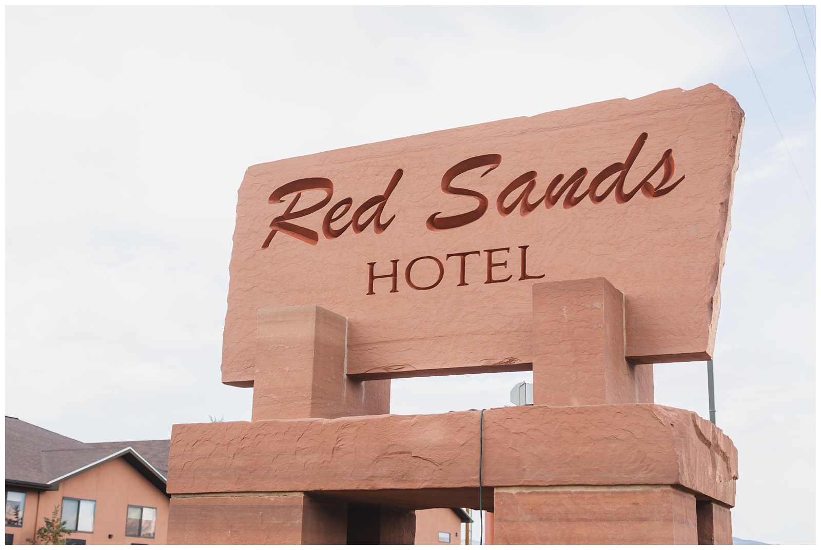
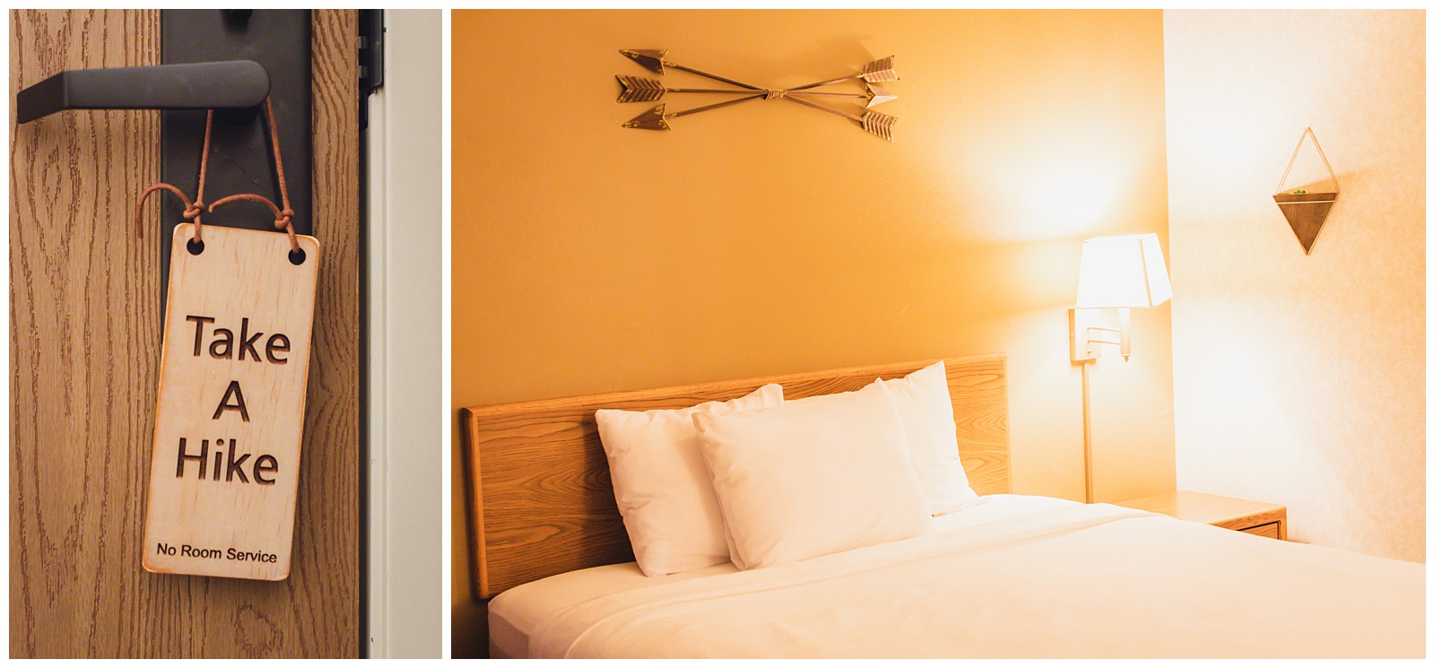
Red Sands Hotel in Torrey, Utah, was another favorite from our trip. Below is the view we had from our room, and I loved the simple but classy style throughout the entire place. It also has a cute restaurant where I had my first non-takeout restaurant meal since COVID came six months earlier.

day 12 • 09.22.20
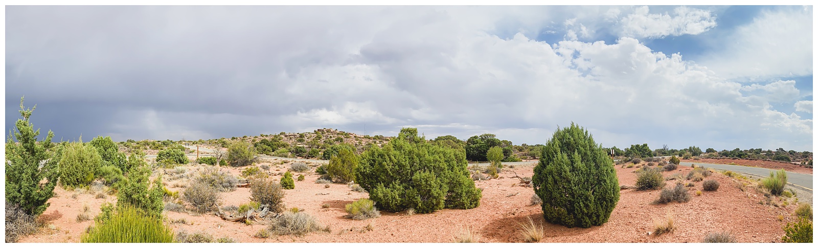
Torrey, UT >>> Canyonlands National Park >>> Dead Horse Point State Park >>> Moab, UT
This was the pivotal day we learned we could safely shoot photos and videos from our sunroof (this upping the quality of our driving videos pretty exponentially!). Although it would have been nice to make this discovery sooner, this drive was a great one for using our new skill — since the scenic drive to Canyonlands started by taking us back through Capitol Reef.
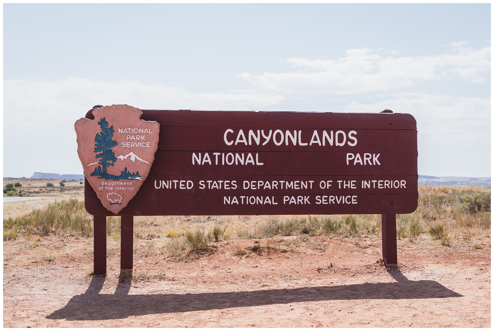 Canyonlands is approximately the area of 172,121 football fields (That’s 227,598 acres)! It has four distinct regions, including Island in the Sky (which is the one we visited). {Source: Moab Adventure Center}
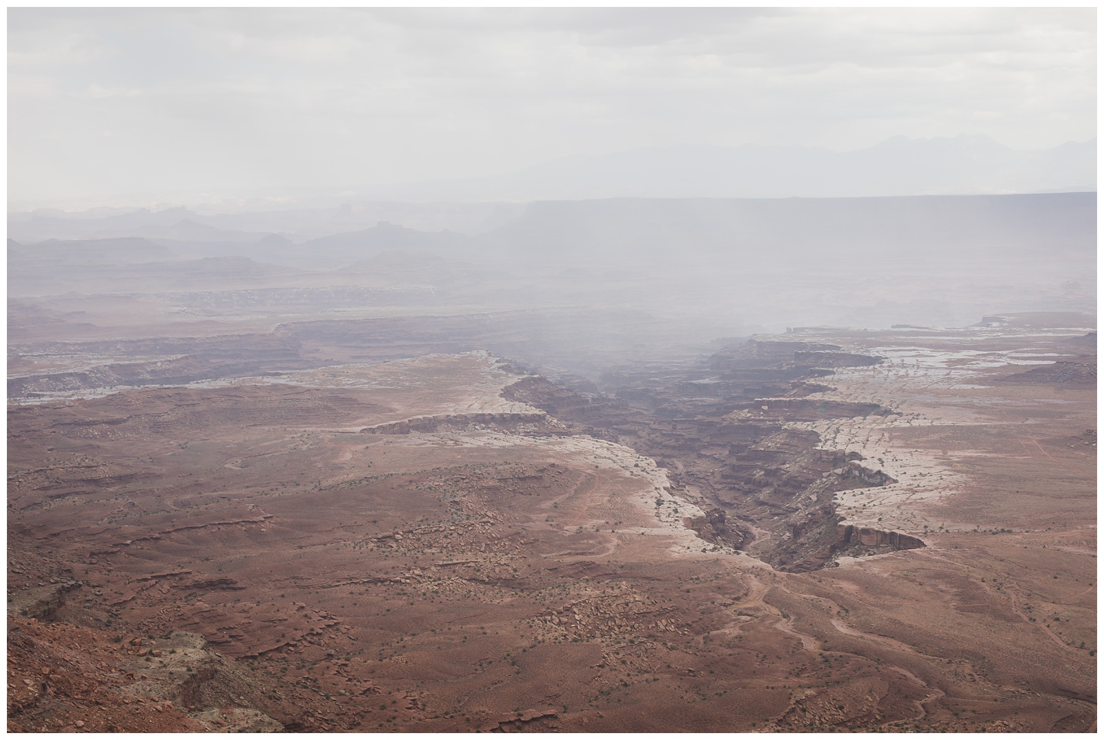
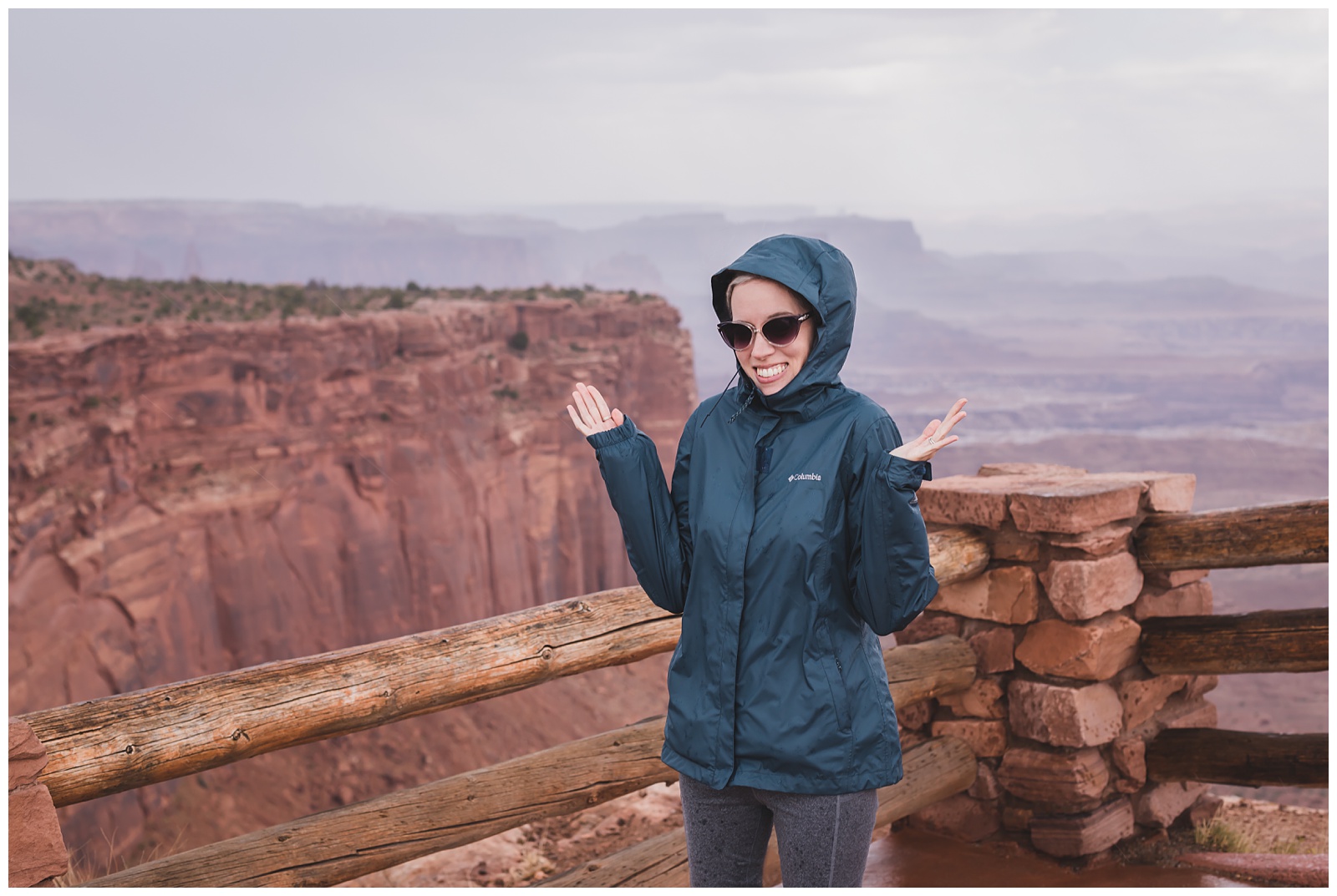
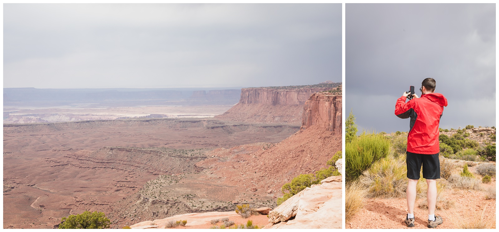
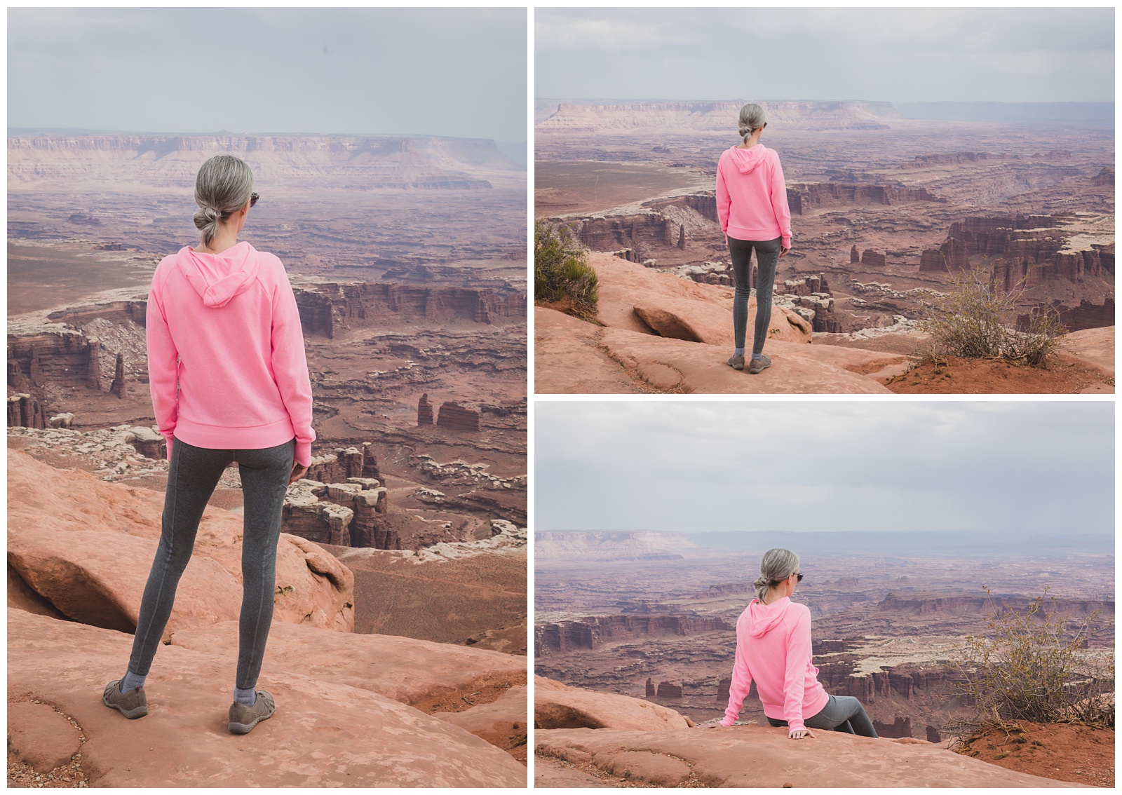
A storm blew in pretty soon after we arrived in the park, catching up to us at Buck Canyon Overlook. And as far as we could tell, we were the only people traveling with rain gear!
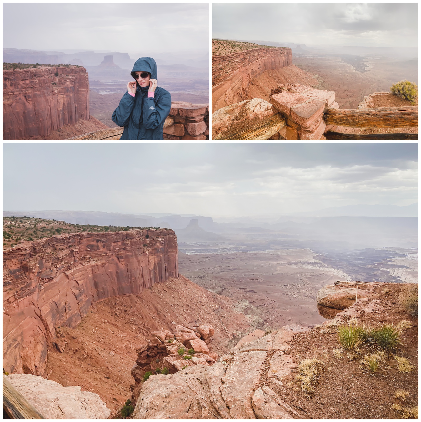
Storm on the left, sun on the right.
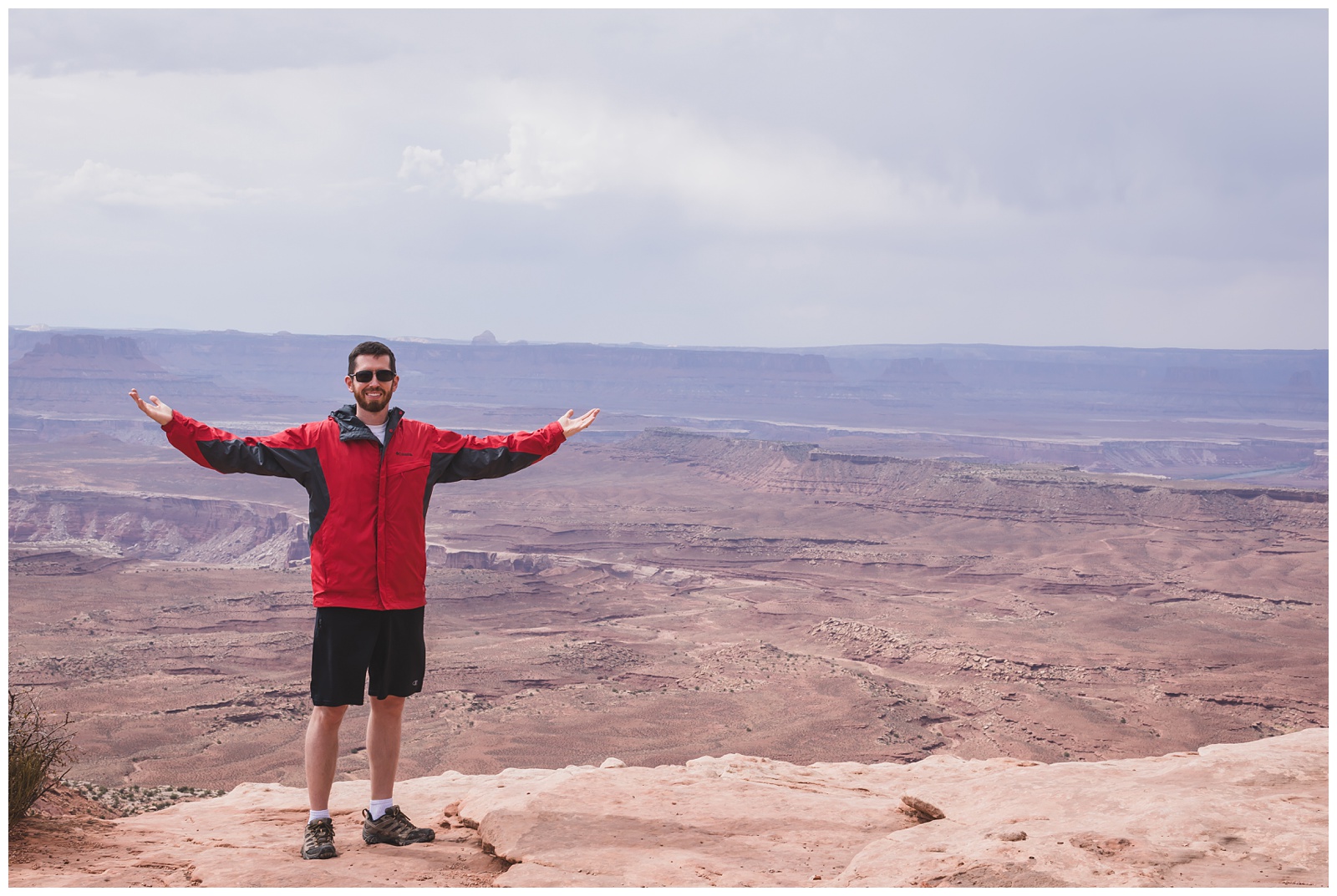
King of the world at Orange Cliffs Overlook.
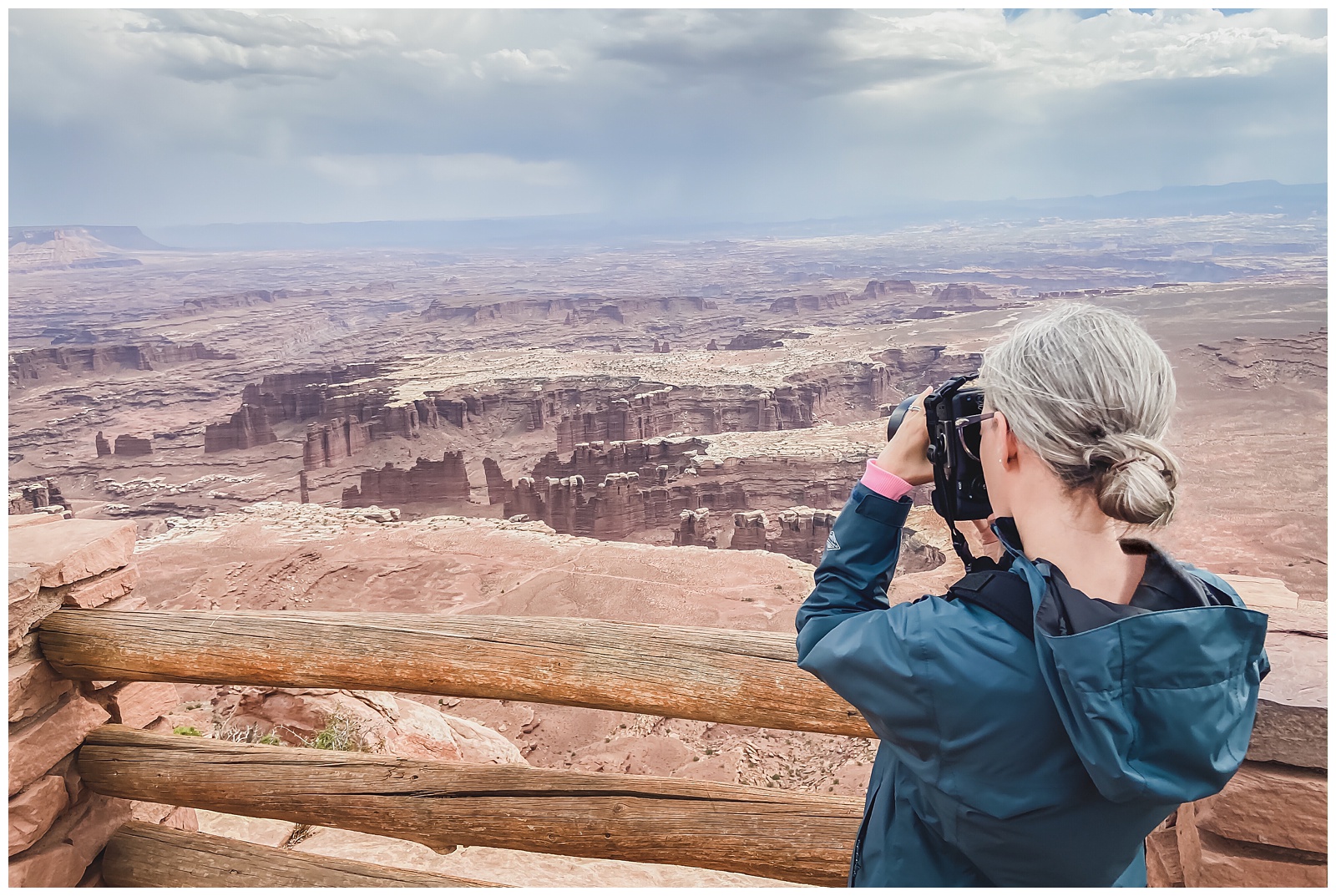
At the end of the main road in the Island in the Sky district is Grand View Point Overlook, which lives up to its name!
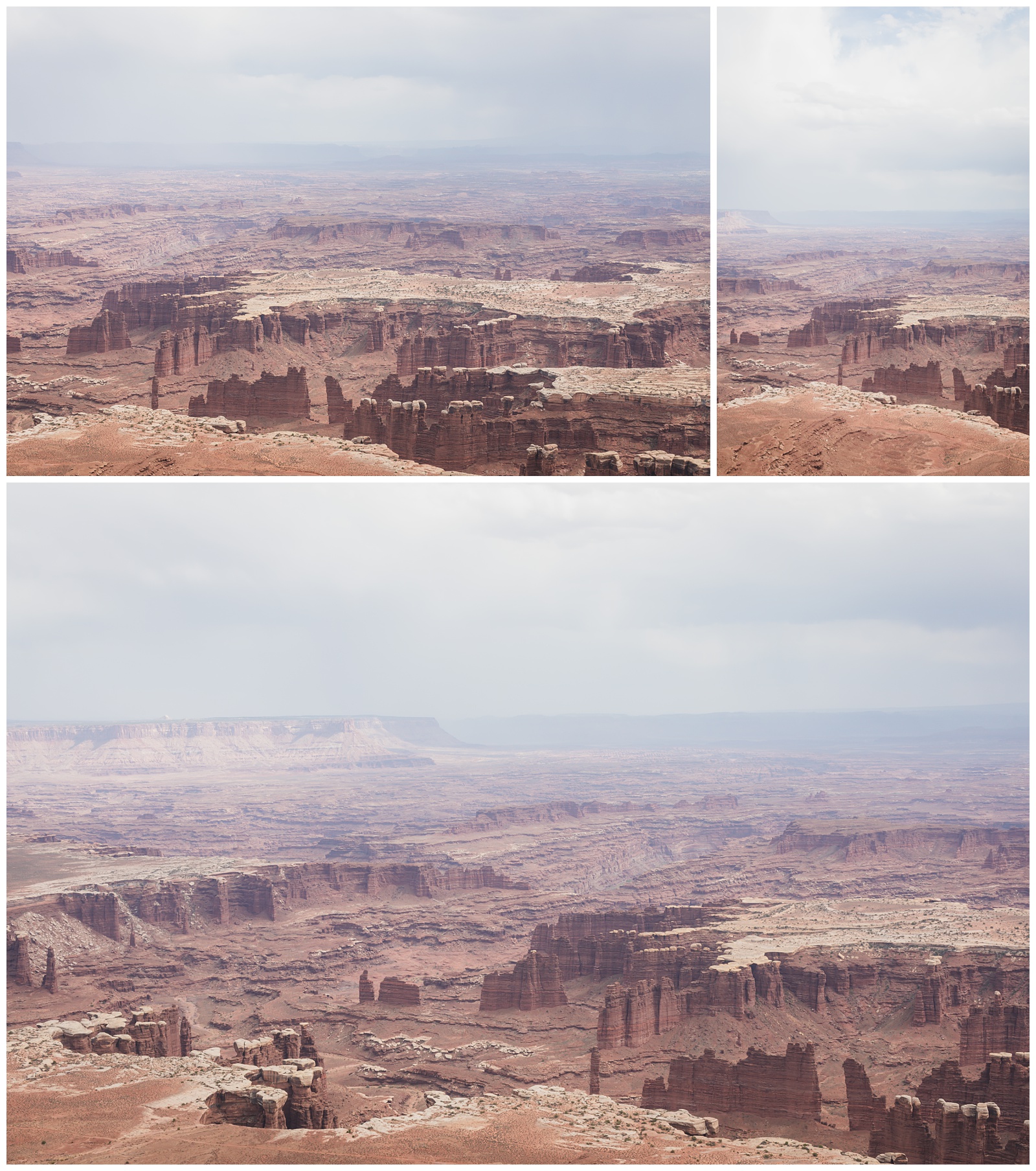
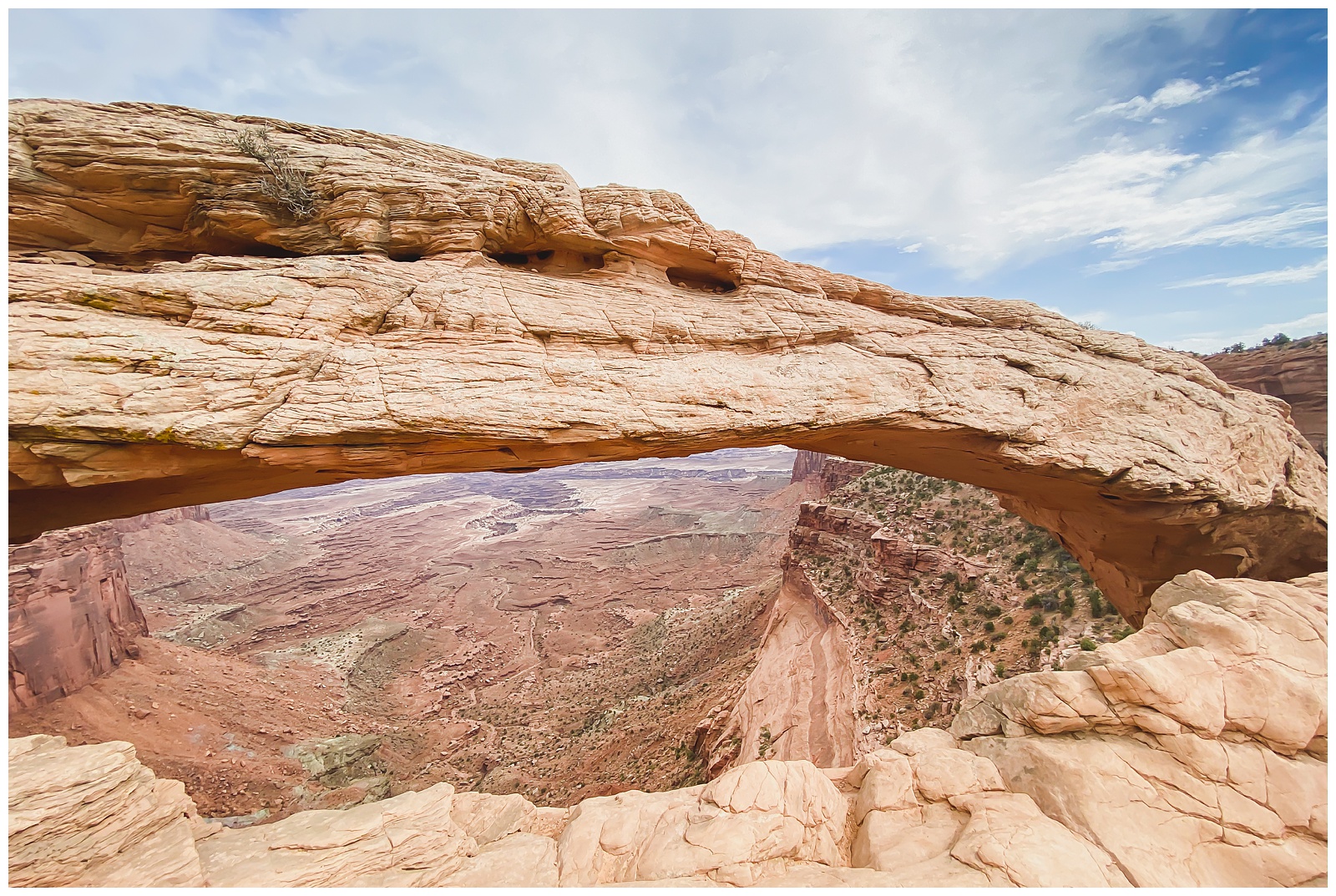
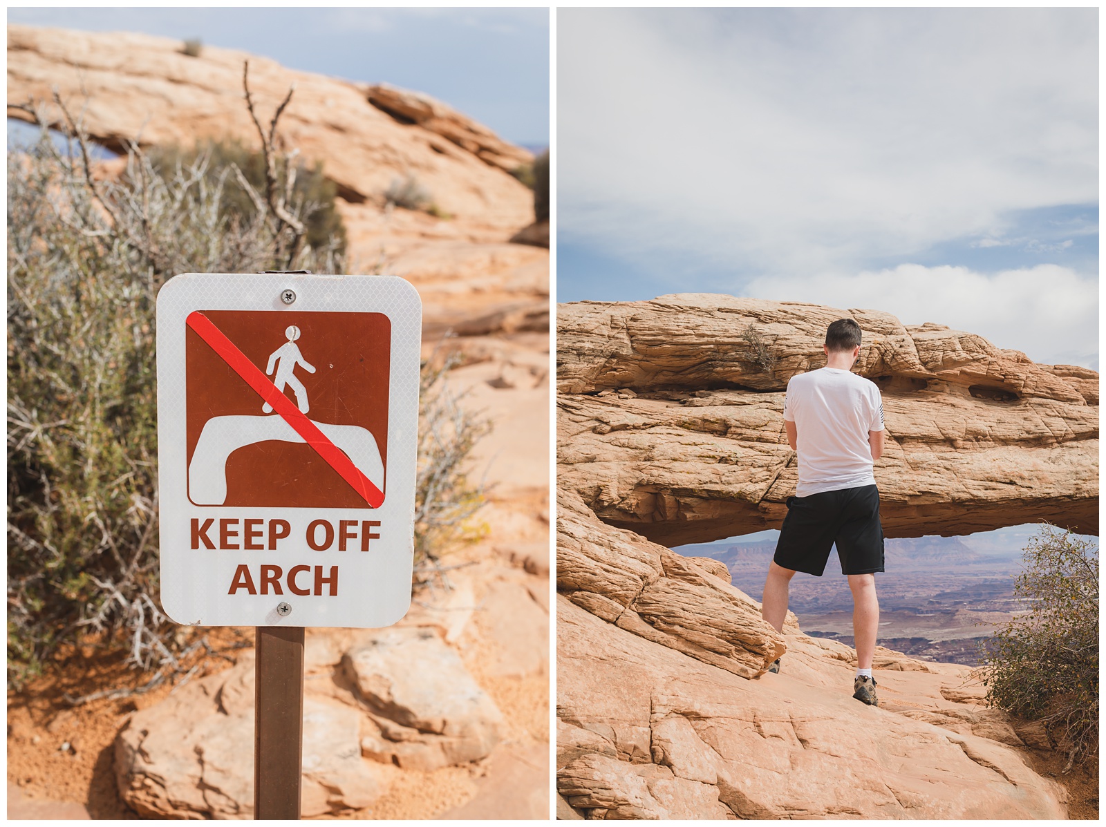
On our way back out of the park, we stopped at Mesa Arch — probably Canyonland’s most famous sight. Photographers arrive before the crack of dawn and crowd shoulder-to-shoulder in front of the arch to get a shot of the sun rising in its window. I’ll admit I contemplated whether it was worth driving through the middle of the night to attempt that iconic photo, but I ultimately decided just to settle for whatever images we could get there at a less ungodly hour!
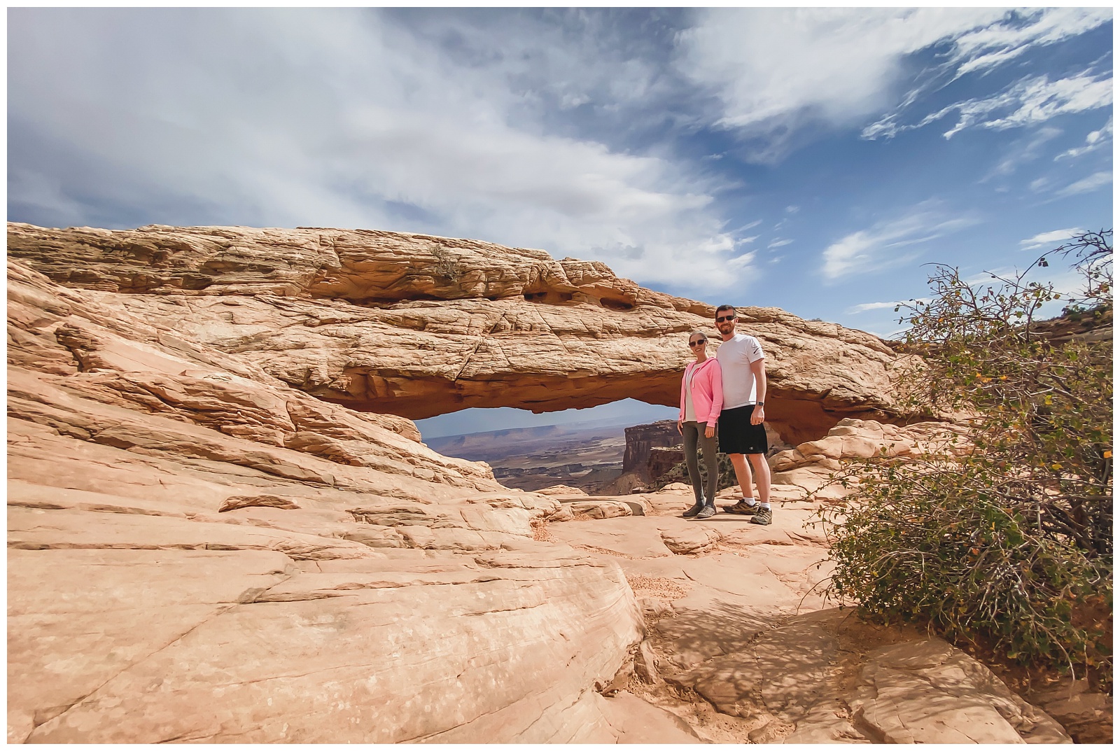
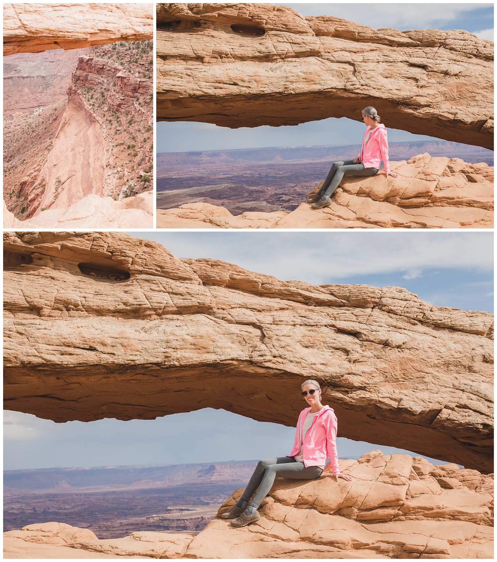 Smiling despite the sheer drop-off just on the other side of my seat!
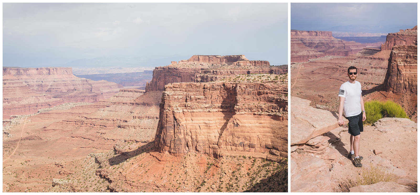
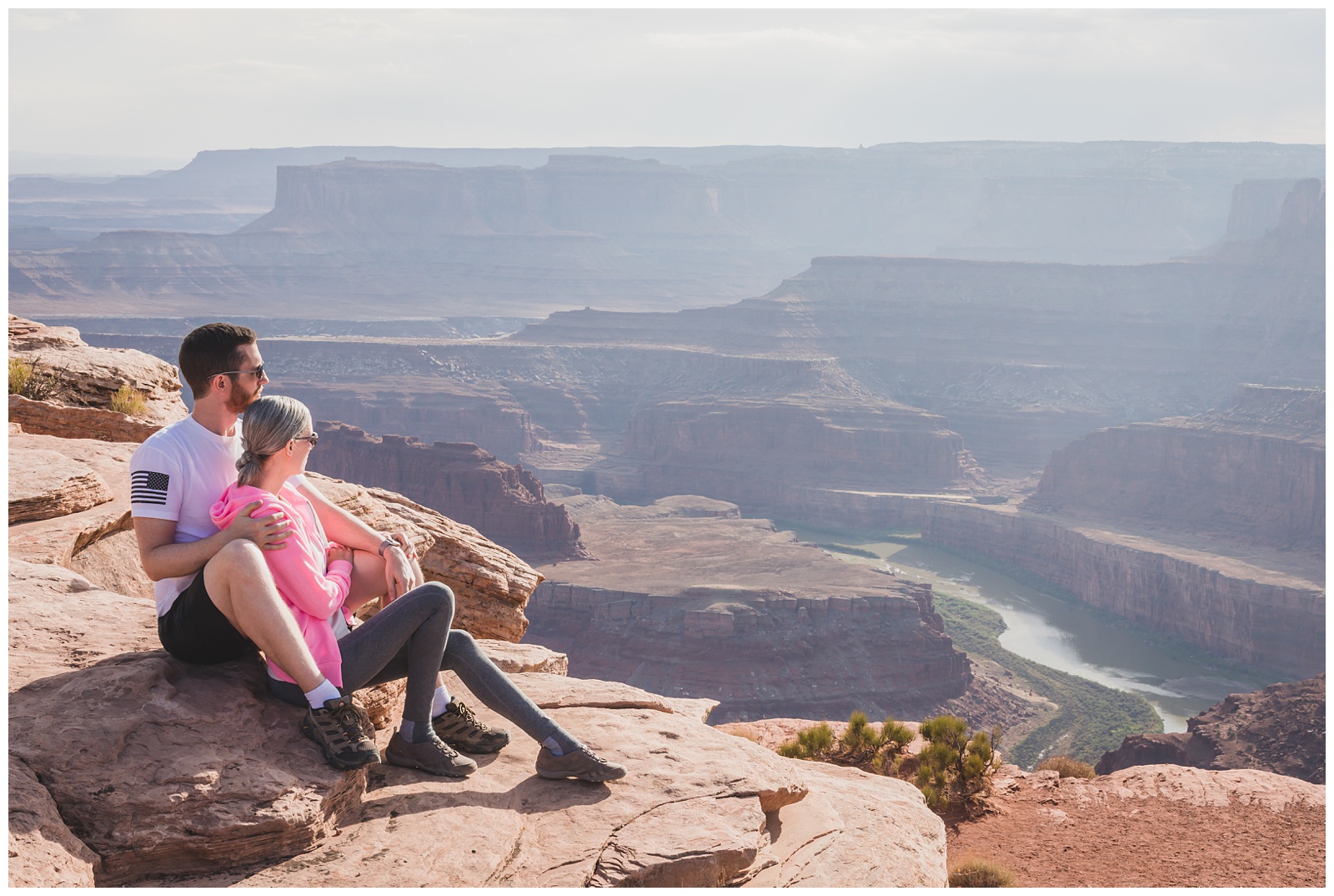
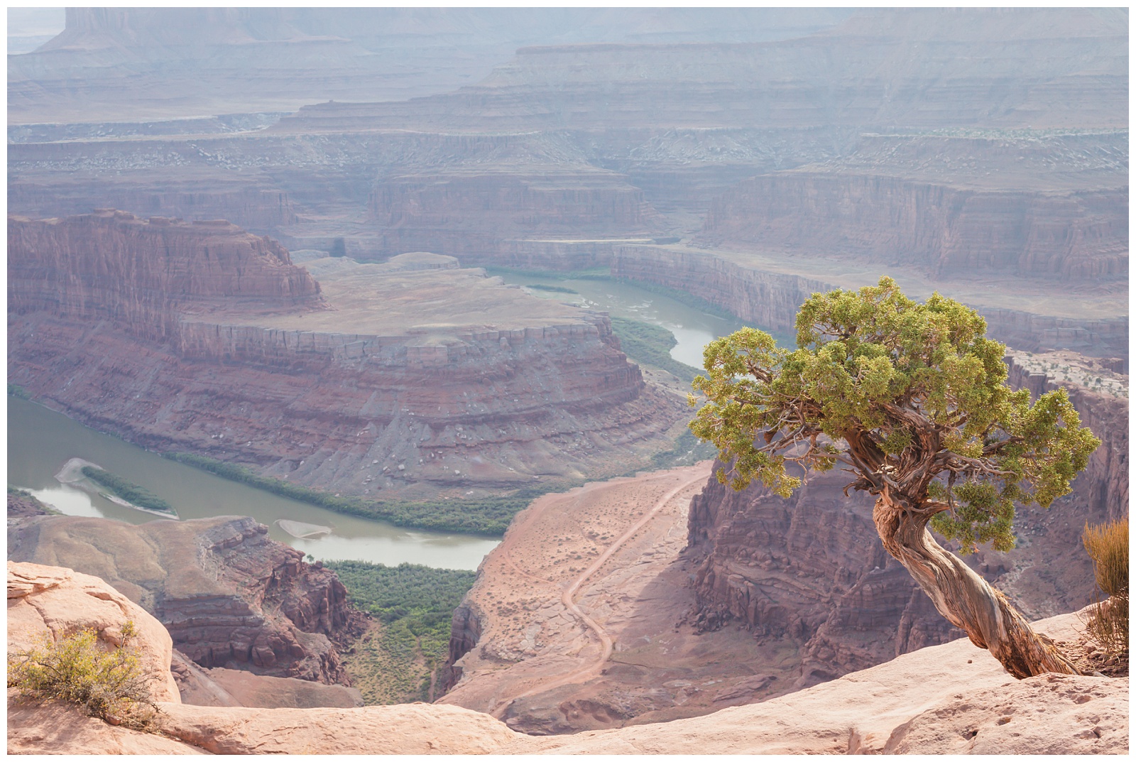
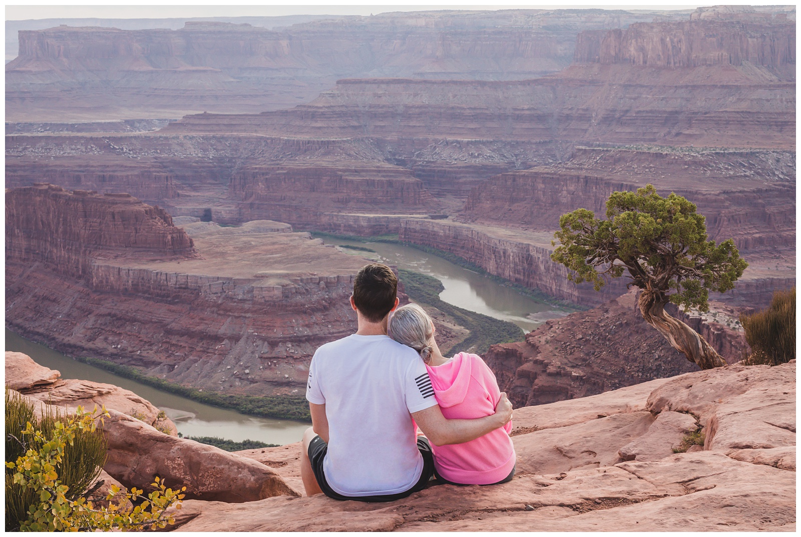
Shafer Canyon Overlook — our last stop in Canyonlands before driving to nearby Dead Horse Point State Park.
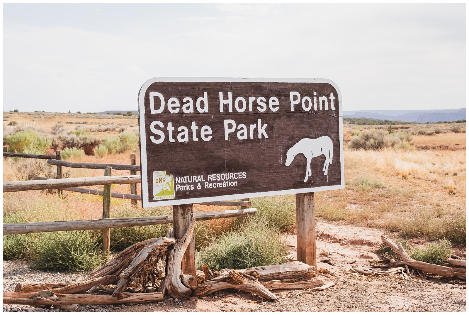 Dead Horse Point is a peninsula of rock atop sheer sandstone cliffs. It’s connected to the mesa by a narrow strip of land called the neck. According to legend, the point was at one time used as a corral for wild mustangs roaming the mesa top. Cowboys rounded up these horses, herding them across the narrow neck of land and onto the point. The neck, which is only 30 yards wide, was then fenced off with branches and brush. This created a natural corral surrounded by precipitous cliffs straight down on all sides, affording no escape. Cowboys then chose the horses they wanted and let the others go free. But one time, sadly and for some unknown reason, horses were left corralled on the waterless point, where they died of thirst within view of the Colorado River. {Source: Utah State Parks}
(It’s a pretty awful story, but I figured it was worth including an explanation as to how the park got its unusual name!)
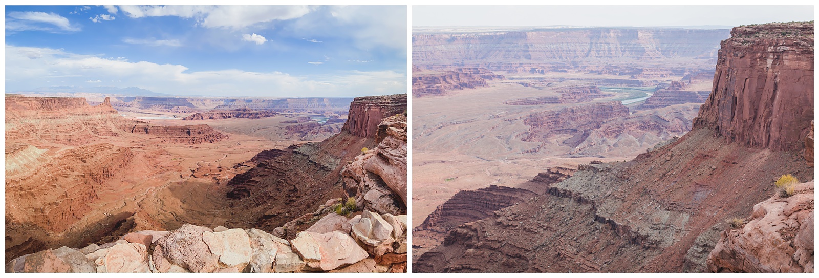
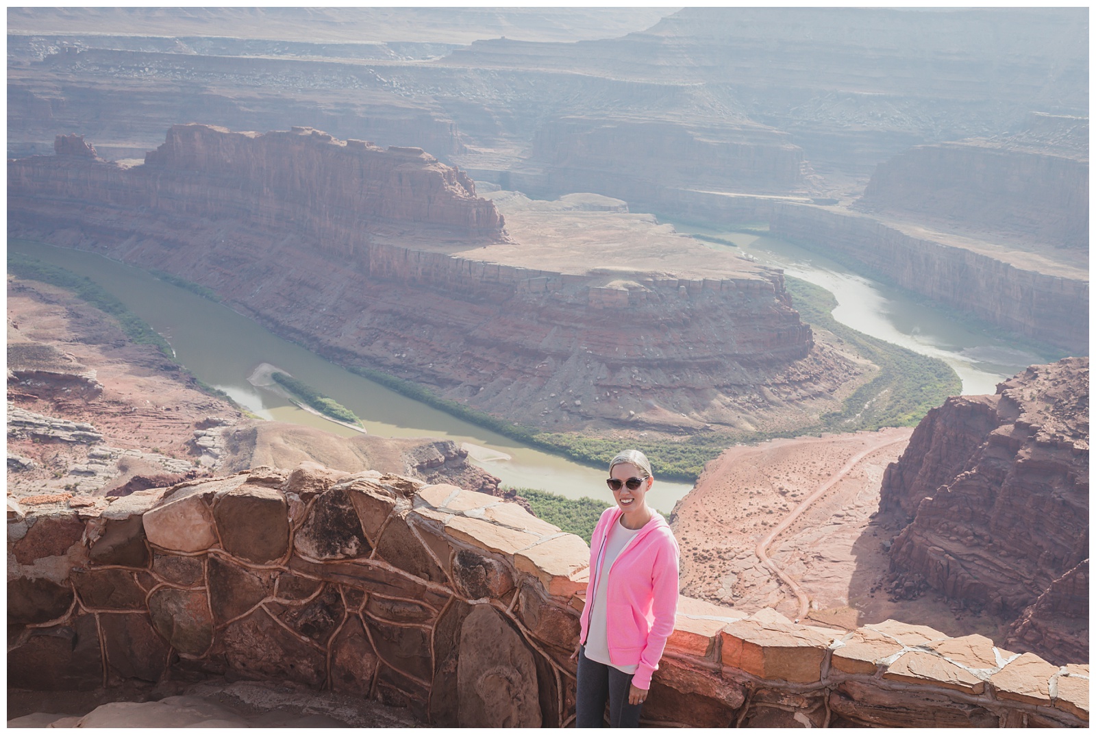
Dead Horse Point — the namesake spot in the park, 2,000 feet above a gooseneck in the Colorado River.
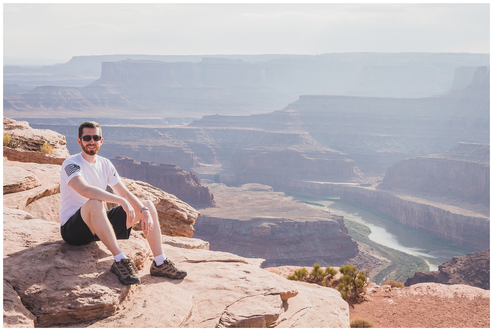
 This was the last addition to our trip itinerary but ended up being our favorite sight that day!
We have photos of us in this pose in the mountains, at the ocean and now in the desert. ☺️
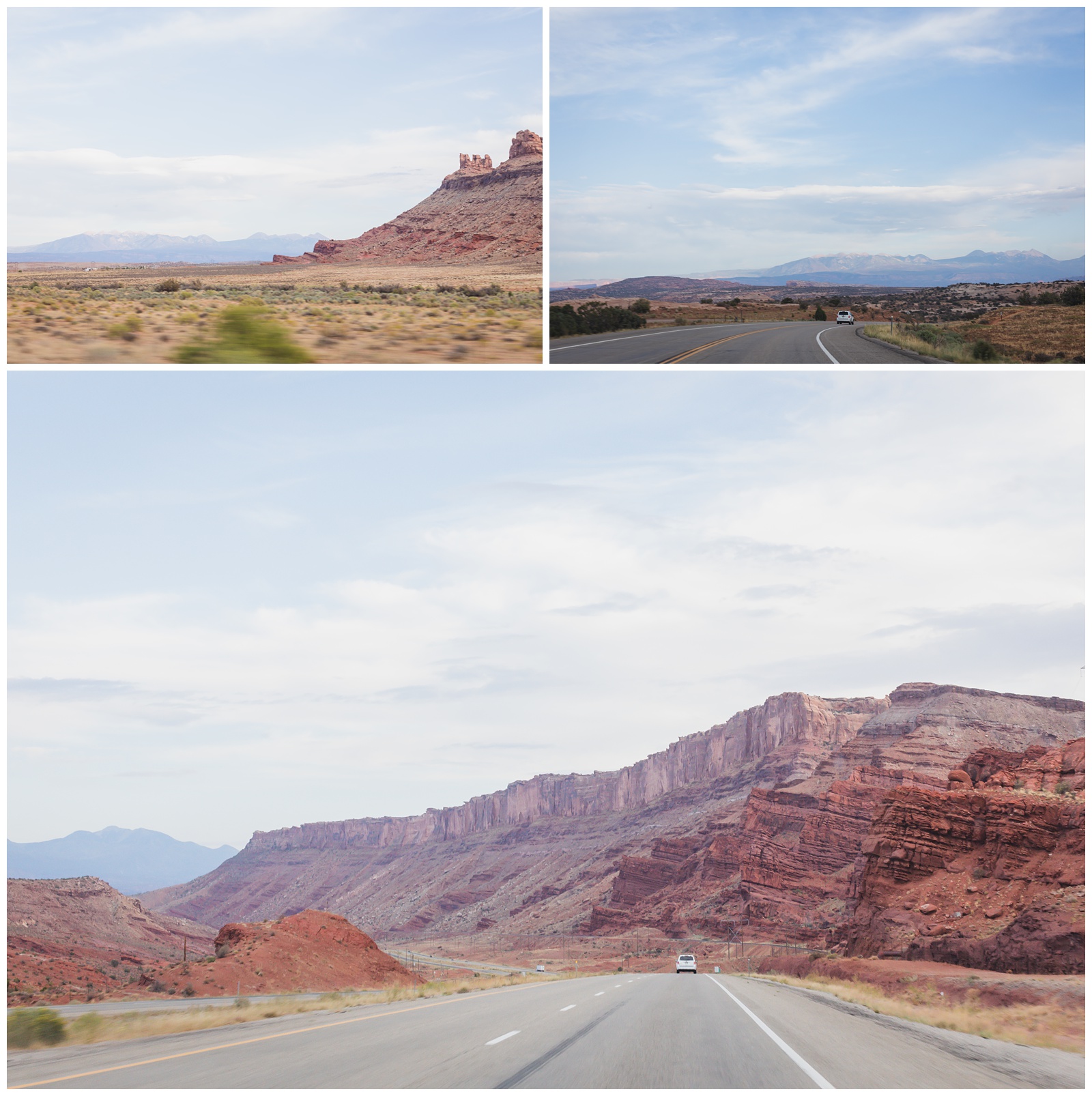
On the road to Moab.
day 13 • 09.23.20
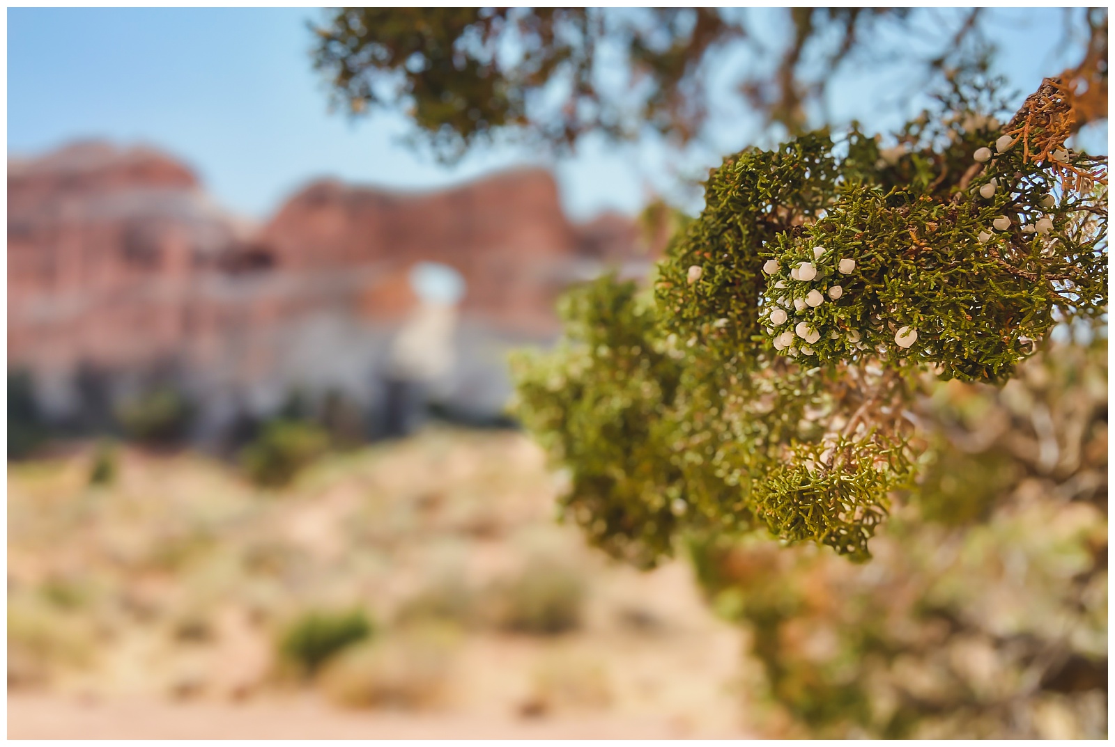
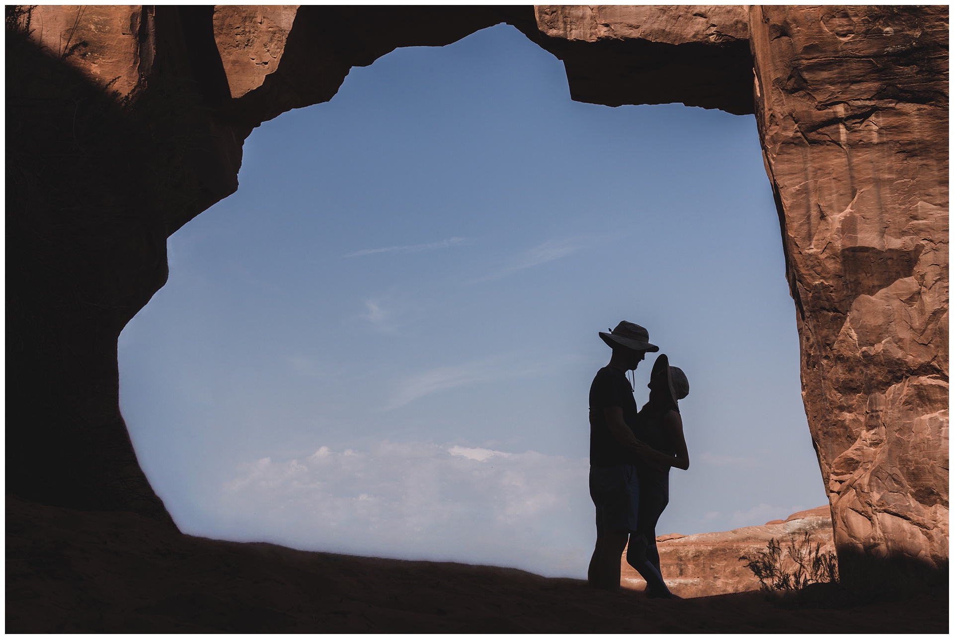
Arches National Park
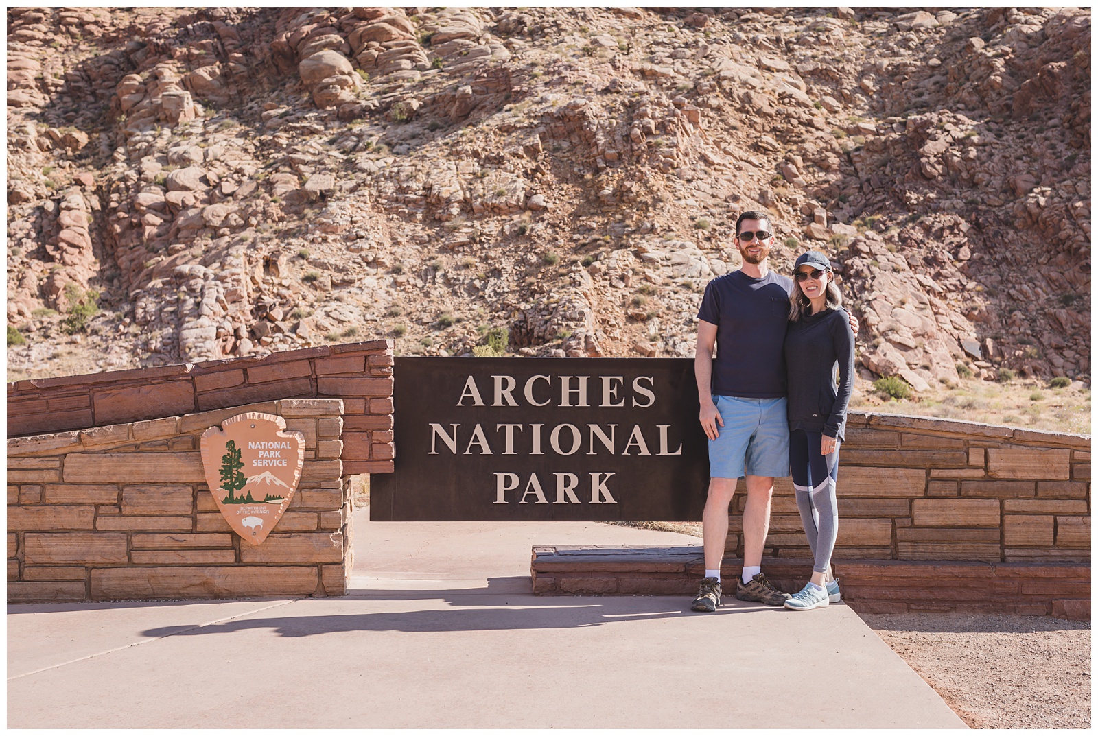
Arches has the densest concentration of natural stone arches in the world, with more than 2,000 documented in the park — ranging from sliver-thin cracks to spans greater than 300 feet. {Source: National Park Service}
We visited Bryce Canyon and Zion National Parks in 2018, and after visiting Capitol Reef and Canyonlands the previous two days, only Arches remained as the last of Utah’s five National Parks left on our list!
La Sal Mountains
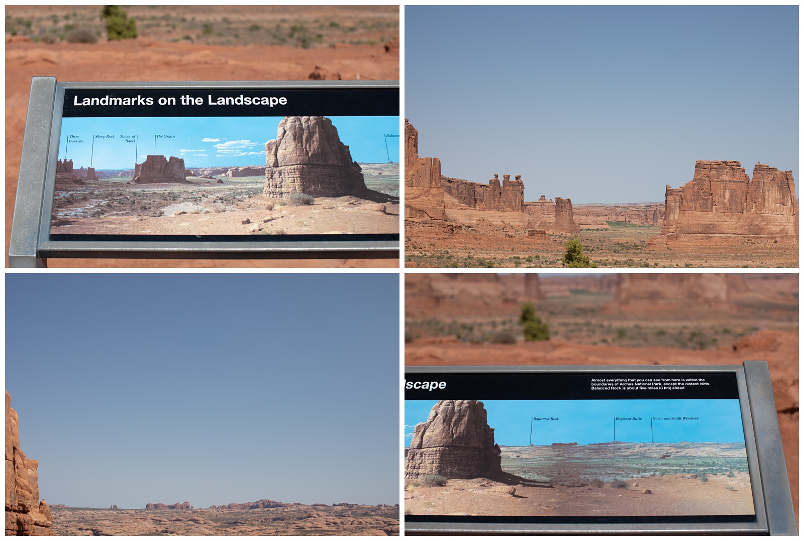
And many more landmarks!
Garden of Eden
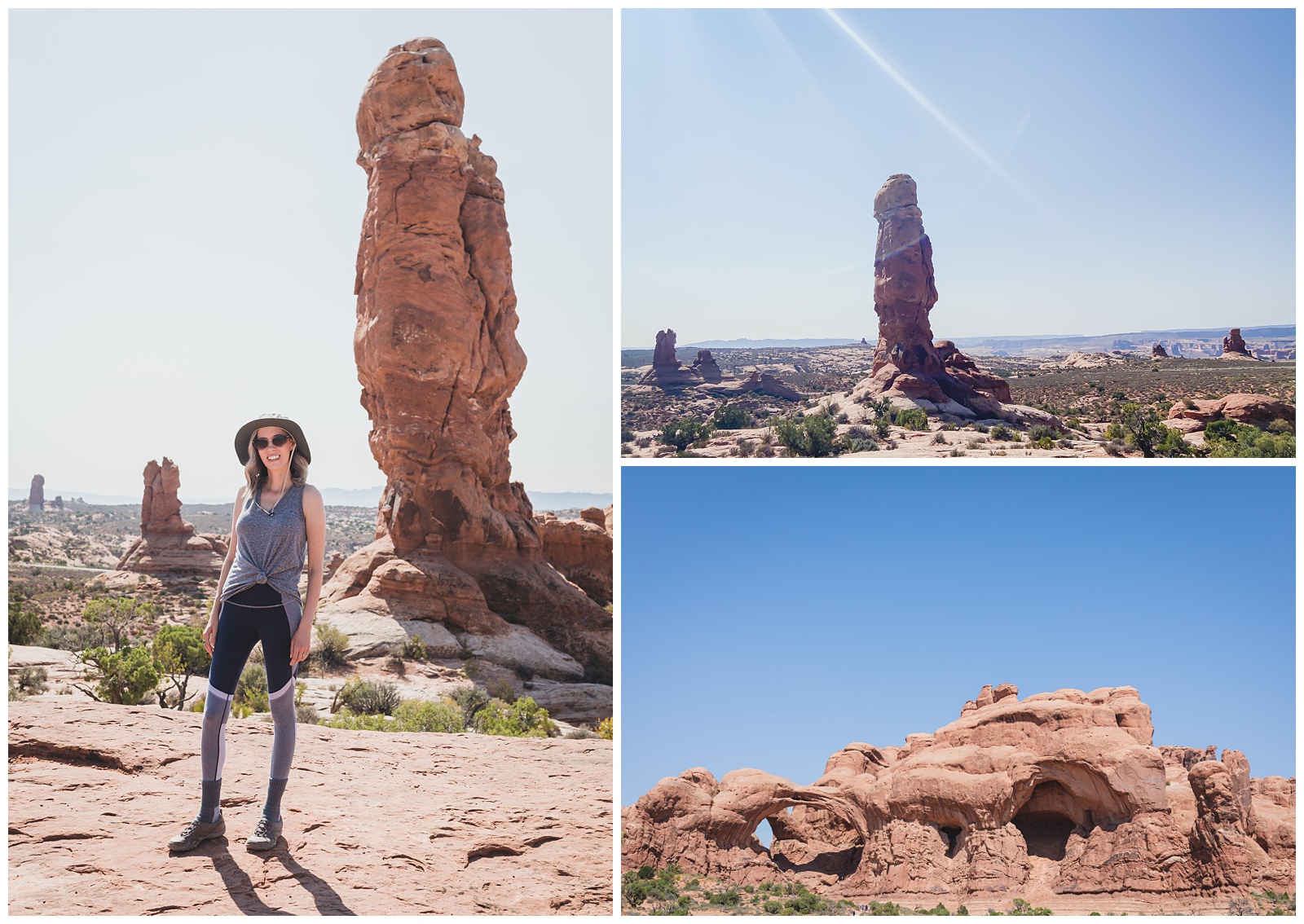
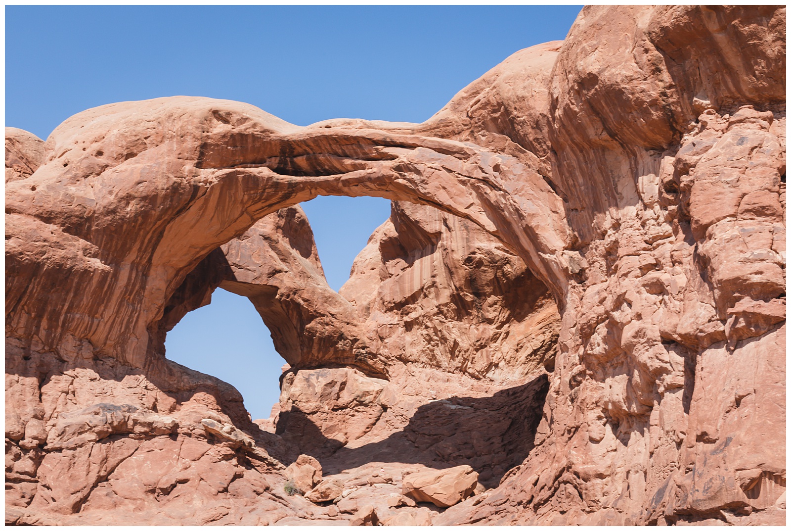 Double Arch
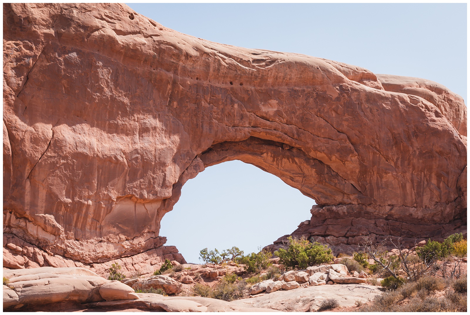
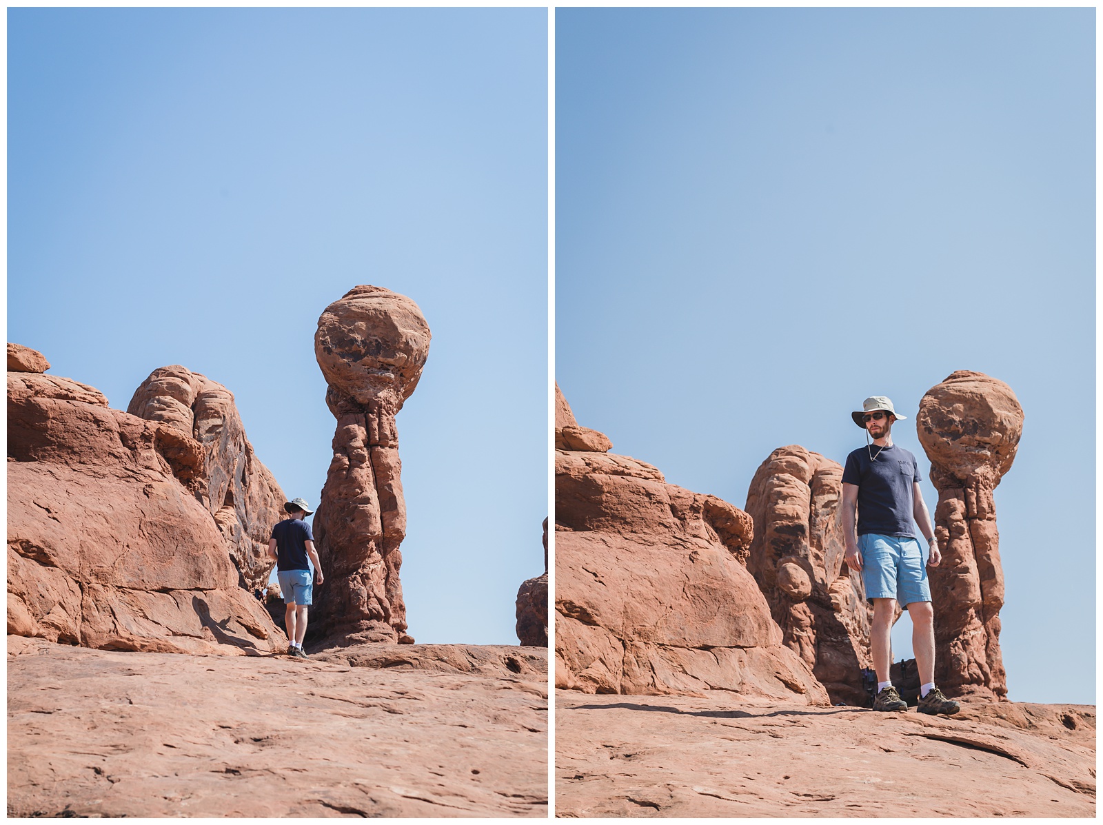
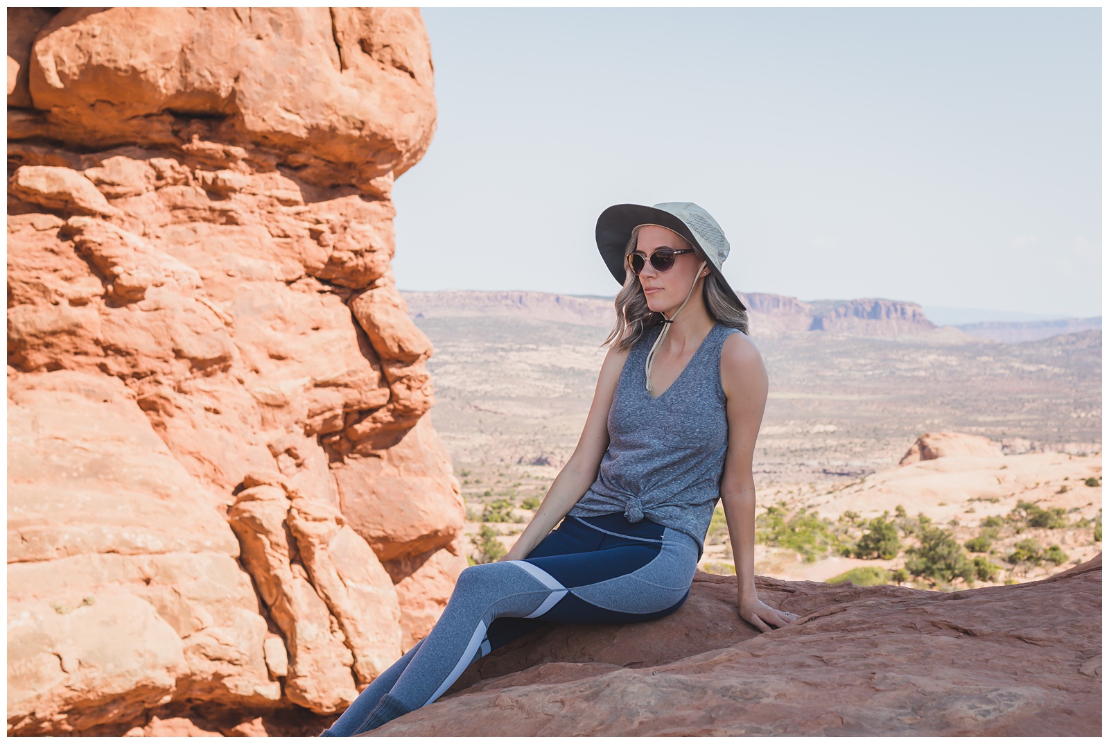
North Window (And below, me sitting in its shade — a nice respite on the hottest day of our trip.)
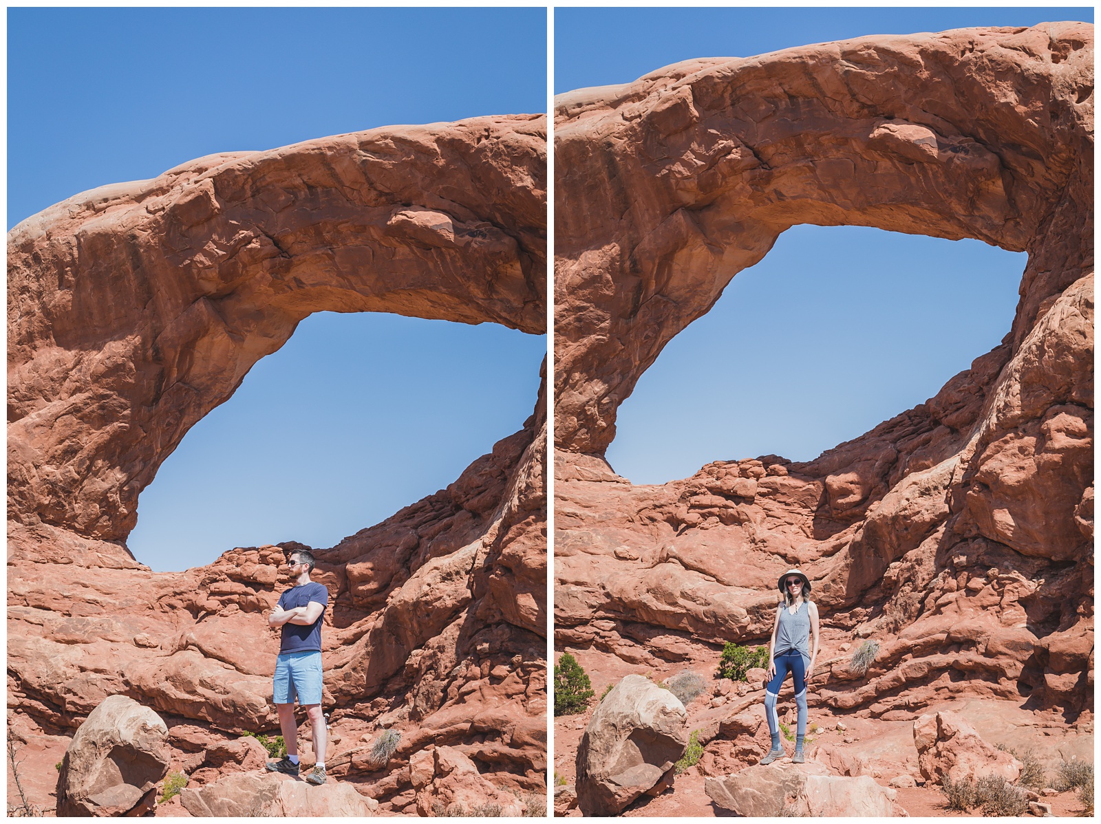 South Window
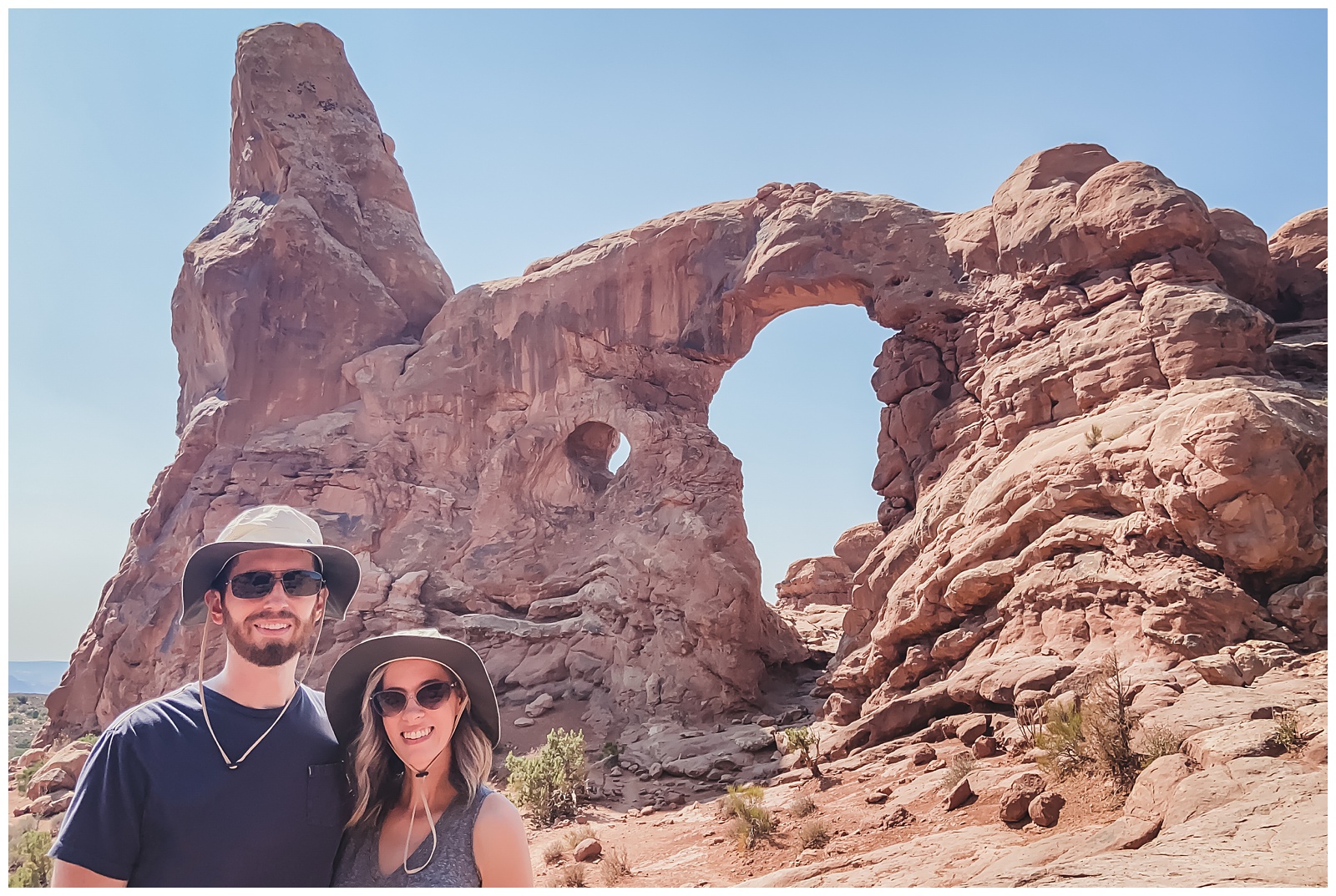
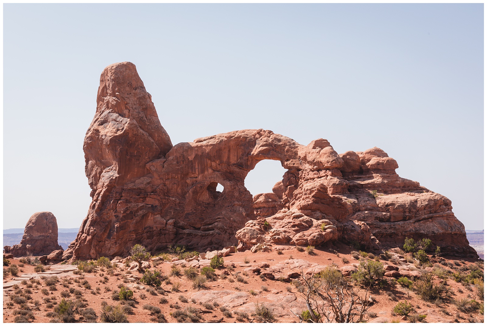 Turret Arch
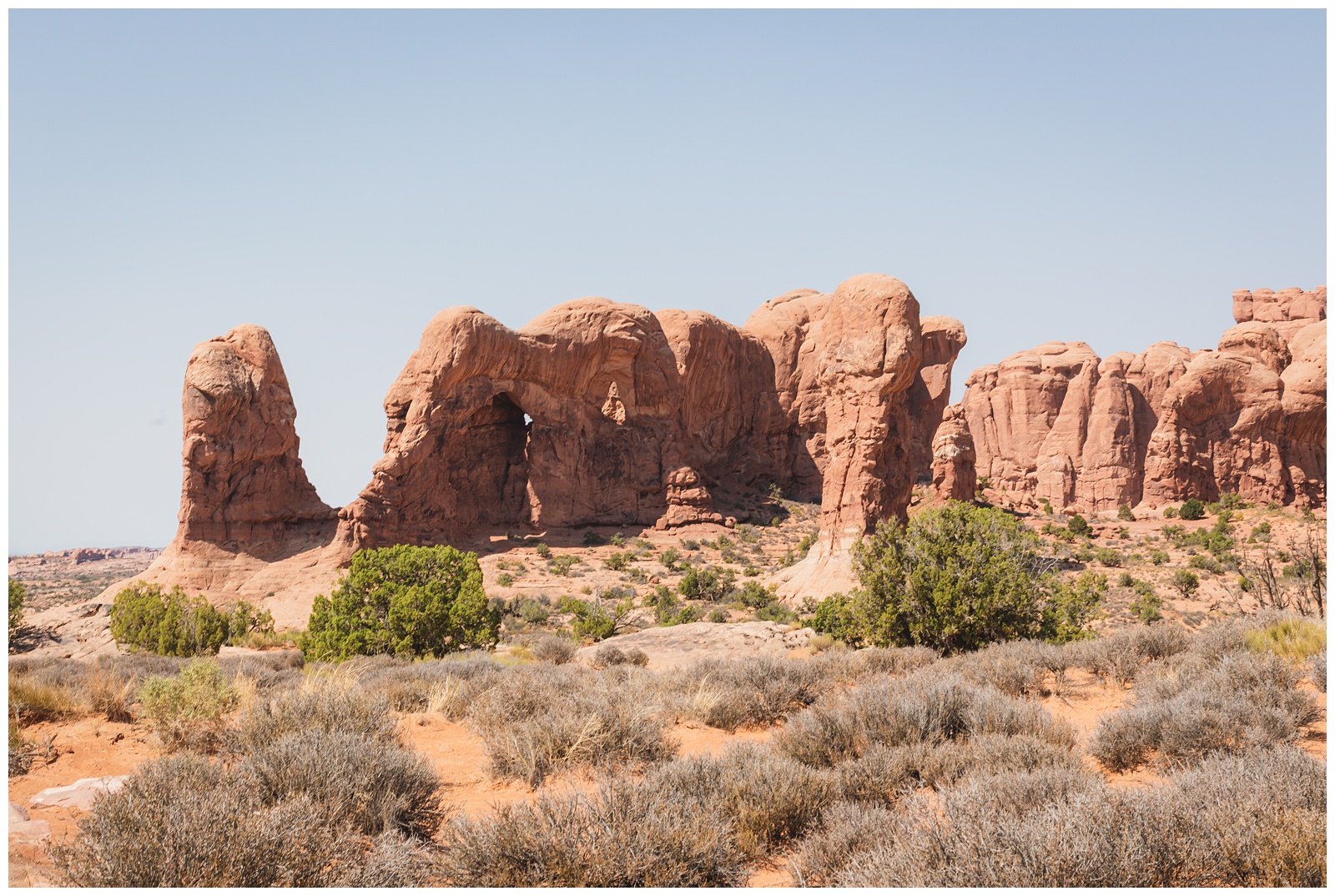 Parade of Elephants
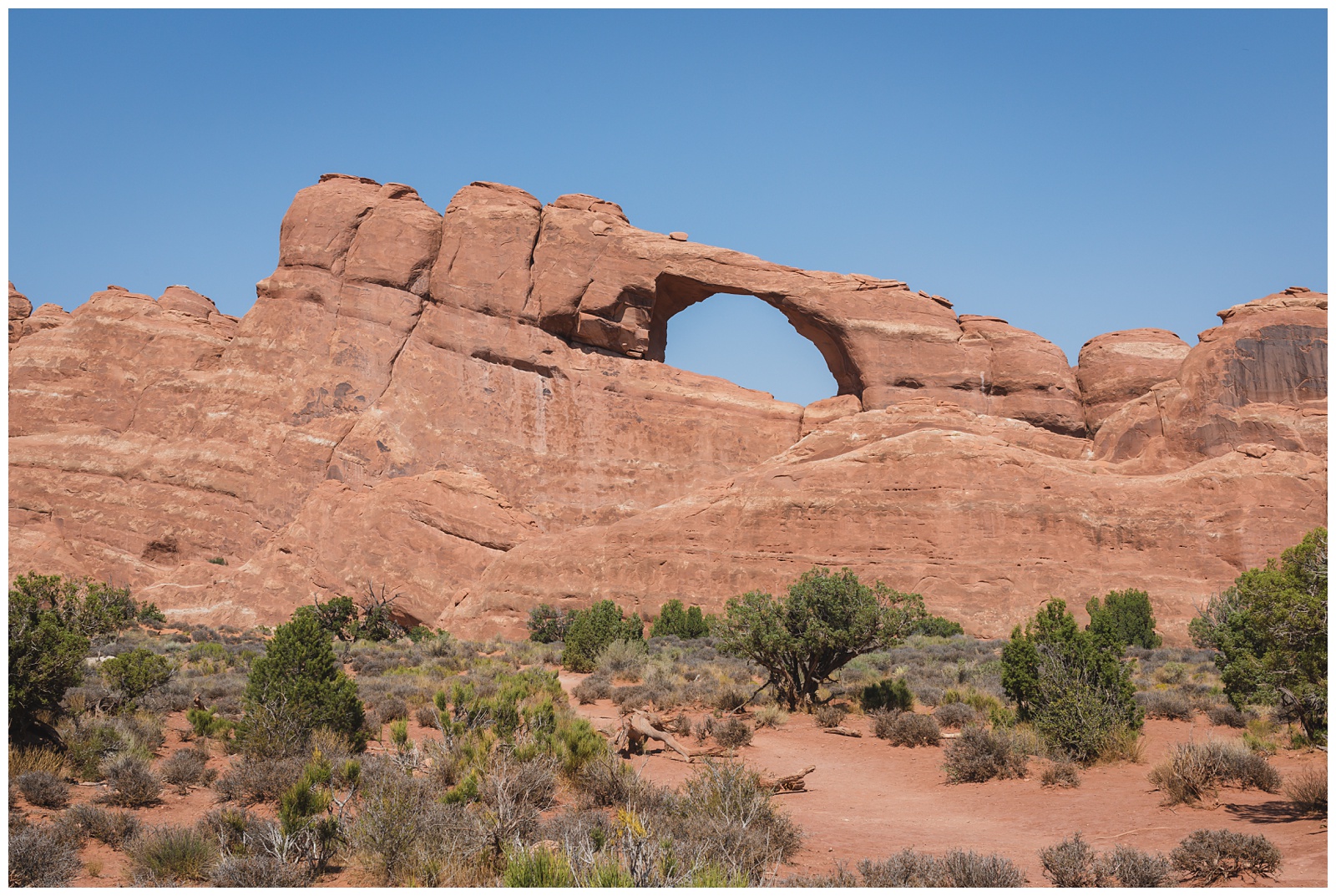
Skyline Arch
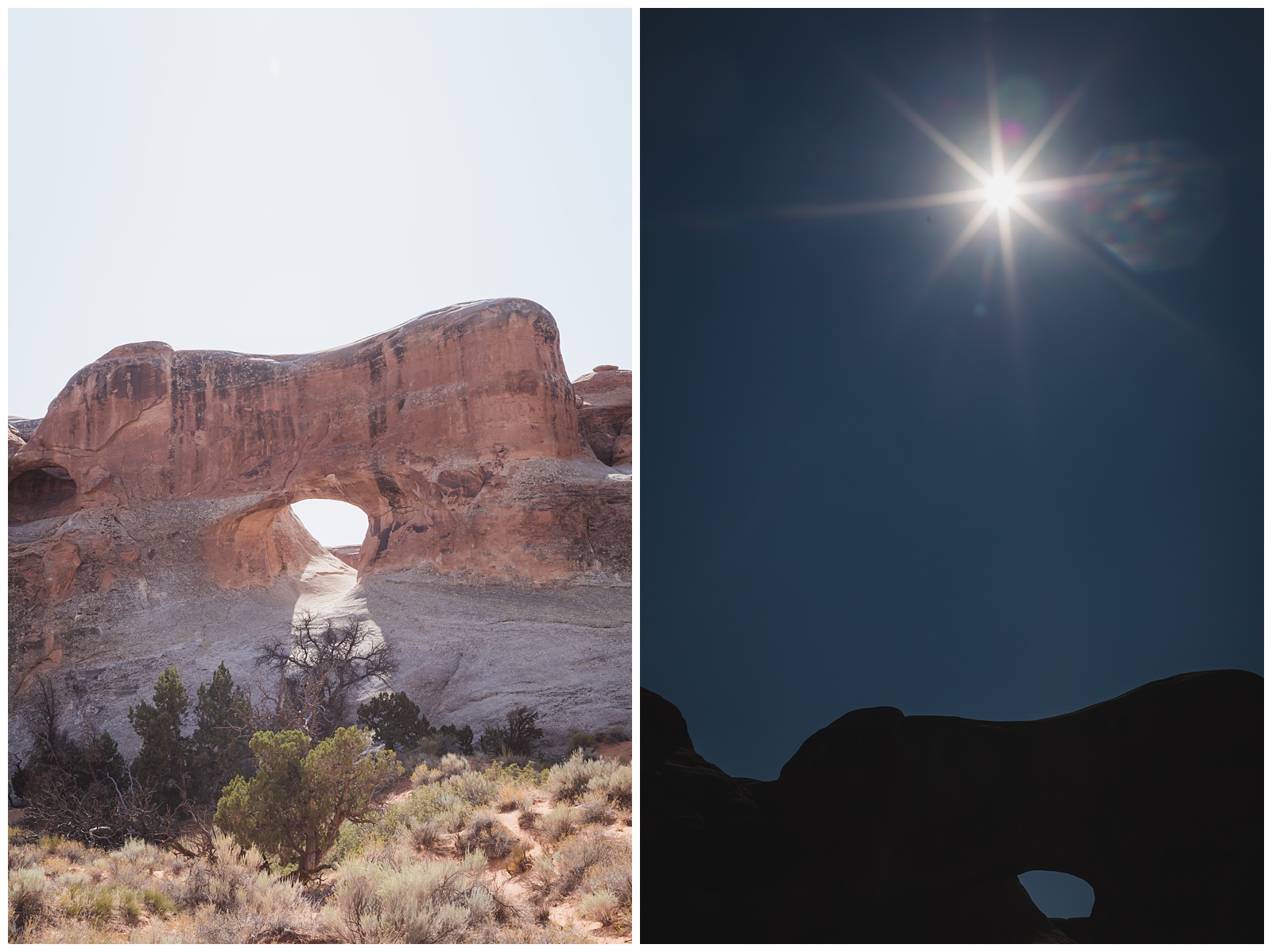
Tunnel Arch, via the Devils Garden Trail.
A silhouette shot at Pine Tree Arch, a little farther down the trail.
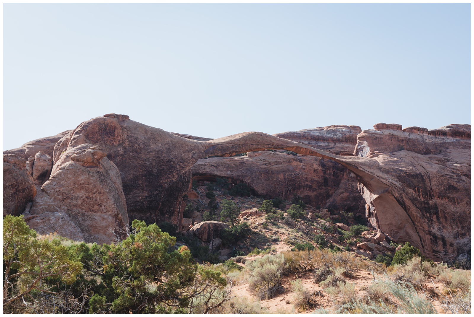 And finally Landscape Arch, our last stop on this particular hike before getting to the day’s main event …
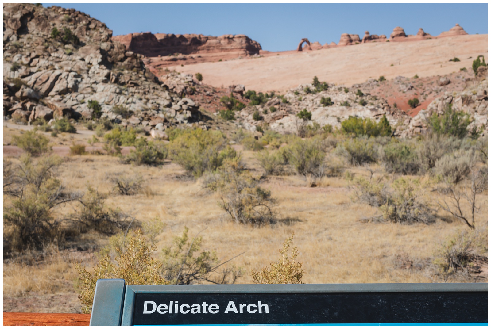
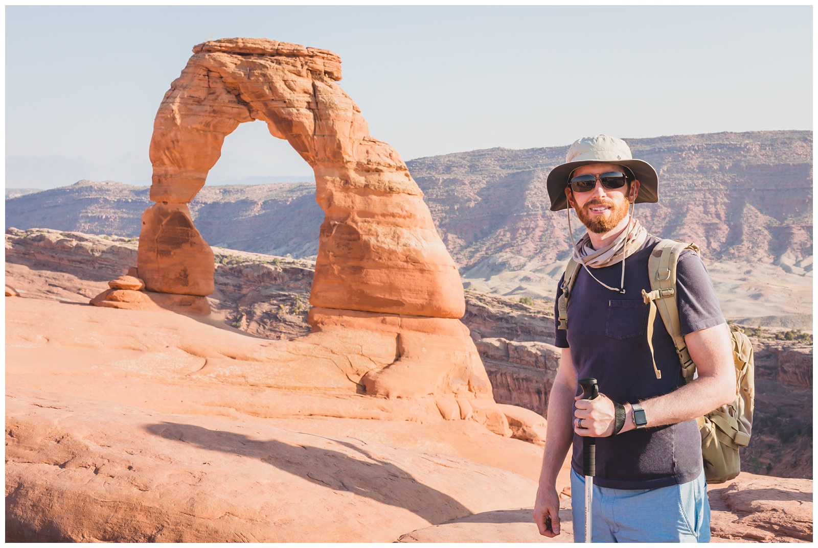
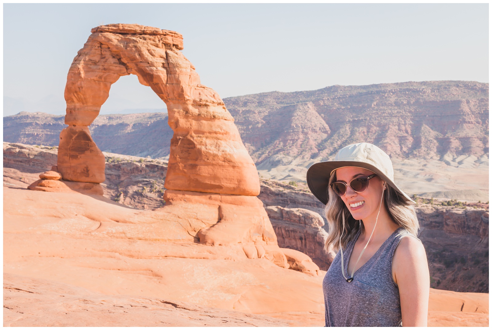
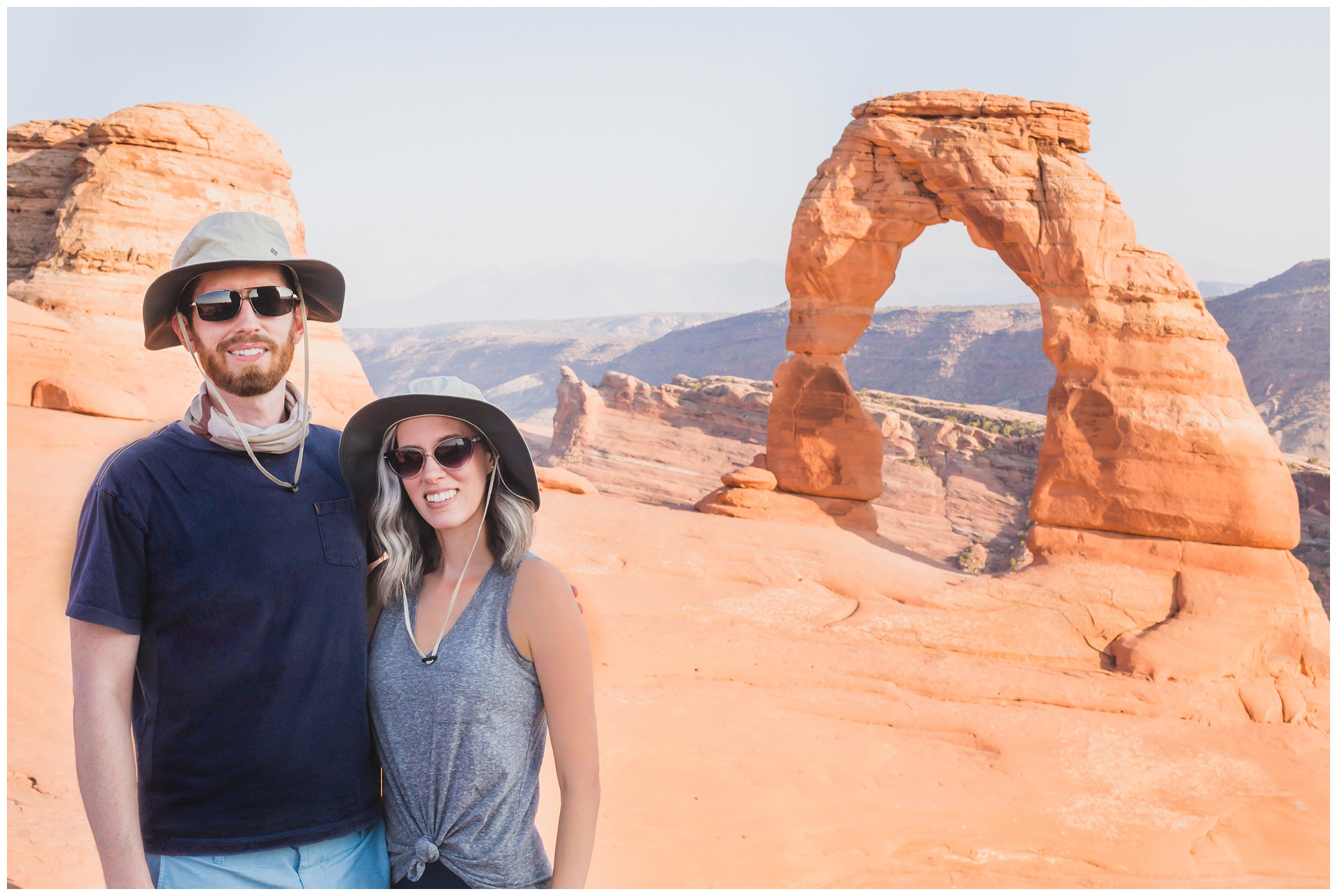
Delicate Arch! We stopped to catch a distant glimpse of it from Delicate Arch Viewpoint before starting the hike to its base.
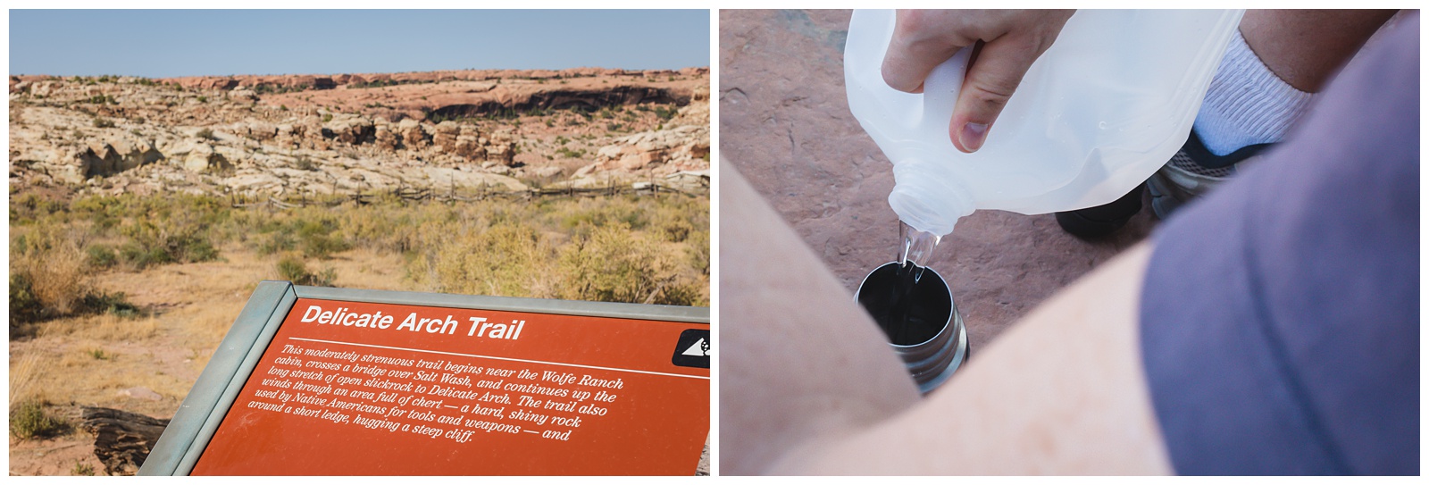
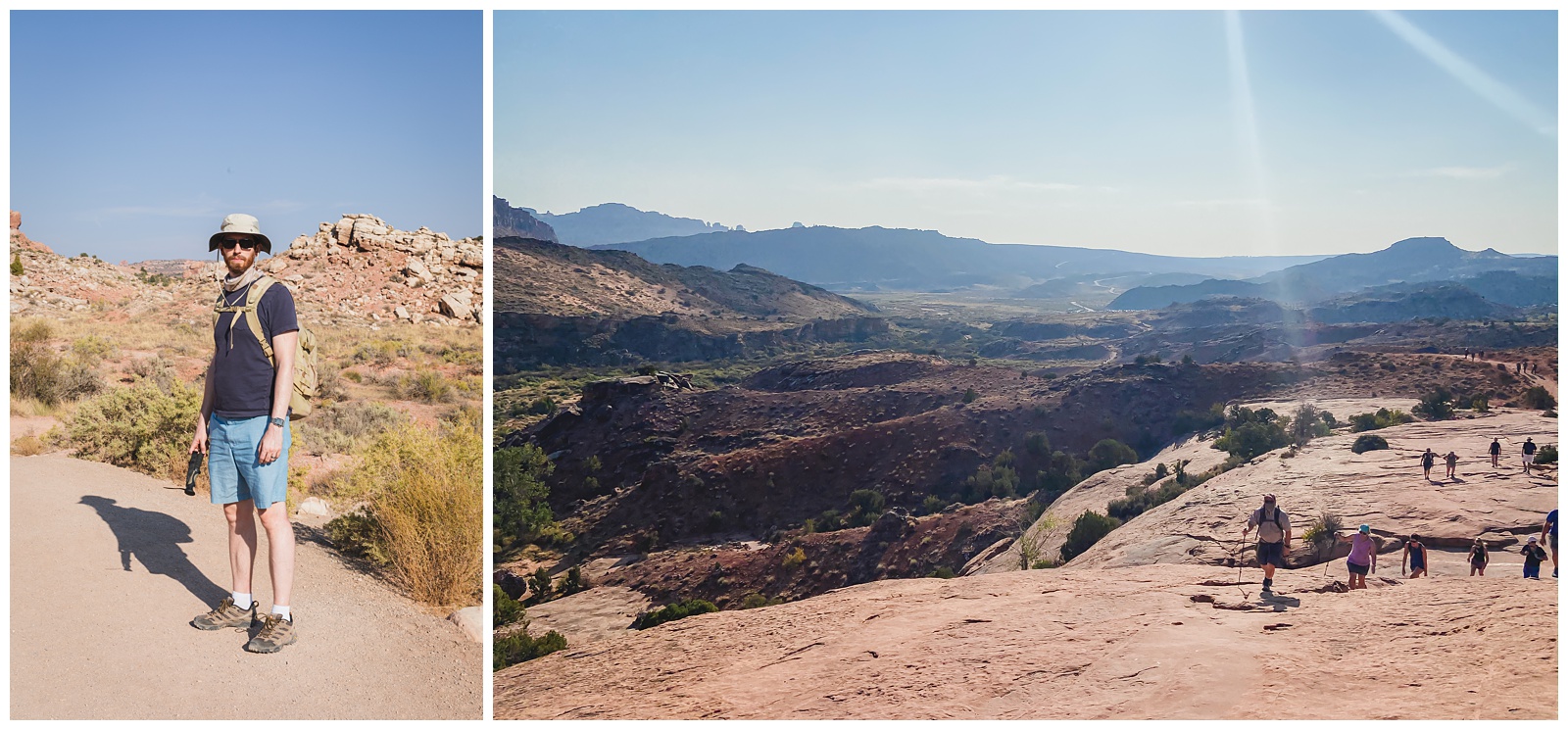
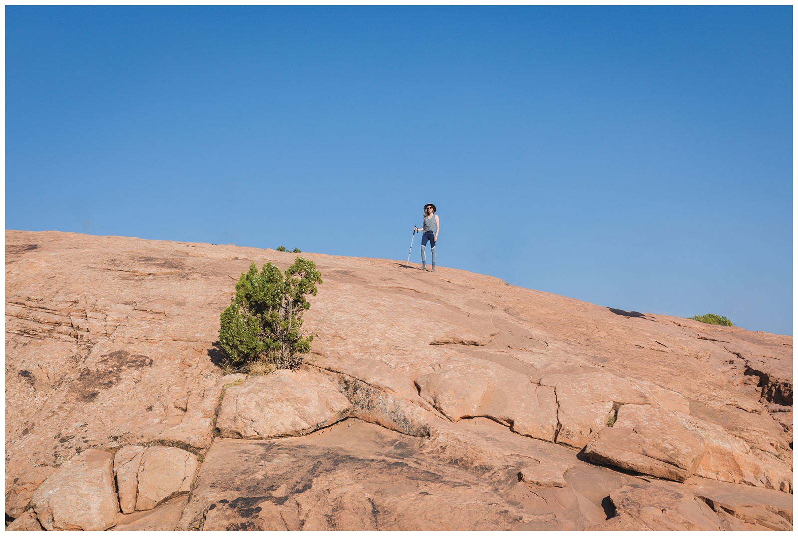
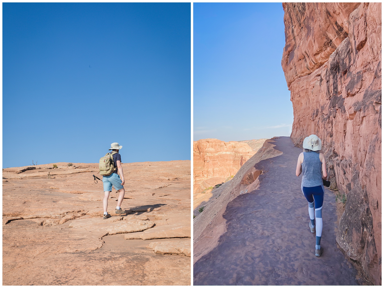
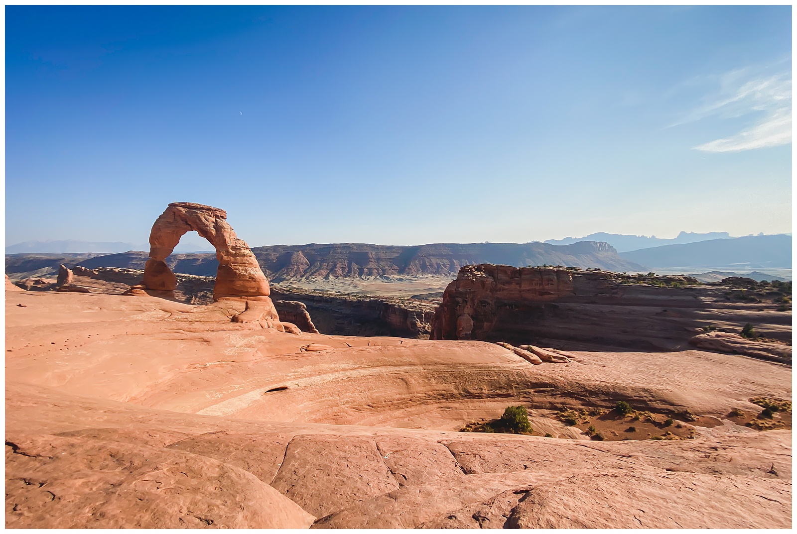 Our view upon rounding that bend! The arch was just as impressive in person as in every photo I’d seen of it, especially with golden hour arriving.
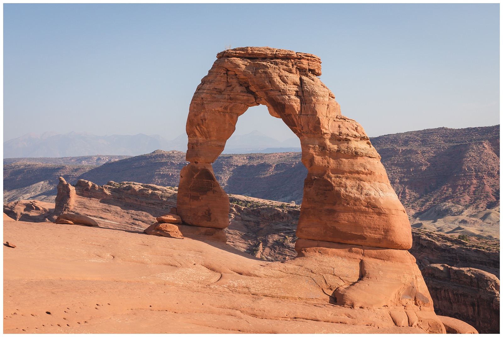 Delicate Arch is the most famous and recognizable in the park, which made it a perfect last sight to see at the last Utah park on our list!
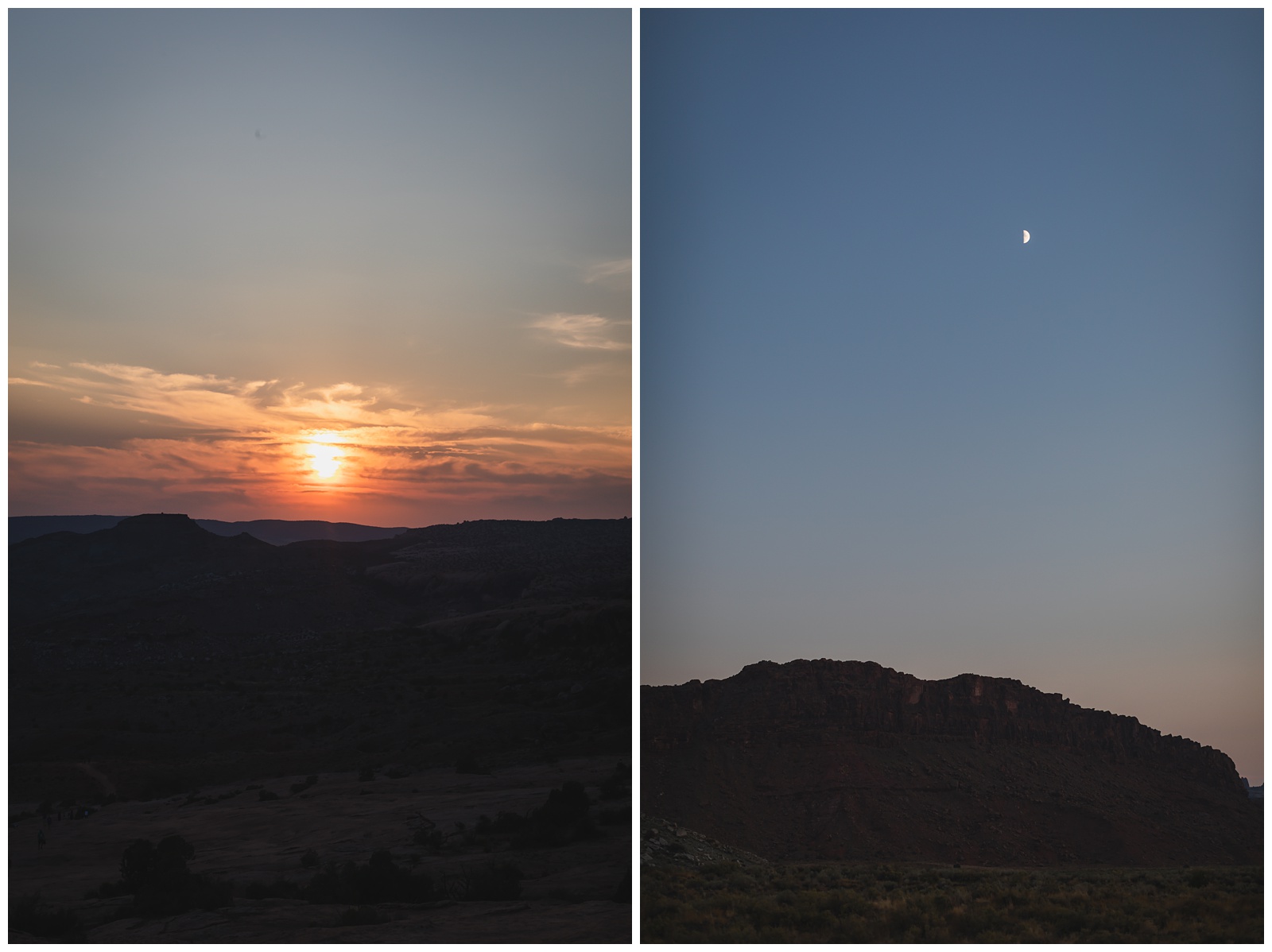
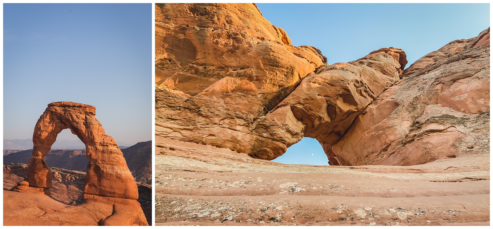 Twisted Donut Arch, at right, is great for getting a framing shot of Delicate Arch. We opted not to scale that wall to get to it but did use it for a cool moon-framing photo on our hike back down to the trailhead.
day 14 • 09.24.20
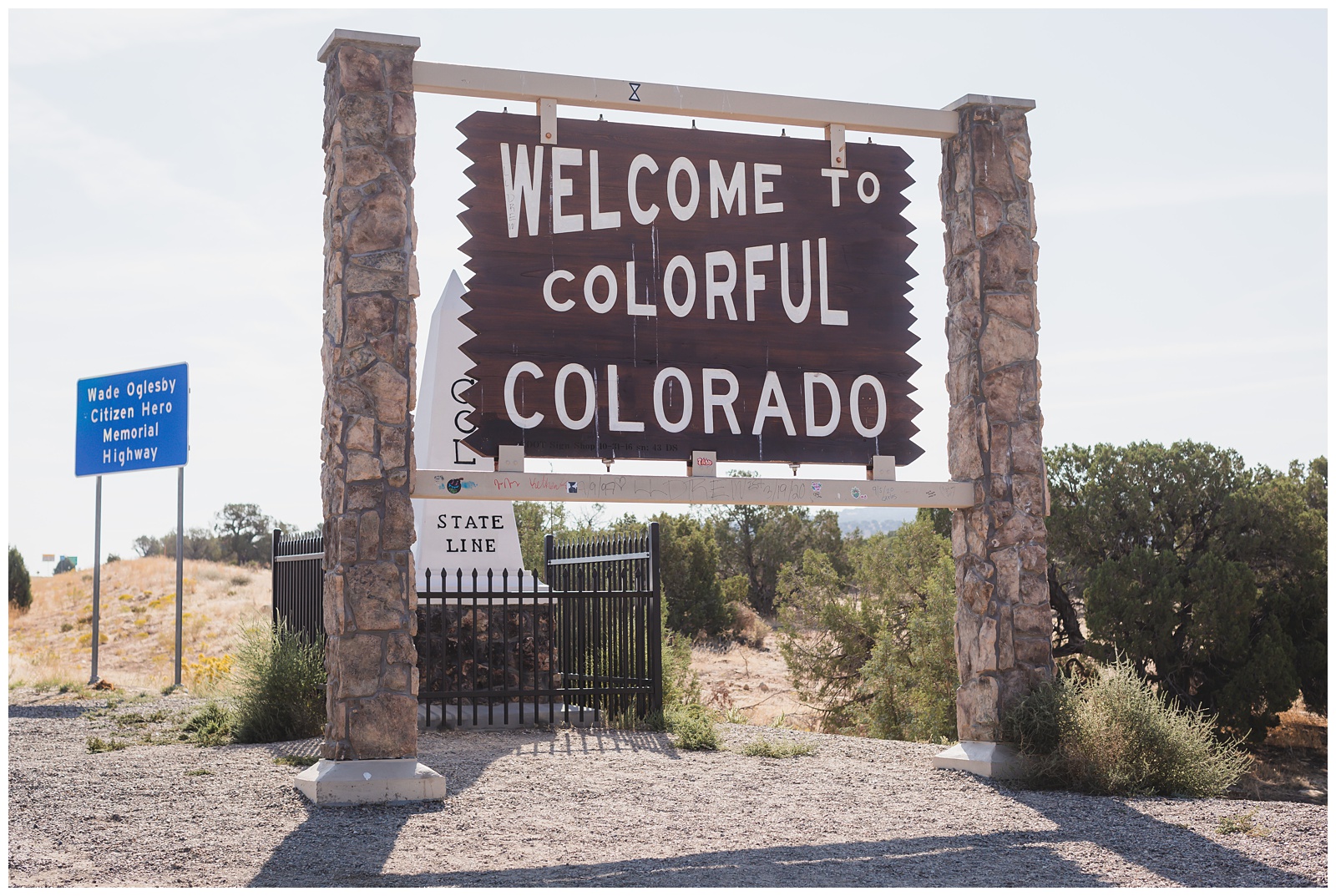
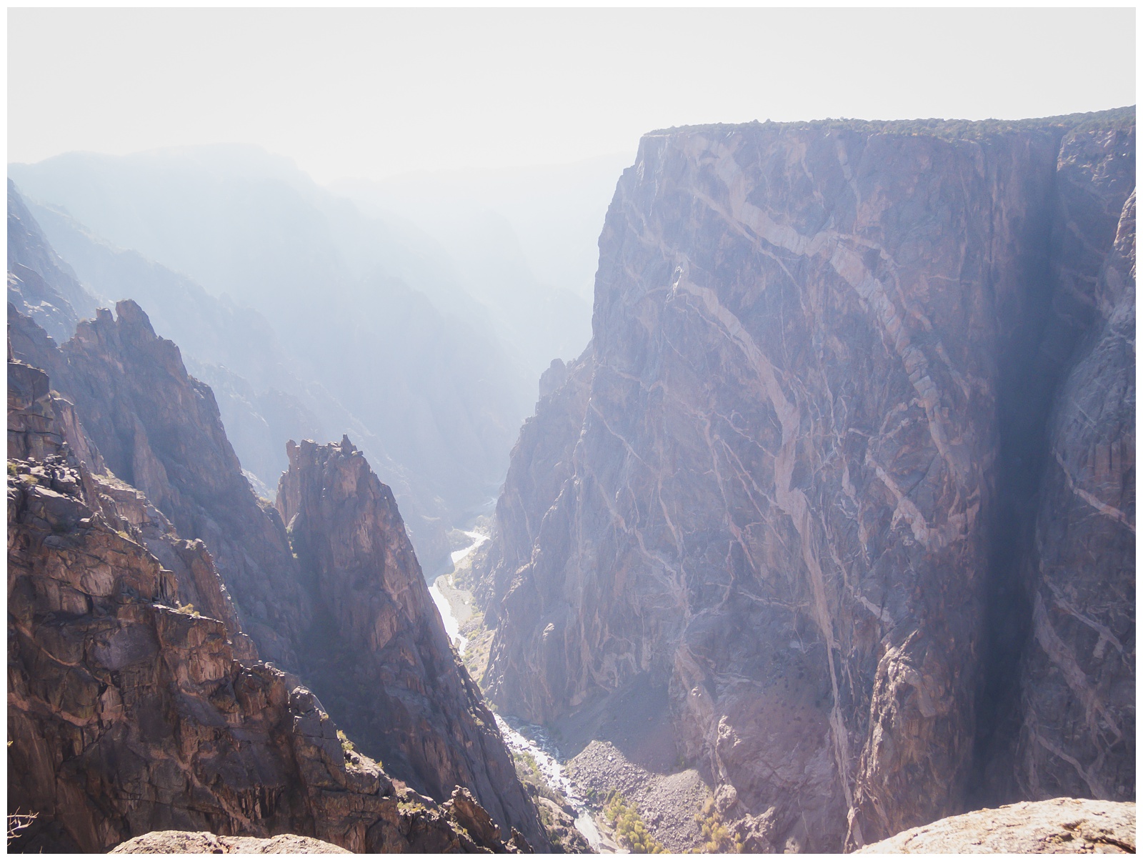
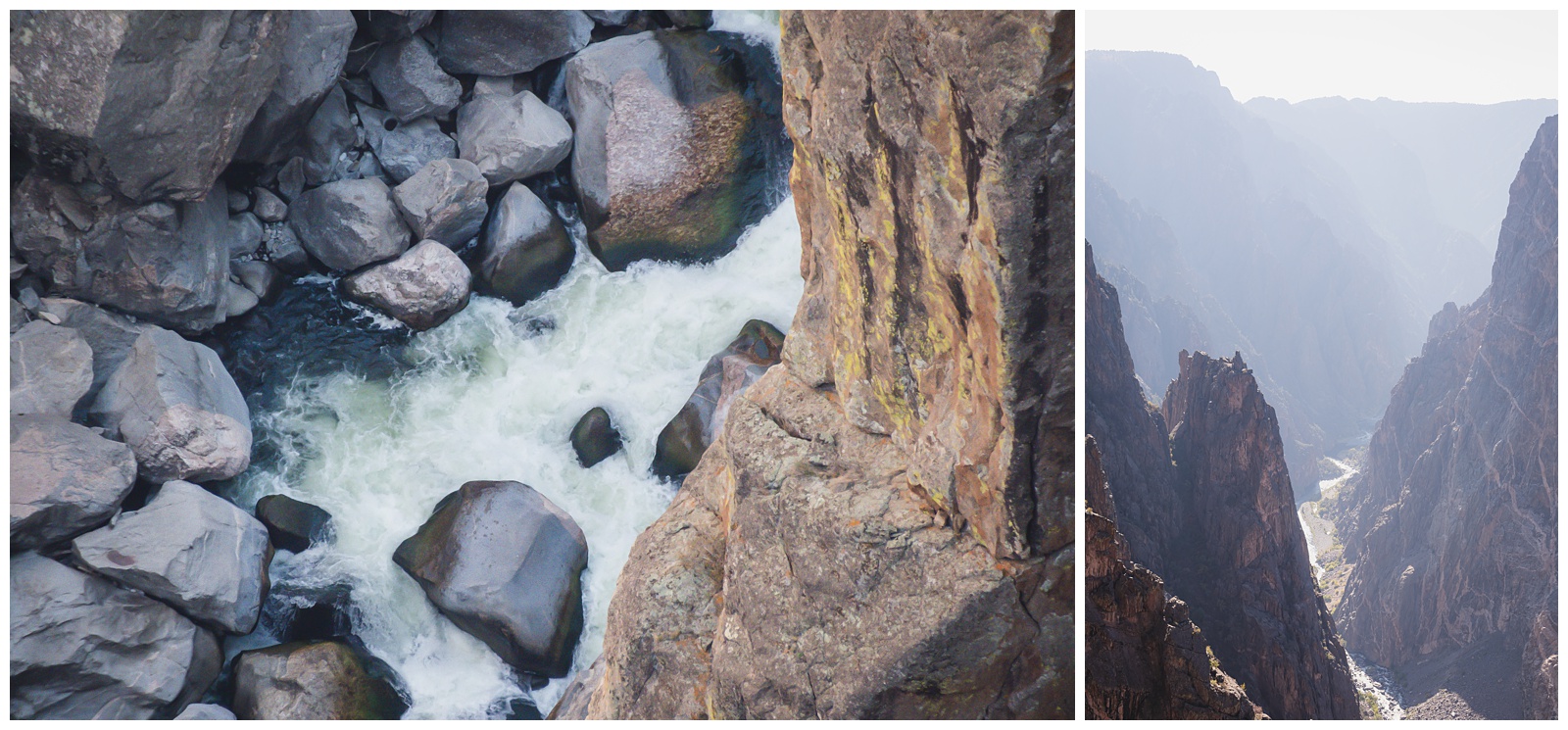
Moab, UT >>> Black Canyon of the Gunnison National Park >>> Alamosa, CO
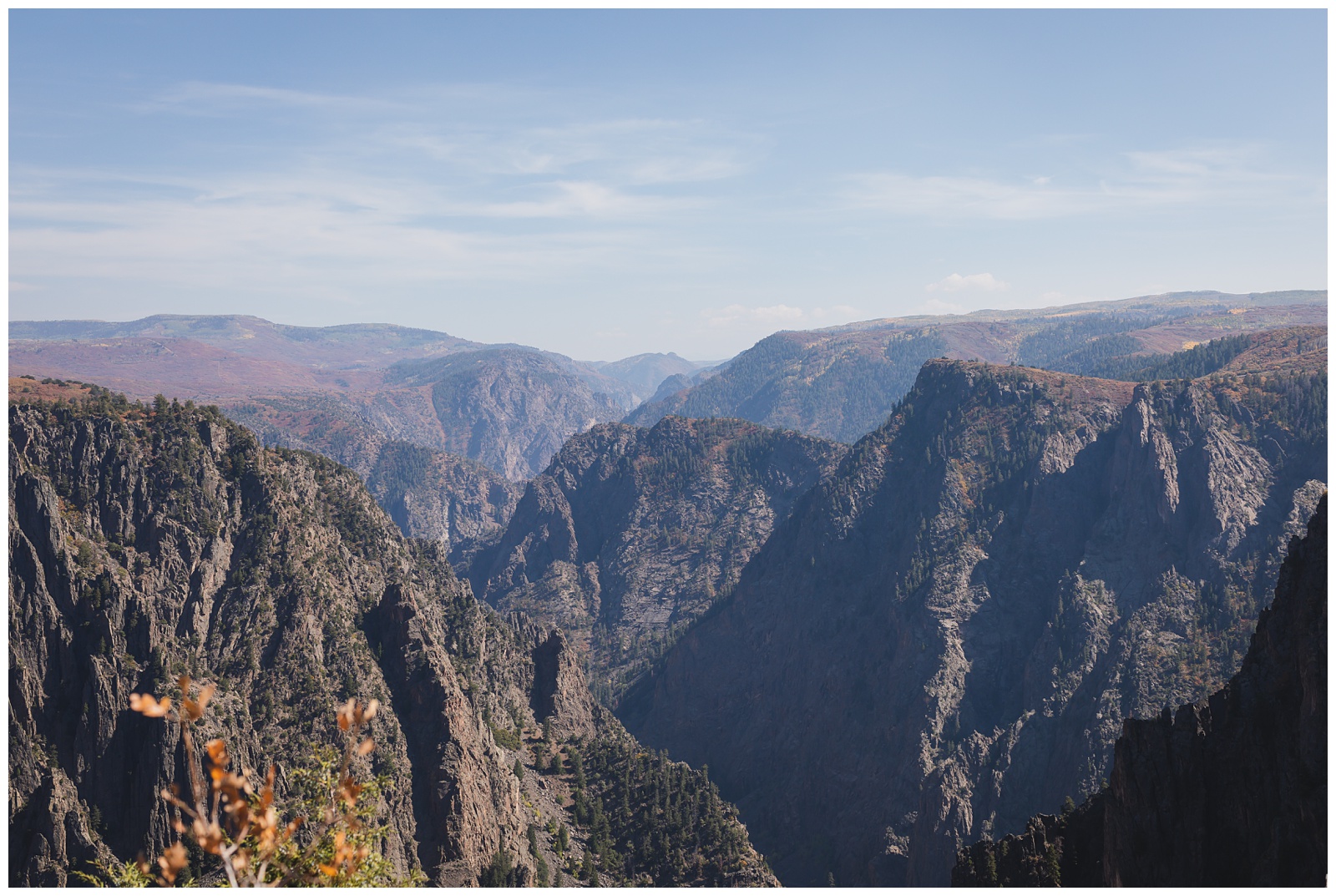
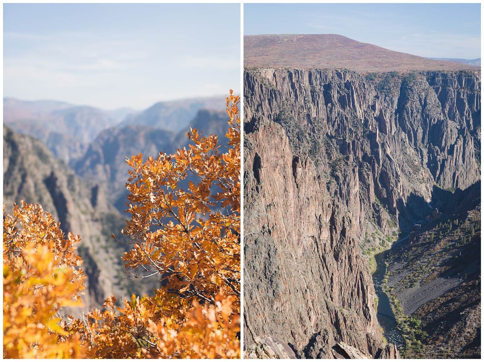
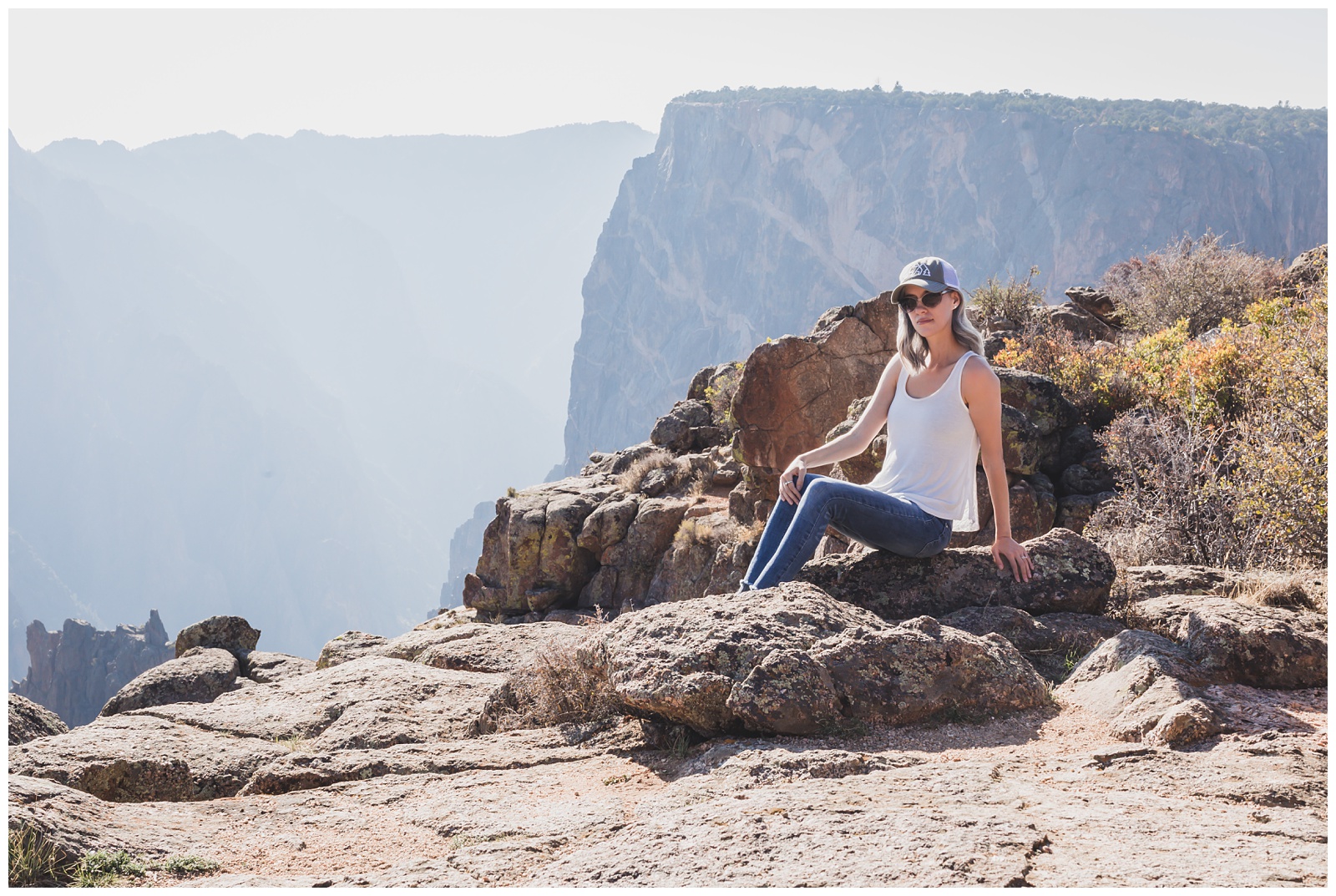
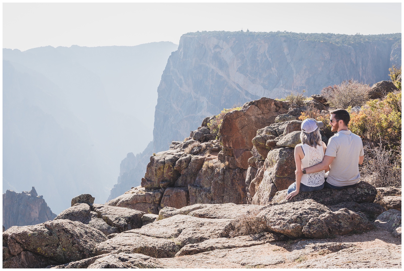
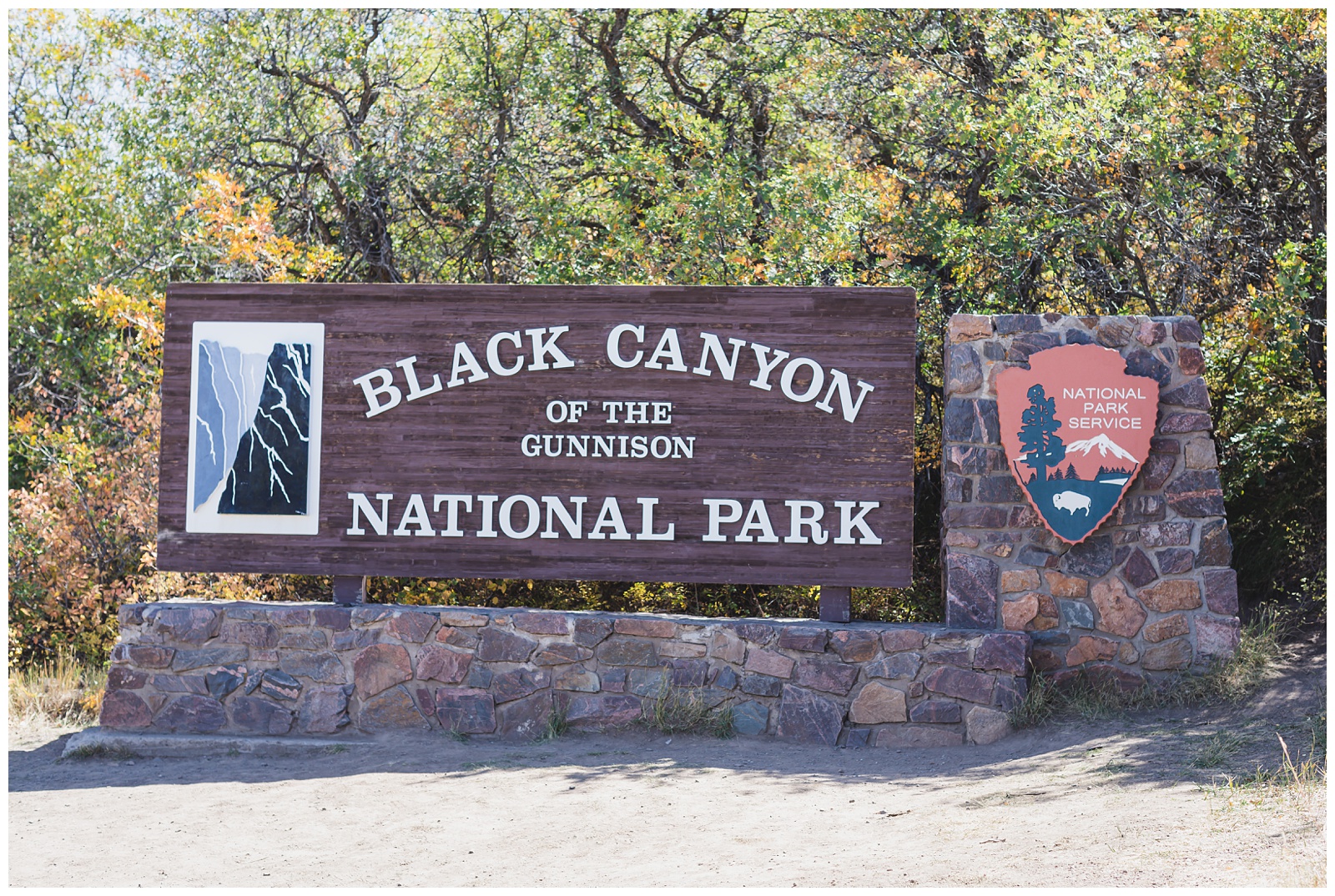 With an average depth of 2,000 feet, Black Canyon of the Gunnison has some of the steepest cliffs, oldest rock and craggiest spires in North America. It’s been called “Colorado’s Own Grand Canyon.” It was carved by the Gunnison River, and no evidence exists of humans ever occupying its gorge. Its name comes from the fact that some parts of the gorge receive only 33 minutes of sun daily.
{Source: Uncover Colorado}
With an average depth of 2,000 feet, Black Canyon of the Gunnison has some of the steepest cliffs, oldest rock and craggiest spires in North America. It’s been called “Colorado’s Own Grand Canyon.” It was carved by the Gunnison River, and no evidence exists of humans ever occupying its gorge. Its name comes from the fact that some parts of the gorge receive only 33 minutes of sun daily.
{Source: Uncover Colorado}
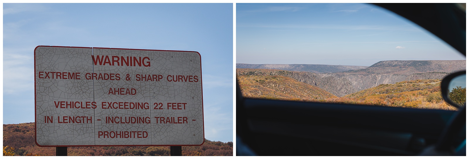
Right after entering the park, we took East Portal Road into the canyon — descending 2,000 feet in 5 miles!
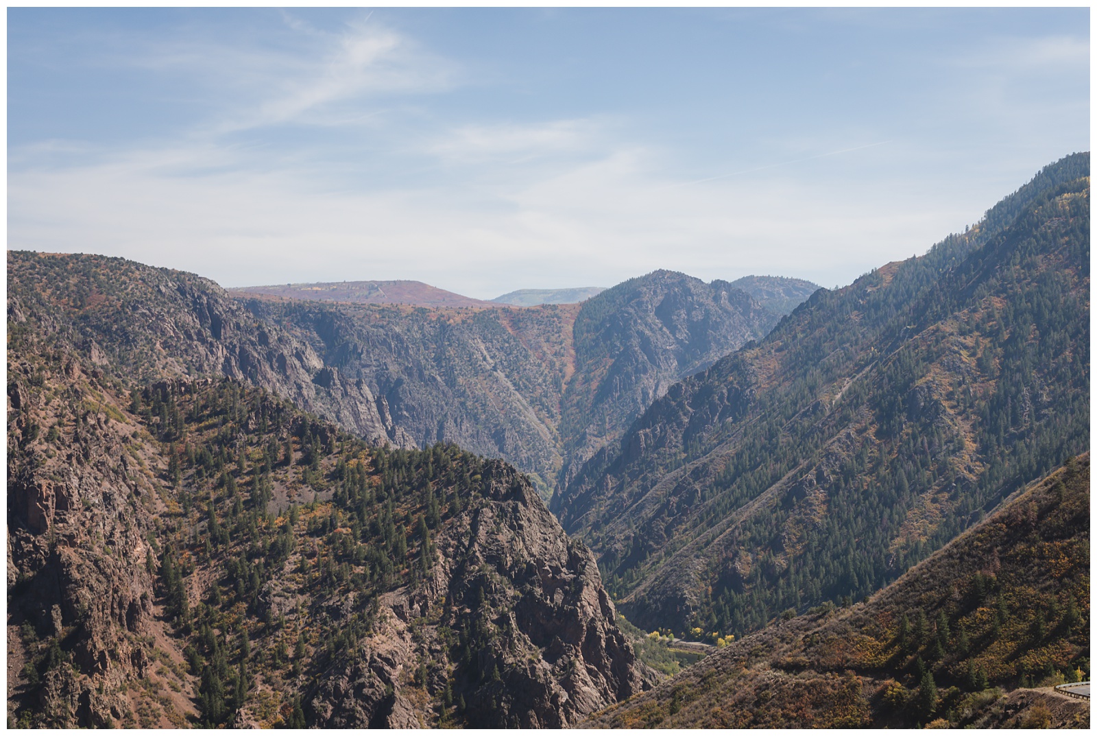
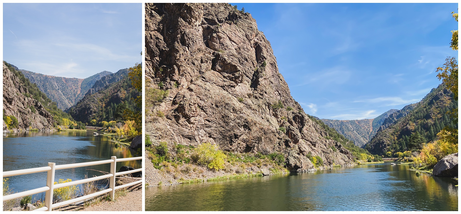
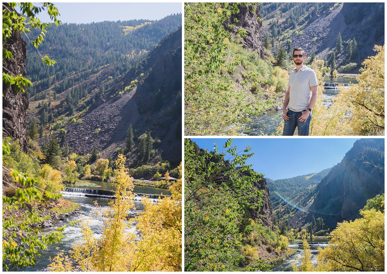
We had a picnic lunch by the Gunnison River at the base of the canyon and then drove back up to see the views from the rim.
 Tomichi Point
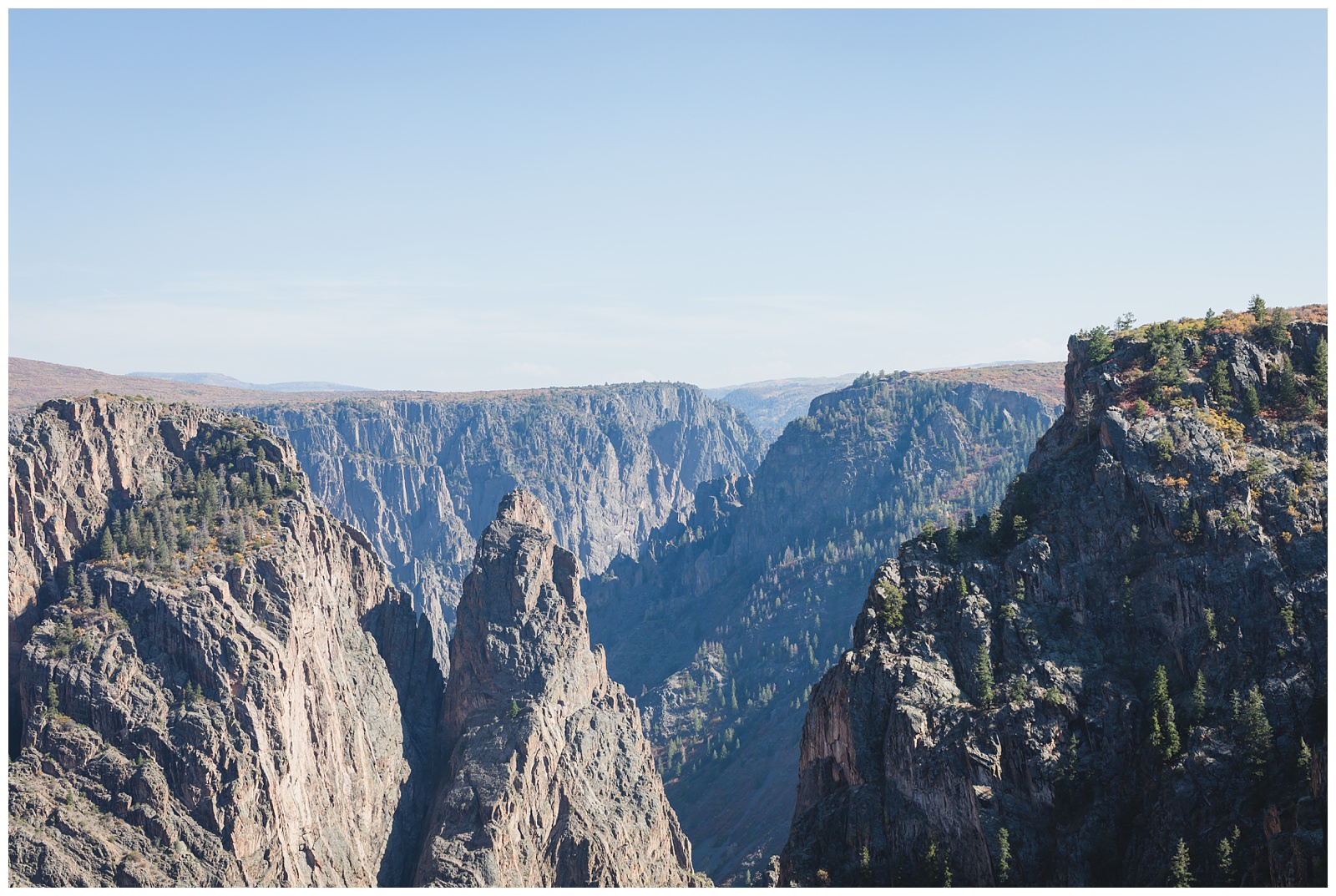 Gunnison Point
 And my favorite: Painted Wall View
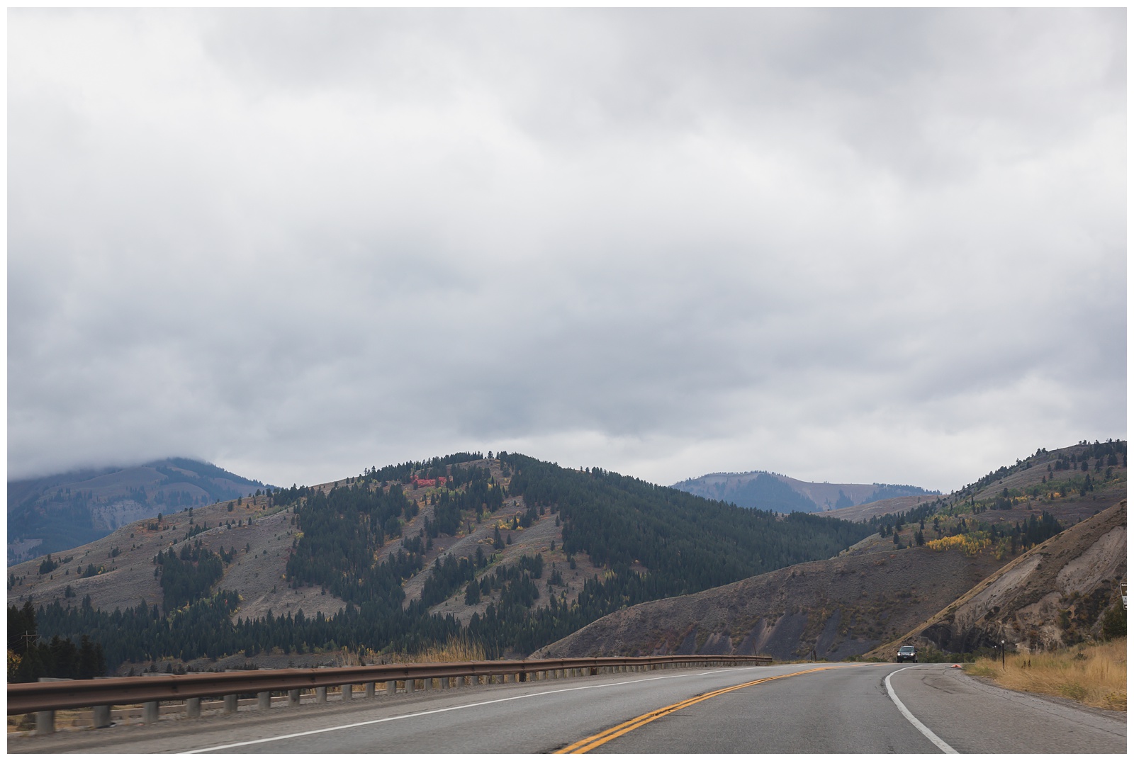
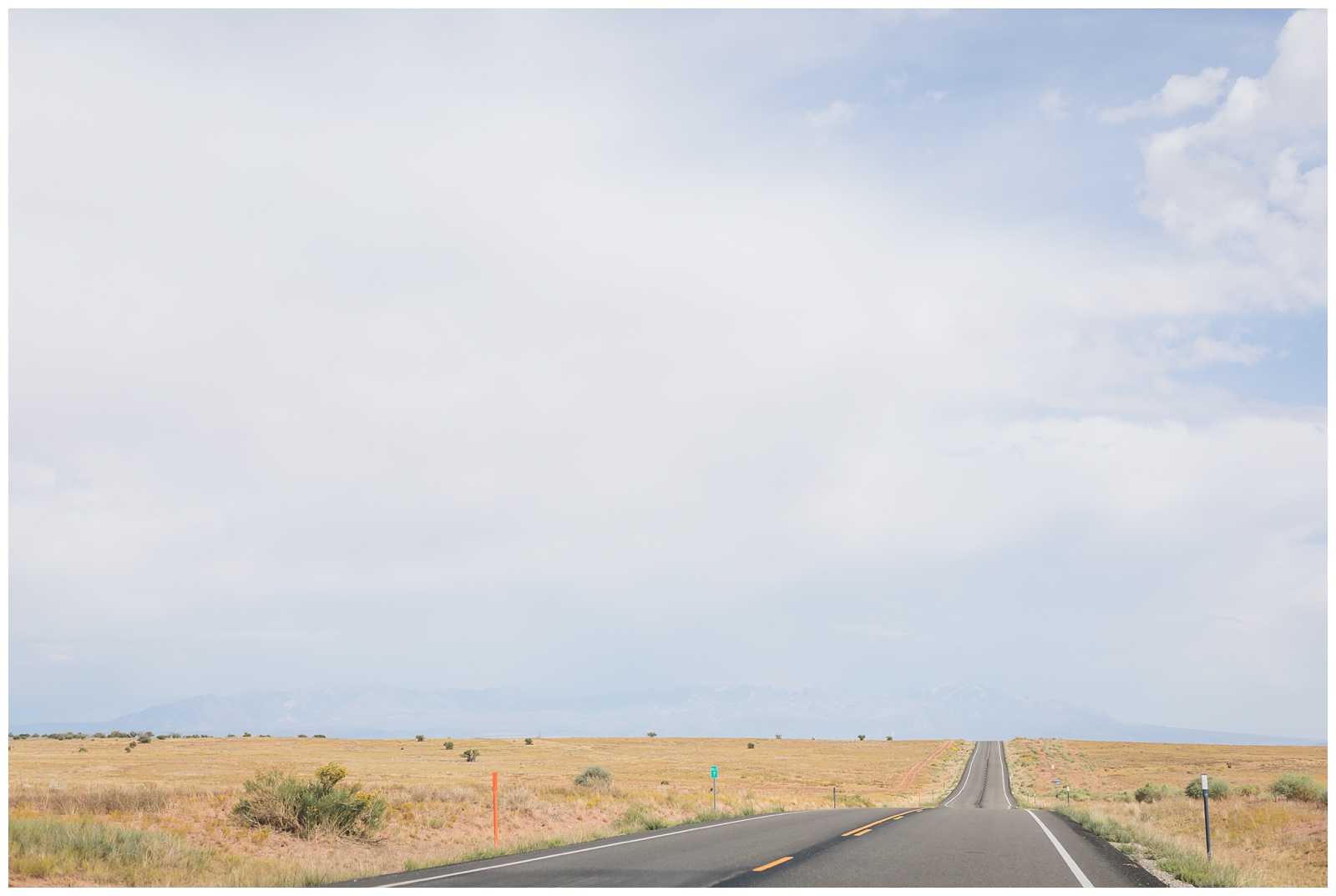
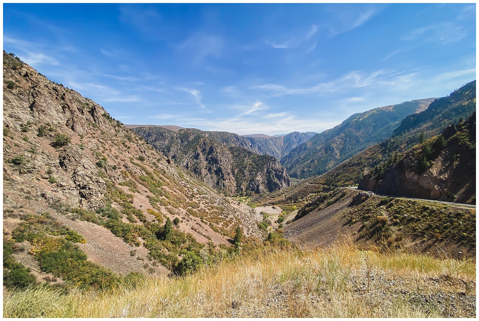
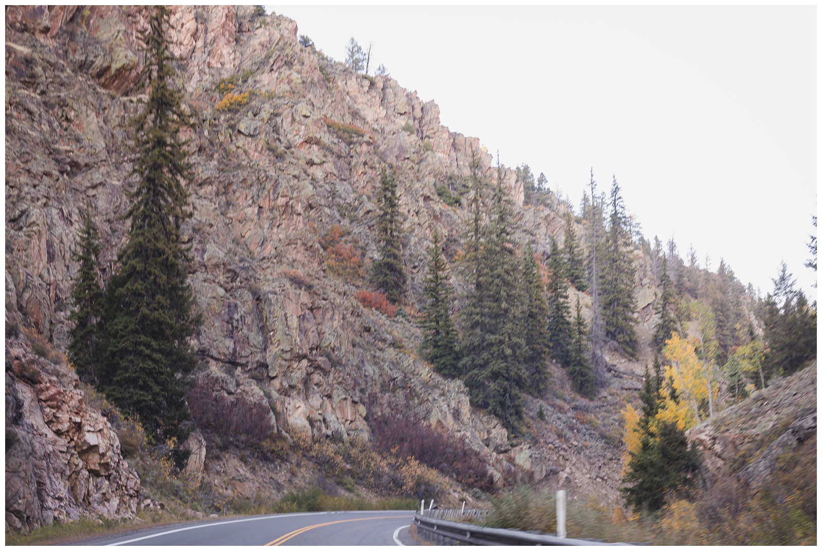
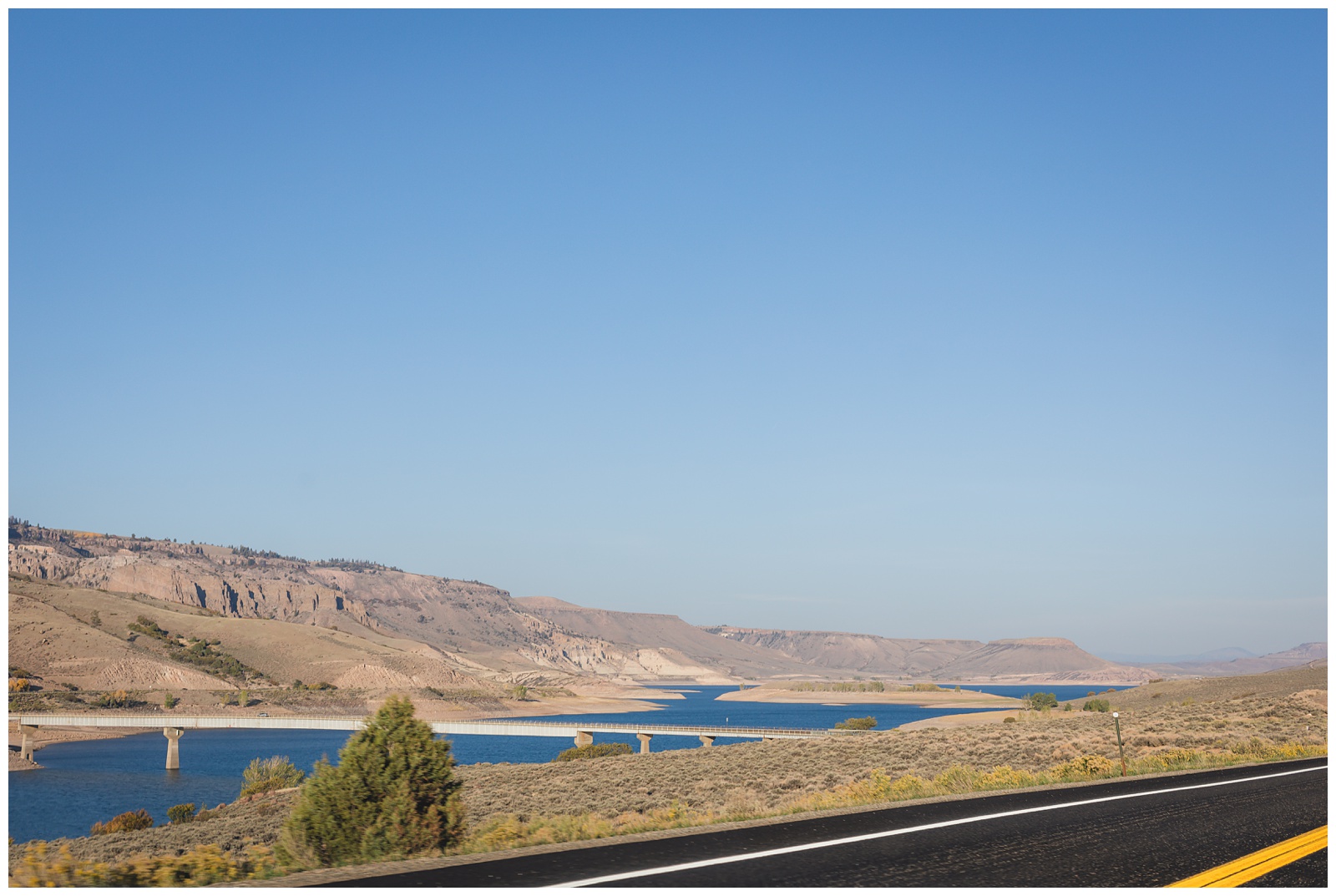
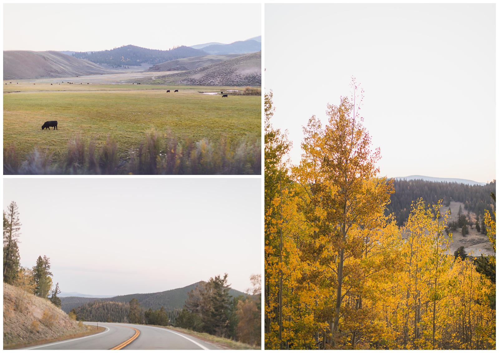
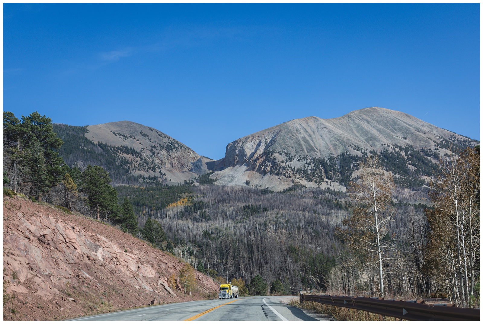
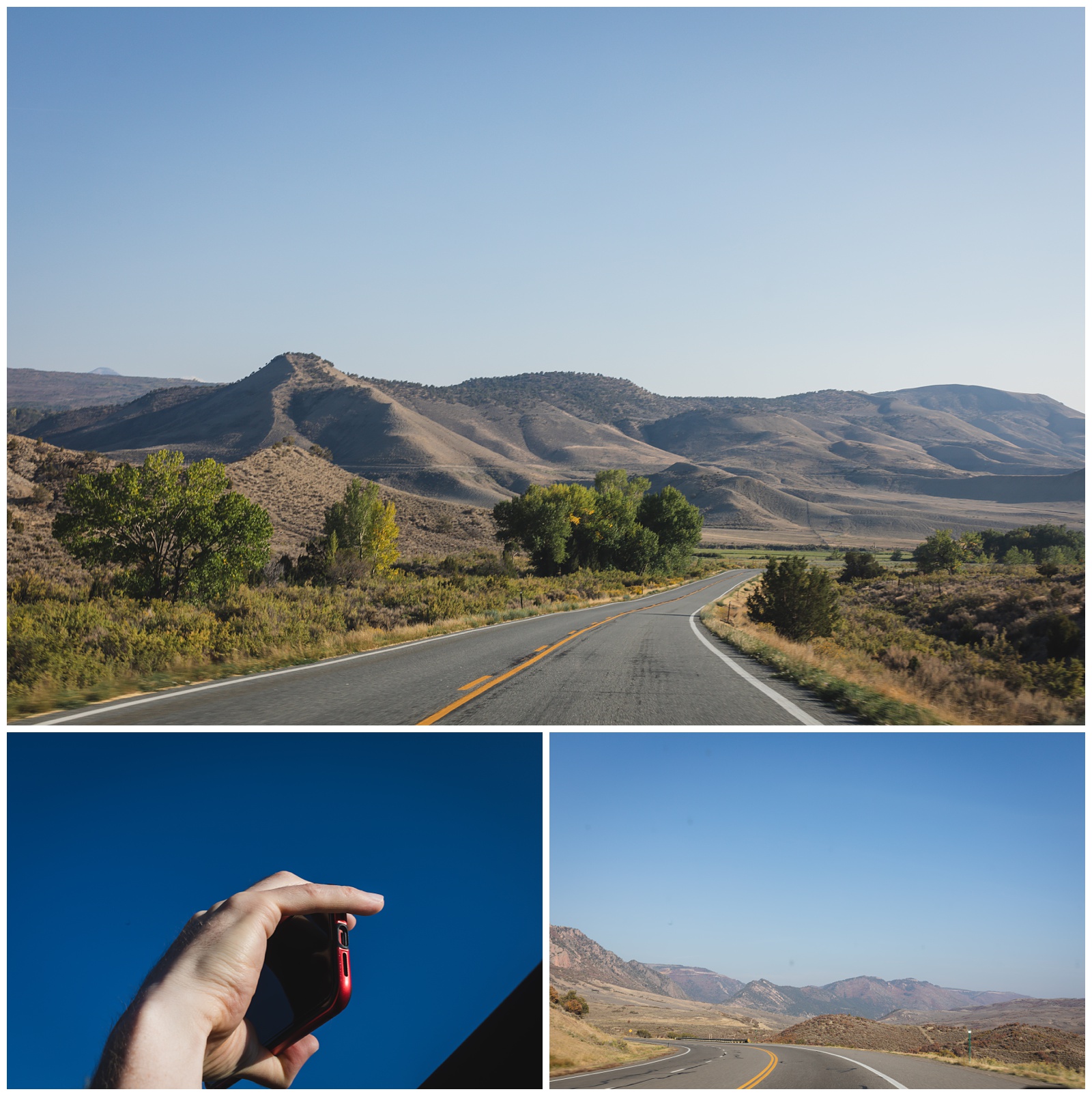 The drive from Black Canyon of the Gunnison to Alamosa was one of our favorites, and for long spans of time, we had the mountain roads all to ourselves.
day 15 • 09.25.20
Alamosa, CO >>> Great Sand Dunes National Park >>> Colorado Springs, CO
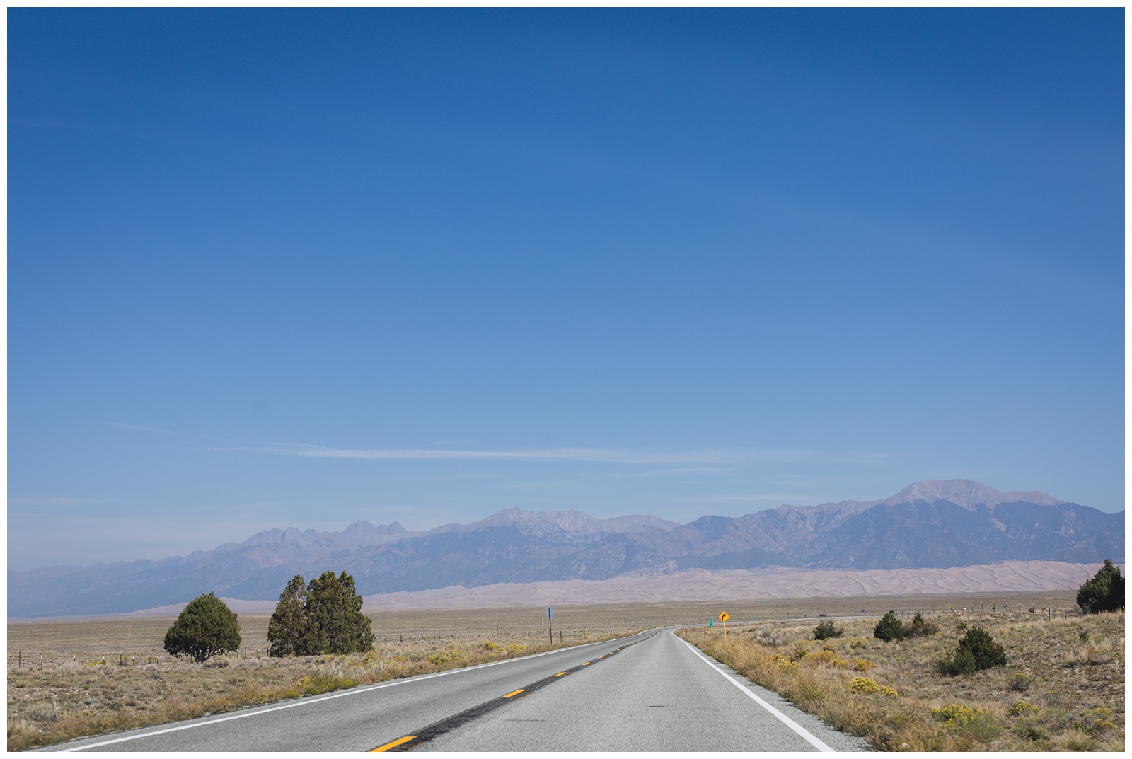
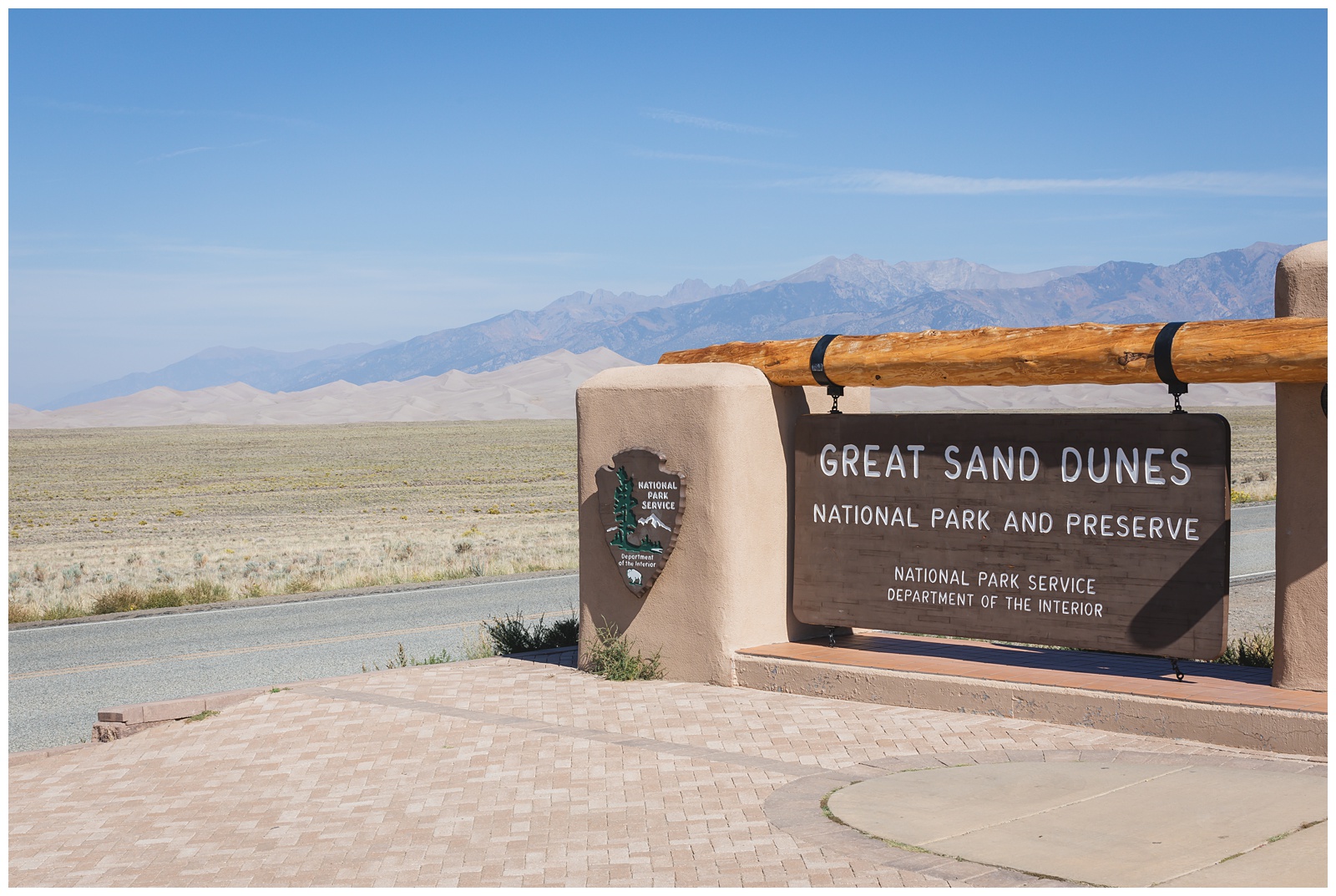
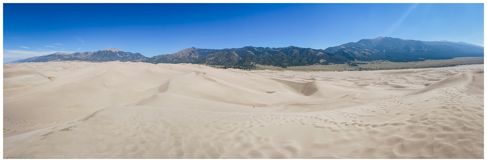
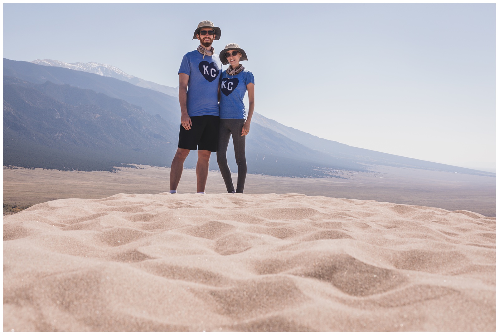
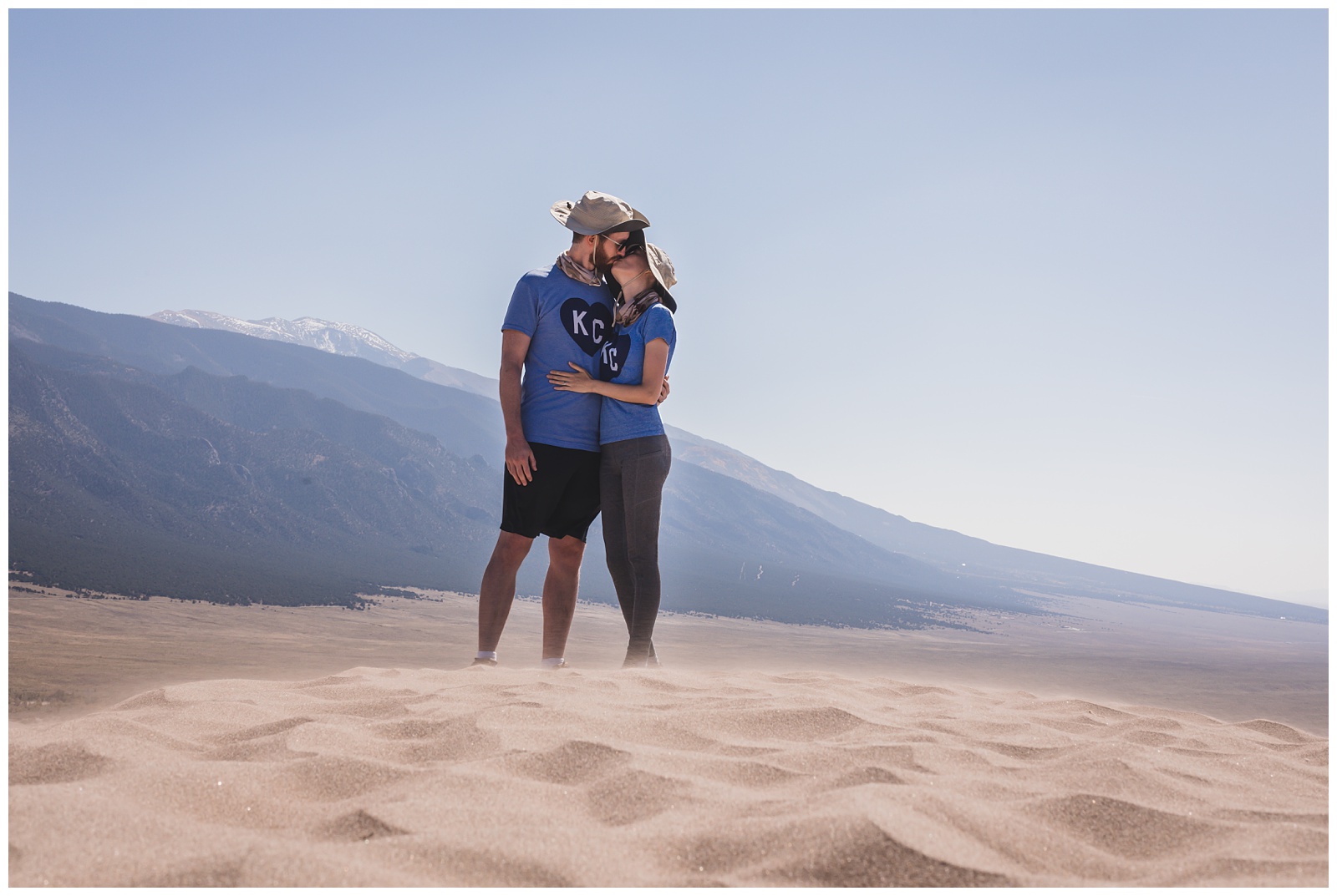
Great Sand Dunes was National Park No. 10 of this 10th-anniversary trip (not to mention our last of Colorado’s four National Parks to visit) — and what a park to wrap up that set of 10s!
The park has North America’s tallest sand dunes. They rise higher than 70-story buildings and sprawl beneath the snow-capped Sangre de Cristo Mountains, which soar to more than 13,000 feet and include some patches of tundra. The dunes were created after a large lake dried up thousands of years ago, and the wind drove the sand to the base of the mountains. {Source: National Park Service}
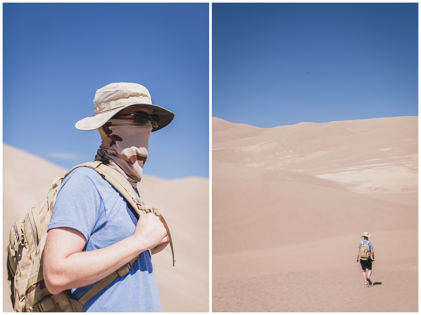
Seth’s Army-issued neck gaiters definitely came in handy! And although he’d seen larger dunes while deployed to the Middle East, this landscape was an impressive first for me.
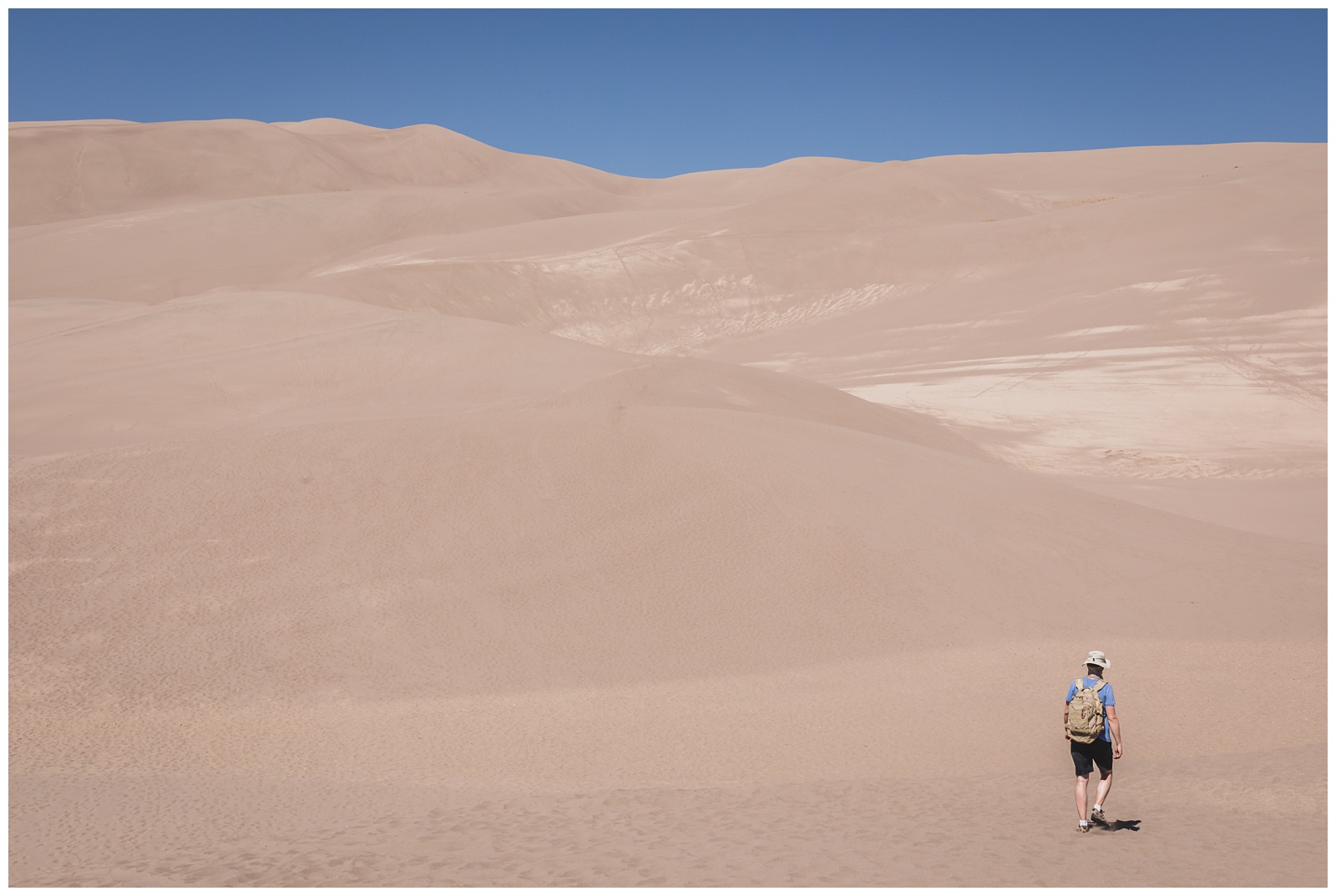
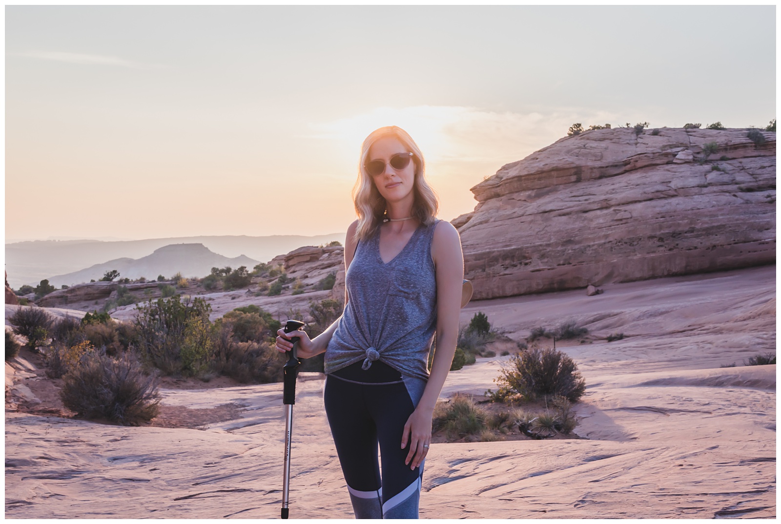
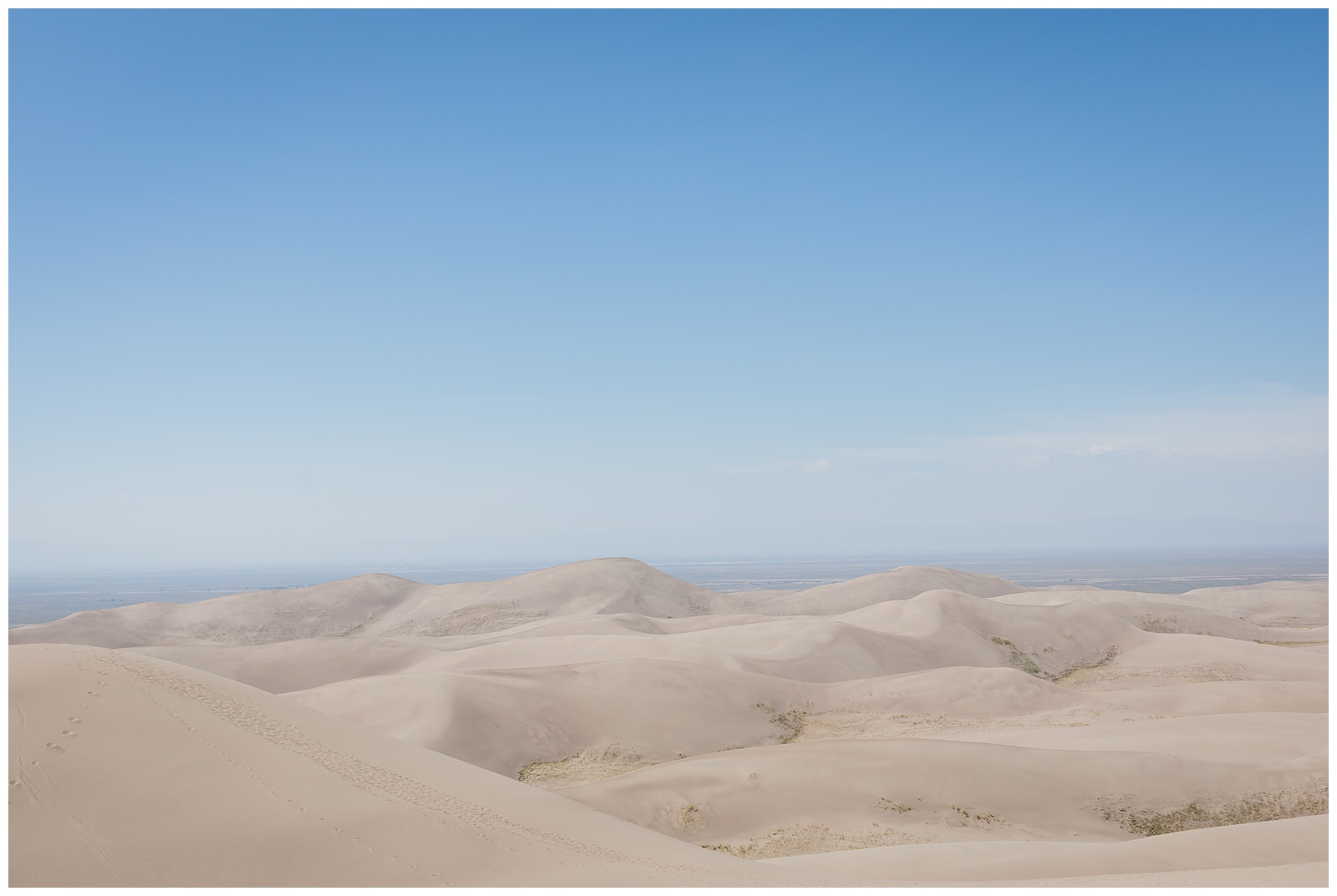
The dunefield doesn’t have any trails, which made it a little tricky to find the most direct route to the top.
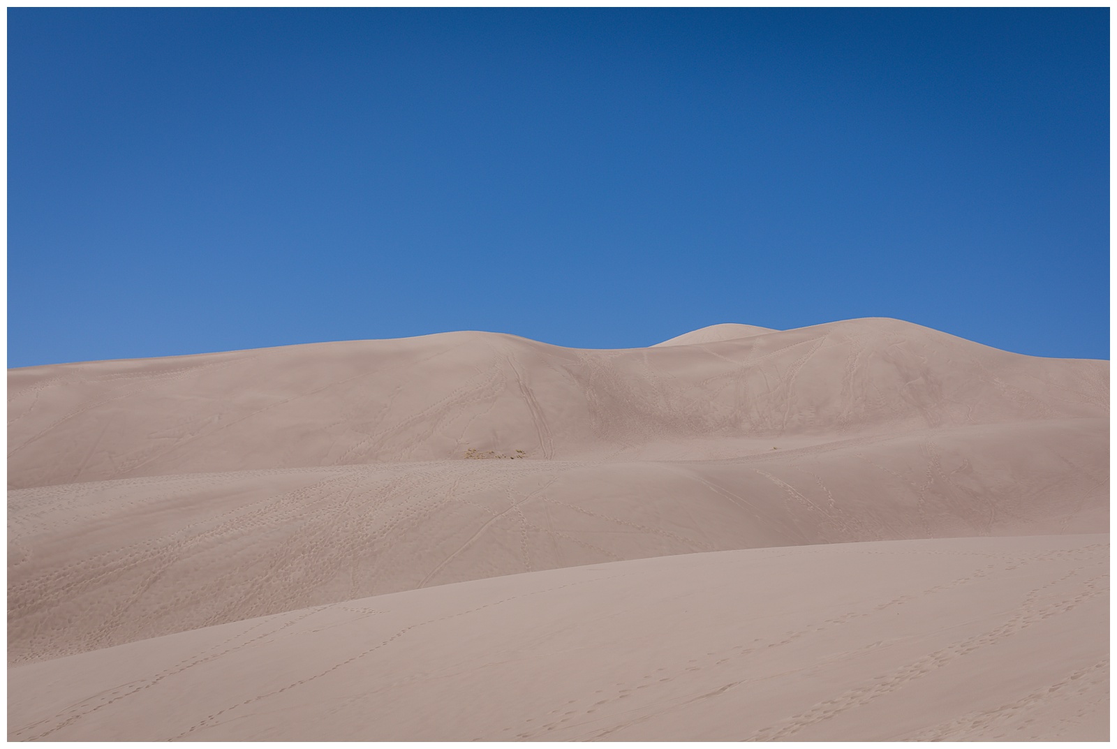
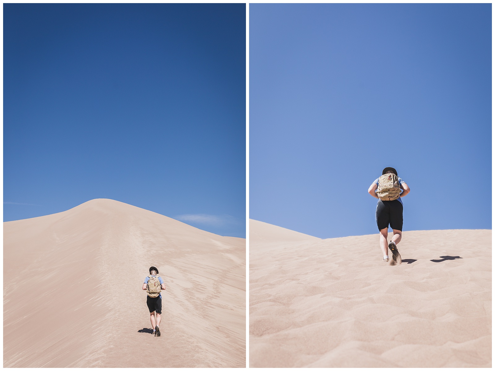
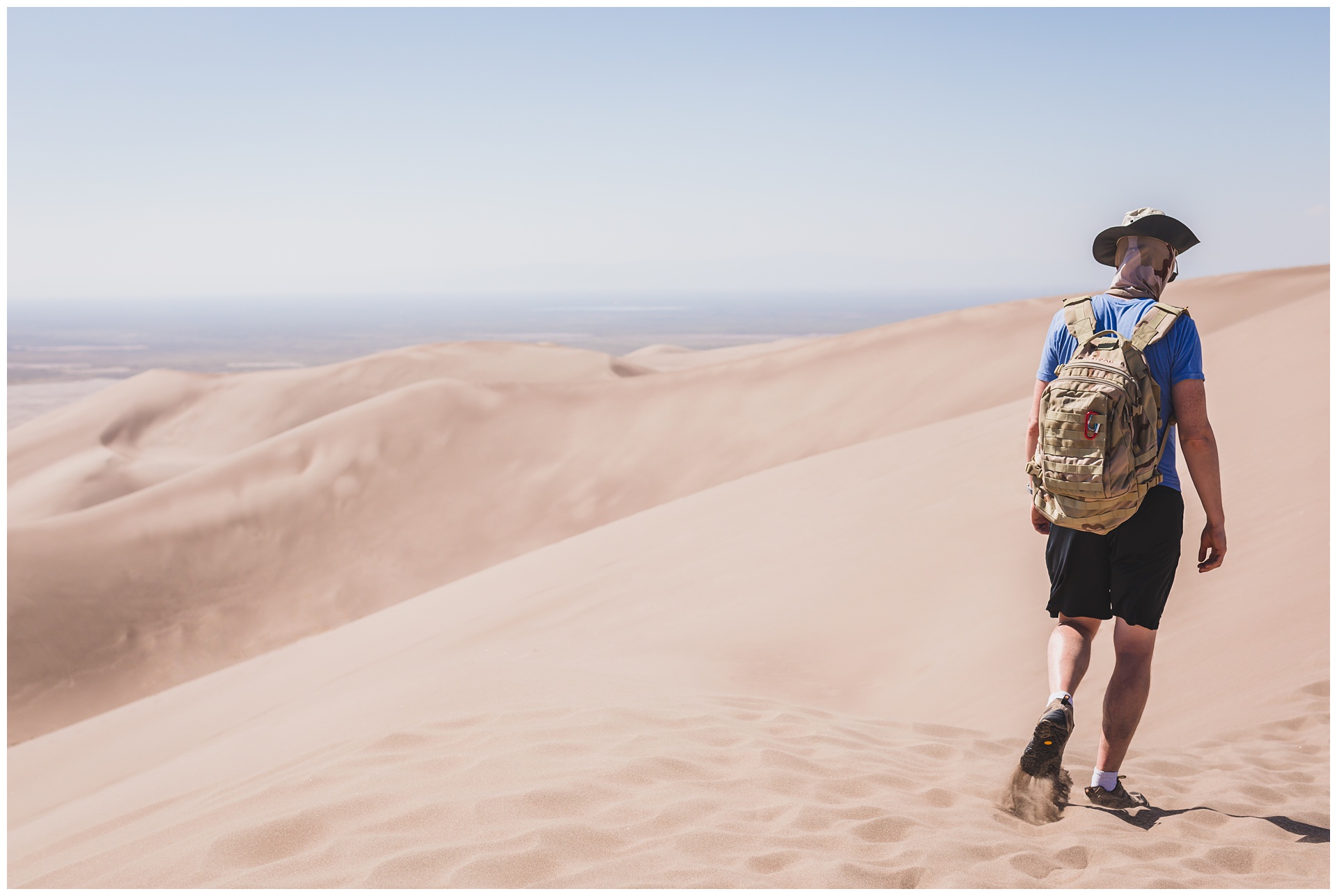 But after an hour hiking uphill in sand (definitely our most strenuous endeavor of the trip), we made it to the summit of 650-foot High Dune!
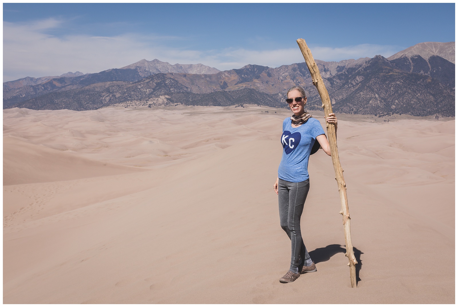
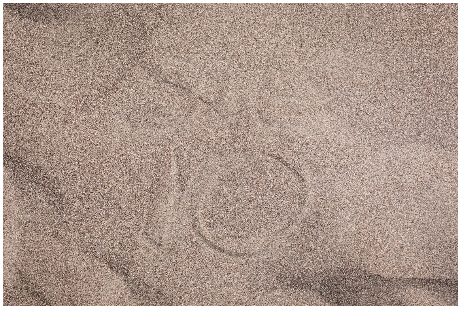 It’s not easy to make a mark in dry, blowing sand, but I did my best.
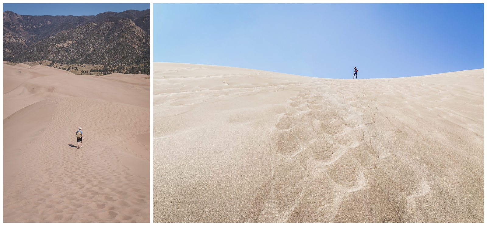
The hike down was more sliding than walking. It’s obvious why people bring sleds and snowboards!
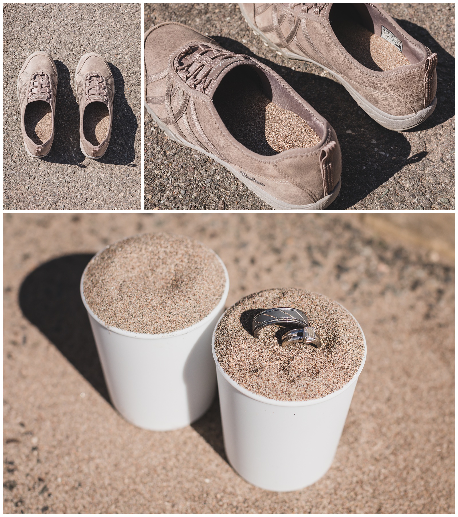
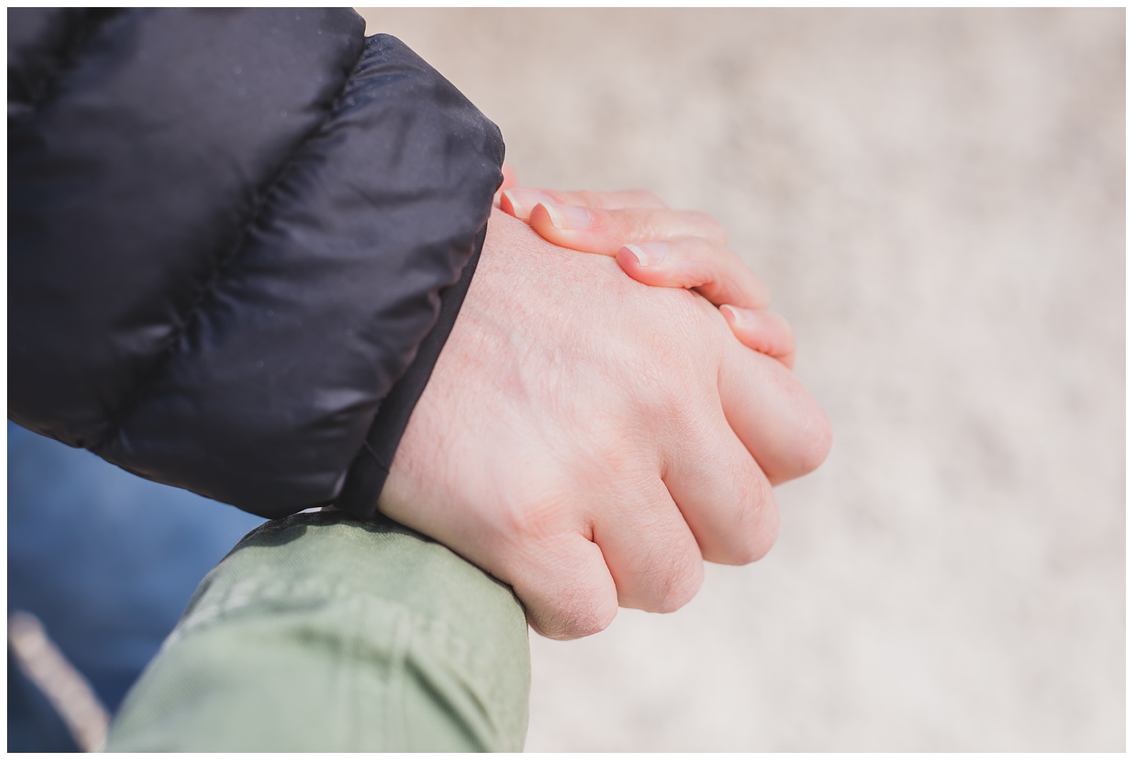
By the time we got back to our car, our shoes were so full of sand they would hardly stay on. And given that we’d poured unity sand at our wedding, I thought it seemed appropriate to get a detail shot of our wedding rings in what I’ve dubbed our “10th-anniversary sand.”
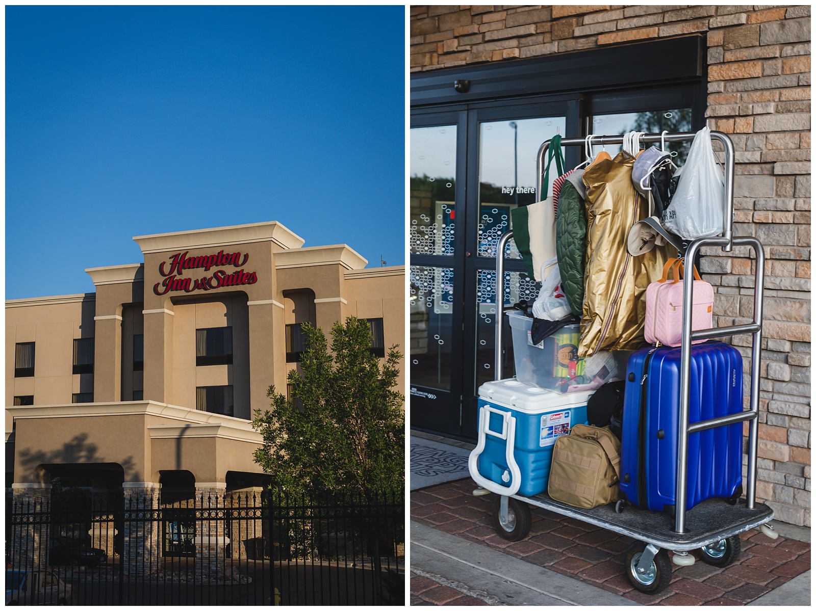
At right: I wanted to capture what our loading and unloading entailed. We definitely became masters at managing all our stuff!
Feeling brand new after showering off all the sand. ✨
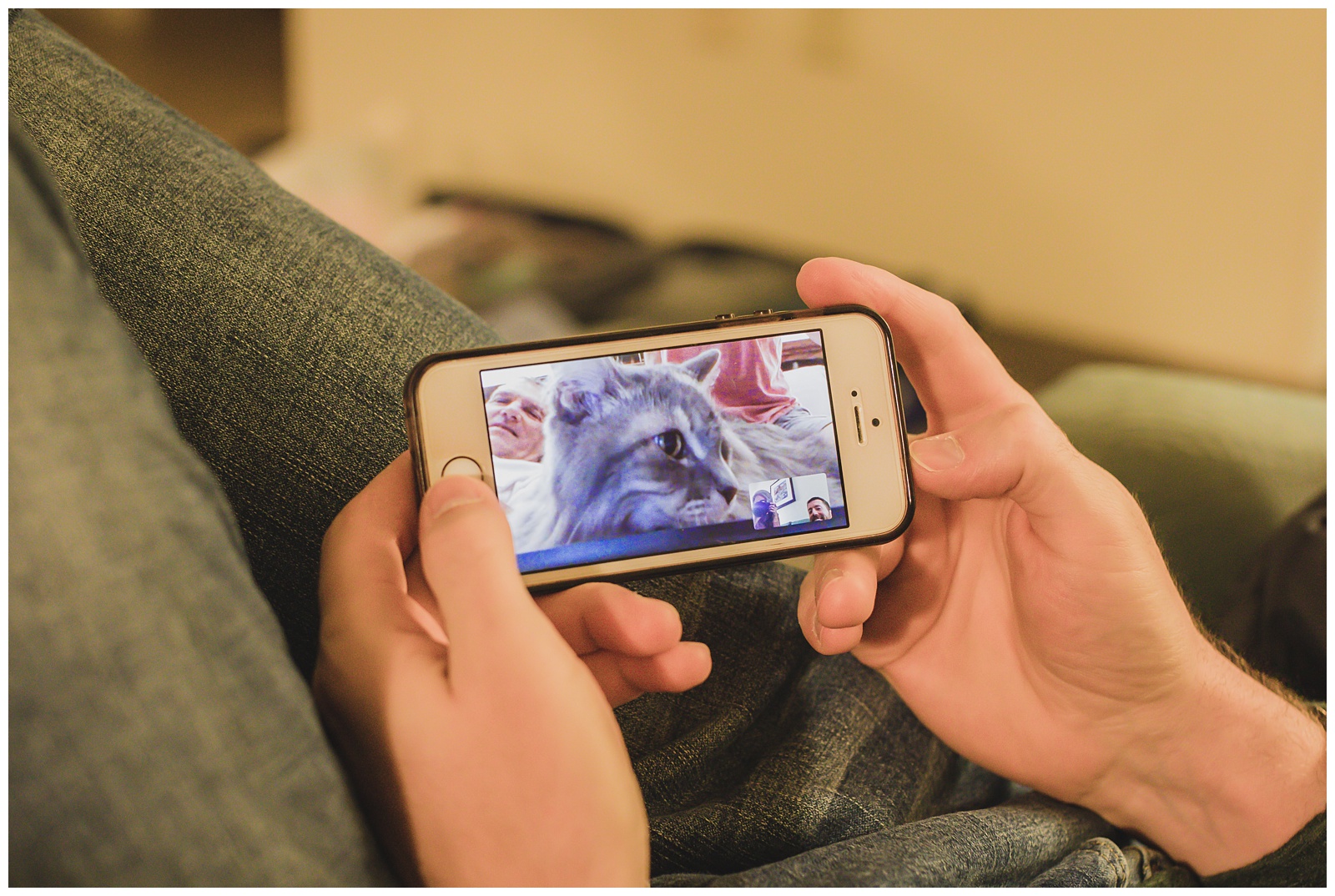
Day 15 of our trip happened to fall on our cat’s 15th birthday, so of course we had to FaceTime Luke at my parents’ and sing him “Happy Birthday”! (He was thrilled, clearly.)
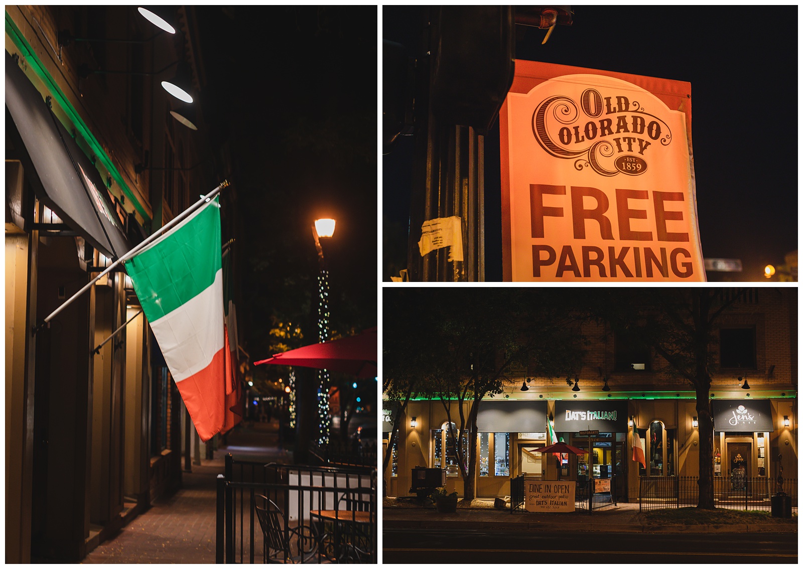
For dinner that night, we went to an Italian restaurant in Colorado Springs’ Old Colorado City (thinking we’d definitely earned those carbs!).

day 16 • 09.26.20
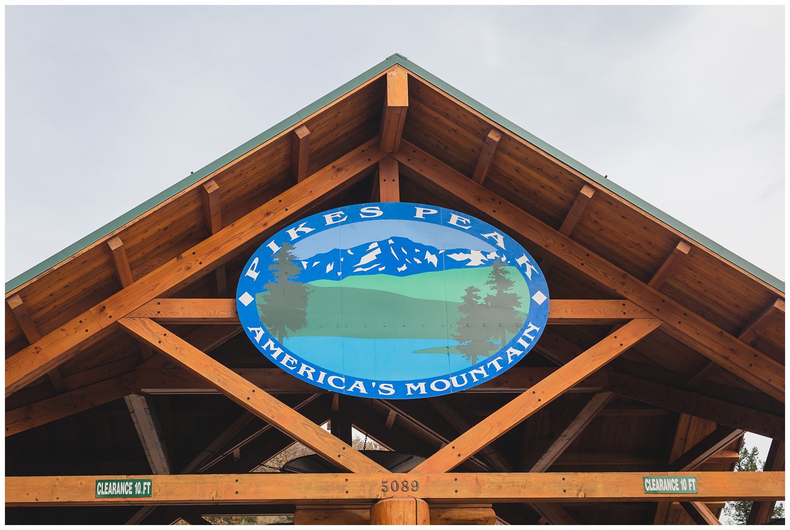
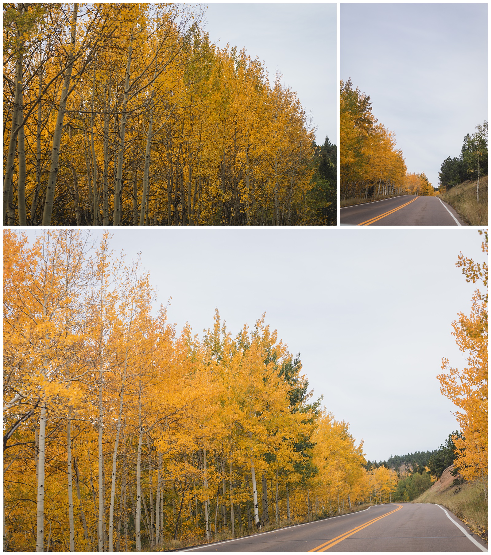
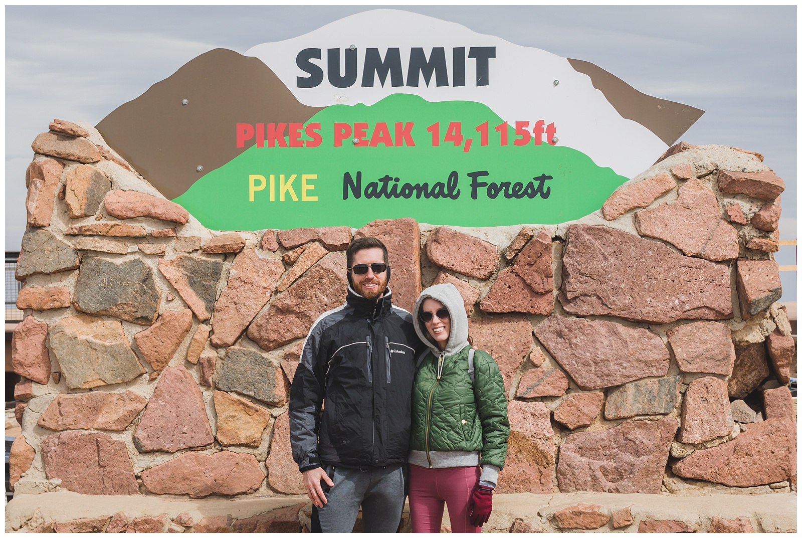
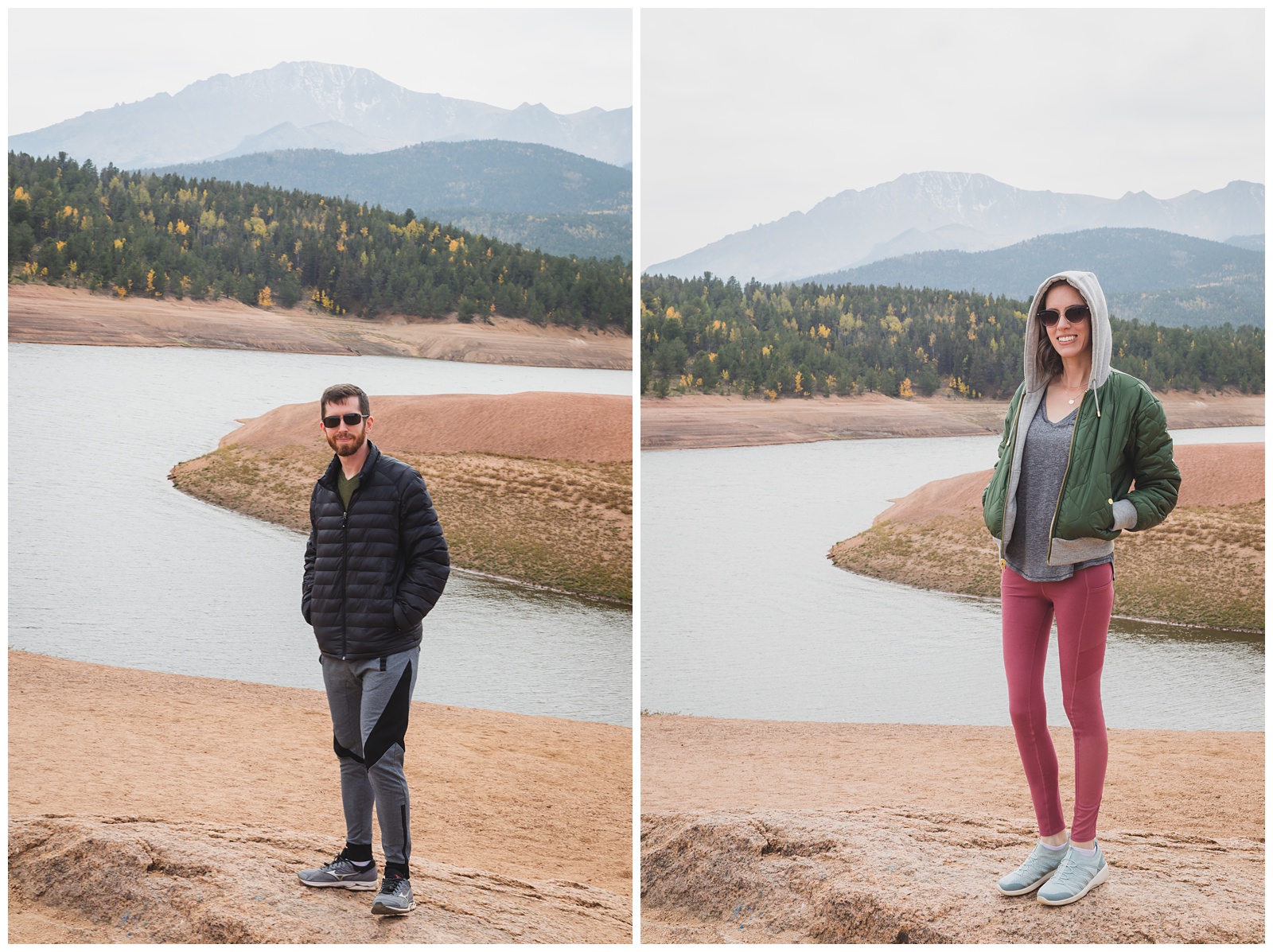
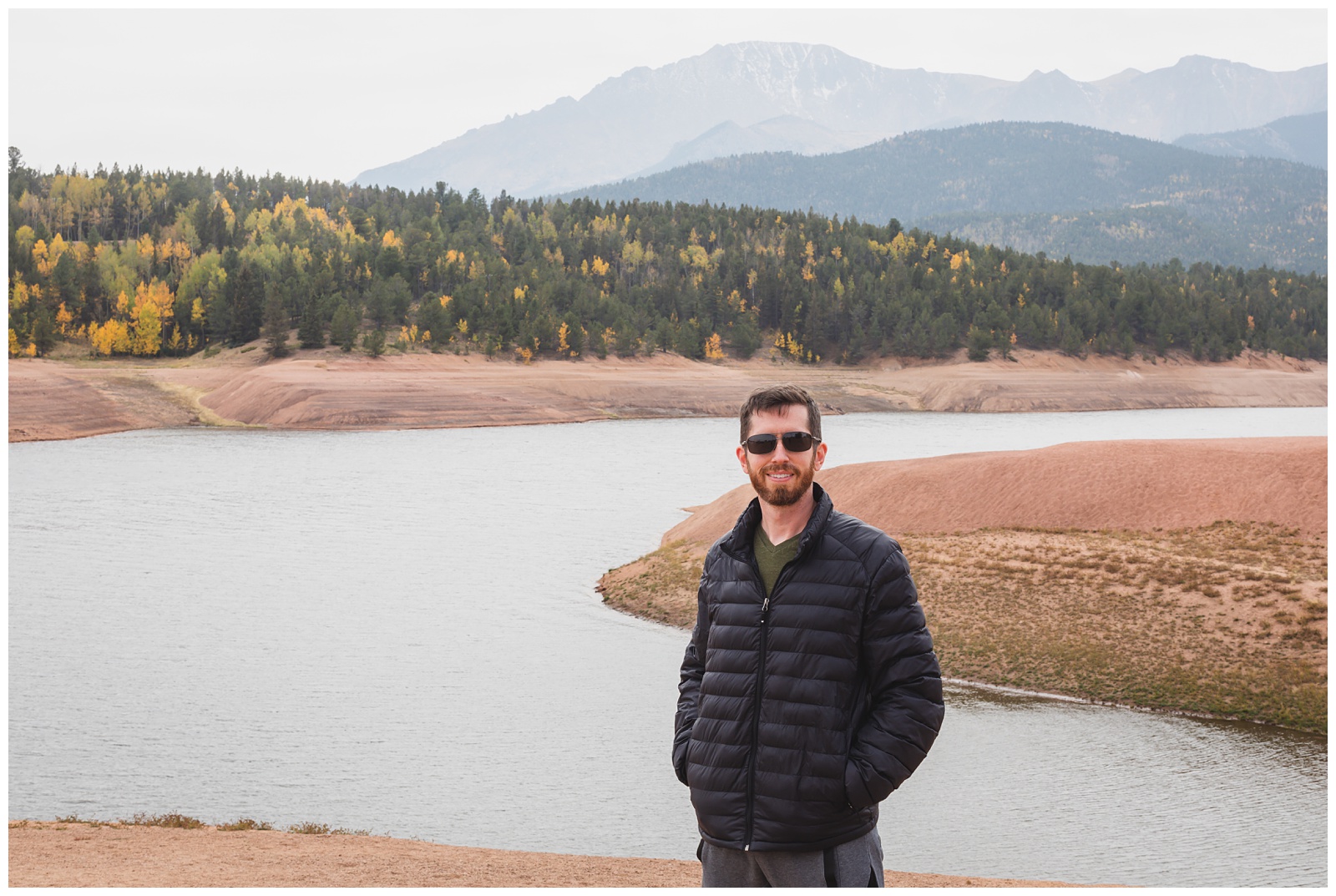
Colorado Springs, CO >>> Pikes Peak >>> Garden of the Gods >>> Oakley, KS
The lady at the toll booth told us the summit would likely close soon due to high winds, but we went through anyway and hoped for the best.
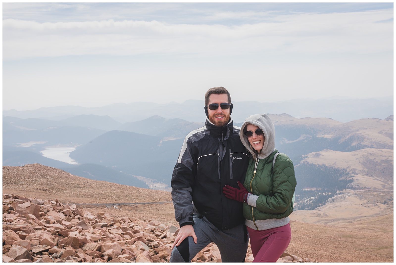
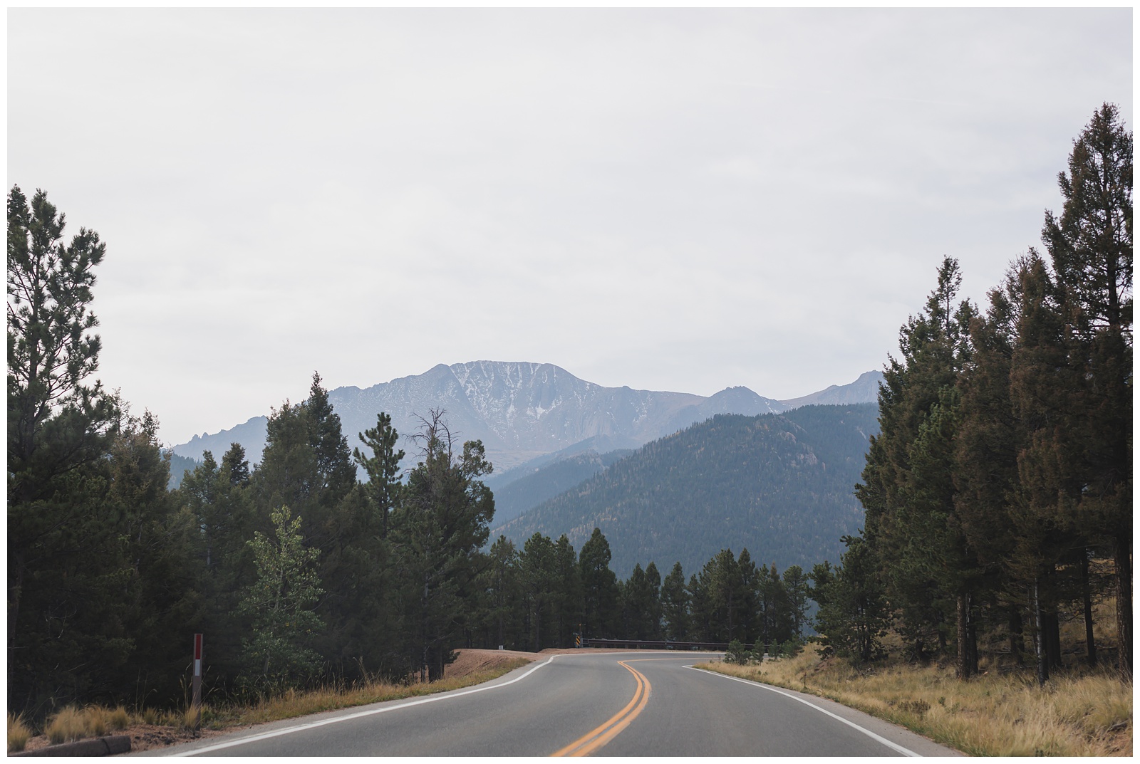 Pikes Peak! At 14,115 feet, it is the highest summit of the southern Front Range of the Rocky Mountains. {Source: History Colorado}
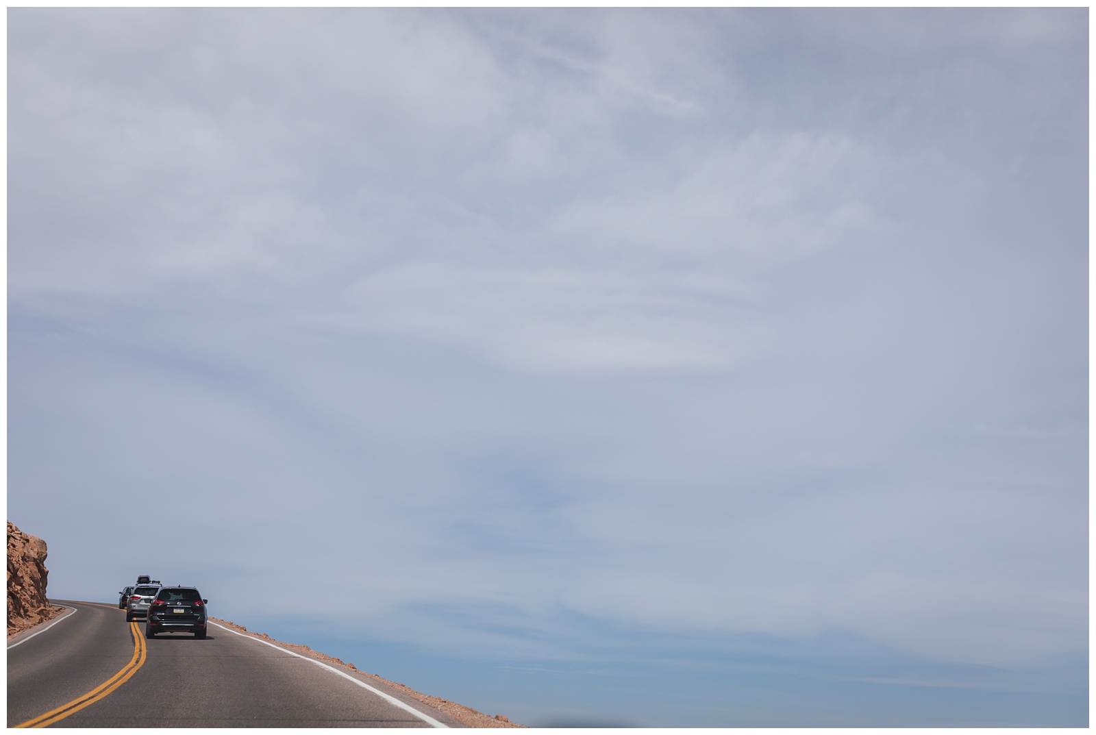
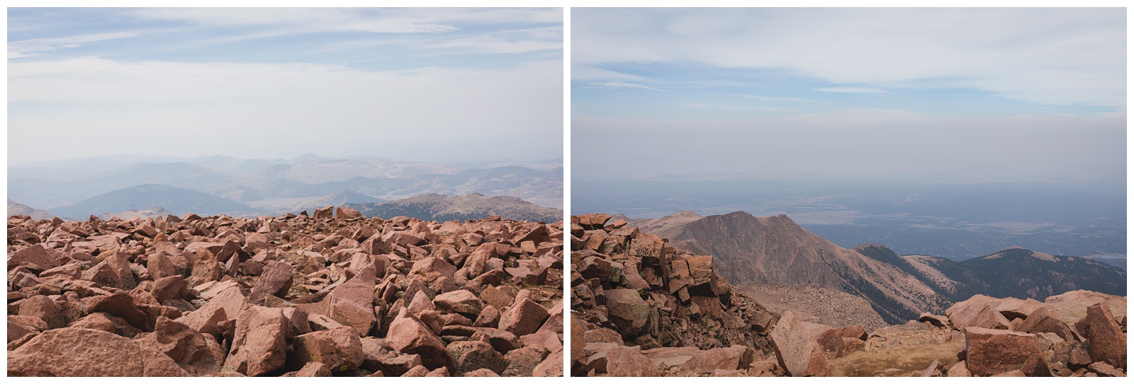
Fortunately, the summit was open when we arrived — although it definitely was very windy and cold, with gusts at 50 mph and temperature and wind chill readings in the 30s.
Fun fact: This was my third time at this summit but my first time getting there by car; I hiked the mountain in my teens and then again in my 20s … which I’d say gave me the right just to ride up in my 30s!
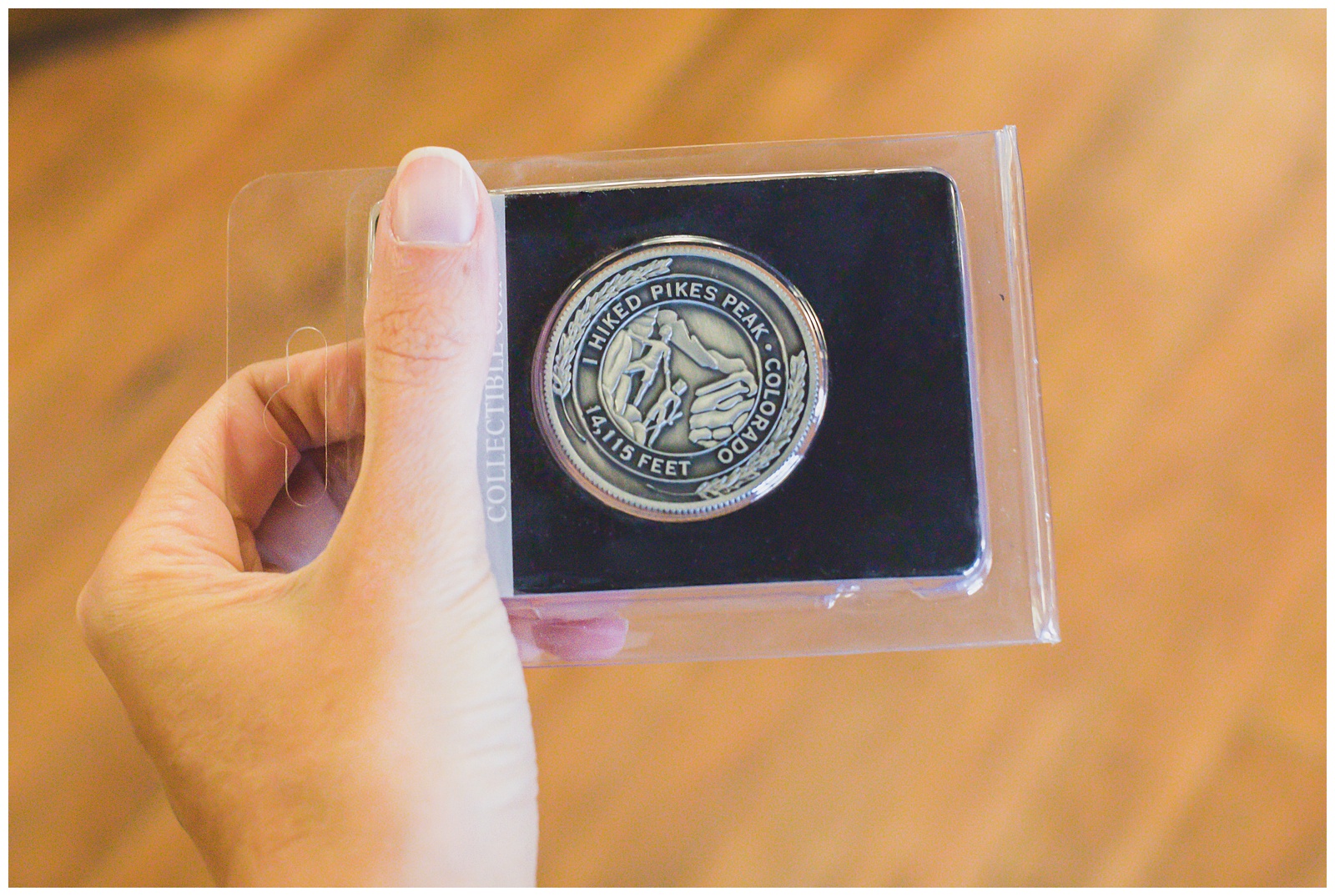
A little belated, but definitely earned.
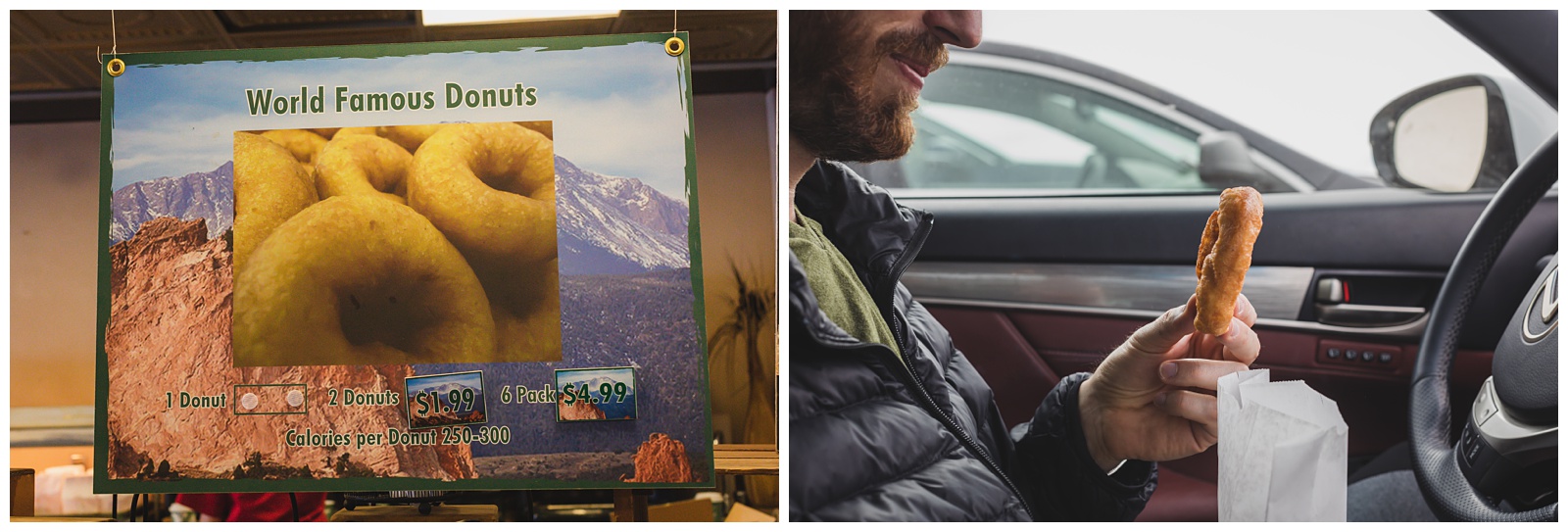
The Pikes Peak Summit House sells the only donuts made at an elevation over 14,000 feet, and I think it’s safe to say they’re Seth-approved!
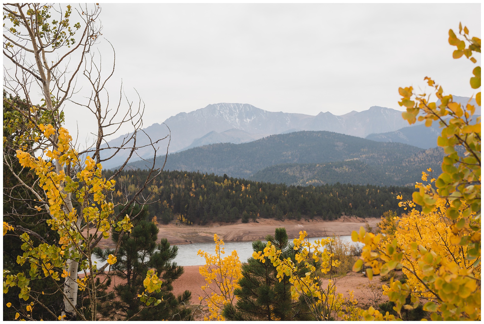
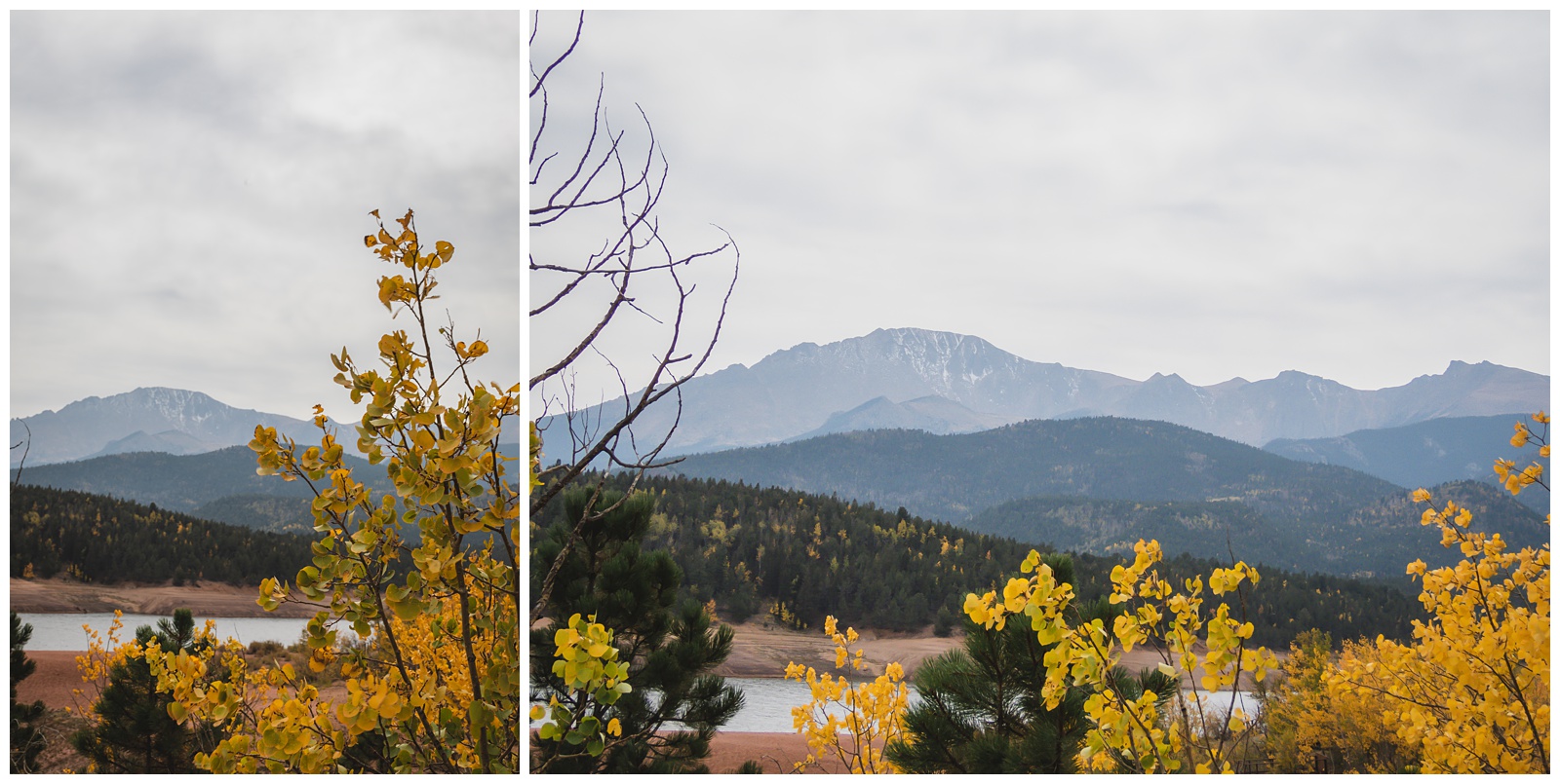
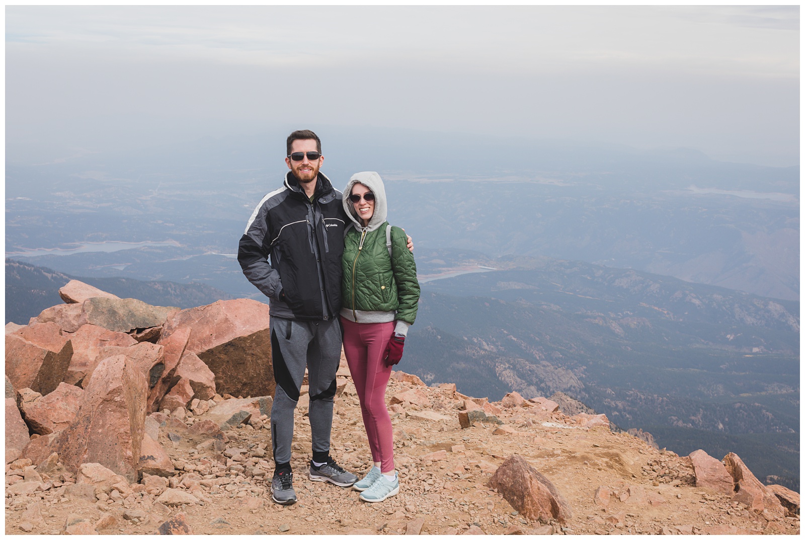
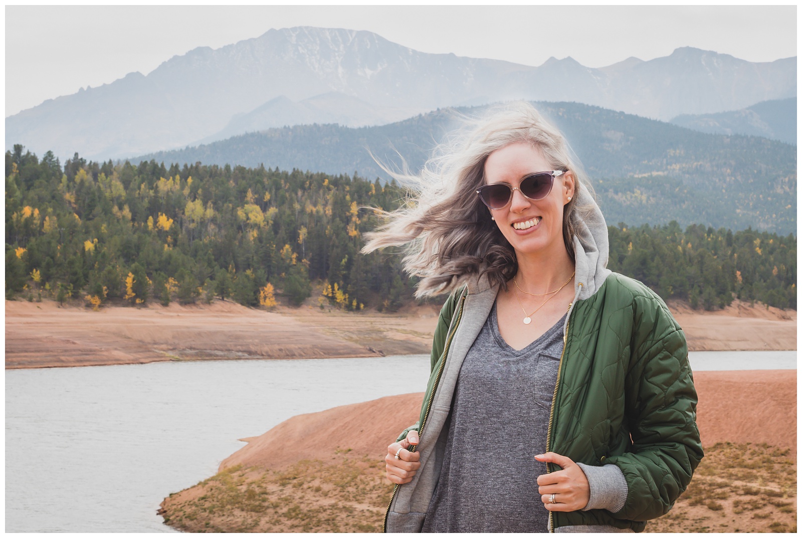 On the drive back down, we stopped at Crystal Creek Reservoir for one more look at the mountain. And even that far from the summit, it was still pretty windy!
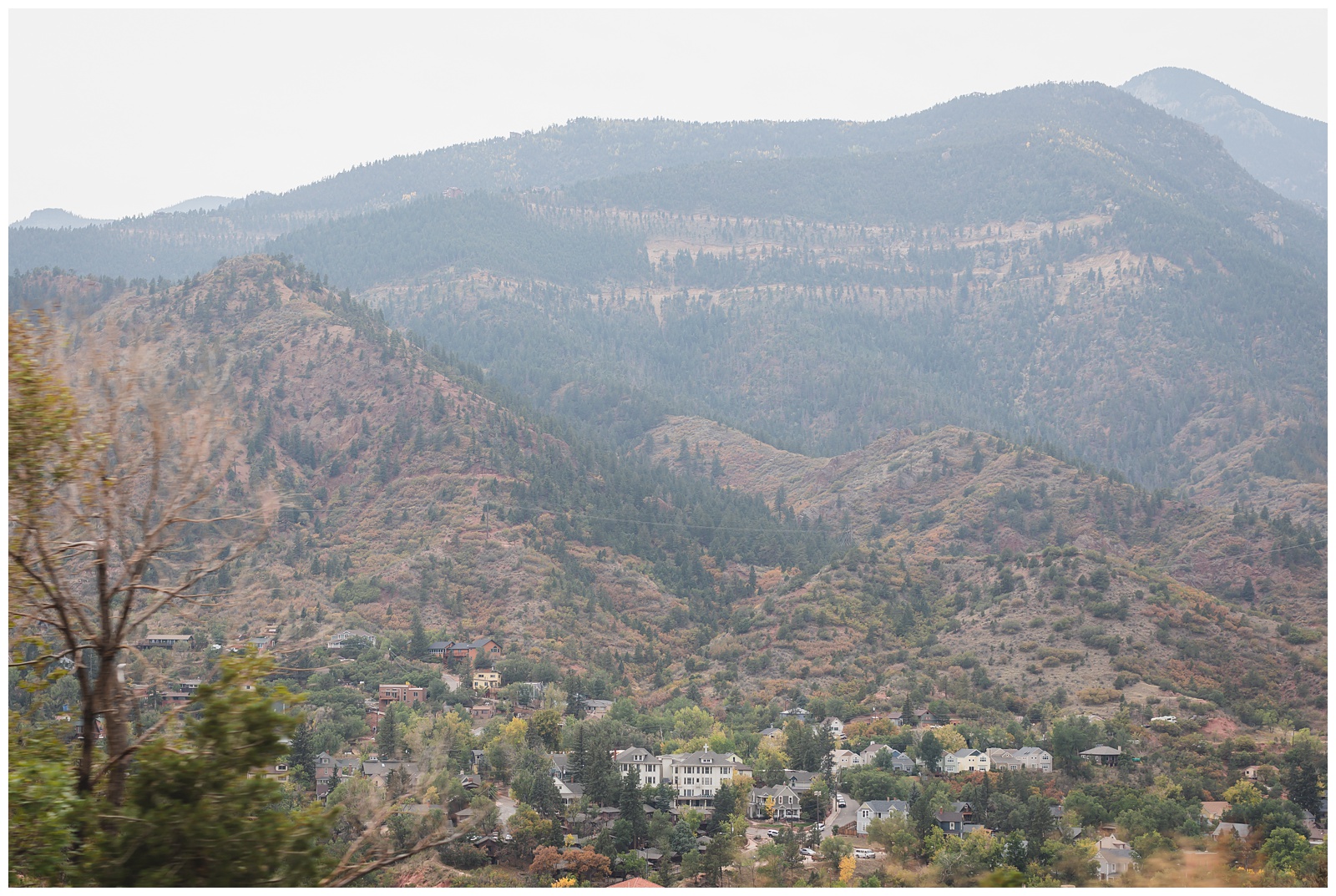
I snapped this shot of Manitou Springs as we passed it on the highway and didn’t realize until I took a closer look several days later that the white building featured prominently is where I stayed for a couple of weeks one summer, during a camp I attended in high school!
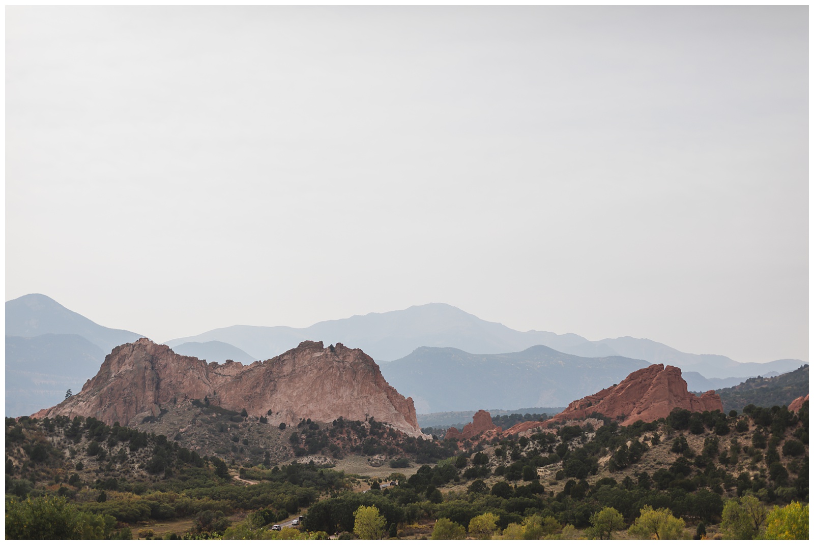
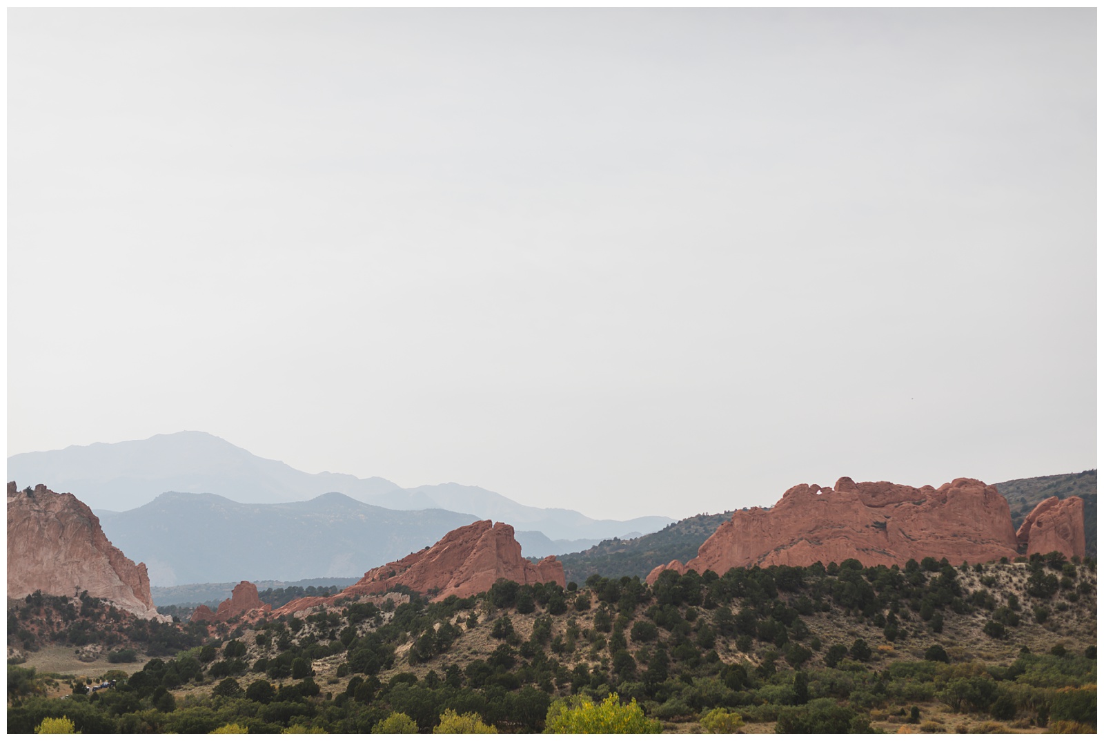
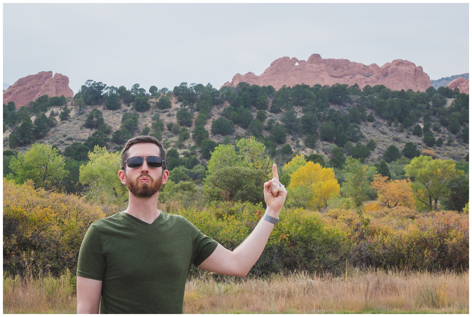
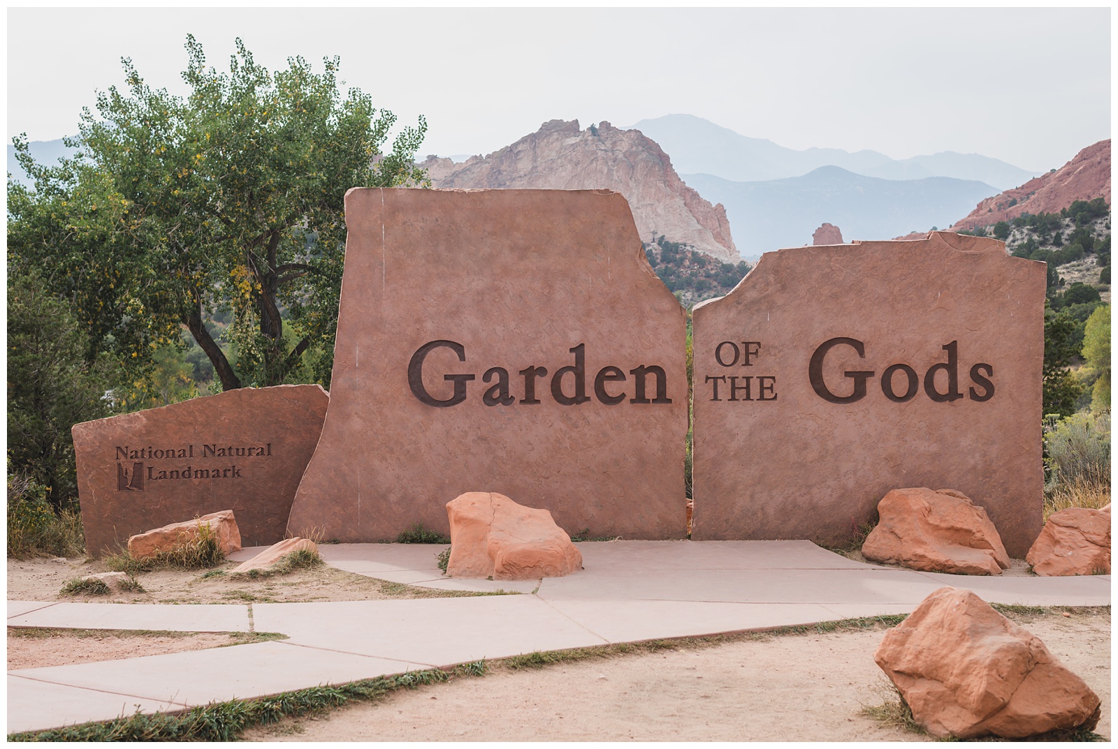 The 300-foot orange sandstone rocks in Garden of the Gods were once sand dunes. The area has 21 miles of trails, is free to visit and has been voted the best city park in the country. {Source: Garden of the Gods}
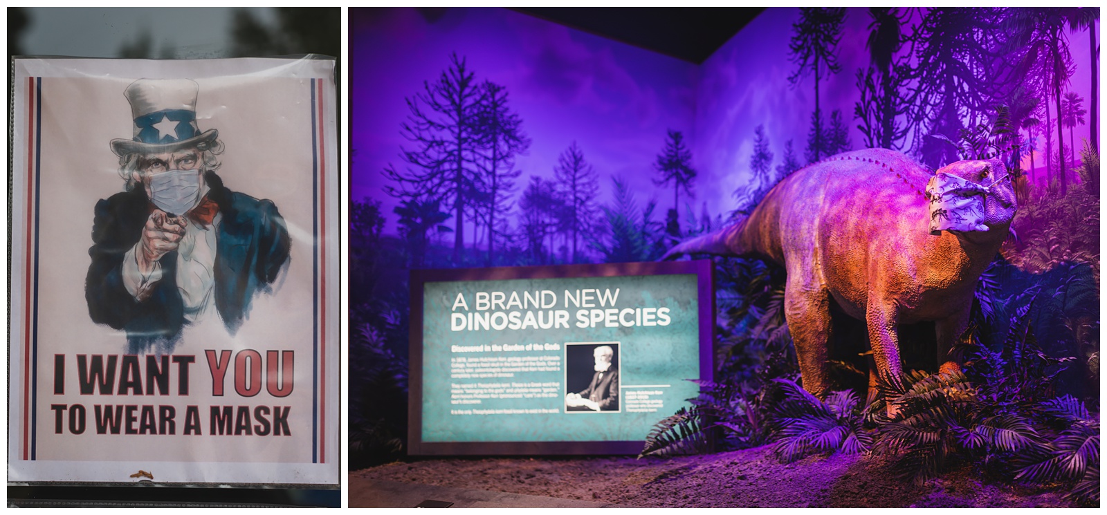
At the Visitor Center, even the dinosaur was practicing COVID protocols.
 Pikes Peak from the Visitor Center terrace.
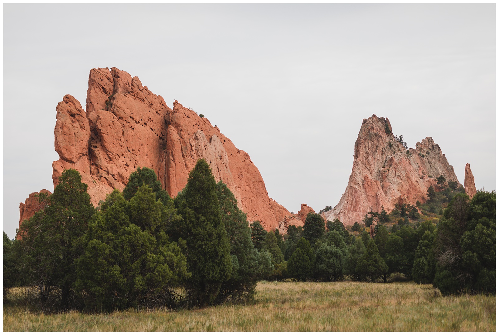
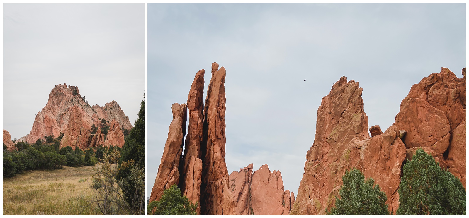
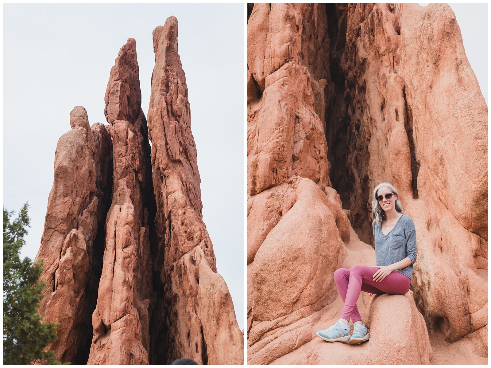
A kissy face for the Kissing Camels formation — our favorite in the park.
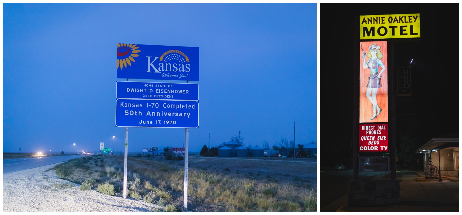
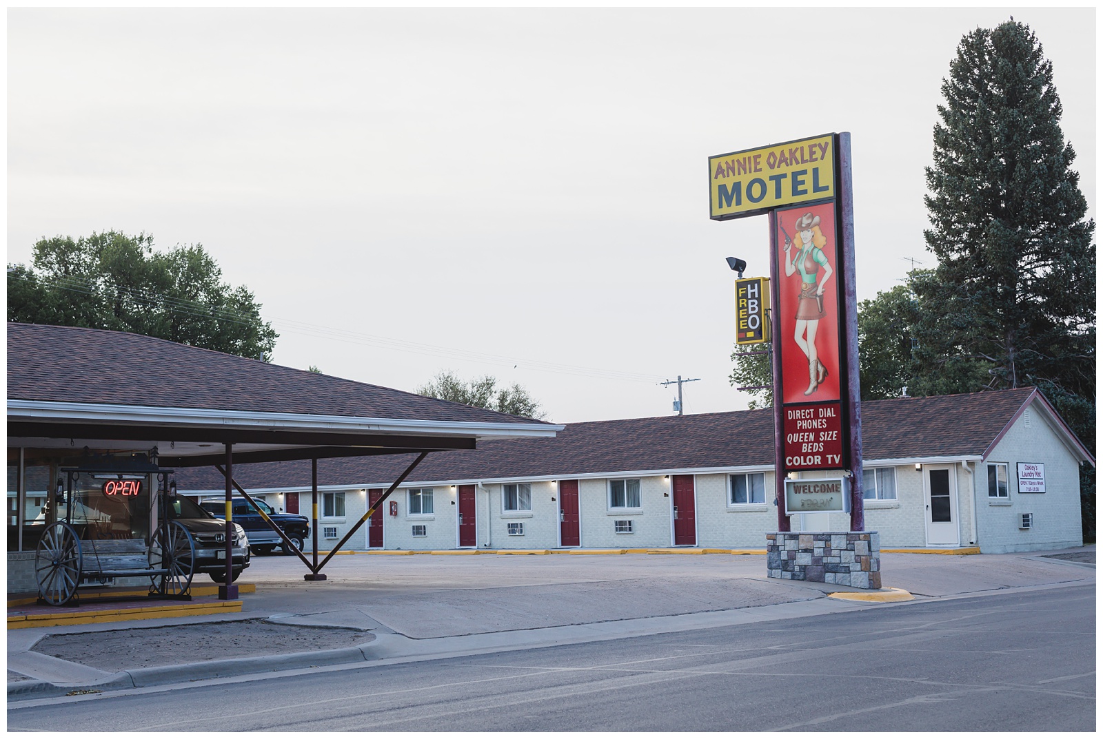
Driving into Kansas, we were racing against the sunset in hopes of capturing the Kansas sign before dark … And we just barely made it! Fortunately, the cool vintage sign at our motel photographed just fine at night.
day 17 • 09.27.20
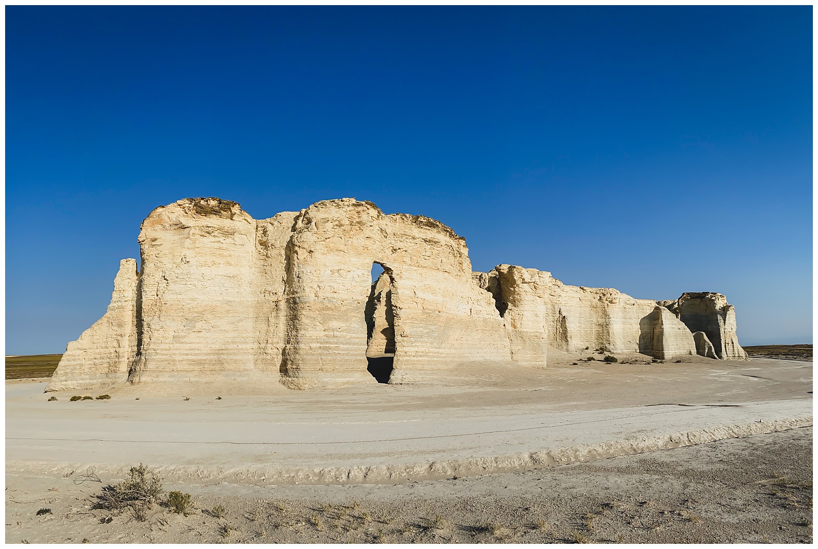
Oakley, KS >>> Monument Rocks Natural Area >>> Little Jerusalem Badlands State Park >>> Topeka, KS >>> Independence, MO
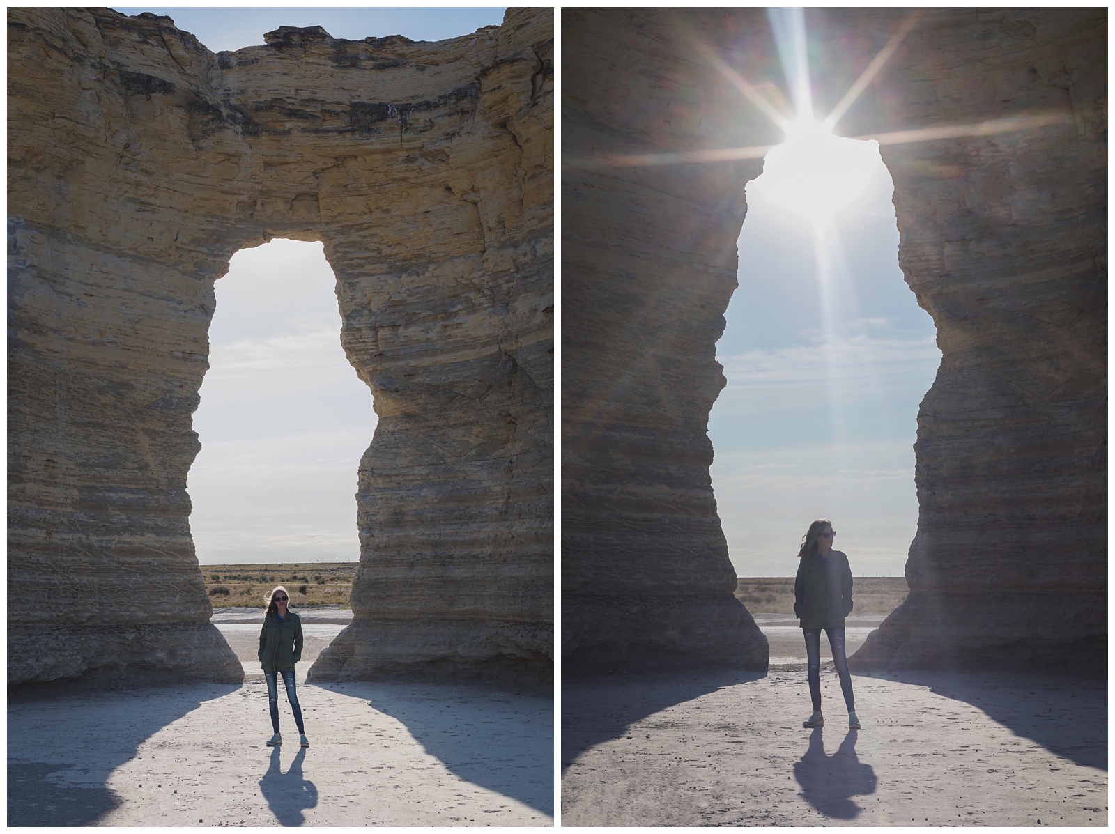
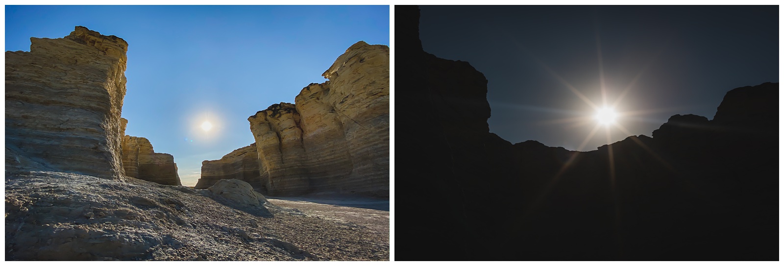
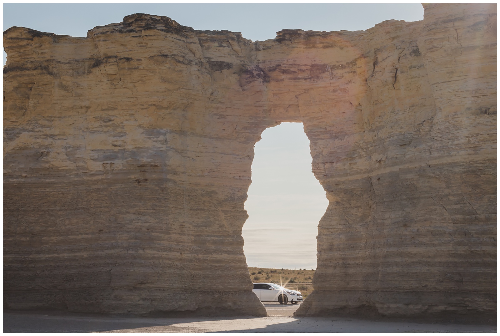
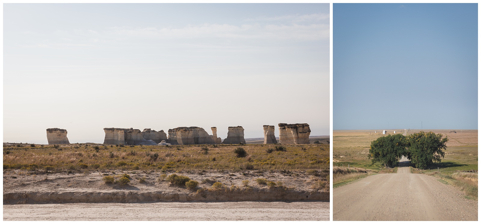
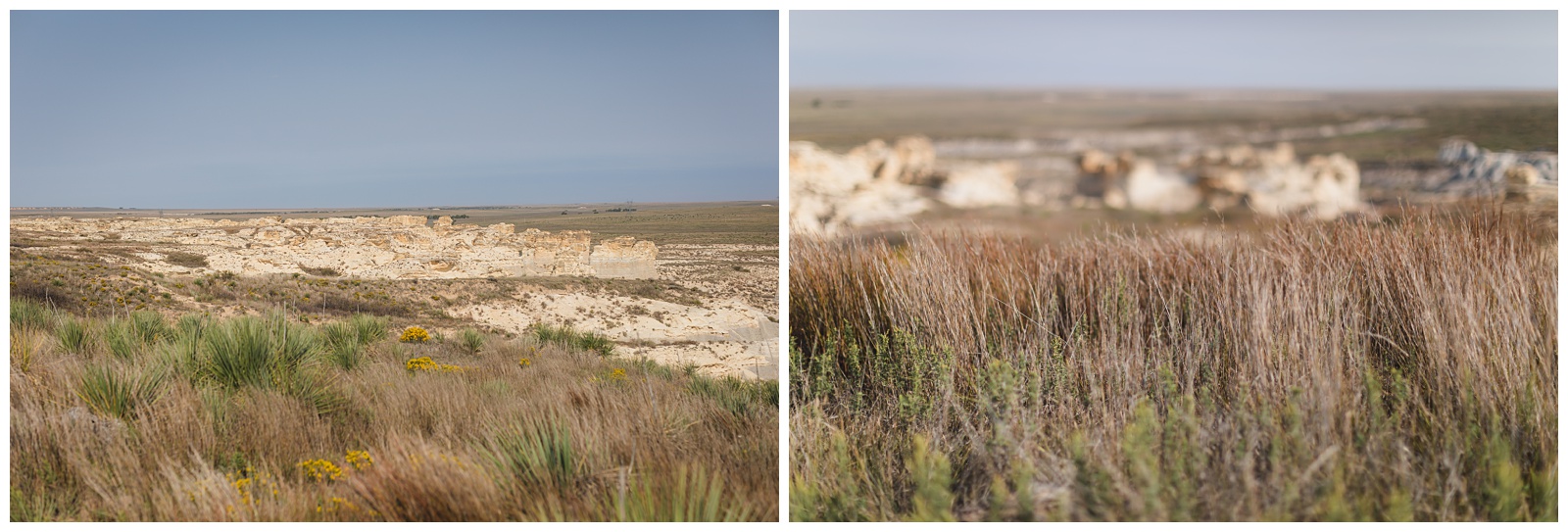
At last we were at the end of the road (so to speak) — the last day of our trip, with just two more sights to see. And in true Western Kansas form, they came with a lot of wind. I told Seth these locations actually felt windier to me than the summit of Pikes Peak the day before!
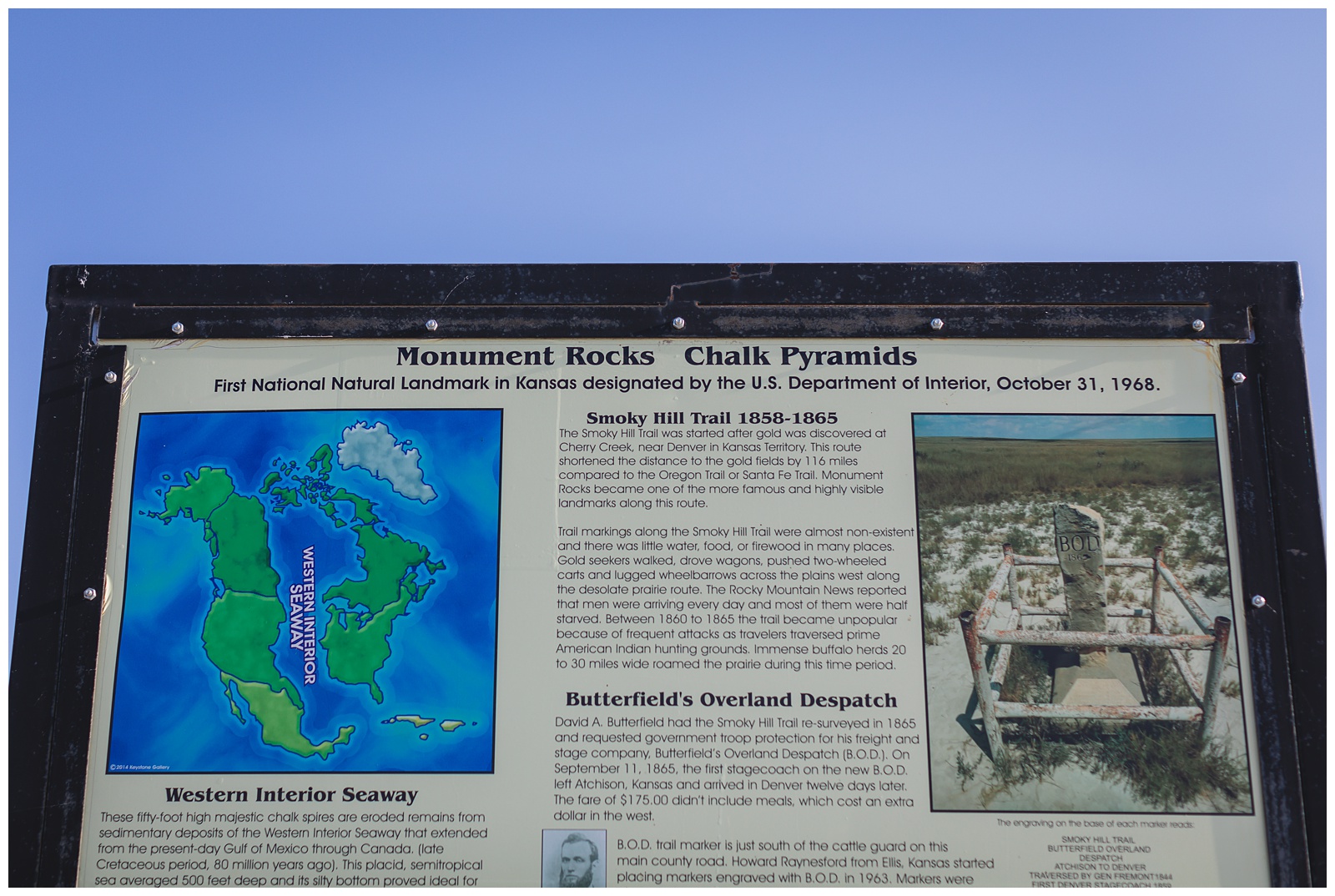 Monument Rocks are a series of fossil-rich chalk formations that were the first landmark chosen by the U.S. Department of the Interior as a National Natural Landmark. {Source: Kansas Travel & Tourism}
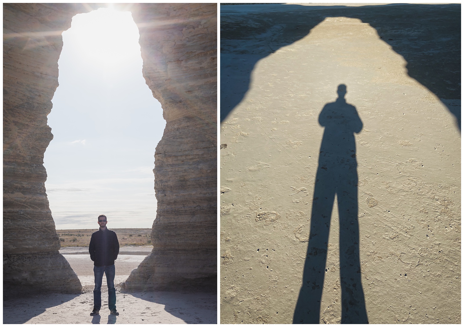
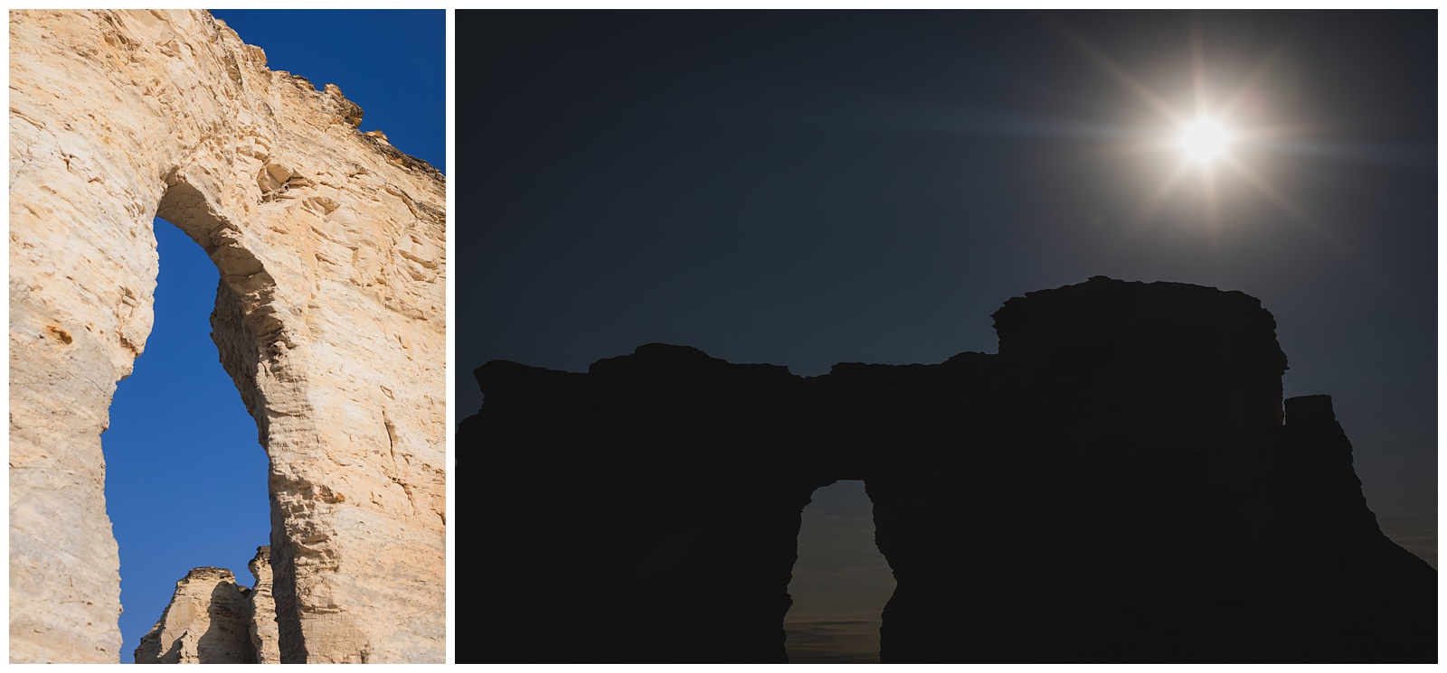
 If you haven’t figured it out by now: We like sunbursts!
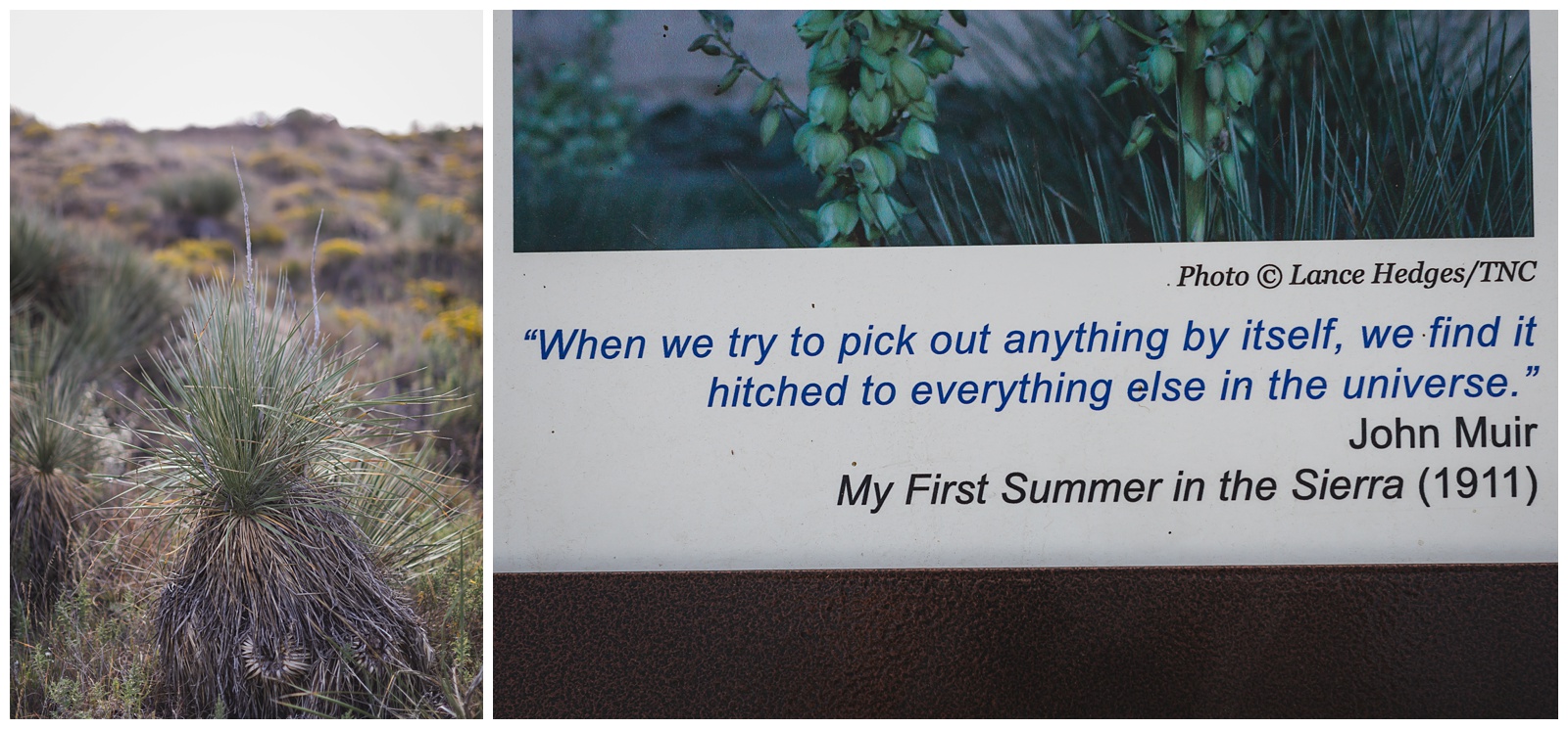
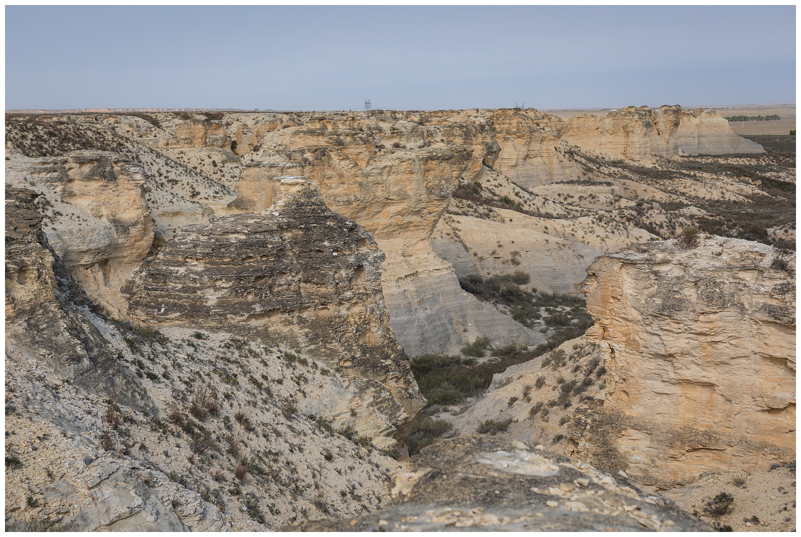
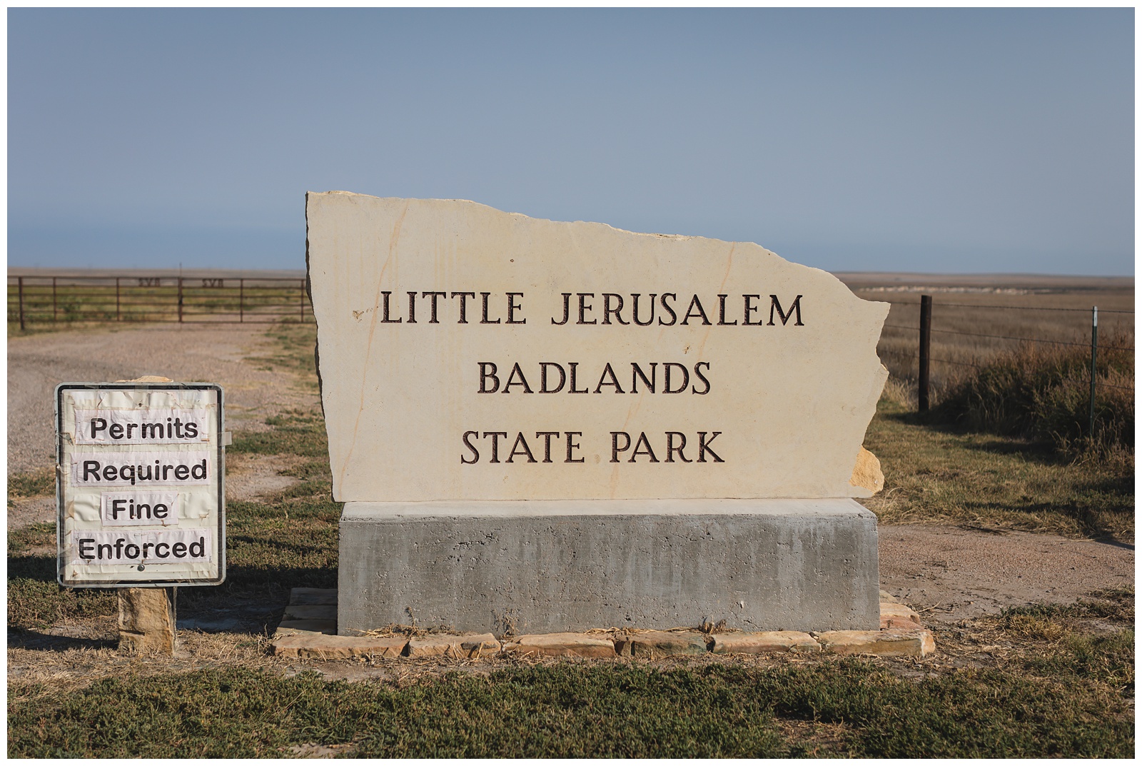 Little Jerusalem received its name due to its chalk formations looking like the ancient walled city of Jerusalem from a distance. {Source: The Nature Conservancy}
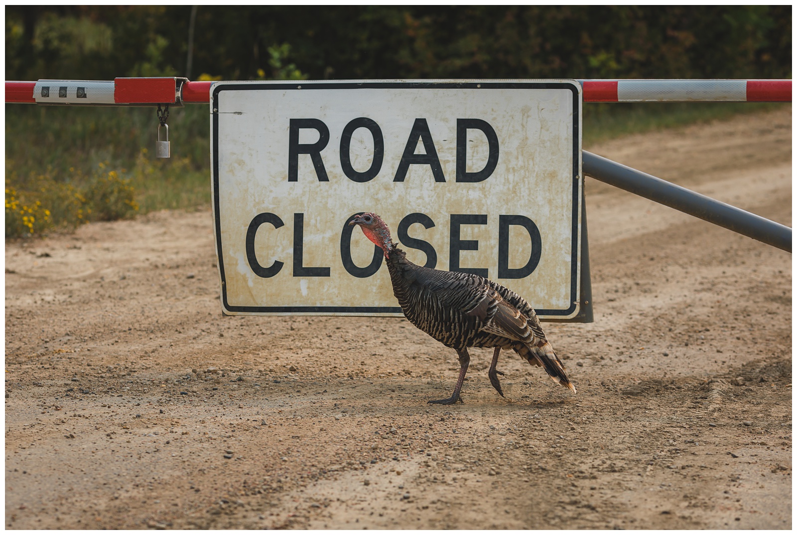
And I thought it was pretty awesome that our trip was bookended by Badlands — the National Park at the very beginning and the State Park at the very end!
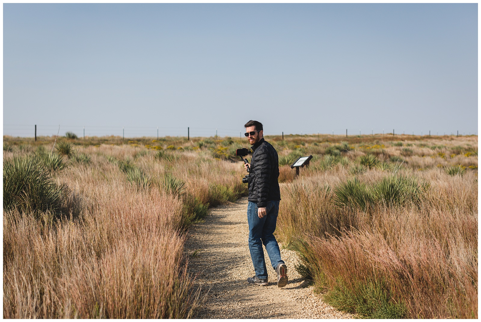
Seth had a blast (no pun intended!) shooting video in the insane wind.
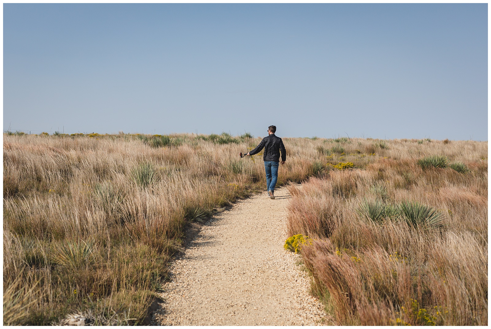
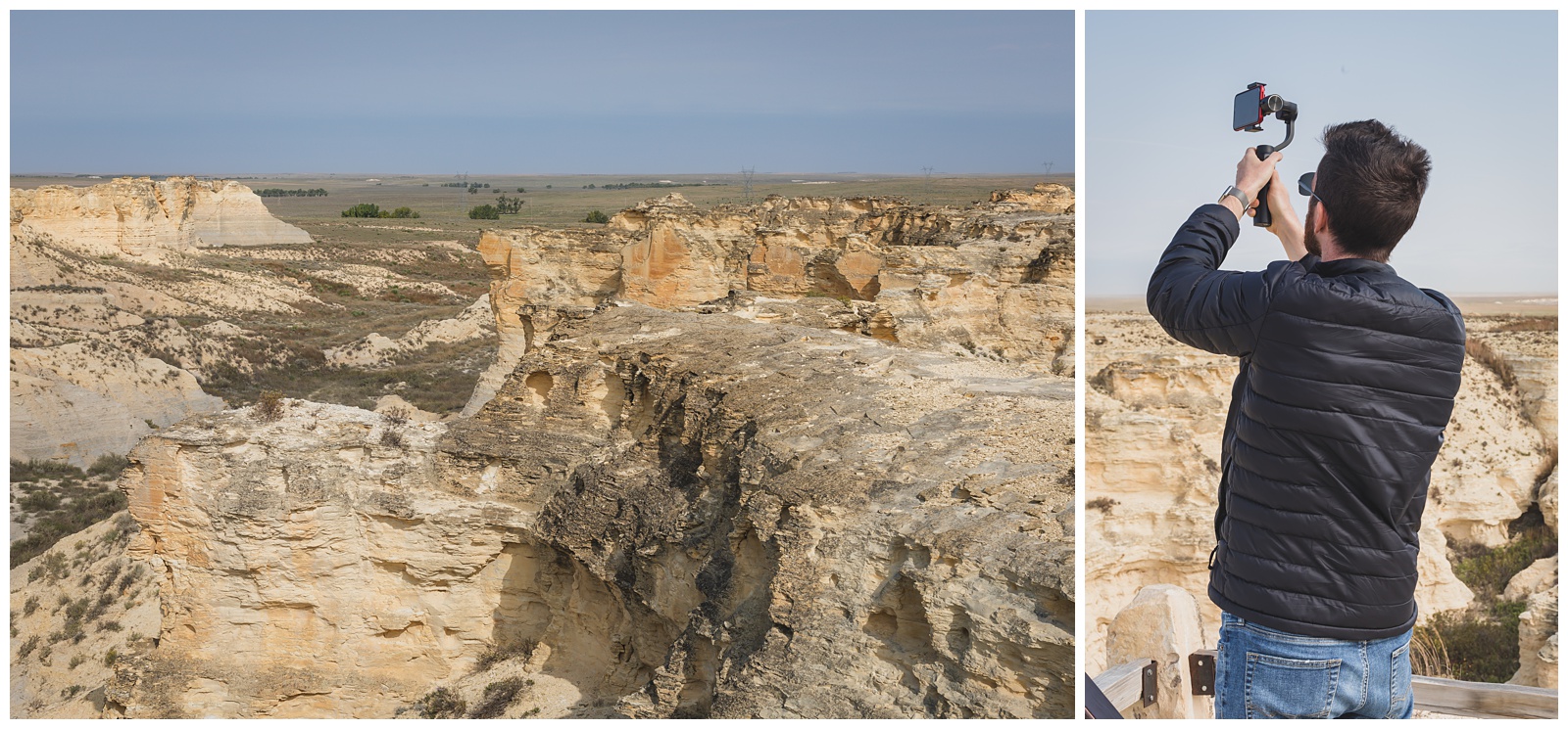
This iPhone gimbal (above right) became especially vital after I realized on the first day of our trip that I’d neglected to bring batteries for our gimbal that holds larger cameras (And of course since I’d tried to pack somewhat light, I had no backup batteries or any of the other Plan Bs I take with us to weddings). It was probably just as well, though, that I’d inadvertently relieved us from carrying the big gimbal everywhere we went!
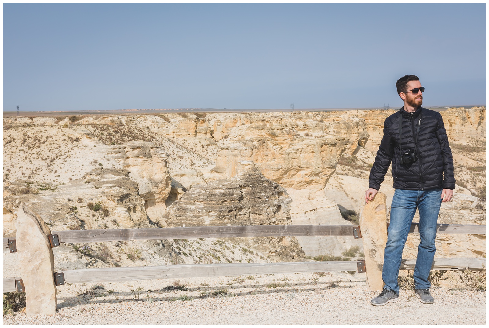
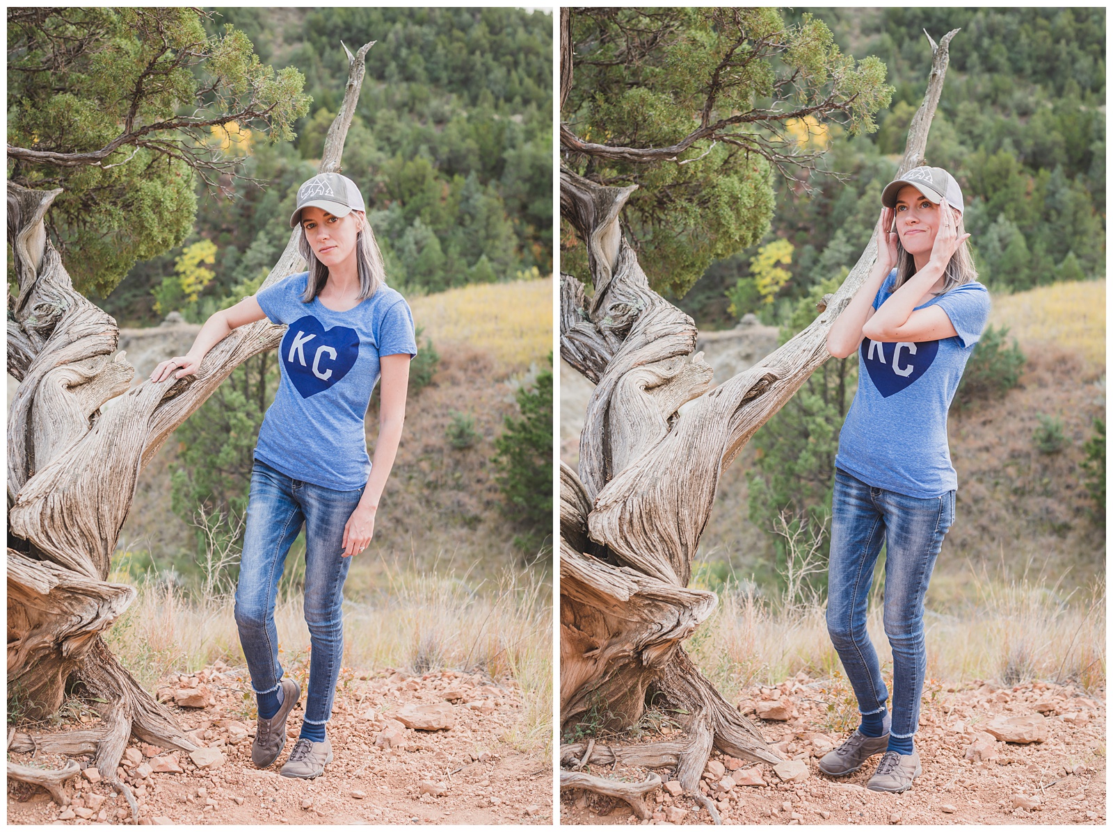
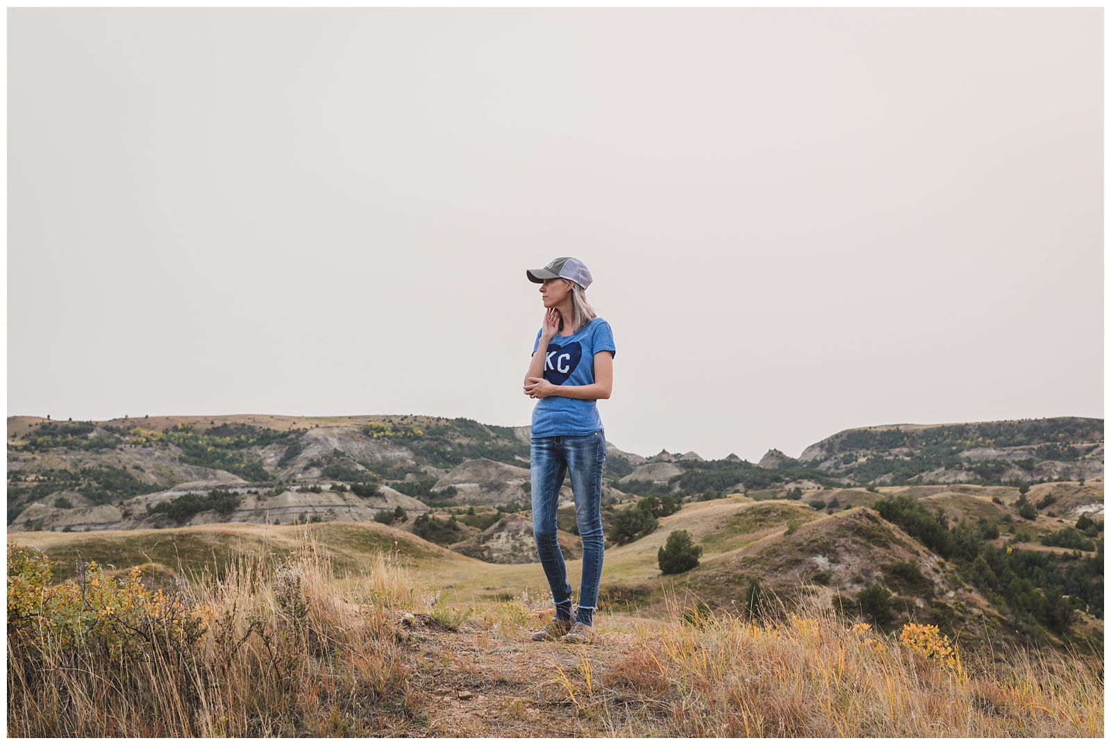
Of course I had to wear my Kansas shirt for our day in Kansas.
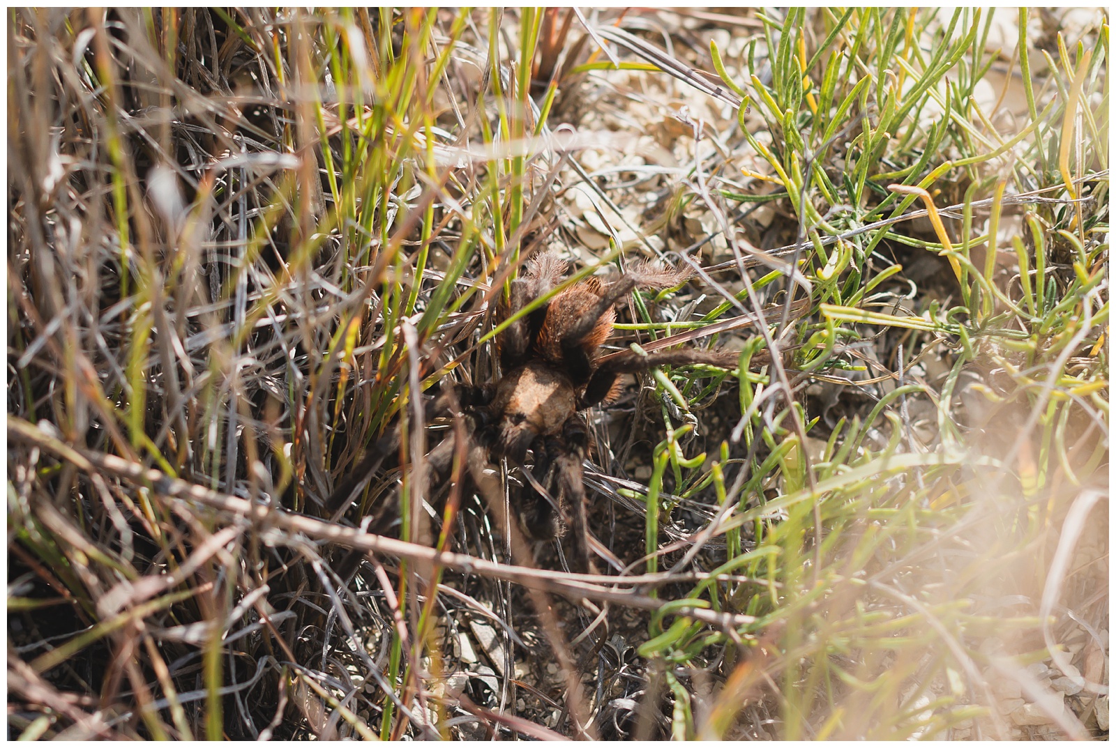
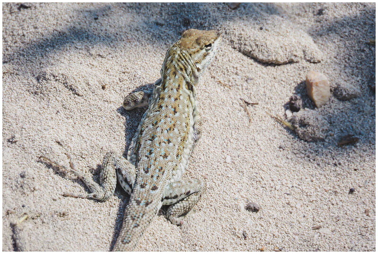
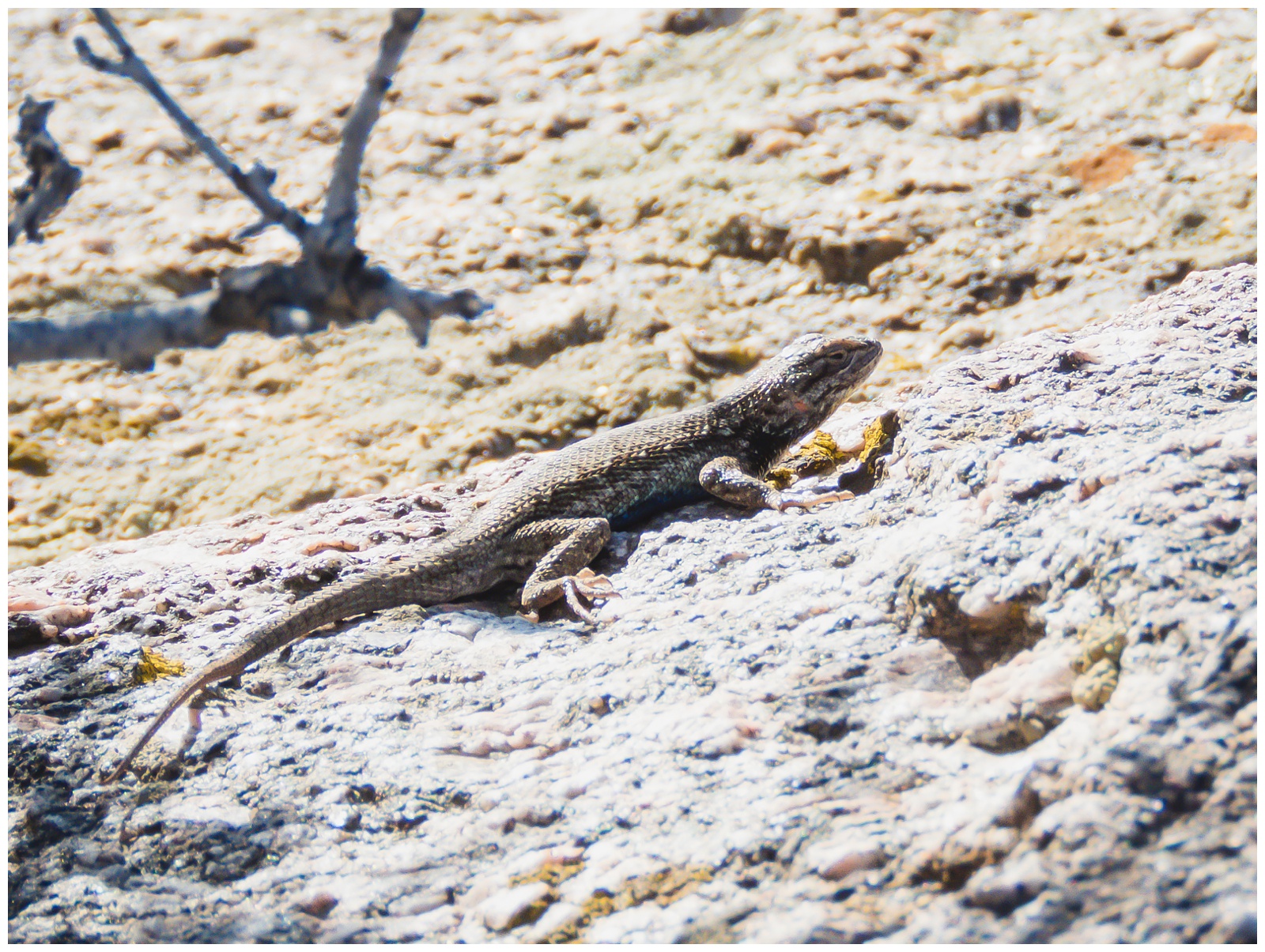
Our last wildlife sightings of the trip: a tarantula …
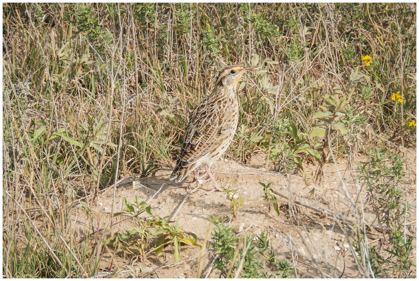
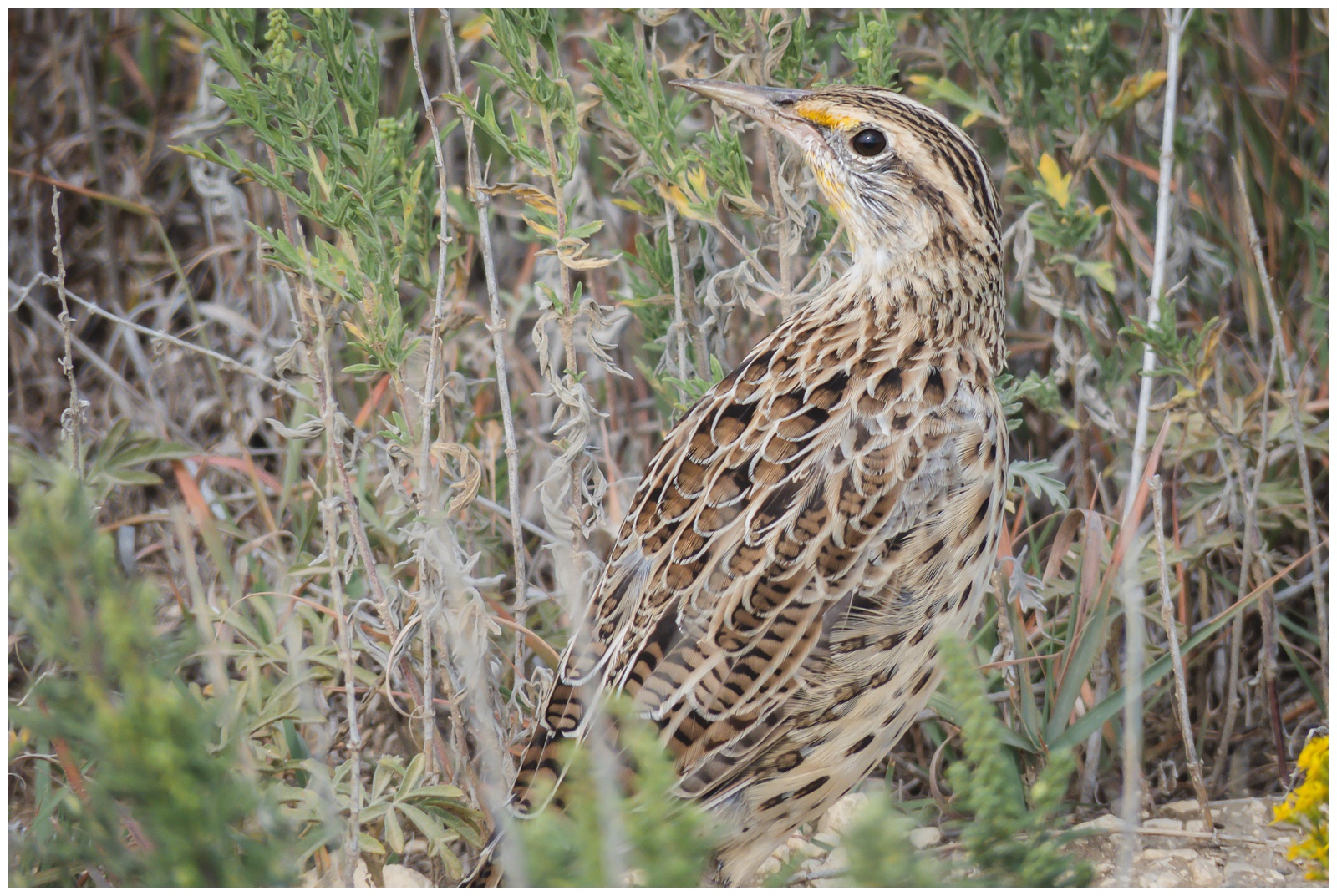
A meadowlark (the state bird of Kansas) …
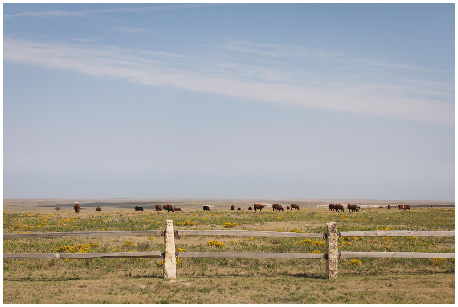
And some quintessential Kansas cows.
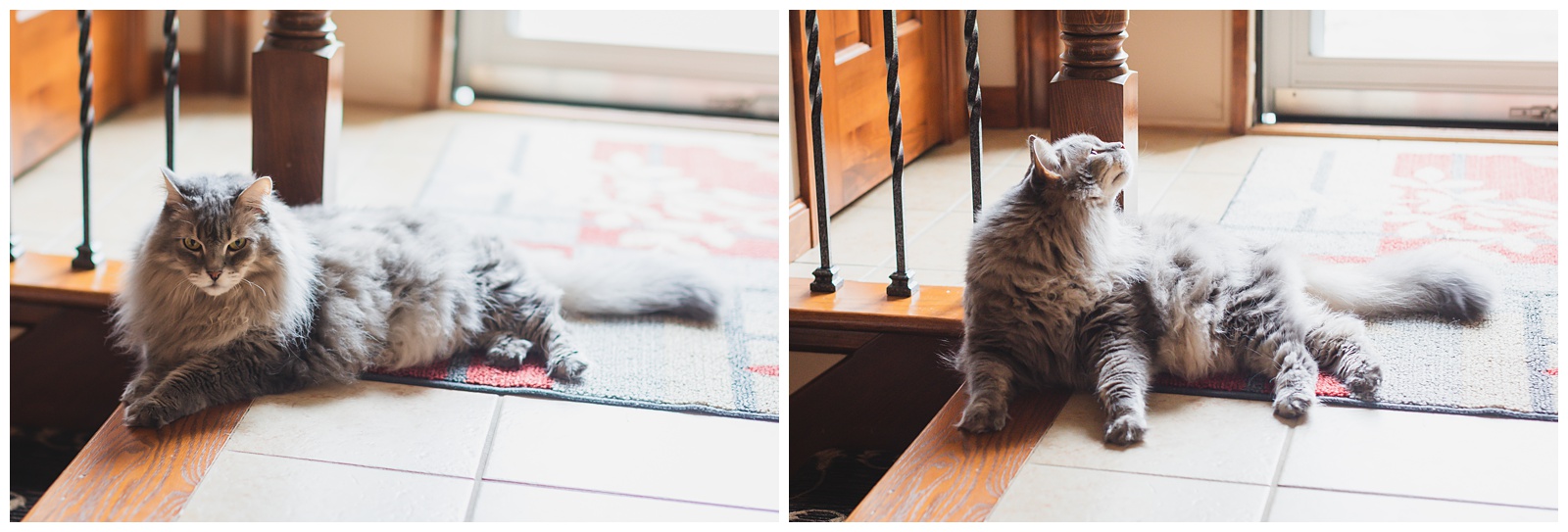
But our favorite animal of all awaited us at my parents’ house in Topeka!
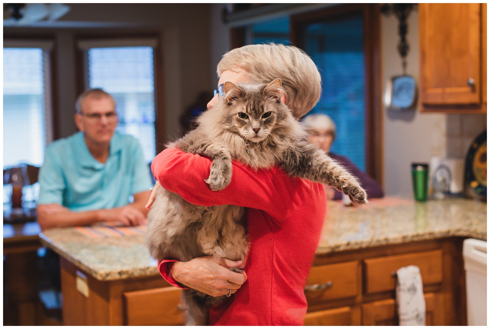

We wore our masks when we stopped there, and I think it’s especially fitting that this is the last photo of us from this trip — since this is how it looks to travel (or just to exist) in 2020!
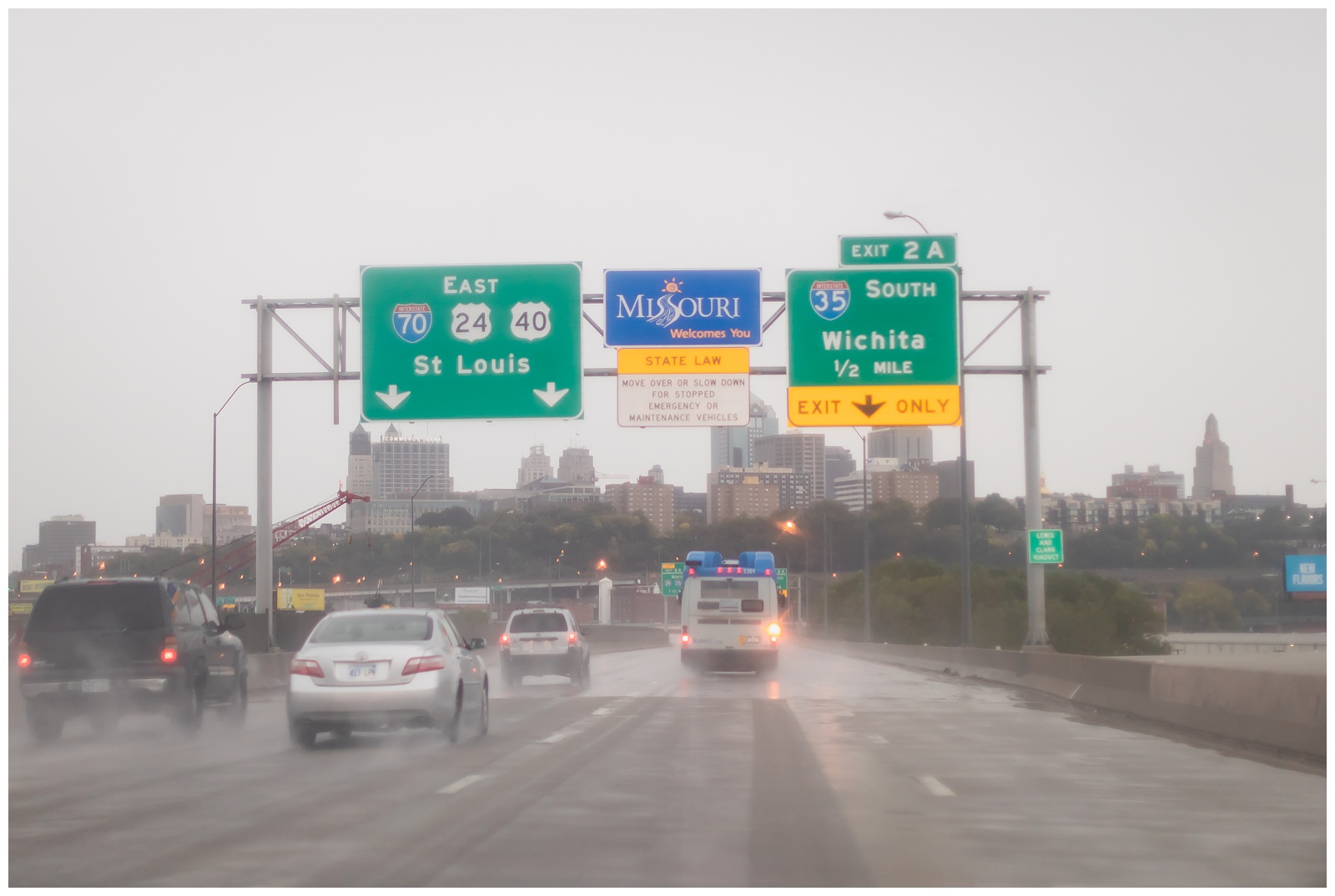
And finally, the last state sign captured! Complete with the Kansas City skyline. 🙌🏻 We felt fortunate that the only substantial rains of our trip we were during the drive-time windows on the first and last days.
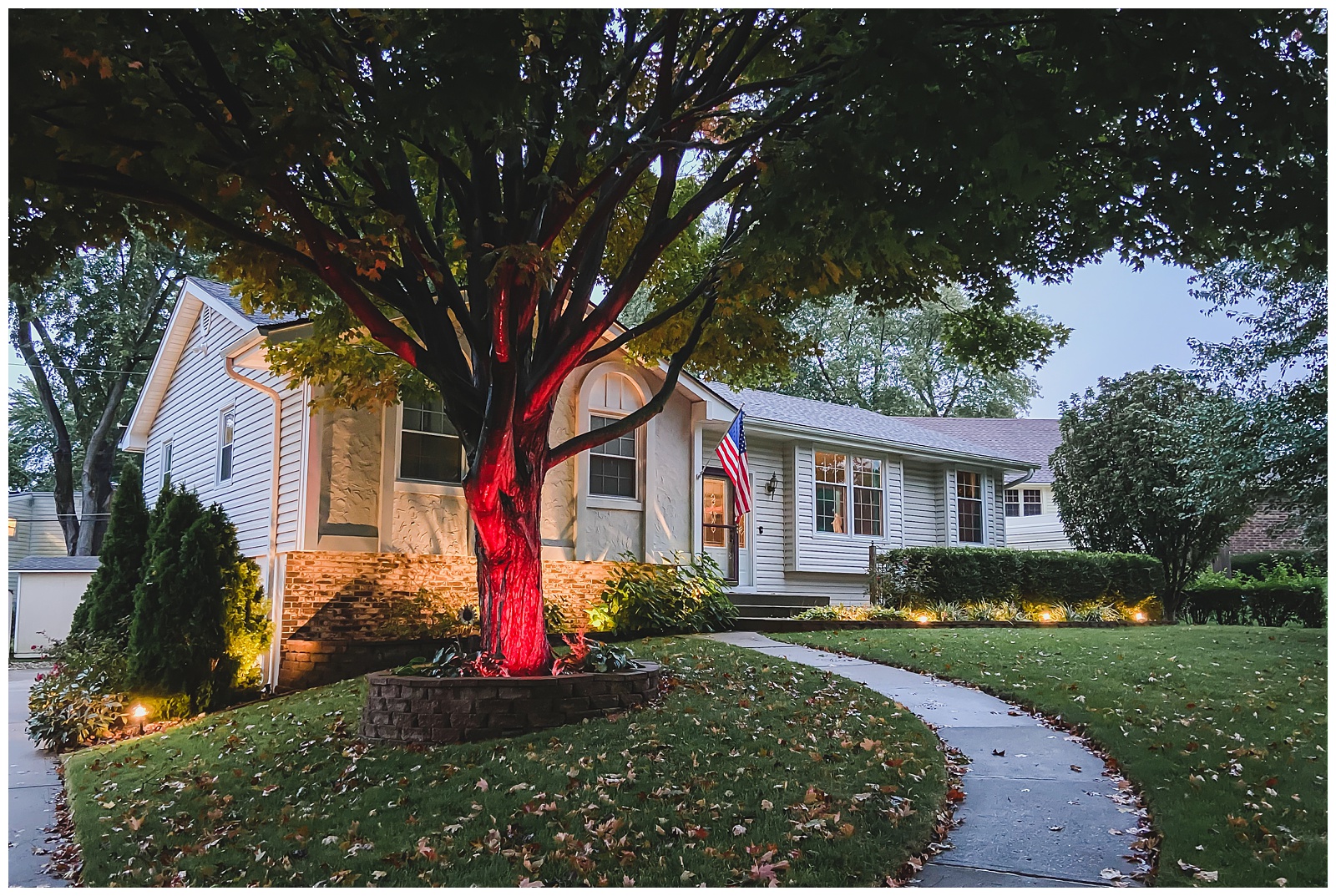 Home sweet home. We weren’t necessarily glad for the adventure to be over, but we were definitely glad to have accomplished all we’d set out to do — which wasn’t a given, with such a long sight list and so many miles to travel in such a volatile time. We’re grateful to have been unaffected by shutdowns or quarantine orders, to have had good health in the midst of this pandemic and, most of all, to have been able to mark this especially meaningful anniversary in an especially monumental way!
I'm a print-journalist-turned-wedding-photographer who fully believes in the value of telling true stories beautifully. By means of a camera, I am a curator so my clients can be keepers of their most important moments.
start here
weddings over here:
take this quiz to create
a timeline for your day!
a nature trail
session in autumn
an elegant summer wedding at the elms
TIPS FOR TOP-NOTCH TRAVEL PHOTOGRAPHY
weatherproof
your wedding day


